
PROVINCIAL ASSESSMENT
GRADE 12
GEOGRAPHY P1
JUNE 2025
MARKS: 150
TIME: 3 hours
This question paper consists of 20 pages.
Copyright reserved Please turn over
Skip to contentQuestion paper 








View all


Geography Grade 12 NW June 2025 Question Paper (English)
Grade 12 Geography question paper from the NW June Exam 2025 (English), 20 pages. Read online or get the free PDF download, memo linked when available.
Geography · Grade 12 · NW June Exam · 2025 · English. Question paper, 20 pages. Read online or download the PDF.
- Subject
- Geography
- Grade
- Grade 12
- Language
- English
- Document type
- Question paper
- Year
- 2025
- Exam period
- NW June Exam
- Curriculum
- CAPS
- Pages
- 20
- File size
- 1.6 MB
Loading document…
Loading document…
1 of 20
Document textSearch extracted text and jump to a page.
Geography/P1 2 NW/June 2025
Grade 12
INSTRUCTIONS AND INFORMATION
1. This question paper consists of TWO sections.
SECTION A
QUESTION 1: CLIMATE AND WEATHER (40)
QUESTION 2: GEOMORPHOLOGY (40)
QUESTION 3: SETTLEMENT GEOGRAPHY (40)
SECTION B
QUESTION 4: GEOGRAPHICAL SKILLS AND TECHNIQUES (30)
2. Answer ALL FOUR questions.
3. ALL diagrams are included in the QUESTION PAPER.
4. Leave a line between the subsections of questions answered.
5. Start EACH question at the top of a NEW page.
6. Number the answers correctly according to the numbering system used
in this question paper.
7. Do NOT write in the margins of the ANSWER BOOK.
8. Draw fully labelled diagrams when instructed to do so.
9. Answer in FULL SENTENCES, except when you must state, name,
identify or list.
10. Units of measurement MUST be indicated in your final answer e.g. 1 020
hPa, 14 °C and 45 m.
11. You may use a non-programmable calculator.
12. You may use a magnifying glass.
13. Write neatly and legibly.
SPECIFIC INSTRUCTIONS AND INFORMATION FOR SECTION B
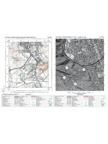
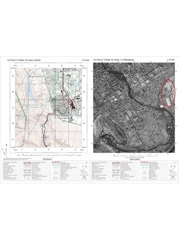
14. A 1 : 50 000 topographic map 2829DB LADYSMITH and a 1 : 10 000
orthophoto map 2829 DB 6 LADYSMITH are provided.
15. The area demarcated in RED/BLACK on the topographic map represents
the area covered by the orthophoto map.
16. Show ALL calculations. Marks will be allocated for steps in calculations.
17. You must hand in the topographic and orthophoto map to the invigilator
at the end of this examination.
Copyright reserved Please turn over
Geography/P1 3 NW/June 2025
Grade 12
SECTION A: CLIMATE & WEATHER, GEOMORPHOLOGY AND
SETTLEMENT GEOGRAPHY
QUESTION 1: CLIMATE AND WEATHER
1.1 Refer to sketch below. Various options are provided as possible answers
to the following questions based on synoptic weather map Choose the
answer and write only the letter (A–D) next to the question numbers
(1.1.1 to 1.1.5) in the ANSWER BOOK, e.g. 1.1.6 D.
[Adapted from: weathersa.co.za]
1.1.1 The above mid-latitude cyclone is in … stage.
A initial
B development
C mature
D occlusion
1.1.2 The atmospheric pressure at B is …
A 992 hPa.
B 996 hPa.
C 1 000 hPa.
D 1 004 hPa.
1.1.3 Line labelled B on the sketch is a …
A contour line.
B isotherms.
C isobar.
D latitude.
Copyright reserved Please turn over
Geography/P1 4 NW/June 2025
Grade 12
1.1.4 Isobaric interval of synoptic weather map/chat in sketch above is
… hPa.
A 2
B 4
C 6
D 8
1.1.5 Outward curve or elongation of isobars away from a low pressure
cell is …
A ridge.
B trough.
C Saddle.
D moisture front. (5 x 1) (5)
Copyright reserved Please turn over
Geography/P1 5 NW/June 2025
Grade 12
1.2 Refer to the sketch showing the formation of line thunderstorms. Match
the statements in COLUM A with the options in COLUMN B. Write only Y
or Z next to the question numbers (1.2.1 to 1.2.5) in the ANSWER BOOK,
e.g. 1.2.6 Z.
[Source: Examiner’s own sketch]
COLUMN A COLUMN B
1.2.1 Air mass labelled D can reach central Y: above
plateau because inversion layer is … the Z: below
escarpment.
1.2.2 Ocean current in the Indian Ocean is … Y: Cold Benguela
current. Z: Warm
Mozambique
1.2.3 The temperature and moisture content Y: warm moist
of air mass labelled C is … air. Z: cold dry
1.2.4 The density of air mass labelled C is … Y: less dense
Z: more dense
1.2.5 Line thunderstorms occurs on … side of Y: western
the moisture front Z: eastern
(5 x 1) (5)
Copyright reserved Please turn over
Geography/P1 6 NW/June 2025
Grade 12
1.3 Refer to extract on tropical cyclone ‘Filipo’.
NORTHERN KWAZULU NATAL BEARS A BRUNT OF
TROPICAL STORM FILIPO
Date: 14 March 2024
Families living in the northern Kwazulu Natal districts had to evacuate
their homes after torrential downpours and gusty winds, brought by
tropical storm Filipo ripped through the area on Wednesday. The heavy
rains accompanied by strong winds began in the early hours in the
extreme north of the province and it has caused a massive damage in low
lying areas.
Bridges are damaged, roads inaccessible, households in the
Umhlabuyalingana area have been flooded leading to family members
seeking temporary shelter with relatives and neighbours. There were also
reports that trees are falling on the roads.
“Our teams are on the ground monitoring the situation closely, we
appreciate the co-operation from the communities, the risk is not over yet,
let us all prioritise safety and avoid travelling during this period” said the
Gogta MEC.
[Adapted from: iol.co.za]
1.3.1 In which season do tropical cyclones generally occur? (1 x 1) (1)
1.3.2 Give evidence from the extract to support your answer to
QUESTION 1.3.1. (1 x 1) (1)
1.3.3 Do tropical cyclones travel eastwards/westwards? (1 x 1) (1)
1.3.4 Give reason for your answer in QUESTION 1.3.3. (1 x 2) (2)
1.3.5 Fewer tropical cyclones have occurred in this season, substantiate
this view. (2 x 2) (4)
1.3.6 In a paragraph of approximately SIX lines, explain negative
physical (natural) impact of torrential downpours (heavy rainfalls)
associated with tropical cyclones. (3 x 2) (6)
Copyright reserved Please turn over
Geography/P1 7 NW/June 2025
Grade 12
1.4 Refer to sketch below showing South African Berg winds.
[Source: http://www.studyx.com ]
1.4.1 Are berg winds an example of (onshore/offshore) winds? (1 x 1) (1)
1.4.2 Identify TWO conditions visible on the sketch under which berg
winds originate. (2 x 1) (2)
1.4.3 Draw a labelled cross-section to explain the formation of berg
winds along the east coast of South Africa. (4 x 1) (4)
1.4.4 In a paragraph of approximately EIGHT lines, explain the impact
of berg wind conditions on the physical (natural) environment.
(4 x 2) (8)
[40]
Copyright reserved Please turn over
Geography/P1 8 NW/June 2025
Grade 12
QUESTION 2: GEOMORPHOLOGY
2.1 Various options are provided as possible answers to the following questions.
Choose the answer and write only the letter (A–D) next to the question
numbers (2.1.1 to 2.1.5) in the ANSWER BOOK, e.g. 2.1.6 D.
[Source:www.studocu.com]
2.1.1 Watershed refers to …
A a high lying area separating two drainage systems.
B igneous rock that has many joints.
C igneous rock has been affected by volcanic activity.
D rock beneath the stream that has no particular structure.
2.1.2 The stream order at Z is … order.
A 1st
B 2nd
C 3rd
D 4th
Copyright reserved Please turn over
Geography/P1 9 NW/June 2025
Grade 12
2.1.3 The drainage density of the drainage basin A (north of the watershed)
is high because it is influenced by the river flowing in areas of … and
…
(i) less vegetation
(ii) high porosity
(iii) high rainfall
(iv) high permeability
A (ii) and (iv)
B (i) and (iii)
C (i) and (ii)
D (ii) and (iv)
2.1.4 A point where two of more rivers meet is known as a …
A river catchment.
B drainage basin.
C river confluence.
D surface run-off.
2.1.5 The region of higher land between two rivers that are in the same
drainage system is a/an …
A watershed.
B interfluve.
C water table.
D source. (5 x 1) (5)
Copyright reserved Please turn over
Geography/P1 10 NW/June 2025
Grade 12
2.2 Refer to the sketches below. Complete the statements in COLUMN A with the
options in COLUMN B. Write only Y or Z next to the question numbers (2.2.1
to 2.2.5) in the ANSWER BOOK, e.g. 2.2.6 Y.
[Source: www.studocu.com]
COLUMN A COLUMN B
2.2.1 Area labelled C is … Y: lateral erosion.
Z: headward erosion.
2.2.2 River B is … Y: less energetic.
Z: more energetic.
2.2.3 River B flows on a … Y: lower gradient.
Z: higher gradient.
2.2.4 Elbow of capture is evident … Y: before capture.
Z: after capture.
2.2.5 River capture may lead to … Y: river rejuvenation.
Z: graded stream.
(5 x 1) (5)
Copyright reserved Please turn over
Geography/P1 11 NW/June 2025
Grade 12
2.3 Refer to the sketches showing the profile and grading of a river.
[Adapted from: www.studyblue.com]
2.3.1 Define the term longitudinal profile. (1 x 2) (2)
2.3.2 Identify a temporary base level of erosion in sketch B. (1 x 1) (1)
2.3.3 How does the temporary base level of erosion in QUESTION 2.3.2
occur? (1 x 2) (2)
2.3.4 Draw a labelled free-hand cross section of an ungraded river profile.
Marks will be allocated for following:
(a) Shape of an ungraded profile (1 x 1) (1)
(b) Any THREE labels (3 x 1) (3)
2.3.5 Describe the processes that the river in sketches B and C would
undergo to reach a graded state. (3 x 2) (6)
Copyright reserved Please turn over
Geography/P1 12 NW/June 2025
Grade 12
2.4 Refer to the infographic below on catchment and river management.
Umzimvubu River is one of the most
important rivers in South Africa. It is
located in the Eastern Cape
Province. The river has its source in
the northern region of the Eastern
Cape, in the Matatiele and Mount
Fletcher area near the Lesotho
border. The Umzimvubu flows with
meanders and bends in a generally
southeasterly direction and flows
into the Indian Ocean through an
impressive gorge known as the
"Gates of St John" into a mouth
located at Port St. Johns. It is
approximately 400 km long with a
catchment area of 19 853 km².
Although it is one of South Africa's
major rivers, the Umzimvubu and its
basin are largely undeveloped. Presently this river is part of the
Umzimvubu to Keiskamma Water Management Area. The river is facing
a number of challenges originating from illegal sand dealers who are
tempering with river banks, illegal dumping, unauthorised fishing and lack
of water testing points, as a results, the quality of water in this river have
been deteriorating.
[Source: https://af.wikipedia.org/wiki/Umzimvubu]
2.4.1 Define the term river management. (1 x 2) (2)
2.4.2 What are the challenges faced by Umzimvubu river, according to
the extract? (1 x 1) (1)
2.4.3 Why are water testing points important? (1 x 2) (2)
2.4.4 Umzimvubu river is on the lower course, substantiate this view.
(1 x 2) (2)
2.4.5 In a paragraph of approximately EIGHT lines, explain strategies
that could be implemented in order to make Umzimvubu river to
become a sustainable source of water. (4 x 2) (8)
[40]
Copyright reserved Please turn over
Geography/P1 13 NW/June 2025
Grade 12
QUESTION 3: RURAL AND URBAN SETTLEMENTS
3.1 Refer to diagram below showing types of settlements. Match the
descriptions below with the letters (A–E) in the sketch. You may use the
same letter for more than one answer.
[Source: www.viaafrica.com]
3.1.1 A settlement with a linear shape.
3.1.2 A settlement located away from water, as water is a threat.
3.1.3 An isolated farmstead.
3.1.4 A settlement where farmers live in the village and not on their farms.
3.1.5 A settlement where a river meander provides protection from
invasions. (5 x 1) (5)
Copyright reserved Please turn over
Geography/P1 14 NW/June 2025
Grade 12
3.2 Various options are provided as possible with answers to the following
questions. Choose the answer and write only the letter (A–D) next to the
question numbers (3.2.1 to 3.2.5) in the ANSWER BOOK, e.g. 3.2.6 D.
3.2.1 ... is the maximum distance a customer is willing to travel to buy
goods.
A Central place
B Sphere of influence
C Range
D Threshold
3.2.2 ... goods are used almost daily and are found in most types of
settlements.
A High-order
B Threshold
C Low-order
D Comparative
3.2.3 An urban service centre supplying goods and services to the
surrounding rural area is known as a ...
A central place.
B low-order centre.
C rural hamlet.
D high order centre.
3.2.4 ... refers to the number of customers a business needs to be
profitable.
A Sphere of influence
B Threshold population
C Urban population
D Range of population
3.2.5 The area from which a business draws its customers is a/an …
A range of goods.
B local service centre.
C sphere of influence.
D urban hierarchy. (5 x 1) (5)
Copyright reserved Please turn over
Geography/P1 15 NW/June 2025
Grade 12
3.3 Refer to the pie-chart below on reasons for rural urban migration.
[Adapted from:www.google.com/search?q=reasons+for+migration&safe Gram Vaani]
3.3.1 Define the term rural-urban migration. (1 x 2) (2)
3.3.2 Provide ONE physical push factor from the pie-chart that results in
rural urban migration. (1 x 1) (1)
3.3.3 According to the diagram, 32% of rural-urban migration is caused
by other reasons than those depicted in the diagram. Explain TWO
other social factors in the rural areas, which can lead to rural-urban
migration. (2 x 2) (4)
3.3.4 Write a paragraph of approximately EIGHT lines, in which you
explain sustainable measures that the government can implement
to prevent rural depopulation due to poor social conditions in rural
areas. (4 x 2) (8)
Copyright reserved Please turn over
Geography/P1 16 NW/June 2025
Grade 12
3.4 Refer to sketch below on hierarchy of settlements.
[Source: Examiner’s own sketch]
3.4.1 Define the concept urban hierarchy. (1 x 2) (2)
3.4.2 What will hinder (prevent) the town from expanding in a northerly
direction? (1 x 1) (1)
3.4.3 Will more specialised goods city A, rather than city B? (1 x 1) (1)
3.4.4 Explain your answer to QUESTION 3.4.3. (1 x 2) (2)
3.4.5 Refer to the shopping centre.
(a) Is the new shopping centre a regional or a neighbourhood
shopping centre. (1 x 1) (1)
(b) Comment on the suitability of the location of shopping centre
to QUESTION 3.4.5 (a). (2 x 2) (4)
(c) Explain the impact of this shopping centre (answer to
QUESTION 3.4.5 (a) on the threshold population of city A.
(2 x 2) (4)
[40]
TOTAL SECTION A: 120
Copyright reserved Please turn over
Geography/P1 17 NW/June 2025
Grade 12
SECTION B
QUESTION 4: GEOGRAPHICAL SKILLS AND TECHNIQUES
GENERAL INFORMATION ON LADYSMITH
Co-ordinates: 28º 33’ 35’’ S; 29º 46’ 50’’ E
Ladysmith (uMnambithi) is a town in Uthukela district of KwaZulu’ Natal. It lies
230 kilometres north west of Durban and 365 kilometres south east of
Johannesburg. Important industries in the area include food processing, textile
and tyre production.
[Source: https://af.wikipedia.org/wiki/Ladysmith]
The following English terms and their Afrikaans translations are shown on the
topographical map:
ENGLISH AFRIKAANS
Diggings Uitgrawings
River Rivier
Sewerage works Rioolwerke
Estate Landgoed
Salt pan Soutpan
Nature reserve Natuurreservaat
Copyright reserved Please turn over
Geography/P1 18 NW/June 2025
Grade 12
4.1 MAP SKILLS AND CALCULATIONS
4.1.1 2829DB LADYSMITH topographical map index is found in …
A shaded block A.
B shaded block B.
C shaded block C.
D shaded block D. (1 x 1) (1)
4.1.2 29º on the sketch above represent lines of …
A latitude.
B longitude.
C contour lines.
D isotherms. (1 x 1) (1)
4.1.3 Refer to the topographical map and choose ONE word(s) from
those in the brackets to answer the question below.
The direction to which Pound Spruit river in block C5 flows is (South
West/South East) and it also have a (high/low) drainage density.
(2 x 1) (2)
4.1.4 Calculate the average gradient of the slope from spot height 1 001
in block B2 to spot height 999 in block B3 on the orthophoto map.
Show the following steps:
a) Vertical Interval (1)
b) Horizontal Equivalent (2)
c) Average gradient (3) (5)
4.1.5 What is the meaning of your answer in QUESTION 4.1.4? (1 x 1) (1)
Copyright reserved Please turn over
Geography/P1 19 NW/June 2025
Grade 12
4.2 MAP INTERPRETATION
Refer to white city in block C5 and cultivated land in block D4 on the
topographical map.
4.2.1 Name the wind that blows down white city in block C5 at night.
(1 x 1) (1)
4.2.2 Explain how the wind identified in QUESTION 4.2.1 negatively
influences crops grown on the valley floor at G in block D4.(1 x 2) (2)
4.2.3 Provide sustainable measures to put in place in order to assist
farmers to be able to grow crops. (2 x 2) (4)
Refer to Hyde Park in block A3.
4.2.4 Define the concept urban heat island. (1 x 1) (1)
4.2.5 Discuss sustainable strategies that have been implemented in
Hyde Park in order to reduce temperatures. (2 x 2) (4)
Copyright reserved Please turn over
Geography/P1 20 NW/June 2025
Grade 12
4.3 GEOGRAPHICAL INFORMATION SYSTEMS (GIS)
Refer to images of Ladysmith Secondary School and answer the
questions that follow.
IMAGE A IMAGE B
[
[Source: googlemaps.com]
4.3.1 Are images A and B are stored as (pixels/symbols)? (1 x 1) (1)
4.3.2 Which image, A or B, has a higher resolution? (1 x 1) (1)
4.3.3 Give a reason for your answer to QUESTION 4.3.2. (1 x 2) (2)
4.3.4 Define the concept data layer. (1 x 2) (2)
4.3.5 How will the drainage data layer encourage crop farming in area
G in block D4 on the topographical map? (1 x 2) (2)
TOTAL SECTION B: 30
GRAND TOTAL: 150
Copyright reserved
Study this subject
Revise the topics in this paper, then practise them question by question.
- Grade 12 Geography notes
CAPS revision notes with worked examples.
- Geography questions by topic
Past exam questions sorted by CAPS topic, with memos where available.
- Grade 12 Geography quizzes
Short topic quizzes with instant feedback.
- All Grade 12 Geography past papers
Past papers by year, with memos where available.
- Grade 12 past papers
More Geography and other subjects in this collection.
Recommended for this subject
More papers and memos for this grade and subject.
Question paper
Geography Grade 12 P2 Gauteng June 2025 Question Paper (English)
Question paper
Geography Grade 12 Paper 1 KZN Mock 2025 Question Paper
Question paper
Geography Grade 12 Paper 2 KZN Mock 2025 Question Paper
Question paper
Geography Grade 12 Paper 1 NSC June 2025 Question Paper (English)
Question paper
Geography Grade 12 Eastern Cape June 2023 Question Paper
Question paper
Geography Grade 12 GAU June 2023 Question Paper
Related documents
Memorandum
Geography Grade 12 Paper 1 NSC November 2025 Memo (English)
Question paper
Geography Grade 12 P1 GP Prelim 2023 Question Paper (English)
Question paper
Geography Grade 12 Eastern Cape June 2022 Question Paper (Eng)
Question paper
Geography Grade 12 P1 Gauteng Mock 2022 Question Paper (English)
Question paper
Geography Grade 12 P2 Eastern Cape Mock 2018 Question Paper (Eng)
Question paper
Geography Grade 12 Paper 1 EC June 2016 Question Paper (English)
More from Grade 12 Geography
Memorandum
Geography Grade 12 Paper 2 Gauteng Mock 2025 Memo
Memorandum
Geography Grade 12 Gauteng June 2024 Memo (English)
Question paper
Geography Grade 12 Paper 2 KZN Prelim 2023 Question Paper
Question paper
Geography Grade 12 MAPS 2023 Question Paper
Question paper
Geography Grade 12 Paper 2 MAPS 2023 Question Paper
Memorandum