
NATIONAL
SENIOR CERTIFICATE
GRADE 12
GEOGRAPHY P1
NOVEMBER 2025
MARKING GUIDELINES
MARKS: 150
These marking guidelines consist of 12 pages.
Copyright reserved Please turn over
You're offline
Skip to contentMemorandum 
%20June%202024%20Possible%20Answers_hlayiso.com_--7e728632-059d-401a-ba75-fd45632f6091/v1-269fb55ac60eebf555e6/card.webp)

%20June%202025%20Question%20Paper--ba0a3969-240a-4bba-bdb6-7d02a7f80205/v1-98bc441a090fdcbd55aa/card.webp)
_hlayiso.com_--4c59a80f-eefb-4b65-9ca9-51658f6452b0/v1-e79e48ec611b0f079df9/card.webp)
View all

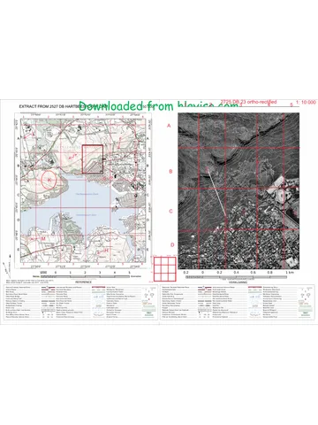

%20QP_hlayiso.com_--cc0a9c5e-7556-4aa2-a8c6-caf4da66af7f/v1-b59d47c1a7139a0ae375/card.webp)
Geography P1 Nov 2025 MG Eng
Geography · Grade 12 · NSC November Exam · 2025 · English. Memorandum, 12 pages. Read online or download the PDF.
- Subject
- Geography
- Grade
- Grade 12
- Language
- English
- Document type
- Memorandum
- Year
- 2025
- Exam period
- NSC November Exam
- Paper
- 1
- Pages
- 12
- File size
- 378.2 KB
Loading document…
Loading document…
1 of 12
Document textSearch extracted text and jump to a page.
Geography/P1 2 DBE/November 2025
NSC – Marking Guidelines
PRINCIPLES FOR MARKING GEOGRAPHY- NSC NOVEMBER 2025 AND SC/NSC
JUNE 2026
The following marking principles have been developed to standardise marking in all
provinces.
MARKING
• ALL questions MUST be marked, irrespective of whether it is correct or incorrect
M
• Where the maximum marks have been allocated for a particular question, place an
over the remainder of the text to indicate the maximum marks have been achieved.
• Where a correct fact has been mentioned more than once in a specific response R
• A clear, neat tick must be used: ✓
o If ONE mark is allocated, ONE tick must be used: ✓
o If TWO marks are allocated, TWO ticks must be used: ✓✓
o The tick must be placed at the FACT that a mark is being allocated for
o Ticks must be kept SMALL, as various layers of moderation may take place
• Incorrect answers must be marked with a clear, neat cross:
o Use MORE than one cross across a paragraph/discussion style questions to
indicate that all facts have been considered
o Do NOT draw a line through an incorrect answer
o Do NOT underline the incorrect facts
For the following action words, ONE-word answers are acceptable: list, name, state,
identify
For the following action words, a FULL sentence must be written: describe, explain,
evaluate, analyse, suggest, differentiate, distinguish, define, discuss, why, how
The following action words need to be read within its context to determine whether a ONE-
word answer or FULL sentence is required: provide, what, tabulate and give
NOTE THE FOLLOWING
• If the numbering is incorrect or left out, as long as the sequence of answers to questions
is followed candidates can be credited
• Spelling errors if recognisable, award the marks provided the meaning is correct.
• Be sensitive to the sense of an answer, which may be stated in a different way
• In questions where a letter is the accepted response, but the learner writes the actual
answer- award marks.
• There will be additional guidelines for the marking of certain questions.
TOTALLING AND TRANSFERRING OF MARKS
• Each sub-question must be totalled
o Questions in Section A have five sub-sections, therefore five sub-totals per
question required. Section B has three sub-sections and three sub-totals.
o Sub-section totals to be written in the right-hand margin at the end of the sub-
section and underlined
o Sub-totals must be written legibly
o Leave room to write in moderated marks on different levels
• Total sub-totals and transfer total to top left-hand margin next to question number
• Transfer total to cover of answer book
Copyright reserved Please turn over
Geography/P1 3 DBE/November 2025
NSC – Marking Guidelines
30 QUESTION 1
1.1.1 A (South Atlantic High) (1) ✓
1.1.2 B (Kalahari High) (1) ✓
1.1.3 B (South Indian) (1) 2
1.2.1 Melting snow ✓
1.2.2 Mouth
1.2.3 Third order ✓ 2
1.3.1 Katabatic
1.3.2 1 occurs during the day while 2 occurs at night ✓✓
1.3.3 Cold air rolls down✓✓
into the valley and forms an inversion
✓✓
Air flows downslope
6
1.4.1 Shape of front concave
Steep gradient of front ✓
1.4.2 Warm air undercuts the cold air
✓✓ ✓✓
1.4.3 Air behind the cold front is colder than the air in front. Cold air moves faster than warm
air ahead of it. Cold front catches up with the warm✓✓ front. 7
1.5.1 (a) A river that only flows all year round
(b) The river channel is wide
✓✓ ✓✓
(c) Regularity of rainfall and the soil type over which the streams flow. Rainfall occurs
regularly R
✓
1.5.2 Gauteng and the Eastern Cape
1.5.3 The cost of food production will increase at it is costly to buy purified water. Farmers
will have to buy more chemicals ✓✓to purify water. Chemicals cost a lot and this ✓✓will
✓✓
increase production costs. It will be costly to purify water for use in electricity
generation. These costs will be included M in electricity prices. Costs will increase the
price of electricity during production. There will be less clean water to generate hydro-
electricity.
13
Copyright reserved Please turn over
Geography/P1 4 DBE/November 2025
NSC – Marking Guidelines
SECTION A: CLIMATE AND WEATHER AND GEOMORPHOLOGY
QUESTION 1: CLIMATE AND WEATHER
1.1 1.1.1 Z (1)
1.1.2 Z (1)
1.1.3 Y (1)
1.1.4 Y (1)
1.1.5 Z (1)
1.1.6 Y (1)
1.1.7 Y (1)
1.1.8 Z (1) (8 x 1) (8)
1.2 1.2.1 D (1)
1.2.2 C (1)
1.2.3 C (1)
1.2.4 B (1)
1.2.5 A (1)
1.2.6 C (1)
1.2.7 D (1) (7 x 1) (7)
Copyright reserved Please turn over
Geography/P1 5 DBE/November 2025
NSC – Marking Guidelines
1.3 1.3.1 Polar front (1) (1 x 1) (1)
1.3.2 Atmospheric instability (1)
Give Frictional drag (1)
ONE
reason Jet streams (1)
why the Orographic features (accept examples) (1)
boundary
forms a Temperature differences (1)
wave Windspeed differences (1)
[ANY ONE] (1 x 1) (1)
1.3.3 Mature stage (1) (1 x 1) (1)
Stage
1.3.4 Steep pressure gradient results in gale force/strong winds (2)
Explain Strong updraughts/rapid upliftment results in (cumulonimbus clouds) heavy
how the
weather rainfall (2)
conditions
developed Air behind the cold front undercuts the warm air ahead of it gives rise to
in C and (cumulonimbus clouds) and heavy rainfall (2)
D
F+Q [ANY TWO- MUST MENTION GALE FORCE/STRONG WINDS AND
HEAVY RAINFALL] (2 x 2) (4)
INSTRUCTIONS FOR PART MARKING
Steep pressure gradient (1)
Strong updraughts/rapid upliftment (1)
Air behind the cold front undercuts the warm air (1)
[ANY ONE- MAXIMUM ONE MARK]
1.3.5
Cross-
section
from E-F
Marks will be allocated for:
Correct cross-section drawing (1)
Direction of movement of system (1)
One type of cloud (Cb /Cu) (1)
One sector (1) (4 x 1) (4)
Copyright reserved Please turn over
Geography/P1 6 DBE/November 2025
NSC – Marking Guidelines
1.3.6 The air behind the cold front is colder than the air in front of the warm front
Explain (2)
how the
difference The cold air behind the cold front undercuts the warmer air in front of the
in
temperat
warm front (2)
ure of The warmer (less dense air) is uplifted over the colder (denser) air (2)
the air
masses
(2 x 2) (4)
formed a INSTRUCTIONS FOR PART MARKING
cold front
occlusion
The air behind the cold front is colder (1)
Process The cold air behind the cold front undercuts(1)
The warmer (less dense) air is uplifted (1)
[MAXIMUM TWO MARKS]
1.4 1.4.1 Immature stage (1) (1 x 1) (1)
1.4.2 The pressure in the centre is 996 hPa (1)
TWO Wind speed is 75 km/h (1)
reasons
in fact file (Accept: it has been given a name) (1)
[ANY TWO] (2 x 1) (2)
1.4.3 Coriolis force is present within these latitudes resulting in deflection (2)
Explain High temperatures/warm oceans promote high evaporation rate (2)
why the
TC Latent heat released during condensation (2)
developed
between
High evaporation rate will lead to intense low pressure (2)
5°-20 S° [ANY TWO] (2 x 2) (4)
F+Q
INSTRUCTIONS FOR PART MARKING
Coriolis force is present (1)
High temperatures/warm oceans (1)
Latent heat (1)
High evaporation rate (1)
[MAXIMUM TWO MARKS]
1.4.4 Hurricane force/strength /very strong destructive/ winds (2)
Describe Torrential rainfall/heavy rainfall/thunderstorms (2)
the
weather Hailstorms (2)
conditions
associated Lightning (2)
with the [ANY TWO] (2 x 2) (4)
forward
left-hand
quadrant
Copyright reserved Please turn over
Geography/P1 7 DBE/November 2025
NSC – Marking Guidelines
1.4.5 It moved from land/Madagascar to the warmer waters (Mozambique
Explain channel) resulting in increased evaporation/latent heat (2)
why the
TC Less frictional drag over the ocean increases the wind speed (2)
intensified
from 8-
(Central) pressure dropped (996 hPa to-976 hPa) due to warmer ocean (2)
13 Jan [ANY TWO] (2 x 2) (4)
F+Q
INSTRUCTIONS FOR PART MARKING
It moved from land/Madagascar to the warmer waters (1)
Less frictional drag over the ocean (1)
(Central) pressure dropped (996 hPa to-976 hPa) (1)
[MAXIMUM TWO MARKS]
1.5 1.5.1 East London (1)
Durban (1)
[ANY ONE] (1 x 1) (1)
1.5.2 Large temperature range (2)
Give High air temperatures/Air temperature of 34 °C/27 °C (2)
evidence
to Low humidity/dry air/clear sky (2)
support (Accept- presence of Kalahari HP and coastal LP) (2)
1.5.1
[ANY ONE] (1 x 2) (2)
1.5.3 TEMPERATURE
Explain The air descends (from the interior) down the escarpment (2)
the
processes The air is heated adiabatically (1 °C/100 m) (2
that lead
to berg
[ANY ONE]
winds to
be warm
and dry
MOISTURE
Moisture is evaporated as air descends (from the interior to the coast) (2)
[MUST INCLUDE TEMPERATURE AND MOISTURE] (2 x 2) (4)
1.5.4 Create firebreaks/buffer zone (accept examples) (2)
Paragraph
Suggest Build water storage facilities (accept examples) (2)
sustainable
strategies
Educate community about strategies they could implement (accept
to reduce examples) (2)
the
negative Make emergency services accessible (accept examples) (2)
impact of
veld fires Access to fire-fighting equipment (2)
Implement early warning systems (accept examples) (2)
Create emergency assembly points (accept examples) (2)
Create awareness (accept examples) (2)
Create lookout towers (2)
Install sprinklers (2)
Evacuation routes and plans (accept examples) (2)
Remove alien vegetation/plants (which is flammable) (2)
[ANY FOUR] (4 x 2) (8)
[60]
Copyright reserved Please turn over
Geography/P1 8 DBE/November 2025
NSC – Marking Guidelines
QUESTION 2: GEOMORPHOLOGY
2.1 2.1.1 Z (1)
2.1.2 Z (1)
2.1.3 Z (1)
2.1.4 Y (1)
2.1.5 Y (1)
2.1.6 Z (1)
2.1.7 Y (1)
2.1.8 Z (1) (8 x 1) (8)
2.2 2.2.1 A (1)
2.2.2 C (1)
2.2.3 C (1)
2.2.4 C (1)
2.2.5 D (1)
2.2.6 A (1)
2.2.7 C (1) (7 x 1) (7)
2.3 2.3.1 A side view of a river from source to mouth (2)
[CONCEPT] (1 x 2) (2)
INSTRUCTIONS FOR PART MARKING
A side view of the river (1)
2.3.2 B (1) (1 x 1) (1)
2.3.3 No temporary base levels/knickpoints (1)
Give No obstructions (accept examples) (1)
evidence
in the Smooth concave shape (1)
sketch
graded
[ANY TWO] (2 x 1) (2)
profile
Copyright reserved Please turn over
Geography/P1 9 DBE/November 2025
NSC – Marking Guidelines
2.3.4 Natural
Classify
each base Waterfall (1)
level as
natural or
human-
made Human-made
Dam (1) (2 x 1) (2)
2.3.5 It is the lowest (ultimate) level to which a river can erode (2)
Sea [CONCEPT] (1 x 2) (2)
2.3.6 Profile C is a closed V-shaped (narrow, deep and steep sided) whereas
Differenti
ate
profile D is an open U-shaped (very wide and gently sloping) (2)
between
shape
[MUST MENTION BOTH PROFILES] (1 x 2) (2)
2.3.7 Profile C
Explain Vertical/downward erosion is dominant in the upper course (2)
the main
processes
that give
rise to Profile D
shape of Deposition is dominant in the lower course (2)
C and D
Lateral erosion occurs (2)
[ANY ONE]
[MUST REFER TO BOTH PROFILE C AND D] (2 x 2) (4)
2.4 2.4.1 Lower (1) (1 x 1) (1)
2.4.2 Due to deposition (2)
Gentle Slow movement/velocity of water (2)
gradient
at C [ANY ONE] (1 x 2) (2)
2.4.3 River rejuvenation results in vertical (downward) erosion (2)
Incised
meanders Results in a deeper stream channel/valley (due to vertical erosion)(2)
(2 x 2) (4)
2.4.4 Continuous (lateral) erosion takes place on the outer bank/under-cut slope
PARAGRAPH
(2)
Explain
how an Deposition on the inner bank/slip off slope (2)
ox-bow Meander neck narrows (2)
lake
forms River floods and cuts through meander neck (2)
Process Meander loop is separated from the main stream (by deposition resulting in
an ox-bow lake) (2)
[ANY FOUR] (4 x 2) (8)
2.5 2.5.1 Poor service provision (1)
Why are
dense Do not have means to pay for waste removal services (1)
settlements
associated
Piled up waste in the settlement is disposed of in the river (1)
with
pollution
[ANY ONE] (1 x 1) (1)
Copyright reserved Please turn over
Geography/P1 10 DBE/November 2025
NSC – Marking Guidelines
2.5.2 Evidence of solid waste (accept examples) (1)
TWO No infrastructure to remove waste (accept examples) (1).
reasons
to No evidence of potable water (1) (2 x 1) (2)
support [ANY TWO]
answer
to 2.5.1
2.5.3 Houses are close to the river and could easily flood (2)
Explain River banks could collapse destroying houses (accept examples) (2)
how the
rise in [ANY ONE] (1 x 2) (2)
water
level will
affect INSTRUCTIONS FOR PART MARKING
houses Houses are close to the river (1)
due to
their River banks could collapse (1)
location [MAXIMUM ONE MARK]
2.5.4 Reduced water quality (accept examples) (2)
Explain
the
Damages habitat for aquatic life (2)
negative Destroys aquatic life (accept examples) (2)
impact
of poor
Destroys food chains/food webs (2)
river Causes eutrophication (accept examples) (2)
manage Disrupt ecosystems (2)
ment on
the Loss of biodiversity (2)
health of Increased sedimentation (accept examples) (2)
rivers
[ANY TWO] (2 x 2) (4)
2.5.5 Relocate the people (2)
Suggest
strategies Create a buffer zone (2)
that
municiplaity
Create awareness campaigns (accept examples) (2)
can put in Educate people on river management (accept examples) (2)
place to
ensure Encourage people not to build houses on the river bank (2)
sustainabi
lity of the Implement legislation (2)
river Impose fines (2)
Plant more vegetation (accept examples) (2)
Provide more refuse removal facilities (accept examples) (2)
Continuous monitoring/testing (2)
Encourage community involvement (accept examples) (2)
Provide incentives to people (accept examples) (2)
Encourage the recycling of waste (2)
Build proper sanitation/drainage systems/water treatment plants (2)
Maintain infrastructure (2)
[ANY THREE] (3 x 2) (6)
[60]
TOTAL SECTION A: 120
Copyright reserved Please turn over
Geography/P1 11 DBE/November 2025
NSC – Marking Guidelines
SECTION B
QUESTION 3: GEOGRAPHICAL SKILLS AND TECHNIQUES
3.1 3.1.1 1167,5 m – 928,0 (1) m = 239,5 m (1) (2 x 1) (2)
3.1.2 C (1) (1 x 1) (1)
3.1.3 Formula: Vertical Interval (VI)
Horizontal Equivalent (HE)
VI= 60 m
HE= 3,8 (1) cm x 100 = 380 (1) m Range: (3,7 cm – 3,9 cm)
Range: (370 m – 390 m)
60 (1) (For correct substitution)
380
1 : 6,33 (1) Range: (1:6,16 – 1:6,50) (4 x 1) (4)
3.1.4 A (1) (1 x 1) (1)
3.1.5 No (1) (1 x 1) (1)
3.1.6 There is an obstruction (accept examples from the topographical map)
between L and H (1) (1 x 1) (1)
3.2 3.2.1 C (1) (1 x 1) (1)
3.2.2 Perennial water/Dams/ (1)
Evidence
for Reservoirs (1)
seasonal
rainfall Non-perennial rivers (1)
[ANY ONE] (1 x 1) (1)
3.2.3 Presence of vegetation results in evapotranspiration (2)
Explain
why
Presence of vegetation provides shade (2)
area 8 Natural surfaces absorb less heat (2)
has Less buildings/built up areas to absorb heat (2)
lower
temps Fewer human activities that generate heat (2)
than Better air movement cools the area (2)
surrounding
built-up [ANY ONE] (1 x 2) (2)
areas
F+Q
INSTRUCTIONS FOR PART MARKING
Presence of vegetation (1)
Natural surfaces (1)
Less buildings/built up areas (1)
Fewer human activities (1)
Better air movement (1)
[MAXIMUM ONE MARK]
3.2.4 North/ NW/NNW/North East/ north to south /southwards (1) (1 x 1) (1)
Copyright reserved Please turn over
Geography/P1 12 DBE/November 2025
NSC – Marking Guidelines
3.2.5 Row of trees (windbreaks) are on the north/north east of the orchards or
Wind
direction vineyards (2)
evidence
Wind blows down the mountain slopes (katabatic wind) (2)
Wind breaks are planted perpendicular to the prevailing wind (2)
[ANY ONE] (1 x 2) (2)
3.2.6 Many river systems flow in a north easterly and south westerly direction (2)
Evidence
from map Many river systems are flowing (away) in opposite directions from the
for
watershed Stellenboschberg (2)
[ANY ONE] (1 x 2) (2)
3.2.7 L (1) (1 x 1) (1)
3.2.8 L is found in the upper course (2)
Rapids are characteristic of the upper course (2)
The flow of water is turbulent (2)
The stream flows over steep gradient (2)
High velocity (2)
Uneven riverbed (2)
[ANY ONE] (1 x 2) (2)
3.3 3.3.1 C (1) (1 x 1) (1)
3.3.2 River (1) (1 x 1) (1)
3.3.3 Make the scale larger (2) (1 x 2) (2)
Explain
how to
manipulate
the scale
3.3.4 D (1) (1 x 1) (1)
3.3.5 A (1) (1 x 1) (1)
3.3.6 The clarity of the photograph is poor (2)
There is low resolution (2)
It shows less details (2)
Image is blurry / unclear / distorted (2)
Large pixels (2)
[ANY ONE] (1 x 2) (2)
TOTAL SECTION B: 30
GRAND TOTAL: 150
Copyright reserved
Recommended for this subject
Published documents with matching subject and grade metadata.
Memorandum
Geography Grade 12 NSC P2 MEMO September 2025 Gauteng
Memorandum
Gr 12 Geography (English) June 2024 Possible Answers hlayiso.com
Memorandum
2023 KZN Prelim P1 Memo hlayiso.com
Memorandum
2023 MP June Memo hlayiso.com
Memorandum
2023 WC Prelim P1 Memo hlayiso.com
Memorandum
GEOGRAPHY P2 GR12 MEMO SEPT2022 English final hlayiso.com
Related documents
Matched using subject, grade, language, document type and exam metadata.
Question paper
Geography P1 May June 2025 Eng
Memorandum
GEOGRAPHY P1 GR12 MEMO SEPT2018 English hlayiso.com
Memorandum
Geography P1 Memo June 2018 English hlayiso.com
Memorandum
GEOGRAPHY P1 GR12 MEMO SEPT2017 English hlayiso.com
Question paper
Geography P2 (English) June 2025 Question Paper
Memorandum
Geography P1 Nov 2020 Memo Eng (2) hlayiso.com
More from Grade 12 Geography
Explore more published documents in this catalogue.
Question paper
Geography Grade 12 NSC P1 QP September 2025 KZN
Question paper
Geography Grade 12 NSC P2 QP September 2025 KZN
Question paper
HARTBEESPOORT DAM1 D FINAL
Question paper
2023 GAU June QP hlayiso.com
Question paper
Geography P1 (English) QP hlayiso.com
Question paper