
Study & Master
Support Pack | Grade 11
CAPS
Geography
The atmosphere – geographical
knowledge
This support pack for the The atmosphere – geographical
knowledge module in the Geography Grade 11 CAPS curriculum
provides valuable revision activities. All activities have the answers
provided. Learners can work through these individually at home or
these could form the basis of a catch-up class or online lesson. You
have permission to print or photocopy this document or distribute it
electronically via email or WhatsApp.
For more information on our Study & Master CAPS-approved
textbooks and valuable resource materials, visit
www.cambridge.org
Brighter Thinking | Better Learning
Skip to contentStudy guide 
View all
GEO 11 Support Pack for The atmosphere geographica
Grade 11 Geography study guide, 8 pages. Read online or get the free PDF download.
Publisher: Study & Master
Geography · Grade 11. Study guide, 8 pages. Read online or download the PDF.
- Subject
- Geography
- Grade
- Grade 11
- Document type
- Study guide
- Publisher
- Study & Master
- Curriculum
- CAPS
- Pages
- 8
- File size
- 851.0 KB
Loading document…
Loading document…
1 of 8
Document textSearch extracted text and jump to a page.
The atmosphere – geographical knowledge
QUESTION 1 QUESTION 2
Choose the correct underlined word/words for each Look at Figures 1 and 2. There are symbols and letters
statement. Write down the question number on the diagram, but few labels. Provide labels for the
and the underlined word/words only. following by thinking and reasoning as to what is
1. Weather generally changes on a daily/annual/ happening in the diagram.
decadal/millennial basis. 1. What does the circular arrow at the top of the
2. Insolation stands for incoming Sun rays/incumbent diagram represent?
solar re-radiation/incoming solar radiation/inward 2. a) What do the letters H stand for?
solar refraction. b) What do the letters L stand for?
3. Ocean currents transfer water and energy/air and c) What do the letters PGF stand for?
energy/air and water/energy and radiation. 3. Why are the wind arrows deflected, rather than
4. The climate classification we still use today was being straight?
devised over a hundred years ago by Sigmund 4. What do the values 0º, 30º and 60º represent?
Freud/Albert Einstein/Walter Scott/Wladimir 5. Explain the term Intertropical Convergence Zone
Köppen. (ITCZ) by breaking down these words to form a
5. The Spanish term for a reversal in Pacific ocean- simpler meaning. [8]
atmosphere circulation is El Toro/El Paso/
El Niño/La Bianca.(5×2)
[10]
60° L subpolar low L
PGF wind
30° H subtropical high H
wind PGF
0° L Intertropical Convergence Zone (ITCZ) L
wind PGF
30° H subtropical high H
PGF wind
60° L subpolar low L
Figure 1 A simple, unicellular (one cell for each hemisphere)
Figure 2 A simplified representation of the Earth’s
atmospheric circulation pattern, which would move heat
pressure belts
energy from the equator towards the poles if the Earth did
not rotate on its axis
S T U DY & M A S T E R T h e a t m o s p h e r e – g e o g r a p h i c a l k n ow l e d g e 1
QUESTION 3 3. List the low-latitude climates that are dominated
Choose whether the statement is True or False. Write by tropical air masses and have consistent weather
down the question number and ‘T’ or ‘F’ only. patterns.
1. A front separates two air masses. 4. List the mid-latitude climates that are affected by
2. The ITCZ separates polar air masses. two conflicting air masses – tropical and polar –
3. Coriolis force causes the Earth to rotate. and have changeable weather.
4. Pressure gradient force will oblige air to move 5. Apply Köppen’s climate classification system and
from a high- to a low-pressure zone. the climate region/biome subgroups to each of the
5. Drought and desertification are not the same climate regions in Figure 3. Use the three climate
thing. (5×1) types A–C: A – Tropical humid; B – Dry; C – Mild
[5] mid-latitude and these climate region subgroup
QUESTION 4 codes:
Match the statement in Column B of the table with the f – moist, with plenty of rain throughout the year
word or phrase in Column A. m – rainforest climate, but short, dry monsoon
cycle season
Column A Column B
s – dry summer season
1. Coriolis force A. geostrophic winds occur here w – dry winter season
2. geostrophic wind B. drag between two things along (For example, the code for tropical seasonal/
a plane separating them monsoon rainforest is Am.) [10]
3. pressure gradient C. unit of atmospheric pressure
force
4. wind D. deflection caused by Earth’s 400
rotation
5. isobar E. blows parallel to isobars tropical
300 rainforest
6. millibar F. imaginary line joining points of
Annual rainfall (cm)
equal pressure
7. upper atmosphere G. the cause of wind
200
tropical
8. friction H. moving air seasonal
forest
9. hemisphere I. divides Earth into two temperate
hemispheres 100 grassland and desert
savanna
10. equator J. half a sphere
subtropical desert
0
QUESTION 5 30 20 10 0 -10
Average temperature (°C)
Explain what geostrophic flow is, and what
causes it. [10] Figure 3 Africa’s climate regions plotted as temperature
versus rainfall
QUESTION 6
Briefly explain how air convergence, rising and QUESTION 8
subsidence are linked to global precipitation Define:
patterns. [10] 1. rainfall variability
2. monsoon conditions
QUESTION 7 3. semi-arid
Refer to Figure 3 and answer the following questions. 4. Föhn wind
1. Identify the climate region with: 5. savanna(5×2)
a) the highest temperatures and rainfall [10]
b) the lowest temperatures and rainfall.
2. Which group(s) does the semi-arid region belong
to?
2 S T U DY & M A S T E R S U P P O R T PA C K
QUESTION 9 QUESTION 10
Give the opposite, or opposite term, for each of the Refer to the synoptic maps in Figures 5 and 6 on
following as they are used in climatology: pages 5 and 6, and the weather symbols in Figure 4
1. high pressure and answer the questions.
2. arid 1. Why are some station models shown as triangles?
3. tropical or equatorial 2. Compare the temperatures on the two maps in
4. drought general, and Upington and Pretoria specifically.
5. cause(5×1) 3. Give the summer and winter temperatures and
[5] calculate the differences in each case for:
a) Walvis Bay
b) Windhoek.
4. Find the high-pressure cell to the west of southern
Africa in the summer map.
a) Name the pressure belt it belongs to.
b) Explain what has happened to this high-
pressure cell in the winter map, and why this
has happened. [12]
[Total: 90 marks]
WEATHER CLOUD COVER WIND SPEED
in eighths of sky covered
rain
none calm
2–4 km/h
drizzle
1 9 km/h
showers 19 km/h
2 28 km/h
snow
37 km/h
3
hail 46 km/h
56 km/h
4
fog 93 km/h
5 120 km/h
duststorm
1,0 km/h = 0,54 knots
thunderstorm 6
cold front
thunderstorm with hail 7
warm front
weather for preceding
hour but not at time 8 occluded front
of observation
Figure 4 Universal weather symbols are also used on South African synoptic weather maps.
Note that the South African Weather Service prefers to use knots for wind speed, but wind
speeds are shown above in km/h to make them more meaningful.
S T U DY & M A S T E R T h e a t m o s p h e r e – g e o g r a p h i c a l k n ow l e d g e 3
Figure 5 A synoptic map of typical summer conditions over southern Africa
4 S T U DY & M A S T E R S U P P O R T PA C K
Figure 6 A synoptic map of typical winter conditions over southern Africa; note the strongly developed cold front.
S T U DY & M A S T E R T h e a t m o s p h e r e – g e o g r a p h i c a l k n ow l e d g e 5
Answers
QUESTION 1 QUESTION 5
1. daily ✓✓ With geostrophic flow, air starts to move, under
2. incoming solar radiation ✓✓ pressure gradient force, ✓ at right angles to the isobars
3. water and energy ✓✓ from high (H) to low (L). ✓ As soon as this movement
4. Wladimir Köppen ✓✓ starts, the wind comes under the influence of Coriolis
5. El Niño ✓✓ (5×2) force, ✓ which causes it to deviate from its path. ✓
[10] Note how the influence of Coriolis force becomes
QUESTION 2 greater. ✓ Eventually, a situation is reached where the
1. rotation of the Earth on its central axis ✓ wind is blowing parallel to the isobars, ✓ and pressure
2. a) high pressure ✓ gradient and Coriolis force balance each other. ✓
b) low pressure ✓ This wind blowing parallel to the isobars is called a
c) pressure gradient force ✓ geostrophic wind. ✓ Geostrophic winds blow in the
3. because of Coriolis force, which causes moving air upper atmosphere, ✓ where there is little or no
to deflect from a straight path ✓ friction or drag between the moving air and the
4. lines of latitude, with 0° being the equator. ✓ Earth’s surface. ✓ [10]
5. Inter = between and ‘tropical’ is the hot equatorial
regions. Convergence = to come together. QUESTION 6
Zone = an area. So, the ITCZ is the area in the Subsiding air is moving from the upper
tropical regions where air masses come together. atmosphere towards the Earth’s surface. ✓ Rising
The air is then forced to rise, and thunderstorms air is moving from the Earth’s surface towards the
result. ✓✓ [8] upper atmosphere. ✓ Converging air is moving
horizontally, ✓ either in the upper atmosphere or at
QUESTION 3 the Earth’s surface, ✓ where subsidence will result. ✓
1. T ✓ 4. T ✓ When air converges at the Earth’s surface, it can only
2. F ✓ 5. T ✓ go one way, and that is up. ✓ The result (if the air is
3. F ✓ (5×1) moist) is cooling, condensation, and rain, ✓ usually
[5] in the form of thunderstorms. ✓ Similarly, converging
QUESTION 4 upper atmosphere air can only subside, ✓ causing stable
Column A Column B conditions, and no rain. ✓ [10]
1. Coriolis force D. deflection caused by Earth’s
rotation
✓ QUESTION 7
1. a) tropical rainforest ✓
2. geostrophic wind E. blows parallel to isobars ✓
b) subtropical desert ✓
3. pressure gradient G. the cause of wind
✓ 2. temperate grassland and desert and subtropical
force
desert ✓
4. wind H. moving air ✓
3. tropical rainforest and tropical seasonal forest ✓
5. isobar F. imaginary line joining points of
✓ 4. temperate grassland and desert ✓
equal pressure
5. • tropical rainforest: Af ✓
6. millibar C. unit of atmospheric pressure ✓
• tropical seasonal rainforest: Aw ✓
7. upper atmosphere A. geostrophic winds occur here ✓ • savanna: Aw ✓
8. friction B. drag between two things along • temperate grassland and desert: Cw ✓
✓
a plane separating them • subtropical desert: Bw ✓ [10]
9. hemisphere J. half a sphere ✓
10. equator I. divides Earth into two
✓
hemispheres
[10]
6 S T U DY & M A S T E R S U P P O R T PA C K
QUESTION 8 QUESTION 10
1. rainfall variability: variation in rainfall, in 1. These are unmanned/automatic weather
other words much more, or much less than stations. ✓
expected ✓✓ 2. Temperatures for the summer map are generally
2. monsoon conditions: where a large land mass can higher; summer temperatures for Upington and
actually influence pressure systems to the extent Pretoria are 22 °C and 35 °C respectively. Winter
that airflow is onshore in the summer (bringing in temperatures are 22 °C and 19 °C respectively. ✓✓
moisture), and offshore in the winter ✓✓ 3. a) 22 °C and 14 °C; difference = 8 °C ✓✓
3. semi-arid: half dry, such as the Karoo, so semi- b) 34 °C and 22 °C; difference = 12 °C ✓✓
desert ✓✓ The Atlantic Ocean (cold Benguela
4. Föhn wind: hot, dry downslope wind as air current) has a moderating influence on the
compresses as it moves downslope ✓✓ temperatures of Walvis Bay. Walvis Bay is
5. savanna: tropical grasslands on the fringes of the cooler than it would be if there were not the
rainforest area, and lying between the equatorial cold Benguela current. ✓
regions and the deserts at 30º north and south ✓✓ 4. a) subpolar high ✓
(5×2) b) It has shifted northwards and now lies
[10] nearer Namibia/Angola; this is a result of the
QUESTION 9 northward shifting of the ITCZ and southern
1. high pressure – low pressure ✓ hemisphere pressure systems during the
2. arid – humid ✓ southern hemisphere’s winter. ✓✓✓ [12]
3. tropical or equatorial – polar ✓ [Total: 90 marks]
4. drought – flood ✓
5. cause – effect ✓ (5×1)
[5]
S T U DY & M A S T E R T h e a t m o s p h e r e – g e o g r a p h i c a l k n ow l e d g e 7
Study this subject
Notes, quizzes and topic questions for Grade 11 Geography.
- Grade 11 Geography notes
CAPS revision notes with worked examples.
- Geography questions by topic
Past exam questions sorted by CAPS topic, with memos where available.
- Grade 11 Geography quizzes
Short topic quizzes with instant feedback.
- All Grade 11 Geography past papers
Past papers by year, with memos where available.
- Grade 11 Study guides
More Geography and other subjects in this collection.
Recommended for this subject
More papers and memos for this grade and subject.
Memorandum
Geography Grade 11 Paper 1 Eastern Cape November 2025 Memo
Memorandum
Geography Grade 11 P2 Eastern Cape November 2025 Memo (English)
Question paper
Geography Grade 11 P1 Eastern Cape November 2025 Question Paper
Question paper
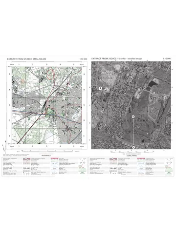
Geography Grade 11 P2 Eastern Cape November 2025 Question Paper
Question paper and memo
Geography Grade 11 Free State March Test 2025 Paper & Memo
Memorandum
Geography Grade 11 Paper 1 Eastern Cape November 2024 Memo
Related documents
Question paper
Geography Grade 11 P2 Eastern Cape November 2024 QP (Eng)
Question paper
Geography Grade 11 P2 North West November 2024 QP (Eng)
Memorandum
Geography Grade 11 P1 Eastern Cape November 2023 Memo (English)
Question paper
Geography Grade 11 P2 Eastern Cape November 2023 QP (Afr)
Question paper
Geography Grade 11 MAPS 2023 Question Paper
Question paper
Geography Grade 11 MAPS 2023 Question Paper
More from Grade 11 Geography
Question paper
Geography Grade 11 Paper 2 MAPS 2023 Question Paper
Question paper
Geography Grade 11 Paper 2 MAPS 2023 Question Paper
Question paper
Geography Grade 11 Paper 2 MAPS 2023 Question Paper
Memorandum
Geography Grade 11 P1 Eastern Cape November 2022 Memo (English)
Memorandum
Geography Grade 11 P2 Eastern Cape November 2022 Memo (Afrikaans)
Memorandum