
NATIONAL
SENIOR CERTIFICATE
GRADE 11
NOVEMBER 2025
GEOGRAPHY P1
MARKS: 150
TIME: 3 hours
This question paper consists of 16 pages.
Skip to contentAll 2025 papers 
View all
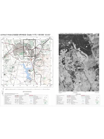
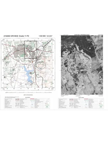
Geography Grade 11 P1 Eastern Cape November 2025 QP (Eng)
Grade 11 Geography Paper 1 question paper from the Eastern Cape November Exam 2025 (English), 16 pages. Read online or download the free PDF.
Geography · Grade 11 · Eastern Cape November Exam · 2025. Question paper, 16 pages. Read online or download the PDF.
- Subject
- Geography
- Grade
- Grade 11
- Document type
- Question paper
- Year
- 2025
- Exam period
- Eastern Cape November Exam
- Paper
- 1
- Curriculum
- CAPS
- Pages
- 16
- File size
- 1.2 MB
Free to read online, no sign-up needed
Loading document…
Loading document…
1 of 16
This exam
Eastern Cape November Exam 2025
- Paper 1Question paperMemo
- Paper 2Question paperMemo
- Other filesQuestion paper
Questions in this paper
Document textSearch extracted text and jump to a page.
2 GEOGRAPHY P1 (EC/NOVEMBER 2025)
INSTRUCTIONS AND INFORMATION
1. This question paper consists of TWO SECTIONS:
SECTION A:
QUESTION 1: The Atmosphere (60)
QUESTION 2: Geomorphology (60)
SECTION B:
QUESTION 3: Geographical Skills and Techniques (30)
2. Answer all THREE questions.
3. ALL diagrams are included in the QUESTION PAPER.
4. Leave a line between subsections of questions answered.
5. Start EACH question at the top of a NEW page.
6. Number the answers correctly according to the numbering system used in this
question paper.
7. Do NOT write in the margins of the ANSWER BOOK.
8. Draw fully labelled diagrams when instructed to do so.
9. Answer in FULL SENTENCES, except when you have to state, name, identify or
list.
10. Units of measurement MUST be indicated in your final answer, e.g. 1 010 hPa,
9 °C and 25 m.
11. You may use a non-programmable calculator.
12. You may use a magnifying glass.
13. Write neatly and legibly.
SPECIFIC INSTRUCTIONS AND INFORMATION FOR SECTION B
14. A 1 : 50 000 topographical map (EXTRACT from 2930 AC and AD HOWICK) and
1 : 10 000 (EXTRACT from 2930AC 25 HOWICK ortho-rectified image) an
orthophoto map of a part of the mapped area are provided.
15. The area demarcated in RED/BLACK on the topographic map represents the
area covered by the orthophoto map.
16. Show ALL calculations. Marks will be allocated for this.
17. You must hand in the topographic and the orthophoto map to the invigilator at the
end of this examination session.
Copyright reserved Please turn over
(EC/NOVEMBER 2025) GEOGRAPHY P1 3
SECTION A: CLIMATE AND WEATHER AND GEOMORPHOLOGY
QUESTION 1: THE ATMOSPHERE
1.1 Complete the statements in COLUMN A with the options in COLUMN B. Write
only Y or Z next to the question numbers (1.1.1 to 1.1.8) in the ANSWER
BOOK, example 1.1.9 Z.
COLUMN A COLUMN B
1.1.1 Incoming solar energy reaching a Y terrestrial radiation
given area Z insolation
1.1.2 The manner in which heat is evened Y albedo
out between the polar areas and the Z energy balance
equator
1.1.3 The earth turns around its imaginary Y rotation
axis once every 24 hours. Z revolution
1.1.4 The time of the year when midday Y equinox
sun is directly overhead at one of the Z solstice
tropics
1.1.5 Circular pattern on a global scale Y primary circulation
Z global air circulation
1.1.6 Difference in air pressure causing air Y pressure gradient
to move from high pressure to low Z Coriolis force
pressure
1.1.7 Zones of high pressure and low- Y pressure belts
pressure areas found at different Z polar front
latitudes
1.1.8 The cell of air circulation that occurs Y Ferrell cell
between 30º ‒ 60º North and South Z polar cell
(8 x 1) (8)
Copyright reserved Please turn over
4 GEOGRAPHY P1 (EC/NOVEMBER 2025)
1.2 Refer to the sketch below and answer the questions that follow. Choose the answer
and write only the letters (A‒D) next to the question numbers (1.2.1 to 1.2.7) in the
ANSWER BOOK, for example 1.2.8 C.
[Source: Examiner’s own sketch]
1.2.1 … are large movements of water that occur in all the oceans of the world.
A Ocean currents
B Tides
C Streams
D Waves
1.2.2 The ocean on the West Coast of South Africa is called the …
A Atlantic Ocean.
B Indian Ocean.
C Pacific Ocean.
D Benguela Ocean.
1.2.3 The exchange of heat between the ocean and the atmosphere mainly
occurs through …
A ocean salanity.
B wind and evaporation.
C sea floor spreading.
D tidal action.
Copyright reserved Please turn over
(EC/NOVEMBER 2025) GEOGRAPHY P1 5
1.2.4 The … is the ocean current that flows along B.
A Canary Current
B Mozambique Current
C Benguela Current
D Kuroshio Current
1.2.5 The ocean currents play a combined role in redistributing heat
energy by …
A increasing temperature.
B decreasing temperature.
C moderating temperatures.
D increasing rainfall.
1.2.6 The cold Benguela Current transfers … air from the poles to the …
zone.
A warm; coastal
B cold; temperate
C warm; desert
D cold; coastal
1.2.7 Warm ocean currents move from the … to the …
A poles; equator.
B west; poles.
C equator; poles.
D east; equator. (7 x 1) (7)
Copyright reserved Please turn over
6 GEOGRAPHY P1 (EC/NOVEMBER 2025)
1.3 Refer to the sketch below and answer the questions that follow.
[Source: Examiner’s own sketch]
1.3.1 Does the wet adiabatic lapse rate occur at A or B? (1 x 1) (1)
1.3.2 Classify any TWO natural disasters that Föhn winds and other similar
kinds of winds can cause. (2 x 1) (2)
1.3.3 Why is the Föhn wind an example of a regional wind? (1 x 2) (2)
1.3.4 Explain why no rain occurs on the leeward side of the mountain.
(1 x 2) (2)
1.3.5 Suggest measures to reduce fires caused by Föhn winds. (4 x 2) (8)
Copyright reserved Please turn over
(EC/NOVEMBER 2025) GEOGRAPHY P1 7
1.4 Refer to the synoptic weather map of Southern Africa.
1.4.1 Determine the pressure reading at B. (1 x 1) (1)
1.4.2 Provide the term given to area D on the map. (1 x 1) (1)
1.4.3 Give evidence from the synoptic weather map to prove that feature
C is a low-pressure cell. (2 x 1) (2)
1.4.4 The synoptic weather map represents winter. Provide evidence from
the map. (2 x 2) (4)
1.4.5 Determine the weather conditions experienced at A by focusing on:
(a) Cloud cover
(b) Wind direction
(c) Dew point temperature (3 x 1) (3)
1.4.6 Comment on the pressure gradient at E and the resultant wind
speed. (2 x 2) (4)
Copyright reserved Please turn over
8 GEOGRAPHY P1 (EC/NOVEMBER 2025)
1.5 Read the extract below on the effects of drought and desertification in Harry
Gwala District Municipality.
DROUGHT AND DESERTIFICATION
Drought and desertification in the Harry Gwala District Municipality, KwaZulu-
Natal, impact communities through reduced water availability, diminished crop
production and loss of agricultural land. This is leading to food insecurity and
potential migration to urban areas. These events also cause increased run-
away fires, high erosion and loss of species and habitat.
1.5.1 What is desertification? (1 x 2) (2)
1.5.2 Quote, from the extract, environmental impacts caused by the events
of drought and desertification. (3 x 1) (3)
1.5.3 Outline the natural causes of desertification. (2 x 2) (4)
1.5.4 Recommend THREE management strategies to reduce
desertification. (3 x 2) (6)
[60]
Copyright reserved Please turn over
(EC/NOVEMBER 2025) GEOGRAPHY P1 9
QUESTION 2: GEOMORPHOLOGY
2.1 Complete the statements in COLUMN A with the options in COLUMN B. Write only
Y or Z next to the question numbers (2.1.1 to 2.1.8) in the ANSWER BOOK, for
example 2.1.9 Z.
COLUMN A COLUMN B
2.1.1 Cuestas is found in topography Y horizontal layers
associated with … Z inclined layers
2.1.2 The landform where the layers dip at Y homoclinal ridge
25º to 45º Z hogsback
2.1.3 Breaking down of rocks due to Y mechanical weathering
extreme temperatures Z chemical weathering
2.1.4 Top soil becomes saturated and Y solifluction
slides on the frozen ground beneath it Z soil creep
2.1.5 The scarp slope faces towards the Y cuesta basin
centre of the dome and the dip slope Z cuesta dome
faces towards the outwards
2.1.6 Mushroom shaped intrusion of Y laccolith
magma Z lopolith
2.1.7 Vertical intrusion along sedimentary Y dykes
rocks Z sills
2.1.8 The factor that distinguishes cuestas Y angle of the dip slope
from homoclinal ridges is the … Z type of resistant rock
(8 x 1) (8)
Copyright reserved Please turn over
10 GEOGRAPHY P1 (EC/NOVEMBER 2025)
2.2 Refer to the sketch below showing slope elements and answer the questions that
follow. Write only the letter (A‒D) next to the question numbers (2.2.1 to 2.2.7) in
the ANSWER BOOK, for example 2.2.8 C.
[Source: lotusarise.com]
2.2.1 Weathered material from the cliff and crest accumulates here.
2.2.2 Also known as the free face.
2.2.3 Covered with sediments from the talus slope.
2.2.4 It has a convex slope.
2.2.5 The cliff retreats backward due to erosion.
2.2.6 The dominant geomorphological processes taking place here are
weathering and soil creep.
2.2.7 Vegetation grows better on this slope. (7 x 1) (7)
Copyright reserved Please turn over
(EC/NOVEMBER 2025) GEOGRAPHY P1 11
2.3 Refer to the sketch below showing topography associated with horizontally layered
rocks.
[Adapted from lotusarise.com]
2.3.1 The process that is responsible for the widening of the valleys is
(scarp retreat / tectonic forces). (1 x 1) (1)
2.3.2 Comment on the general climate of this area. (1 x 2) (2)
2.3.3 Identify the landforms labelled C and D. (2 x 1) (2)
2.3.4 Distinguish between landforms C and D. (2 x 2) (4)
2.3.5 Briefly discuss the impact of the utilisation of this landscape by
humans. (3 x 2) (6)
Copyright reserved Please turn over
12 GEOGRAPHY P1 (EC/NOVEMBER 2025)
2.4 Refer to the sketch below showing tors.
[Source: internetgeography.net]
2.4.1 What are tors? (1 x 2) (2)
2.4.2 Mention ONE igneous intrusion from which tors develop. (1 x 1) (1)
2.4.3 Describe the characteristics of the rocks mentioned in
QUESTION 2.4.2. (2 x 2) (4)
2.4.4 In a paragraph of approximately EIGHT lines, explain how tors
develop. (4 x 2) (8)
Copyright reserved Please turn over
(EC/NOVEMBER 2025) GEOGRAPHY P1 13
2.5 Refer to the photograph and extract below showing mass movement.
HEAVY RAINS TRIGGER LANDSLIDES IN PORT ST. JOHNS, EC
FRIDAY 24 MARCH 2023 – 10:30 am
Heavy rainfall in Port St. Johns has recently triggered landslides and widespread
flooding, causing significant damage to homes, roads and infrastructure. Mayor
Nomvuzo Mlobile Cingos says she ‘is expecting disaster management teams to
arrive in the next few hours’. Gift of the Givers has also volunteered to help those
affected by floods.
[Adapted from www.enca.com]
2.5.1 What is mass movement? (1 x 2) (2)
2.5.2 According to the extract, mention the factor that has triggered
mass movement. (1 x 1) (1)
2.5.3 Give evidence from the photograph, that landslides have taken
place. (2 x 1) (2)
2.5.4 Explain the negative impact that these landslides have on
people. (2 x 2) (4)
2.5.5 Suggest THREE strategies that can be put in place to minimise
the impact of landslides. (3 x 2) (6)
[60]
TOTAL SECTION A: 120
Copyright reserved Please turn over
14 GEOGRAPHY P1 (EC/NOVEMBER 2025)
SECTION B
QUESTION 3: GEOGRAPHICAL SKILLS AND TECHNIQUES
GENERAL INFORMATION ON HOWICK
Co-ordinates: 20º28' S: 30º14'E
Howick is a town located in the Umngeni Local Municipality of KwaZulu-Natal Province,
South Africa. The town is 1 050 m above sea level, and about 88 kilometres from the port
city of Durban. It experiences warm summers and cool dry winters.
[Adapted from https://en.wikipedia.org/wik/Howick. South Africa]
The following English terms and their Afrikaans translations are shown on the
topographic and orthophoto map:
ENGLISH AFRIKAANS
Waterfall Waterval
Nature reserve Natuurreservaat
Show grounds Skougronde
River Rivier
Golf Course Gholfbaan
Parks Parke
Copyright reserved Please turn over
(EC/NOVEMBER 2025) GEOGRAPHY P1 15
3.1 MAPWORK SKILLS AND CALCULATIONS
3.1.1 The orthophoto map is an example of a … photograph.
A high angle oblique
B low angle oblique
C horizontal aerial
D vertical aerial (1)
3.1.2 The scale of the orthophoto map is … times … than the scale of the
topographical map.
(i) five
(ii) ten
(ii) smaller
(iv) larger
A (i) and (iii)
B (i) and (iv)
C (ii) and (iii)
D (iii) and (iv) (1)
3.1.3 On the orthophoto map, the distance from point 10 to point 11 is …
km.
A 0,8
B 0,16
C 1,6
D 8 (1)
3.1.4 … is the photo number for the orthophoto map.
A 29
B 30
C 25
D AC (1)
3.1.5 Determine the grid reference/co-ordinates for the feature at point H
on the topographic map. Write down ONLY the information that is
not available in this question.
A _____ ° 25' 32,4" S (1 x 1) (1)
B 30º _____' ____"E (2 x 1) (2)
Refer to the topographic map to answer the following question.
3.1.6 Calculate the magnetic declination of the given map for the present
year.
Use the following information:
Difference in years = 13 years
Mean annual change = 2' (3 x 1) (3)
Copyright reserved Please turn over
16 GEOGRAPHY P1 (EC/NOVEMBER 2025)
3.2 MAP INTERPRETATION
3.2.1 (a) State the general flow direction of river G (block B2). (1 x 1) (1)
(b) Give evidence from the topographic map to support the answer
in QUESTION 3.2.1(a). (1 x 2) (2)
3.2.2 Give the climatological reason for the numerous dams (perennial
water) on the topographic map. (1 x 2) (2)
3.2.3 (a) Is Howick Falls at point F (Block E2) on the topographic map
intervisible with the caravan park in point I (Block E2)? (1 x 1) (1)
(b) Provide a reason for the answer in QUESTION 3.2.3(a).
(1 x 2) (2)
Refer to the orthophoto map.
3.2.4 The landform at point 8 is a ridge.
(a) Define the term ridge. (1 x 2) (2)
(b) Outline the significance of a ridge. (1 x 2) (2)
3.3 GEOGRAPHIC INFORMATION SYSTEMS (GIS)
3.3.1 The data layers evident at point 9 on the orthophoto map are:
(i) Transport
(ii) Drainage
(iii) Relief/Topography
(iv) Infrastructure
A (i) and (ii)
B (ii) and (iii)
C (iii) and (iv)
D (ii) and (iii) (1 x 1) (1)
3.3.2 Is the topographic or orthophoto map a primary source? (1 x 1) (1)
3.3.3 Give a reason for the answer in QUESTION 3.3.2. (1 x 2) (2)
3.3.4 Explain the difference between spatial resolution and spectral
resolution. (2 + 2) (4)
[30]
TOTAL SECTION B: 30
GRAND TOTAL: 150
Copyright reserved Please turn over
Study this subject
Recommended for this subject
Memorandum
Geography Grade 11 P1 Eastern Cape November 2025 Memo (Eng)
Question paper
Geography Grade 11 P1 Eastern Cape November 2012 QP (Afr)
Memorandum
Geography Grade 11 P2 Eastern Cape November 2025 Memo (Eng)
Memorandum
Geography Grade 11 P1 Eastern Cape November 2024 Memo (Afr)
Memorandum
Geography Grade 11 P1 Eastern Cape November 2023 Memo (Eng)
Memorandum
Geography Grade 11 P1 Eastern Cape November 2012 Memo (Afr)
More from Grade 11 Geography
Question paper and memo
Geography Grade 11 Free State March Test 2025 Paper & Memo
Question paper
Geography Grade 11 MAPS 2023 Question Paper
Question paper
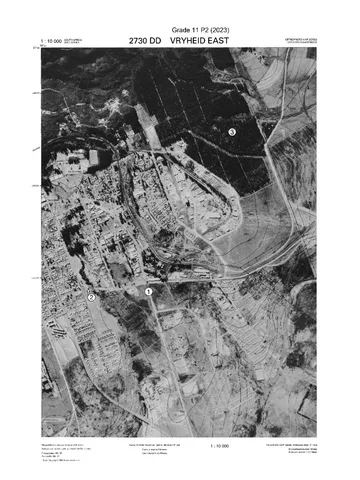
Geography Grade 11 Paper 2 MAPS 2023 Question Paper
Question paper
Geography Grade 11 Paper 2 MAPS 2023 Question Paper
Question paper
Geography Grade 11 Paper 2 MAPS 2023 Question Paper
Memorandum