
NATIONAL
SENIOR CERTIFICATE
GRADE 11
NOVEMBER 2025
GEOGRAPHY P2
MARKING GUIDELINE
MARKS: 150
This marking guideline consists of 9 pages.
Skip to contentAll 2025 papers 
View all
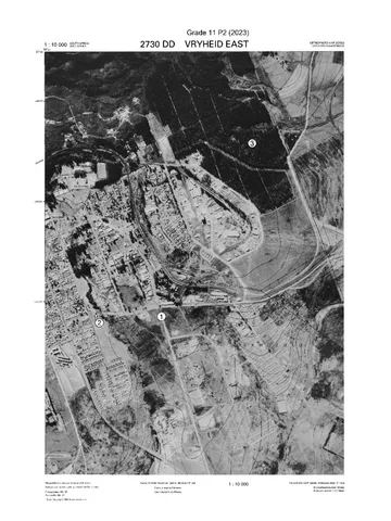
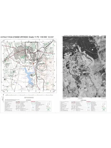
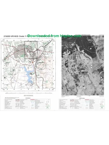
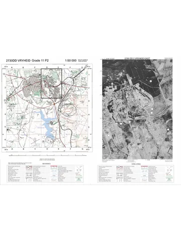
Geography Grade 11 P2 Eastern Cape November 2025 Memo (Eng)
Grade 11 Geography Paper 2 memorandum from the Eastern Cape November Exam 2025 (English), 9 pages. Read online or download the free PDF.
Geography · Grade 11 · Eastern Cape November Exam · 2025 · English. Memorandum, 9 pages. Read online or download the PDF.
- Subject
- Geography
- Grade
- Grade 11
- Language
- English
- Document type
- Memorandum
- Year
- 2025
- Exam period
- Eastern Cape November Exam
- Paper
- 2
- Curriculum
- CAPS
- Pages
- 9
- File size
- 587.1 KB
Free to read online, no sign-up needed
Loading document…
Loading document…
1 of 9
This exam
Eastern Cape November Exam 2025
- Paper 1Question paperMemo
- Paper 2Question paperMemo
- Other filesQuestion paper
Document textSearch extracted text and jump to a page.
2 GEOGRAPHY P2 (EC/NOVEMBER 2025)
SECTION A
QUESTION 1
1.1 1.1.1 Z (1)
1.1.2 Y (1)
1.1.3 Z (1)
1.1.4 Y (1)
1.1.5 Y (1)
1.1.6 Z (1)
1.1.7 Z (1)
1.1.8 Z (1) (8 x 1) (8)
1.2 1.2.1 D (1)
1.2.2 A (1)
1.2.3 D (1)
1.2.4 A (1)
1.2.5 C (1)
1.2.6 C (1)
1.2.7 B (1) (7 x 1) (7)
1.3 1.3.1 To empower local people (1) (1 x 1) (1)
1.3.2 Money sourced primarily from government departments and other
public sectors and development principles. (2) (1 x 2) (2)
1.3.3 Mismanagement of funds (1)
Crash in macadamia nut prices (1) (2 x 1) (2)
1.3.4 Loss of jobs (2)
Families without a source of income (2)
Decrease in quality of life (accept examples) (2)
Increase in poverty levels (2)
Lack of trust in community leaders (2)
People left discouraged / disheartened / unmotivated (2)
Loss of faith in future community development project (2)
Skills specific to nut farming / non-transferable skills (2)
Increase in crime / looting infrastructure (2)
Rural-urban migration / brain drain (2)
Increase in social unrest / protests (2)
[ANY TWO] (2 x 2) (4)
Copyright reserved Please turn over
(EC/NOVEMBER 2025) GEOGRAPHY P2 3
1.3.5 Provide education / skills development / upskilling (2)
Provide ongoing support (accept examples) (2)
Infrastructure delivered on time (2)
Enhance strong partnership between community and other
stakeholders (2)
Build social capital (2)
Ensure project is appropriate (2)
Set up monitoring / evaluation system (2)
Ensure buy-in from all members (2)
Provide a safety-net for emergencies (2)
Involve residents in decision-making (2)
Involve residents in planning (2)
Connect rural producers with regional/national markets (2)
Establish a resource management plan (2)
Implement conflict resolution structures (2)
[ANY THREE] (3 x 2) (6)
1.4 1.4.1 China (1) (1 x 1) (1)
1.4.2 Benefited from the customs relief system (2)
Only paid import duty (tariff) without VAT (2)
Able to sell goods cheaper (accept examples) (2)
[ANY ONE} (1 x 2) (2)
1.4.3 Lower prices / cheaper (2)
Access to wider range of products / greater variety (2)
Increase purchasing power (2)
Convenience (accept examples) (2)
Access to latest goods / fashion (2)
Specialised goods available (2)
Better quality of products (2)
Assess to discounts / promotions / deals (accept examples) (2)
[ANY TWO] (2 x 2) (4)
1.4.4 To protect local businesses who are undercut by cheaper goods (2)
To encourage local production which contributes to the economy (2)
Increase government revenue through higher tariffs (2)
To save / protect jobs in the local industries (2)
To maximise income received from import duties / tariffs (2)
To boost local production which can be exported (2)
To avoid loss of tax revenue from local companies (2)
To help reduce South Africa’s growing trade deficit (2)
Deters consumers from buying poorer quality which costs more in the
long run (2)
Encourage consumers to buy local which keeps money in the country (2)
Trade protectionism protects the interest of SA (2)
Buying local increases the multiplier effect in the South African
economy (2)
[ANY FOUR]
[NO PART MARKING. ANSWER NEEDS AN EXPLANATION AND A
QUALIFIER] (4 x 2) (8)
Copyright reserved Please turn over
4 GEOGRAPHY P2 (EC/NOVEMBER 2025)
1.5 1.5.1 Aid from one government / country to another. (2) (1 x 2) (2)
[CONCEPT]
1.5.2 Saves lives / prevents loss of life (during emergencies) (1)
Alleviates suffering (1)
Addresses urgent health crisis (1)
Emergency-focused (1)
[ANY ONE] (1 x 1) (1)
1.5.3 The USA is cutting off (literally cutting) money (aid) (2) (1 x 2) (2)
1.5.4 Became dependent on aid over the years (2)
Relied on the continuous support / aid (2)
Country remains in crisis mode because of instability (2)
Weak government institutions (2)
No local systems in place to fill the gap (2)
Overreliance on a few key donors (2)
[ANY TWO] (2 x 2) (4)
1.5.5 Decrease in quality of life / standard of living (2)
Increased poverty (2)
Reduced access to basic services (accept examples) (2)
Increased food insecurity (2)
Higher death rate (2)
Increased migration (2)
Break down of families (2)
Increased conflict (2)
Increase in crime / increase in social instability (2)
Increase in child labour (2)
[ANY THREE] (3 x 2) (6)
[60]
Copyright reserved Please turn over
(EC/NOVEMBER 2025) GEOGRAPHY P2 5
QUESTION 2
2.1 2.1.1 Non-conventional (1)
2.1.2 Non-conventional (1)
2.1.3 Conventional (1)
2.1.4 Conventional (1)
2.1.5 Non-conventional (1)
2.1.6 Non-conventional (1)
2.1.7 Conventional (1) (7 x 1) (7)
2.2 2.2.1 Y (1)
2.2.2 Y (1)
2.2.3 Z (1)
2.2.4 Y (1)
2.2.5 Z (1)
2.2.6 Z (1)
2.2.7 Y (1)
2.2.8 Z (1) (8 x 1) (8)
2.3 2.3.1 Northern-Cape (1) (1 x 1) (1)
2.3.2 Average soil loss rate is 12,6 tons per hectare. The natural formation
rate is approximately 4,9 tons per hectare per year. (2) (1 x 2) (2)
2.3.3 Decreased crop yield (2)
Reduced crop quality (2)
Greater risk of crop failure (2)
Reduced income / profit (2)
Reduced farm value (2)
Increased operating costs (accept examples) (2)
[ANY TWO] (2 x 2) (4)
Copyright reserved Please turn over
6 GEOGRAPHY P2 (EC/NOVEMBER 2025)
2.3.4 Planting cover crops / trees / afforestation (2)
Implement strip cropping (2)
Avoid ploughing on steep slopes (2)
Contour ploughing across a slope (2)
Introduce crop rotation (2)
Building step-like level / terraces on slopes (2)
Add a layer of organic material / mulching (2)
Add fertiliser (2)
Reduce / avoid tillage farming (2)
Plant windbreaks (2)
Improve irrigation practices (2)
Controlling veld fires (2)
Fencing paddocks (2)
Avoid overgrazing (2) (4 x 2) (8)
2.4 2.4.1 Renewable (1) (1 x 1) (1)
2.4.2 Increase (1) (1 x 1) (1)
2.4.3 Due to South Africa’s rising electricity demand. (1) (1 x 1) (1)
2.4.4 Plateau landscape (1)
Strong average wind speeds (1) (2 x 1) (2)
2.4.5 Does not deplete any natural resource (2)
No carbon emissions / reduced carbon footprint / no greenhouse gas
emission (2)
No waste products (2)
No water use (2)
Minimal land disturbance (2)
Minimal impact on wildlife and ecosystems (2)
[ANY TWO] (2 x 2) (4)
2.4.6 On-site training / education leads to upskilling (2)
Employment at wind farm decreases poverty (2)
Income into household improves standard of living (accept examples) (2)
Social programmes (accept examples) improve quality of life (2)
Crime / social ills reduced because of less unemployment / social
network (2)
Local workers employed which means families don’t break up (2)
More facilities (accept examples) for greater convenience (2)
Building social capital will create a sense of community belonging (2)
Aesthetics / healthier environment (accept examples) improves life
expectancy. (2)
[ANY THREE] (3 x 2) (6)
NO PART MARKING. ANSWER REQUIRES AN EXPLANATION AND
A QUALIFIER
Copyright reserved Please turn over
(EC/NOVEMBER 2025) GEOGRAPHY P2 7
2.5 2.5.1 Achieving net-zero greenhouse gas (GHG) emissions by 2050 (1) (1)
2.5.2 (Different levels of) government / Public sector (1)
Businesses / Private sector (1)
Individuals / Households (1)
[ANY TWO] (2 x 1) (2)
2.5.3 By promoting renewable energy (accept examples) (2)
Diversifying energy sources (accept examples) (2)
Reducing dependence on coal (2)
[ANY ONE] (1 x 2) (2)
2.5.4 Lower greenhouse gasses / fewer GHGs (2)
Improved air quality (2)
Reduced waste (accept examples) (2)
Less acid rain (2)
Reduced pollution (accept examples) (2)
Less toxic matter seeping into ground water (2)
Less deforestation / land clearing (2)
Reduced land degradation (2)
Reduced impact on global changing (2)
[CAN BE RELATED TO COAL MINING OR PRODUCTION OF
THERMAL ENERGY]
[ANY TWO] (2 x 2) (4)
2.5.5 Expensive to transition / large investments needed (2)
Increases national debt / borrowing money (2)
Loss of jobs related to coal (accept examples) (2)
Loss of country’s economy (GDP) / reduced coal exports (2)
Cost of training people / skills development (2)
Coal mining towns will suffer economic decline (2)
[ANY THREE] (3 x 2) (6)
[60]
Copyright reserved Please turn over
8 GEOGRAPHY P2 (EC/NOVEMBER 2025)
SECTION B
QUESTION 3
3.1 3.1.1 A (1) (1 x 1) (1)
3.1.2 C (1) (1 x 1) (1)
3.1.3 0.9 cm x 100 = 90 (1) m
90 x 90 = 8 100 m² (1) (2 x 1) (2)
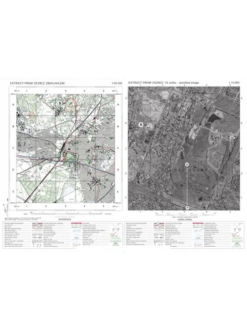
3.1.4 Orthophoto map has a larger scale (2)
Orthophoto map’s scale is five times larger (2)
Topographical map has a smaller scale (2)
Topographical map’s scale is five times smaller (2)
[ANY ONE] (1 x 2) (2)
3.1.5 5 m (1) (1 x 1) (1)
3.1.6 1 590 (m) – 1 565 (m) = 25 m (2) (1 x 2) (2)
3.1.7 C (1) (1 x 1) (1)
3.2 3.2.1 Coal (1) (1 x 1) (1)
3.2.2 Open-cast mine (1)
Diggings (1)
Excavation (1)
Mine dump (1)
[ANY TWO] (2 x 1) (2)
3.2.3 Exposure to noise pollution (1)
Health risks (accept examples) (1)
Contamination of water / water scarcity (1)
Decline in property value (1)
Reduces aesthetical value (1)
Heavy coal trucks increase traffic / damage roads (1)
Blasting can cause structural damage to homes (1)
[ANY TWO] (2 x 1) (2)
3.2.4 Allows for effective transportation of goods / raw material (2)
Allows for effective transportation of workers (2)
Creates accessibility to major markets (2)
Effective transport network attracts investors (2)
Transport costs are reduced / cost-effective (2)
Facilitates the bulk movement of commodities (2)
[ANY TWO] (2 x 2) (4)
3.2.5 C (1) (1 x 1) (1)
Copyright reserved Please turn over
(EC/NOVEMBER 2025) GEOGRAPHY P2 9
3.2.6 Increased sedimentation / cloudiness (1)
Sediments can carry pollutants (accept examples) (1)
Increased nutrient content / Eutrophication (1)
Lower pH / increases acidity (1)
Eroded soil can carry pathogens (1)
Creates a chemical imbalance (1)
[ANY TWO] (2 x 1) (2)
3.3 3.3.1 (a) Spatial (1)
(b) Attribute (1) (2 x 1) (2)
3.3.2 A (1) (1 x 1) (1)
3.3.3 D (1) (1 x 1) (1)
3.3.4 Raster (1) (1 x 1) (1)
3.3.5 Made up of pixels (2)
Data is cell-based (2)
[ANY ONE] (1 x 2) (2)
3.3.6 Area (1)
Polygon (1)
[ANY ONE] (1 x 1) (1)
[30]
TOTAL SECTION B: 30
GRAND TOTAL: 150
Copyright reserved Please turn over
Study this subject
Recommended for this subject
Question paper
Geography Grade 11 P2 Eastern Cape November 2024 QP (Eng)
Question paper
Geography Grade 11 P2 Eastern Cape November 2025 QP
Memorandum
Geography Grade 11 P2 Eastern Cape November 2020 Memo (Eng)
Memorandum
Geography Grade 11 P2 Eastern Cape November 2018 Memo (Eng)
Question paper
Geography Grade 11 P1 Eastern Cape November 2025 QP (Eng)
Question paper
Geography Grade 11 P2 North West November 2024 QP (Eng)
More from Grade 11 Geography
Question paper and memo
Geography Grade 11 Free State March Test 2025 Paper & Memo
Question paper
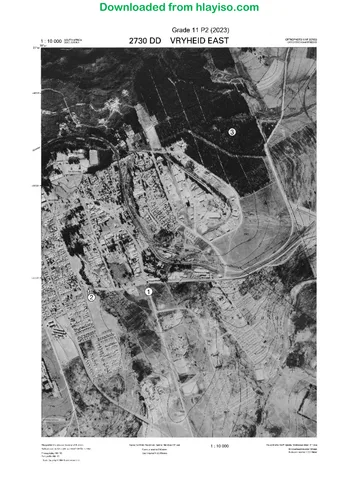
Geography Grade 11 MAPS 2023 Question Paper
Question paper
Geography Grade 11 MAPS 2023 Question Paper
Question paper
Geography Grade 11 Paper 2 MAPS 2023 Question Paper
Question paper
Geography Grade 11 Paper 2 MAPS 2023 Question Paper
Question paper