Blouberg Ridge Primary School
Social Sciences: Geography Teachers: ……………………...
Marking Guideline Grade 4
Date: 2 July 2021 Time: 1 hour
Examiner: L. Arbuckle Moderator: …………………….……
Task 4: Controlled Test Total: 35
Section A: (16)
Question 1: Write down the correct word for each description.
1.1 Something that stands out in an area. landmark
1.2 A place that protects us from the sun, wind and rain. shelter
1.3 Something made by humans. man-made LO (3)
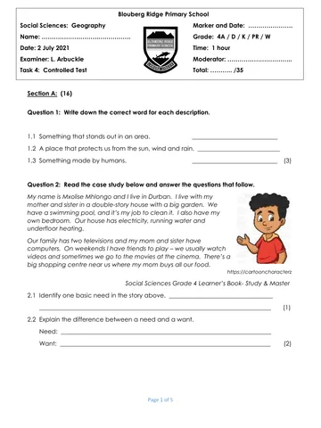
Question 2: Read the case study below and answer the questions that follow.
My name is Mxolise Mhlongo and I live in Durban. I live with my
mother and sister in a double-story house with a big garden. We
have a swimming pool, and it’s my job to clean it. I also have my
own bedroom. Our house has electricity, running water and
underfloor heating.
Our family has two televisions and my mom and sister have
computers. On weekends I have friends to play – we usually watch
videos and sometimes we go to the movies at the cinema. There’s a
big shopping centre near us where my mom buys all our food.
https://cartooncharacterz
Social Sciences Grade 4 Learner’s Book- Study & Master
2.1 Identify one basic need in the story above. Any one – shelter, water, energy,
food LO (1)
2.2 Explain the difference between a need and a want.
Need: something we must have to stay alive and healthy
Want: something we would like to have but don’t need to stay alive or healthy (2)
MO
Page 1 of 5
You're offline
Skip to contentMemorandum
Grade 4 Geography Mid Year Examination Marking Guidelines
Geography · Grade 4 · June Exam · 2021. Memorandum, 5 pages. Read online or download the PDF.
- Subject
- Geography
- Grade
- Grade 4
- Document type
- Memorandum
- Year
- 2021
- Exam period
- June Exam
- Pages
- 5
- File size
- 610.4 KB
Loading document…
Loading document…
1 of 5
Document textSearch extracted text and jump to a page.
Question 3: Look at the pictures below and answer the questions that follow.
Picture A. Picture B.
http://getdrawings.com/ https://www.crayola.co
m/
3.1 Identify the type of settlement seen in Picture A. a farm LO (1)
3.2. Name the settlement seen in Picture B. a town LO (1)
3.3 Compare the two settlements shown above by filling in the missing information on
the table.
Picture A Picture B
A job you can do. a. Any relevant answer b. Any relevant answer based
eg. farmer on the building
eg. teacher at the school
A natural landmark c. trees, pond d. trees
Type of paths e. footpaths f. tarred roads
(footpath, dirt, gravel)
A building that can be g. Any relevant answer h. Any relevant answer based
found eg. barn, shed on the picture.
eg. school, library etc
MO (8)
Section B (19)
Question 4: Answer the questions below.
4.1 Look at the side view of the apple below. Draw a plan view of it in the block
provided.
Side View Plan View
Must show some detail in the middle, not
just a circle
https://www.dreamstime.com/
HO (1)
Page 2 of 5
4.2 Discuss why we use a plan view when drawing maps instead of a side view.
A plan view allows us to see what is behind tall buildings etc. It gives us more
information. HO (2)
Question 5: Fill in the missing words to make the statement true.
5.1 A country is an area that has its own government and laws.
5.2 A round map of the world is called a globe LO (2)
Question 6: Use the compass below to answer the questions.
a. north-east
b. west
https://www.pngitem.com/
6.1 Fill in the missing compass points at a and b. LO (2)
6.2 What are the main compass points known as? They are known as cardinal points (1)
LO
Question 7: Study Map A and key provided on the next page to answer the questions
below.
7.1 Which city is this a map of? East London HO (1)
7.2 Explain why it is important that we can read a grid on a map. So we can find
places easily. MO (1)
7.3 Identify the symbol can we find in the following block:
a. D3 Place of worship. MO (1)
7.4 Locate the square where we can find the following:
a. The Library B3 b. The hospital A2 HO (2)
7.5 There is a hotel in square D4. Draw the missing symbol in the box below: (1)
MO
Page 3 of 5
MapA
Key :
a Built-up area
He Park and sports field
GA Main Road
<-> \ Road
€ Hospital |
Hotel
rad ¢ Library
_ Parking
Page 4 of 5
wanes Railway line
A Place of worship
@ Zoo
1 information
Juta - Investigating Maps Grades 4-6
Question 8: Answer the following questions about the Map of South Africa.
Map B.
a. Northern Cape
https://www.researchgate.net/
8.1 Give the name of the province labelled a. LO (1)
8.2 Identify 1 landlocked country within South Africa’s borders. Lesotho or
Swaziland HO (1)
8.3 Which province is the furthest south on the map? Western Cape MO (1)
8.4 Which ocean lies to the east of South Africa? Indian Ocean MO (1)
8.5 The neighbouring country which lies north-east of Mpumalanga is called
Mozambique. MO (1)
Page 5 of 5
Recommended for this subject
Published documents with matching subject and grade metadata.
Related documents
Matched using subject, grade, language, document type and exam metadata.