
Downloaded from hlayiso.com
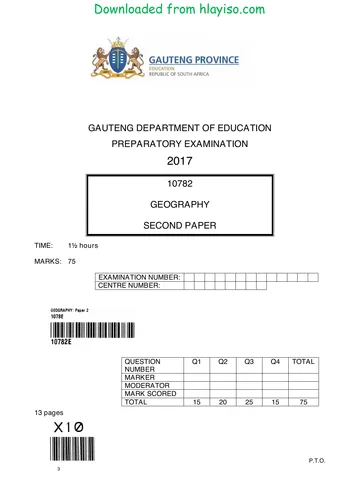
NATIONAL
SENIOR CERTIFICATE
GRADE 12
GEOGRAPHY P2
NOVEMBER 2017
MARKS: 75
TIME: 1½ hours
EXAMINATION
NUMBER:
CENTRE
NUMBER:
M In SM In DM In CM In IM In MC EA EX RM In
Q1
Q2
Q3
Q4
TOT
This question paper consists of 15 pages and
1 page for rough work and calculations.
Copyright reserved Please turn over
Skip to contentQuestion paper %20June%202025%20Question%20Paper--a52dca5e-efc4-4060-84c3-24f7269a2a79/v1-a9ef6866fc707402ff5a/card.webp)
%20June%202025%20Question%20Paper--ba0a3969-240a-4bba-bdb6-7d02a7f80205/v1-98bc441a090fdcbd55aa/card.webp)

%20Preparatory%202017%20Question%20Paper_hlayiso.com_--4ad8597c-c5bb-4d9d-9fae-73ba178541c8/v1-ad48fe9bc0f8232ebee3/card.webp)
_hlayiso.com_--69e0b7d6-90a6-4236-b82c-51f95553a91f/v1-5c923fa820cf9390ccbb/card.webp)
View all

%20June%202024%20Possible%20Answers_hlayiso.com_--7e728632-059d-401a-ba75-fd45632f6091/v1-269fb55ac60eebf555e6/card.webp)
%202024%20Possible%20Answers_hlayiso.com_--e19dd834-ffaf-4fe6-a8a4-9ee8f8597c29/v1-cd443ecc5afd789f654b/card.webp)
Geography Grade 12 Paper 2 NSC November 2017 Question Paper
Grade 12 Geography Paper 2 question paper from the NSC November Exam 2017, 16 pages. Read online or get the free PDF download, memo linked when available.
Geography · Grade 12 · NSC November Exam · 2017. Question paper, 16 pages. Read online or download the PDF.
- Subject
- Geography
- Grade
- Grade 12
- Document type
- Question paper
- Year
- 2017
- Exam period
- NSC November Exam
- Paper
- 2
- Curriculum
- CAPS
- Pages
- 16
- File size
- 465.5 KB
Loading document…
Loading document…
1 of 16
Document textSearch extracted text and jump to a page.
Downloaded from hlayiso.com
Geography/P2 2 DBE/November 2017
NSC
RESOURCE MATERIAL
1. An extract from topographical map 2627CD PARYS
2. Orthophoto map 2627 CD 19 PARYS
3. NOTE: The resource material must be collected by schools for their own use.
INSTRUCTIONS AND INFORMATION
1. Write your EXAMINATION NUMBER and CENTRE NUMBER in the spaces
on the cover page.
2. Answer ALL the questions in the spaces provided in this question paper.
3. You are provided with a 1 : 50 000 topographical map (2627CD PARYS) and
an orthophoto map (2627 CD 19 PARYS) of a part of the mapped area.
4. You must hand the topographical map and the orthophoto map to the
invigilator at the end of this examination session.
5. You may use the blank page at the back of this question paper for all rough
work and calculations. Do NOT detach this page from the question paper.
6. Show ALL calculations and use supplied formulae, where applicable. Marks
will be allocated for these.
7. Indicate the correct unit of measurement in the final answer of calculations.
NO marks will be allocated for answers with incorrect units.
8. You may use a non-programmable calculator and a magnifying glass.
9. The area demarcated in RED on the topographical map represents the area
covered by the orthophoto map.
10. The following English terms and their Afrikaans translations are shown on the
topographical map:
ENGLISH AFRIKAANS
Aerodrome Vliegveld
Caravan Park Karavaanpark
Diggings Uitgrawings
Golf Course Gholfbaan
Gap Poort
Holiday Resort Vakansieoord
Island Eiland
Purification Plant Watersuiweringsaanleg
River Rivier
Sewage Works Rioolwerke
Copyright reserved Please turn over
Downloaded from hlayiso.com
Geography/P2 3 DBE/November 2017
NSC
GENERAL INFORMATION ON PARYS
Parys is a town in the Free State in South Africa. It is located on the banks of the
Vaal River approximately 115 km south of Johannesburg. The completion of the
railway line to Parys in 1905 suddenly made Parys more accessible to the public and
this, in turn, led to the growth of the town as a holiday resort and industrial centre.
Many artists have settled in the town and the variety of new, interesting shops and
attractions make it the ideal breakaway from Gauteng and other big centres. Parys lies
within the Vredefort Dome World Heritage Site. The Vredefort Crater is the largest
verified impact crater on Earth. The Vredefort Dome was added to the list of
UNESCO World Heritage Sites for its geological interest.
PARYS .
Coordinates: 26°54'S 27°27'E
[Adapted from http://en.wikipedia.org/wiki/Parys, South Africa, Freestate]
Copyright reserved Please turn over
Downloaded from hlayiso.com
Geography/P2 4 DBE/November 2017
NSC
QUESTION 1: MULTIPLE-CHOICE QUESTIONS
The questions below are based on the 1 : 50 000 topographical map (2627CD
PARYS), as well as the orthophoto map of a part of the mapped area. Various options
are provided as possible answers to the following questions. Choose the answer and
write only the letter (A–D) in the block next to each question.
1.1 The major industrial region closest to Parys is the … industrial region.
A Port Elizabeth-Uitenhage
B Durban-Pinetown
C Western Cape
D Pretoria-Witwatersrand-Vereeniging
1.2 The topographical map northwest of Parys is situated between the following
lines of latitude:
A 27°00'S and 27°15'S
B 26°30'S and 26°45'S
C 26°00'S and 27°00'S
D 26°15'S and 26°30'S
1.3 The height of the index contour line in block D5 is … metres.
A 1 500
B 1 400
C 1 600
D 1 530
1.4 A human factor limiting further expansion of Parys in a north-westerly direction
is the …
A permanent river.
B international boundary.
C provincial boundary.
D steep gradient.
1.5 The windpump K in block I2 is situated next to the river, because this area has
a … water table.
A high dry season
B high wet season
C low dry season
D low wet season
Copyright reserved Please turn over
Downloaded from hlayiso.com
Geography/P2 5 DBE/November 2017
NSC
1.6 The feature at 26°49'48"S 27°21'54"E/26°49,8'S 27°21,9'E:
A Hiking trail
B Perennial water
C Cultivated land
D Secondary road
1.7 The location of the woodlands in block B9 was influenced by the …
A katabatic flow.
B anabatic flow.
C thermal belt.
D aspect of slope.
1.8 The section of the Vaal River in the mapped area shows characteristics typical
of the …
A middle and lower courses.
B upper course only.
C upper and lower courses.
D lower course only.
1.9 The landform at line 4 on the orthophoto map is a …
A spur.
B valley.
C ridge.
D gap.
1.10 The plots of land in block F9 have elongated (long and narrow) shapes.
The most important reason for this shape is to have access to (the) …
A water.
B fertile soil.
C flat land.
D fuel.
1.11 The road at 3 on the orthophoto map is …
A another road.
B an arterial route.
C a secondary road.
D a main road.
1.12 The cultivated land at 5 on the orthophoto map can be identified by its …
A darker tone.
B smooth texture.
C shadow.
D shape.
Copyright reserved Please turn over
Downloaded from hlayiso.com
Geography/P2 6 DBE/November 2017
NSC
1.13 Refer to the surrounding area at 15 on the orthophoto map. The vertical aerial
photograph used to produce the orthophoto map was taken between …
A 12:00 and 14:00.
B 14:00 and 16:00.
C 10:00 and 12:00.
D 08:00 and 10:00.
1.14 The settlement pattern at L in block D2 is …
A circular.
B linear.
C clustered.
D dispersed.
1.15 The natural water purification feature in blocks J2 and J3 is a …
A windpump.
B cultivated land.
C marsh and vlei.
D excavation.
(15 x 1) [15]
Copyright reserved Please turn over
Downloaded from hlayiso.com
Geography/P2 7 DBE/November 2017
NSC
QUESTION 2: MAP CALCULATIONS AND TECHNIQUES
2.1 Refer to blocks D3 and E3.
2.1.1 Calculate the vertical interval (VI) between M and spot height 1 395 in
metres. Show ALL calculations. Marks will be awarded for
calculations.
_______________________________________________________
_______________________________________________________
_______________________________________________________
_______________________________________________________
(1 x 1) (1)
2.1.2 Calculate the horizontal equivalent (HE) between M and spot
height 1 395 in metres. Show ALL calculations. Marks will be awarded
for calculations.
_______________________________________________________
_______________________________________________________
_______________________________________________________
_______________________________________________________
_______________________________________________________
(2 x 1) (2)
2.1.3 Using the information in QUESTIONS 2.1.1 and 2.1.2, calculate the
average gradient between M and spot height 1 395. Show ALL
calculations. Marks will be awarded for calculations.
vertical interval (VI)
Formula: Gradient =
horizontal equivalent (HE)
_______________________________________________________
_______________________________________________________
_______________________________________________________
_______________________________________________________
_______________________________________________________
(2 x 1) (2)
Copyright reserved Please turn over
Downloaded from hlayiso.com
Geography/P2 8 DBE/November 2017
NSC
2.1.4 Would the gradient calculated in QUESTION 2.1.3 result in a low or
high stream velocity? Give a reason for your answer.
Answer: ________________________________________________
Reason: ________________________________________________
________________________________________________
________________________________________________
(2 x 1) (2)
2.2 Refer to line 6 to 7 on the orthophoto map.
Scale: 1 cm represents 10 m
1400 m 1405 m 1405 m 1380 m
2.2.1 Use the marked-off points below the horizontal axis of the
cross-section to complete the cross-section between 6 and 7 above.
Some heights have been included to assist you. (4 x 1) (4)
2.2.2 Indicate the position of the Pelgrimsrus farmstead on the completed
cross-section in QUESTION 2.2.1. (1 x 1) (1)
Copyright reserved Please turn over
Downloaded from hlayiso.com
Geography/P2 9 DBE/November 2017
NSC
2.2.3 Calculate the vertical exaggeration of the cross-section drawn in
QUESTION 2.2.1. Show ALL calculations. Marks will be awarded for
calculations.
vertical scale (VS)
Formula: Vertical exaggeration =
horizontal scale (HS)
_______________________________________________________
_______________________________________________________
_______________________________________________________
_______________________________________________________
_______________________________________________________
_______________________________________________________
(4 x 1) (4)
2.3 Refer to the orthophoto map and the topographical map.
2.3.1 The magnetic declination of the orthophoto map for 1980 is
given as 17°50ʹ west of True North. Is the magnetic declination of the
orthophoto map bigger or smaller than the magnetic declination
indicated on the topographical map?
_______________________________________________________
(1 x 1) (1)
2.3.2 Give a reason for the difference in the magnetic declination between
the topographical map and the orthophoto map.
_______________________________________________________
_______________________________________________________
(2 x 1) (2)
2.3.3 Why is it important for a hiker to correct the magnetic declination?
_______________________________________________________
_______________________________________________________
(1 x 1) (1)
[20]
Copyright reserved Please turn over
Downloaded from hlayiso.com
Geography/P2 10 DBE/November 2017
NSC
QUESTION 3: APPLICATION AND INTERPRETATION
3.1 Refer to blocks E4 and F3.
3.1.1 Name the drainage pattern in this area.
_______________________________________________________
(1 x 1) (1)
3.1.2 Refer to the topographical map and explain why the drainage pattern
named in QUESTION 3.1.1 developed.
_______________________________________________________
_______________________________________________________
_______________________________________________________
(1 x 2) (2)
3.1.3 Is the drainage density of this area high or low? Give ONE reason for
your answer.
Drainage density: ________________________________________
Reason: ______________________________________________
______________________________________________
______________________________________________
______________________________________________
(1 + 2) (3)
3.2 Refer to the farmstead at O in block G2.
3.2.1 Is the farmstead at O a wet-point settlement or a dry-point
settlement? Give a reason for your answer.
Answer: _______________________________________________
Reason: ________________________________________________
________________________________________________
________________________________________________
(1 + 2) (3)
Copyright reserved Please turn over
Downloaded from hlayiso.com
Geography/P2 11 DBE/November 2017
NSC
3.2.2 Name and explain ONE human-made factor that influenced the
choice of site for the farmstead.
Human-made factor: ______________________________________
Explanation: ___________________________________________
___________________________________________
___________________________________________
(1 + 2) (3)
3.3 Refer to blocks G9 and G10, which is the rural-urban fringe of Parys.
3.3.1 Name ONE activity/service in block G9 and/or block G10 that is found
in the rural-urban fringe.
_______________________________________________________
(1 x 1) (1)
3.3.2 Explain why the activity/service named in QUESTION 3.3.1 is located
in the rural-urban fringe.
_______________________________________________________
_______________________________________________________
_______________________________________________________
(1 x 2) (2)
3.4 Although West End (W) in block H7 is situated close to the CBD, it
experiences much lower average temperatures than expected.
3.4.1 Give and explain ONE reason for the statement above.
Reason: ________________________________________________
Explanation: _____________________________________________
_____________________________________________
_____________________________________________
(1 + 2) (3)
3.4.2 Describe ONE climatological disadvantage for people living in
West End.
_______________________________________________________
_______________________________________________________
_______________________________________________________
(1 x 2) (2)
Copyright reserved Please turn over
Downloaded from hlayiso.com
Geography/P2 12 DBE/November 2017
NSC
3.5 The mapped area receives seasonal rainfall. Give TWO points of evidence in
the topographical map to substantiate (support) this statement.
_____________________________________________________________
_____________________________________________________________
_____________________________________________________________
_____________________________________________________________
(2 x 1) (2)
3.6 Parys is a popular holiday resort.
3.6.1 Give ONE reason why Parys became a popular holiday destination.
_______________________________________________________
_______________________________________________________
(1 x 1) (1)
3.6.2 Explain the positive impact of Parys as a popular holiday destination
on the local economy.
_______________________________________________________
_______________________________________________________
_______________________________________________________
(1 x 2) (2)
[25]
Copyright reserved Please turn over
Downloaded from hlayiso.com
Geography/P2 13 DBE/November 2017
NSC
QUESTION 4: GEOGRAPHICAL INFORMATION SYSTEMS (GIS)
4.1 Parys is located in the Vredefort Crater. Geologists are conducting research
and collecting data on an on-going basis.
4.1.1 Is the data that is collected considered to be primary or secondary
data?
_______________________________________________________
(1 x 1) (1)
4.1.2 Give a reason for your answer to QUESTION 4.1.1.
_______________________________________________________
_______________________________________________________
_______________________________________________________
(1 x 2) (2)
4.1.3 Explain how remote sensing can further assist the geologists with
their research.
_______________________________________________________
_______________________________________________________
_______________________________________________________
_______________________________________________________
(2 x 2) (4)
4.2 Refer to block J8. Buffering plays an important role in protecting settlements
from being flooded.
4.2.1 Define the term buffering.
_______________________________________________________
_______________________________________________________
(1 x 1) (1)
4.2.2 There is no evidence of buffering taking place between the Vaal River
and Parys in blocks G7 and G8. Give a reason from the topographical
map to support this statement.
_______________________________________________________
_______________________________________________________
(1 x 2) (2)
Copyright reserved Please turn over
Downloaded from hlayiso.com
Geography/P2 14 DBE/November 2017
NSC
4.2.3 Explain why no buffering takes place between the Vaal River and
Parys in blocks G7 and G8.
_______________________________________________________
_______________________________________________________
_______________________________________________________
(1 x 2) (2)
4.3 Refer to the rough sketch below, an exaggerated version of block F8.
(The examiner's sketch of block F8 is not drawn to scale).
1
2
....
..
1
2
Reference:
1 – Orchards and vineyards
2 – Cultivated lands
4.3.1 NO data standardisation is taking place in the sketch.
Give a reason to substantiate (support) this statement.
_______________________________________________________
_______________________________________________________
(1 x 1) (1)
Copyright reserved Please turn over
Downloaded from hlayiso.com
Geography/P2 15 DBE/November 2017
NSC
4.3.2 Standardise the data in the sketch below, using the acceptable
standardised conventional signs (map symbols) for a 1 : 50 000
topographical map.
(2 x 1) (2)
[15]
TOTAL: 75
Copyright reserved
Downloaded from hlayiso.com
Geography/P2 DBE/November 2017
NSC
ROUGH WORK AND CALCULATIONS
(NOTE: Do NOT detach this page from the question paper.)
Copyright reserved
Study this subject
Revise the topics in this paper, then practise them question by question.
- Grade 12 Geography notes
CAPS revision notes with worked examples.
- Geography questions by topic
Past exam questions sorted by CAPS topic, with memos where available.
- Grade 12 Geography quizzes
Short topic quizzes with instant feedback.
- All Grade 12 Geography past papers
Past papers by year, with memos where available.
- Grade 12 past papers
More Geography and other subjects in this collection.
Recommended for this subject
More papers and memos for this grade and subject.
Question paper
Geography Grade 12 P1 Gauteng June 2025 Question Paper (Afr)
Question paper
Geography Grade 12 P2 Gauteng June 2025 Question Paper (English)
Question paper
Geography Grade 12 Paper 1 KZN Mock 2025 Question Paper
Question paper
Geography Grade 12 Paper 2 KZN Mock 2025 Question Paper
Question paper
Geography Grade 12 Paper 1 NSC June 2025 Question Paper (English)
Question paper
Geography Grade 12 Eastern Cape June 2023 Question Paper
Related documents
Question paper
Geography Grade 12 Paper 2 Gauteng Mock 2017 Question Paper
Question paper
Geography Grade 12 P2 Gauteng Mock 2017 Question Paper (Afr)
Question paper
Geography Grade 12 Paper 2 NSC June 2017 Question Paper
Question paper
Geography Grade 12 Paper 2 NSC November 2022 Question Paper
Question paper
Geography Grade 12 Paper 2 NSC November 2022 Question Paper
Question paper
Geography Grade 12 Paper 2 NSC November 2022 Question Paper
More from Grade 12 Geography
Memorandum
Geography Grade 12 Paper 2 Gauteng Mock 2025 Memo
Memorandum
Geography Grade 12 Paper 1 NSC November 2025 Memo (English)
Memorandum
Geography Grade 12 P2 Eastern Cape Prelim 2024 Memo (Afrikaans)
Memorandum
Geography Grade 12 Gauteng June 2024 Memo (English)
Memorandum
Geography Grade 12 Paper 2 Gauteng Prelim 2024 Memo (Afrikaans)
Memorandum