
PROVINCIAL ASSESSMENT
GRADE 10
GEOGRAPHY
JUNE 2024
MARKING GUIDELINES
MARKS: 150
These marking guidelines consist of 8 pages.
Copyright reserved Please turn over
Skip to contentQuestion paper 
%20Controlled%20Test%201%202023%20Question%20Paper_hlayiso.com_--bf06e433-8b83-4cb3-a00a-28c97101f988/v1-e3ceb109619a47bc1bd5/card.webp)
/GEOGRAPHY%20P1%20GR10%20QP%20NOV2020_English.docx--aefbccc1-ec40-4766-8c8c-ddf8423198f8/v1-21898a99f80ef19b01dd/card.webp)
View all
Geography Grade 10 North West June 2024 Question Paper (English)
Grade 10 Geography question paper from the North West June Exam 2024 (English), 8 pages. Read online or get the free PDF download, memo linked when available.
Geography · Grade 10 · North West June Exam · 2024 · English. Question paper, 8 pages. Read online or download the PDF.
- Subject
- Geography
- Grade
- Grade 10
- Language
- English
- Document type
- Question paper
- Year
- 2024
- Exam period
- North West June Exam
- Curriculum
- CAPS
- Pages
- 8
- File size
- 255.2 KB
Loading document…
Loading document…
1 of 8
Document textSearch extracted text and jump to a page.
Geography 2 NW/June 2024
Grade 10 – Marking Guidelines
SECTION A
QUESTION 1
1.1.
1.1.1 B (1)
1.1.2 C (1)
1.1.3 D (1)
1.1.4 A (1)
1.1.5 D (1)
1.1.6 A (1)
1.1.7 B (1)
1.1.8 C (1) (8 x 1) (8)
1.2.
1.2.1 Humidity (1)
1.2.2 Evaporation (1)
1.2.3 Condensation (1)
1.2.4 Precipitation (1)
1.2.5 Dew point (1)
1.2.6 Clouds (1)
1.2.7 Relative humidity (1) (7 x 1) (7)
1.3
1.3.1 Ozone depletion is the destruction of ozone so that a hole form in the ozone layer.
(Concept) (2) (1 x 2) (2)
1.3.2 Stratosphere (1) (1 x 1) (1)
1.3.3 Overgrazing (1)
Deforestation (1)
CFC’s (1)
(ANY TWO) (2 x 1) (2)
1.3.4 It may cause skin cancer (1)
Eye cataracts (1)
Lowering of immune system, resulting in increased illness in people & animals (1)
Increase in the incidence of malaria (1)
(ANY TWO) (2 x 1) (2)
1.3.5 People should try to use products labelled “ozone friendly” (2)
The Montreal Protocol is seen as one of the most successful attempts at
reducing the effects of ozone depletion (2)
All CFCs should be replaced (2)
Plant more trees (2)
Use public transport (2)
Educational awareness programmes (2)
(ANY FOUR) (4 x 2) (8)
Copyright reserved Please turn over
Geography 3 NW/June 2024
Grade 10 – Marking Guidelines
1.4
1.4.1 Longitudinal position (1) (1 x 1) (1)
1.4.2 Role of ocean current (1) (1 x 1) (1)
1.4.3 Distance from the sea (1)
Aspect (1)
Altitude (1)
(ANY ONE) (1 x 1) (1)
1.4.4 Air is more heated at (b) because the sun’s rays strike
directly there. Heat is concentrated on a small surface area (2)
Solar energy travels through smaller volume of atmosphere
therefore less scattering, absorption and scattering (2) (2 x 2) (4)
1.4.5 Far from the moderating effect of the oceans (2)
Climate characterised by hot summers and cold winters. (2) (2 x 2) (4)
1.4.5 The temperature of these two ocean currents that flows past
these two towns are different, on the east coast the Warm Mozambique
current flows past Durban and cold Benguela current on the west coast (2)
Rainfall depends on the amount of moisture in the atmosphere
so air on the eastern side is moist and high probability of rainfall
than the western side (2)
Air on the West coast is cold and dry, so chances of rainfall are low (2)
(3 x 2) (6)
1.5
1.5.1 Summer (1) (1 x 1) (1)
1.5.2 North West (1) (1 x 1) (1)
1.5.3 (a) Cumulonimbus cloud (1) (1 x 1) (1)
1.5.3 (b) Heavy rainfall (1)
Hailstorms (1)
Lighting (1)
Thunderstorms (1)
Cloudy conditions (1)
(ANY TWO) (2 x 1) (2)
1.5.4 Rainfall leads to faster growing plant/ grazing (2)
There will be enough water for livestock (2)
(ANY ONE) (1 x 2) (2)
1.5.5. Heavy rainfall may cause floods (2)
Floods cause erosion of soil erosion (2)
Heavy rainfall destroys natural vegetation (2)
Heavy rainfall destroys natural habitats of animal/ ecosystems (2)
Copyright reserved Please turn over
Geography 4 NW/June 2024
Grade 10 – Marking Guidelines
Hurt animal (2)
Lighting can burn vegetation (2)
(Any THREE) (3 X 2) (6)
QUESTION 2
2.1
2.1.1 Alfred Wegener (1)
2.1.2 Pangaea (1)
2.1.3 Laurasia (1)
2.1.4 Gondwanaland (1)
2.1.5 same (1)
2.1.6 tectonic plates (1)
2.1.7 still (1) (7 x 1) (7)
2.2
2.2.1 F (1)
2.2.2 D (1)
2.2.3 A- Sill (1)
B- Volcano (1)
C- Dyke (1)
2.2.4 magma (1)
2.2.5 G (1)
2.2.6 Erosion of top soil (1) (8 x 1) (8)
2.3
2.3.1 A – Crust (1)
B – Mantle (1) (2 x 1) (2)
2.3.2 Igneous rocks (1)
Sedimentary rocks (1)
Metamorphic rocks (1)
(ANY ONE) (1 x 1) (1)
2.3.3 Uses of igneous rocks
Contains valuable metals such as copper, gold, iron and manganese (2)
Mining activities can take place to generate income (2)
Provides building materials (2)
Can be used to make tombstones (2)
Uses of Sedimentary rocks
Used to make cements (2)
Can be used for building materials (2)
Can be used to make tiles and bricks (2)
Can be used to make statues and sculptures (2)
Uses of metamorphic rocks
Used for roofs and garden paths (2)
Copyright reserved Please turn over
Geography 5 NW/June 2024
Grade 10 – Marking Guidelines
Used in road construction (2)
Minerals are found in this rock for beautification and sculptures (2)
(Any TWO) (2 x 2) (4)
2.3.4 Sial is the upper layer of the earth (continental crust), made
up of silica and aluminium (2)
Sima is the lower layer of the earth (oceanic crust), made up
of silica and magnesium (2) (2 x 2) (4)
2.3.5 Crust
It is the solid outermost portion of the earth and is typically 8 to 40
kilometres thick. (2)
Its nature is brittle. (2)
The crust makes up about 5% of the earth's mass and almost 1% of its
volume. (2)
Oceanic and continental regions have different crustal thicknesses. (2)
The oceanic crust is 5 km thinner. (2)
The thickness of continental crust about 30 kms. (2)
Crust composes of Silica (Si) and aluminium (Al). (2)
The crust's components have an average density of 3 g/cm 3. (2)
(ANY TWO) (2 x 2) (4)
2.4
2.4.1 Undersea earthquake (1) (1 x 1) (1)
2.4.2 Focus: Place inside the earth’s crust where the earthquake
originates (Concept) (2)
Epicentre: The point on the earth’s surface directly above
the focus (Concept) (2) (2 x 2) (4)
2.4.3 Result of an earthquake below or near the ocean floor that cause the ocean
floor to suddenly rise or fall. (2)
A wave forms that radiate outward in all directions away from the source. (2)
(2 x 2) (4)
2.4.4 Provide them with shelter/food/ clean water (2)
Medical personal must be sent to affected areas (2)
Emergency personal must be sent to affected areas. (2)
Give affected people money to start their lives again (2)
Build houses on higher ground (2)
Build specially strengthened buildings (2)
Educate people (2)
Having disaster supplies on hand (2)
Early warning systems must be in place (2)
(ANY THREE) (3 x 2) (6)
Copyright reserved Please turn over
Geography 6 NW/June 2024
Grade 10 – Marking Guidelines
2.5
2.5.1 Volcanism is the eruption of molten rock from inside the earth to the surface.
(Concept) (2) (1 x 2) (2)
2.5.2 347 people (1) (1 x 1) (1)
2.5.3 Active (1)
Ring of fire (1) (2 x 1) (2)
2.5.4 People can become ill because of breathing ash. (2) (1 x 2) (2)
2.5.5 Negative effects of volcano
Lava flows burn and bury vegetation and buildings (2)
Earth movements associated with a volcano can set off mudslides (2)
Harden lava can injure or kill people (2)
Positive effects of volcano
Volcanic ash can act as a fertiliser for soil (2)
Volcanic regions such as Hawaii become tourist attractions (2)
Underground water in volcanic regions is hot enough to
use for heating systems and electricity generation (2)
(ANY FOUR) – (Must refer to both) (4 x 2) (8)
(60)
QUESTION 3
3.1
3.1.1 C (1) (1 X 1) (1)
3.1.2 D (1) (1 X 1) (1)
3.1.3 A (1) (1 X 1) (1)
3.1.4 128º (1)/ SE (1) (2 X 1) (2)
3.1.5 (a) Difference in years: 2024 – 2009 = 15 (1) years
(b) Mean annual change: 7' (1) Westwards
(c) Total change: 15 x 7' W = 105' W or 1º 45' (1) W
(d) magnetic declination for 2024:25 º 07' W +(1) 1º 45' =
26 º 52' West of True North (5 x 1) (5)
[10]
Copyright reserved Please turn over
Geography 7 NW/June 2024
Grade 10 – Marking Guidelines
3.2
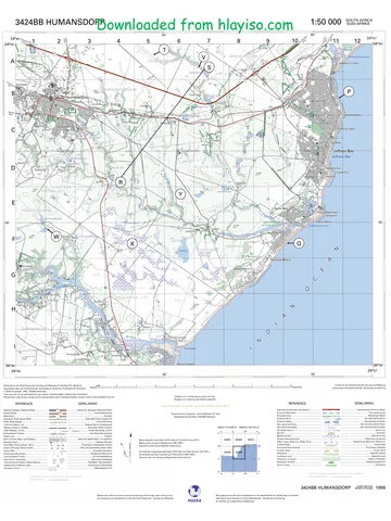
3.2.1 a) 786,9 m (1)
3.2.1 b) 1088 m (1)
3.2.1 c) 1315,6 m (1) (3 x 1) (3)
3.2.2 Golf (1) (1 x 1) (1)
3.2.3 Concave (1) (1 x 1) (1)
3.2.4 Contours are close towards each other at the top and apart at the bottom of
the slope (2) (1 x 2) (2)
3.2.5 Presence of non- perennial rivers (1) /
Reservoirs (1)/ Wind pumps (1)/ Dams (1) Furrows (1)
(ANY TWO) (2 x 1) (2)
3.2.6 Yes (1) (1 x 1) (1)
3.2.7 It is part of the Camdeboo National Park that is bounded
by a green border (2)
Conservation is a priority in this area. (2)
(ANY ONE) (1 x 2) (2)
[12]
3.3
3.3.1 Remote sensing Collecting or gathering or capturing information about the
earth from a distance without physical contact (Concept) (2) (1 x 2) (2)
3.3.2 Data (1) (1 x 1) (1)
3.3.3 mouse (1)
Printer (1)
hard drive (1)
keyboard (1)
monitor (1)
scanner (1)
digitiser (1)
cables (1)
CPU (1)
(ANY ONE) (1 x 1) (1)
Copyright reserved Please turn over
Geography 8 NW/June 2024
Grade 10 – Marking Guidelines
3.3.4 Topographical map consist of point, line and polygon symbols (2) (1 x 2) (2)
3.3.5 Point: School (1)
Church (1)
(ANY ONE) (1 x 1) (1)
POLYGON: Recreational areas (1)
built-up area (1)
(ANY ONE) (1 x 1) (1)
[8]
TOTAL SECTION B: 30
GRAND TOTAL: 150
Copyright reserved
Study this subject
Revise the topics in this paper, then practise them question by question.
- Grade 10 Geography notes
CAPS revision notes with worked examples.
- Geography questions by topic
Past exam questions sorted by CAPS topic, with memos where available.
- Grade 10 Geography quizzes
Short topic quizzes with instant feedback.
- All Grade 10 Geography past papers
Past papers by year, with memos where available.
- Grade 10 past papers
More Geography and other subjects in this collection.
Recommended for this subject
More papers and memos for this grade and subject.
Question paper
Geography Grade 10 P1 North West November 2024 QP (Eng)
Question paper
Geography Grade 10 P2 North West November 2024 QP (Eng)
Question paper
Geography Grade 10 Gauteng March Test 2023 Question Paper (Eng)
Question paper
Geography Grade 10 Eastern Cape November 2020 Question Paper
Question paper
Geography Grade 10 Eastern Cape November 2020 Question Paper
Question paper
Geography Grade 10 P1 Eastern Cape November 2020 QP (Eng)
Related documents
Question paper
Geography Grade 10 P2 Eastern Cape November 2020 QP (Eng)
Question paper
Geography Grade 10 P1 2020 QP (Eng)
Question paper
Geography Grade 10 P1 Eastern Cape November 2018 QP (Eng)
Question paper
Geography Grade 10 P2 National November 2018 Question Paper (Eng)
Question paper
Geography Grade 10 P1 Eastern Cape November 2017 QP (Eng)
Question paper
Geography Grade 10 P1 National November 2017 Question Paper (Eng)
More from Grade 10 Geography
Study guide
Gr10 Geografie OG studyguide LR
Annual teaching plan
Gr 10 Geo ATP 2023 24
Question paper and memo
Geography Grade 10 Free State March Test 2025 Paper & Memo
Question paper and memo
Geography Grade 10 Paper 1 Limpopo June 2025 Paper & Memo
Question paper and memo
Geography Grade 10 Eastern Cape June 2024 Paper & Memo
Addendum