
Downloaded from hlayiso.com
Downloaded f rom St anmorephysics. com
GRADE 10 GEOGRAPHY JUNE EXAMINATION 2024
NATIONAL
SENIOR CERTIFICATE
GRADE 10
GEOGRAPHY
MAY 2024 EXAMINATION
MARKS: 150
TIME: 3 HOUR
This question paper consists of 15 pages
1
Skip to content
View all
Geography Grade 10 Eastern Cape June 2024 Paper & Memo
Grade 10 Geography question paper and memo from the Eastern Cape June Exam 2024, 21 pages. Read online or get the free PDF download.
Geography · Grade 10 · Eastern Cape June Exam · 2024. Question paper and memorandum, 21 pages. Read online or download the PDF.
- Subject
- Geography
- Grade
- Grade 10
- Document type
- Question paper and memo
- Year
- 2024
- Exam period
- Eastern Cape June Exam
- Curriculum
- CAPS
- Pages
- 21
- File size
- 599.0 KB
Free to read online, no sign-up needed
Loading document…
Loading document…
1 of 21
Document textSearch extracted text and jump to a page.
Downloaded from hlayiso.com
Downloaded f rom St anmorephysics. com
GRADE 10 GEOGRAPHY JUNE EXAMINATION 2024
INSTRUCTIONS AND INFORMATION
1. This question paper consists of TWO SECTIONS
2. SECTION A consists of TWO questions of 60 marks each.
3. SECTION B consists of ONE question of 30 marks
4. All THREE questions are COMPULSORY.
5. All diagrams are included in the QUESTION PAPER
6. Leave a line between subsections of questions answered.
7. Number the answers correctly according to the numbering system used in this
question paper. Number the answers in the centre of the line.
8. Do NOT write in the margins of the ANSWER BOOK.
9. Draw fully labelled diagrams when instructed to do so.
10. Answer in FULL SENTENCES, except when you must state, name, identify or list
11. Write neatly and legibly
2
Downloaded from hlayiso.com
Downloaded f rom St anmorephysics. com
GRADE 10 GEOGRAPHY JUNE EXAMINATION 2024
SECTION A: CLIMATE AND WEATHER AND GEOMORPHOLOGY
QUESTION 1: CLIMATE AND WEATHER
1.1. Various options are provided as possible answers to the following
questions. Choose the answer and write only the letter (A–D) next to the
question numbers (1.1.1 to 1.1.8) in the ANSWER BOOK, e.g. 1.1.9 D.
1.1.1. The layer of gas surrounding the earth on which all life depends is
called the…
A. lithosphere
B. atmosphere
C. hydrosphere
D. tectonosphere
1.1.2. … is an example of a permanent gas found in the atmosphere.
A. ozone
B. methane
C. nitrogen
D. sulphur dioxide.
1.1.3. The process whereby the lowest parts of the atmosphere is heated
by contact with the warm earth surface is known as…
A. convection
B. reflection
C. conduction
D. absorption
1.1.4. Mountains are colder than low lying areas because the …
A. temperature of warm air increases with height.
B. rising cold air decrease in temperature with height.
C. temperature of warm air decreases with height.
D. Warm air subsides with height.
3
Downloaded from hlayiso.com
Downloaded f rom St anmorephysics. com
GRADE 10 GEOGRAPHY JUNE EXAMINATION 2024
1.1.5. The amount of water vapour in the air compared to how much water
vapour the air can hold is called…
A. Absolute humidity
B. Condensation
C. Dew point temperature
D. Relative humidity
1.1.6. Cumulonimbus clouds are associated with …
A. thunderstorms
B. fine weather
C. slight drizzle
D. light rain
1.1.7 The temperature at which the condensation of water vapour takes
place is known as …
A. condensation.
B. evaporation.
C. sublimation.
D. dew point temperature. (7x1) (7)
1.2. Study the sketch on the layers of the atmosphere.
1.2.1. Identify the layer where ozone is found.
4
Downloaded from hlayiso.com
Downloaded f rom St anmorephysics. com
GRADE 10 GEOGRAPHY JUNE EXAMINATION 2024
1.2.2. Name the layer responsible for protecting the earth against
dangerous ultra-violet rays of the sun.
1.2.3. Identify the layer which seperates the troposphere and
stratosphere.
1.2.4. Name the layer where all weather producing processes occurs.
1.2.5. Which layer is responsible for protecting the earth against dust and
rocks from space?
1.2.6. Identify the coldest layer of the atmosphere.
1.2.7. In which layer will oxygen be found?
1.2.8. In which layer will long distance aircraft fly? (8x1) (8)
1.3. Study the infographic on the greenhouse effect.
[Source: Google image]
1.3.1. Explain the concept: the greenhouse effect? (1x2) (2)
1.3.2. According to the pie graph, which sector contributes the most to
greenhouse emissions globally? (1x1) (1)
5
Downloaded from hlayiso.com
Downloaded f rom St anmorephysics. com
GRADE 10 GEOGRAPHY JUNE EXAMINATION 2024
1.3.3. Name ONE greenhouse gas emitted by this sector. (Answer to 1.3.2.)
(1x2) (2)
1.3.4. Explain how continuous emission of greenhouse gases into the
atmosphere will have a negative impact on the environment. (2x2) (4)
1.3.5. Suggest THREE strategies this sector (Answer to 1.3.2) can
implement to reduce the emission of greenhouse gases. (3x2) (6)
(15)
1.4 Study the sketch on a type of rainfall.
1.4.1. Identify the type of rainfall in the sketch. (1x1) (1)
1.4.2. On which side of the mountain is vegetation found (Windward or
Leeward) (1x1) (1)
1.4.3. Give ONE reason why more vegetation will be growing on this side
of the mountain. (Answer to Question 1.4.2.) (1x1) (1)
1.4.4. Briefly explain how this type of rainfall is formed. (Answer to
Question 1.4.1) (2x2) (4)
6
Downloaded from hlayiso.com
Downloaded f rom St anmorephysics. com
GRADE 10 GEOGRAPHY JUNE EXAMINATION 2024
1.4.5. In a paragraph of not more than EIGHT lines explain the negative
physical impact of this type of rainfall on this side of the mountain
(Answer to Question 1.4.2) (4x2) (8)
(15)
1.5. Study the synoptic map.
1.5.1. What is a synoptic weather map? (1x1) (1)
1.5.2. What is the season of the map? (1x1) (1)
1.5.3. Give ONE reason for your answer to question 1.5.2. (1x2) (2)
1.5.4. What type of pressure cell is found at A on the synoptic weather map?
(1x2) (2)
1.5.5. Study the weather station of Lüderitz at C on the synoptic map and
state the:
(a) cloud cover (1x1) (1)
7
Downloaded from hlayiso.com
Downloaded f rom St anmorephysics. com
GRADE 10 GEOGRAPHY JUNE EXAMINATION 2024
(b) windspeed (1x1) (1)
(c) wind direction (1x1) (1)
1.5.6 Explain why the temperature of Lüderitz (24 0 C) is much lower than
the temperature of Durban (290 C). (3x2) (6)
(15)
[60]
QUESTION 2: GEOMORPHOLOGY
2.1. Study the diagram on the structure of the earth. Give ONE term that best
describe each of the descriptions below. Write only the term next to the
question number (2.1.1) in the ANSWER BOOK. The same term may be
used for more than one answer.
2.1.1. This layer is semi molten and about 2900 km thick
2.1.2. A very solid layer and the depth of this layer varies between 10 km
and 70 km
.
2.1.3 This layer is extremely hot and solid because of extreme pressure.
8
Downloaded from hlayiso.com
Downloaded f rom St anmorephysics. com
GRADE 10 GEOGRAPHY JUNE EXAMINATION 2024
2.1.4. Nickel and Iron is found in this layer.
2.1.5. This layer is thicker under the continents and thinner under the
oceans.
2.1.6. Continental Plates drift on this layer.
2.1.7. This layer is mostly formed of granite.
(7x1) (7)
2.2. Match the terms in COLUMN B with the descriptions in COLUMN A. write
only the correct letter (A–H) next to the corresponding question number.
(2.2.1–2.2.8) in the ANSWER BOOK, for example, 2.2.8 K.
COLUMN A COLUMN B
2.2.1 A rock that has been changed by heat, A Fold mountain
pressure or both
2.2.2 An example of igneous rock B Sedimentary rock
2.2.3 Metamorphic rock which changes from
granite C Metamorphic rock
2.2.4 Rocks which form when magma cools D Granite
2.2.5 Rocks which forms from plants and animals that
were once alive. E Gneis
2.2.6 Remains of plant and animals F Igneous rocks
2.2.7 Mountains formed by the compression of
sedimentary rock strata during plate
movement G Anticline
2.2.8 The bottom part of a fold H Fossils
(8x1) (8)
9
Downloaded from hlayiso.com
Downloaded f rom St anmorephysics. com
GRADE 10 GEOGRAPHY JUNE EXAMINATION 2024
2.3. Study the sketch on Continental drift.
2.3.1. What are plate tectonics? (1x2) (2)
2.3.2. Name the original landmass that existed 250 million years ago. (1x1) (1)
2.3.3. Name the TWO landmasses found in the north and south respectively
when this large landmass split. (2x1) (2)
2.3.4. Name any TWO of the present-day continents that used to be part (2x1) (2)
of the south when the big landmass split.
2.3.5. Explain FOUR pieces of evidence to prove the theory that the
continents were once joined together. (4x2) (8)
10
Downloaded from hlayiso.com
Downloaded f rom St anmorephysics. com
GRADE 10 GEOGRAPHY JUNE EXAMINATION 2024
2.4. Study the infographic on the Haiti earthquake.
Case Study: Haiti Earthquake, 2021
On 14th August 2021 a magnitude 7.2 earthquake struck Haiti in the Caribbean. The
plate boundaries around Haiti are complex. The North American Plate lies to the north
and the Caribbean Plate to the south. The earthquake took place at a conservative
plate boundary, where the Caribbean plate moved eastwards. The focus was only 10
km deep, and the epicentre was 125 km from the capital Port-au-Prince. Years
of exploitation from outside countries, dating back to the enslavement of the island’s
people after Christopher Columbus arrived in 1492, and political unrest within Haiti
have resulted in the country’s current standing as the poorest in Latin America. The
unrest and poverty have translated to the development of the region, which is rife with
substandard structures and building materials. Many structures use concrete, which
is inexpensive and can be used to create heavy walls and roofs that resist hurricane
winds. But much of the region's concrete is unreinforced, and it readily crumbles
under the shaking of earthquakes.
2.4.1. What is an earthquake? (1x2) (2)
2.4.2. Where in Haiti did the earthquake occur? (1x1) (1)
2.4.3. According to the article, the focus was only 10 km deep. Define
the concept focus. (1x2) (2)
11
Downloaded from hlayiso.com
Downloaded f rom St anmorephysics. com
GRADE 10 GEOGRAPHY JUNE EXAMINATION 2024
2.4.4. Explain the negative impact of this earthquake on the people living
close to the epicentre of the earthquake. (2x2) (4)
2.4.5. What strategies can Haiti implement to reduce the impact of
earthquakes? (3x2) (6)
2.5. Study the sketch on a type of volcano.
[Source: Google image]
2.5.1. What is an active volcano? (1x2) (2)
2.5.2. Identify the type of volcano illustrated in the sketch. (1x1) (1)
2.5.3. Give one reason for your answer for QUESTION 2.5.2. (1x2) (2)
2.5.4. Briefly explain how the side vents of the volcano is formed. (2x2) (4)
2.5.5. Explain the positive economic impact of volcanoes for a country. (3x2) (6)
(15)
[60]
TOTAL SECTION A: 120
12
Downloaded from hlayiso.com
Downloaded f rom St anmorephysics. com
GRADE 10 GEOGRAPHY JUNE EXAMINATION 2024
SECTION B
QUESTION 3: GEOGRAPHICAL SKILLS AND TECHNIQUES
GENERAL INFORMATION ON MERRIVALE
Coordinates: 29°31'S; 30°14'E
Merrivale is a town in the Umgungundlovu District Municipality in KwaZulu-Natal. It is
145 km north-west of Durban and 5 km south-east of Howick.
Merrivale experiences warm wet summers and dry winter seasons. The temperatures
between winter and summer range from 5 °C to 32 °C. The topography within the
surroundings of Merrivale varies in elevation from 1 018 metres to 2 308,8 metres above
sea level.
[Adapted from https://en.wikipedia.org/wiki/Merrivale.
The following English terms and their Afrikaans translations are shown on the
topographic map:
ENGLISH AFRIKAANS
Diggings Delwery
Mooi River Mooirivier
Sewerage Works Rioolwerke
Nature Reserve Natuurreservaat
13
Downloaded from hlayiso.com
Downloaded f rom St anmorephysics. com
GRADE 10 GEOGRAPHY JUNE EXAMINATION 2024
3.1 MAP SKILLS AND CALCULATIONS
3.1.1. The 29 in the map reference represents the…
A. latitude
B. longitude
C. contour interval.
D. scale. (1x1) (1)
3.1.2. The contour interval of the orthophoto map is….
A. 20 metres
B. 10 metres
C. 5 metres
D. 15 metres (1x1) (1)
Refer to the orthophoto map.
3.1.3. Calculate the straight-line distance in metres (m) that the power line
covers from 6 in block B3 to 7 in block C5.
Formula: Actual Distance = Map distance x Map scale (2x1) (2)
Refer to the topographic map
.
3.1.4. What is the compass direction from Trigonometrical station 156 in
block D3 to spot height 1388 in block D4? (1x1) (1)
3.1.5. Calculate the True Bearing from Trigonometrical station 156 in block
D3 to spot height 1388 in block D4. (1x2) (2)
3.1.6. Which one Compass direction or True bearing will be a more accurate (1x1) (1)
method to determine direction?
3.2. MAP INTERPRETATION
Refer to the orthophoto map
3.2.1. The orthophoto is an example of a …
A. Low oblique aerial photograph
B. High oblique aerial photograph
C. Vertical photograph
D. Horizontal photograph (1x1) (1)
14
Downloaded from hlayiso.com
Downloaded f rom St anmorephysics. com
GRADE 10 GEOGRAPHY JUNE EXAMINATION 2024
3.2.2 Why do we find the row of trees around the farm in block A5? (1x2) (2)
Give a reason.
Refer to block D4 on the orthophoto map.
3.2.3 (a) Which time of the day (morning/afternoon) was the photograph
taken? (1x1) (1)
(b) Give a reason for your answer to QUESTION 3.2.2(a). (1x2) (2)
Refer to river H in block B1 on the topographic map.
3.2.4. (a) In which direction is the river flowing? (1x2) (2)
(b) Give evidence from the topographic map to support your (1x2) (2)
answer for QUESTION 3.2.5.(a)
Refer to the topographic map
3.2.5. Explain why farming is not possible in block D3 (1x2) (2)
3.3. GEOGRAPHICAL INFORMATION SYSTEMS (GIS)
3.3.1. What is Geographical information systems? (1x2) (2)
3.3.2 Refer to block C2 on the topographic map and state one example of
each of the following spatial features.
(a) Line feature.
(b) Point feature.
(2x1) (2)
.
3.3.3. Is the Orthophoto an example of raster data or vector data? (1x1) (1)
3.3.4. What is remote sensing? (1x1) (1)
3.3.5 State TWO advantages of remote sensing. (2x2) (4)
TOTAL SECTION B: 30
GRAND TOTAL: 150
15
Downloaded from hlayiso.com
Downloaded f rom St anmorephysics. com
NATIONAL
SENIOR CERTIFICATE
GRADE 10
GEOGRAPHY
MAY 2024 Marking Guide
MARKS: 150
TIME: 3 HOUR
This marking guide consists of 7 pages
Downloaded from hlayiso.com
Downloaded f rom St anmorephysics. com
1.1.
1.1.1. B (1)
1.1.2. C (1)
1.1.3. C (1)
1.1.4. C (1)
1.1.5. D (1)
1.1.6. A (1)
1.1.7. D (1) (7X1) (7)
1.2.
1.2.1. Stratosphere (1)
1.2.2. Stratosphere (1)
1.2.3. Tropopause (1)
1.2.4. Troposphere (1)
1.2.5. Mesosphere (1)
1.2.6. Mesosphere (1)
1.2.7. Troposphere (1)
1.2.8. Stratosphere (1) (8x1) (8)
1.3.
1.3.1. The process whereby heat is trapped close to the surface of
the earth by greenhouse gasses. (2)
(CONCEPT) (1x2) (2)
1.3.2. Electricity and heat production (1) (1x1) (1)
1.3.3. Carbon dioxide (2) (2x1) (2)
1.3.4. Global temperature rises and leads to the melting of Ice
caps. (2) (2x1) (2)
Plants and animals that cannot adapt to higher
temperatures die and become extinct. (2) (2x1) (2)
More droughts and floods (2)
Warmer oceans leads to marine life and coral reefs to
die. (2)
(ANY TWO) (2x2) (4)
1.3.5. Introduce measures to save electricity. (2)
Switch to renewable sources of generating electricity. (2)
Introduce carbon tax on generation of electricity. (2)
Introduce an energy tax on combined heat and power (2)
(ANY THREE) (3x2) (6)
Downloaded from hlayiso.com
Downloaded f rom St anmorephysics. com
1.4.
1.4.1. Orographic/relief (1) (1x1) (1)
1.4.2. Windward (1) (1x1) (1)
1.4.3. The windward side of the mountain receives the most rain. (1) (1x1) (1)
1.4.4. Warm moist Air rises from the ocean when the warm air reaches
a mountain, the mountain forces the air upwards (2)
This causes the air to cool as it rises and condensation starts,
leading to rain. (2) (2x2) (4)
1.4.5 Heavy rainfall can lead to soil erosion (2)
Landslides damaging the natural vegetation (2)
Biodiversity can be destroyed because of landslides (2)
Loss of habitats (2)
Food chains/food webs destroyed. (2)
Mudslides due to heavy rain can destroy the environment. (2)
Rockfalls can damage the environment. (2) (4x2) (8)
1.5.
1.5.1. Synoptic weather maps offer a summary of weather conditions
over a country over a particular period. (1x1) (1)
(CONCEPT)
1.5.2. Summer (1x1) (1)
1.5.3. High temperatures over the interior (2)
Low pressure cell over the interior of the country. (2)
(ANY ONE) (2x1) (2)
1.5.4. High pressure cell (2) (2x1) (2)
1.5.5. (a) clear skies (1)
(b) 35 knots (1)
(c) North westerly (1) (3x1) (3)
1.5.6. Lüderitz is located on the west coast and experience lower
temperatures because of the cold Benguela Ocean current. (2)
The prevailing winds from the cold ocean lower the temperature
of Lüderitz. (2)
Durban is situated on East Coast and experience higher
temperatures because of the Warm Mozambique/Agulhas
Ocean current (2) (3x2) (6)
TOTAL 60
QUESTION 2: GEOMORPHOLOGY
Downloaded from hlayiso.com
Downloaded f rom St anmorephysics. com
2.1.1. Mantle (1)
2.1.2. Crust (1)
2.1.3. Inner core (1)
2.1.4 Outer core (1)
2.1.5. Crust (1)
2.1.6 Mantle (1)
2.1.7. Crust (1) (7x1) (7)
2.2.
2.2.1. C (1)
2.2.2. D (1)
2.2.3. E (1)
2.2.4. F (1)
2.2.5. B (1)
2.2.6. H (1)
2.2.7. A (1)
2.2.8. G (1) (8x1) (8)
2.3.
2.3.1. The theory that describes the earth surface as consisting of
several plates that are slowly moving. (2)
(CONCEPT) (1x2) (2)
2.3.2. Pangaea (1) (1x1) (1)
2.3.3. North – Laurasia (1)
South- Gondawanaland (1) (2x1) (2)
2.3.4. South America (1)
Africa (1)
Australia (1)
Antarctica (1)
(ANY TWO) (2x1) (2)
2.3.5. The east coast of South America fits the west coast of Africa
almost perfectly at 2 000 m below sea level. (2)
Geology and fossils of Africa and South America are similar (2)
Rock formations along South Africa’s west coastline match
those along South America’s east coastline. (2)
Similar coal deposits are found in the same stratigraphic
positions in Antarctica, South America, India, Africa and
Australia (2)
Lystrosaurus (which could not swim) fossils are found in Africa,
India and Antarctica. (2)
The contents fit like a puzzle. (2) (4x2) (8)
(ANY FOUR)
Downloaded from hlayiso.com
Downloaded f rom St anmorephysics. com
2.4.1. Vibration in the earth crust. Vibrations are sent in the form of
shockwaves from the point in the crust where faulting and
movement occur. (2) (1x2) (2)
(CONCEPT)
2.4.2. The earthquake took place at a conservative plate boundary,
where the Caribbean plate moves eastwards. (1) (1x1) (1)
2.4.3. The point below the earth where the earthquake occurs. (2) (1x2) (2)
2.4.4. High fatalities in densely populated areas, instant loss. (2)
People lose their homes. (2)
Infrastructure destroyed makes communication difficult. (2)
Secondary hazards such as fires, mudslides often follow an
earthquake which can cause more fatalities and injuries. (2) (2x2) (4)
(ANY TWO)
2.4.5. Setting up earthquake warning systems (2)
Building safer buildings (2)
Establish evacuation routes (2)
Establishment of first aid stations with volunteer doctors and
nurses. (2) (3x2) (6)
(ANY THREE)
2.5
2.5.1. A volcano that erupts on a regular basis (2) (1x2) (2)
2.5.2. Composite volcano (1) (1x1) (1)
2.5.3. Alternating layers of ash and lava (2)
Steep sided conical peak. (2) (2x1) (2)
2.5.4. Lava solidifies in the main vent causing it to block. (2)
The molten lava in the chamber finds a new exit on the side of
the cone. (2) (2x2) (4)
2.5.5. Volcanic soils are fertile and allow intensive agriculture to take
place. (2)
Higher yields lead to more exports. (2)
Volcanic areas attract tourist this can create more jobs in the
tourist industry. (2)
Hot springs can be used for heating houses and attract tourist. (3x2) (6)
(ANY THREE)
3.1.1. A (1) (1x1) (1)
3.1.2. C (1) (1x1) (1)
3.1.3. 9,1 cm x100 =910 metres (2) (2x1) (2)
(Range 900-920)
Downloaded from hlayiso.com
Downloaded f rom St anmorephysics. com
3.1.4. South easterly (2) (2x1) (2)
3.1.5. 1300 (2) (2x1) (2)
3.1.6. True Bearing (2) (2X1) (2)
3.2. MAP INTERPRETATION
3.2.1. C
3.2.2. Wind breaker.
Prevent soil erosion (2x1) (2)
3.2.3. (a) morning (1) (1x1) (1)
(b) The shadows fall in a south-westerly direction (2) (2x1) (2)
3.2.4 (a) Norh easterly (2x1) (2)
(b) The river flows towards the dam (2)
The V-shape contour lines point in a south-westerly direction (2)
Height decreases in a northerly direction (2) (2x1) (2)
(ANY ONE)
3.2.5. The contours are close together (2)
Slope is to steep (2) (2x1) (2)
3.3. GEOGRAPHICAL INFORMATION SYSTEMS
3.3.1. Computer system which captures, stores, analyses, manipulate
and display geographical data. (1x2) (2)
3.3.2. (a) power line(1) , main(1) road contour line (1) other road(1)
(ANY ONE)
(b) Reservoir (1) spot height (1) (2x1) (2)
( ANY ONE)
3.3.3. Raster (1) (1x1) (1)
3.3.4. Capturing data from a distance using satellites, drones. (1) (1x1) (1)
3.3.5 You don’t physically have to be around the area of study. (1) (2X1) (2)
Can obtain information of areas that are inaccessible. (1)
Does not disturb natural inhabitants. (1)
Can cover a large area from above the ground. (1)
Study this subject
Recommended for this subject
Question paper
Geography Grade 10 P1 North West November 2024 QP (Eng)
Question paper
Geography Grade 10 P2 North West November 2024 QP (Eng)
Question paper and memo
Geography Grade 10 September Test 2018 Paper & Memo
Question paper and memo
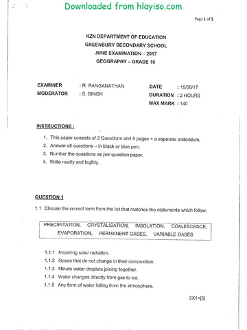
Geography Grade 10 P1 KwaZulu Natal June 2017 Paper & Memo
Question paper and memo
Geography Grade 10 P2 KwaZulu Natal June 2017 Paper & Memo
Question paper and memo
Geography Grade 10 March Test 2017 Paper & Memo
More from Grade 10 Geography
Study guide
Gr10 Geografie OG studyguide LR
Annual teaching plan
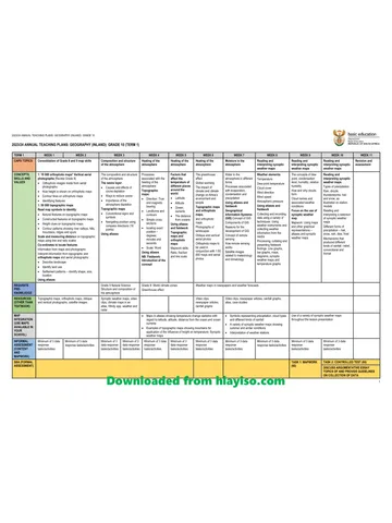
Gr 10 Geo ATP 2023 24
Question paper
Geography Grade 10 Gauteng March Test 2023 QP (Afr)
Question paper
Geography Grade 10 Gauteng March Test 2023 QP (Eng)
Question paper
Geography Grade 10 NSC Term 1 Controlled Test 2023 QP (Afr)
Addendum