
PROVINCIAL ASSESSMENT
GRADE 10
GEOGRAPHY P2
NOVEMBER 2024
MARKS: 150
TIME: 3 hours
This question paper consists of 15 pages.
Copyright reserved Please turn over
Skip to contentAll 2024 papers 
View all
Geography Grade 10 P2 North West November 2024 QP (Eng)
Grade 10 Geography Paper 2 question paper from the North West November Exam 2024 (English), 15 pages. Read online or download the free PDF.
Geography · Grade 10 · North West November Exam · 2024 · English. Question paper, 15 pages. Read online or download the PDF.
- Subject
- Geography
- Grade
- Grade 10
- Language
- English
- Document type
- Question paper
- Year
- 2024
- Exam period
- North West November Exam
- Paper
- 2
- Curriculum
- CAPS
- Pages
- 15
- File size
- 1.5 MB
Free to read online, no sign-up needed
Loading document…
Loading document…
1 of 15
This exam
North West November Exam 2024
- Paper 1Question paper
- Paper 2Question paper
Questions in this paper
Document textSearch extracted text and jump to a page.
Geography/P2 2 NW/November 2024
Grade 10
INSTRUCTIONS AND INFORMATION
1. This question paper consists of TWO sections.
SECTION A
QUESTION 1: POPULATION (60)
QUESTION 2: WATER AND WATER RESOURCES (60)
SECTION B
QUESTION 3: GEOGRAPHICAL SKILLS AND TECHNIQUES (30)
2. Answer ALL THREE questions.
3. All diagrams are included in the QUESTION PAPER.
4. Leave a line between the subsections of questions answered.
5. Start EACH question at the top of a NEW page.
6. Number the answers correctly according to the numbering system used in this
question paper.
7. Do NOT write in the margins of the ANSWER BOOK.
8. Draw fully labelled diagrams when instructed to do so.
9. Answer in FULL SENTENCES, except when you have to state, name, identify or
list.
10. Units of measurement MUST be indicated in your final answer, e.g. 1 020 hPa,
14 °C and 45 m.
11. You may use a non-programmable calculator.
12. You may use a magnifying glass.
13. Write neatly and legibly.
SPECIFIC INSTRUCTIONS AND INFORMATION FOR SECTION B
14. A 1 : 50 000 topographic map 3126DD QUEENSTOWN and a 1 : 10 000
orthophoto map 3126 DD 1 NOOITGEDACHT are provided.
15. The area demarcated in RED/BLACK on the topographic map represents the
area covered by the orthophoto map.
16. Show ALL calculations. Marks will be allocated for steps in calculations.
17. You must hand in the topographical and orthophoto map to the invigilator at
the end of this examination.
Copyright reserved Please turn over
Geography/P2 3 NW/November 2024
Grade 10
SECTION A: POPULATION AND WATER RESOURCES
QUESTION 1: POPULATION
1.1 Choose the term/concept in COLUMN B that matches the statement in
COLUMN A. Write ONLY the letter (A–I) next to the corresponding question
numbers (1.1.1 to 1.1.8) in your ANSWER BOOK, e.g, 1.1.9 J.
COLUMN A COLUMN B
1.1.1 The number of people per A Demographics
square kilometer
1.1.2 Where people live, or how they B Baby boom
are spread around the world
1.1.3 When the country loses C Population distribution
professional people due to
emigration
1.1.4 The deliberate killing of people D Exiles
from a certain ethnic group or
nation
1.1.5 A political migrant who is forced E Refugee
to migrate to another country
1.1.6 Period during which a large F “Brain drain”
number of babies is born
1.1.7 Political migrants who cannot G Population density
return home
1.1.8 The study of population H Ecumene
statistics
I Genocide
(8 x 1) (8)
Copyright reserved Please turn over
Geography/P2 4 NW/November 2024
Grade 10
1.2 Choose the correct word(s) between brackets to make the statements true.
Write ONLY the word(s) next to the question number (1.2.1 to 1.2.7) in your
ANSWER BOOK, e.g, 1.2.8 K. stigmatization.
1.2.1 (Birth rate/Fertility rate) is the average number of children born to
each woman in her child bearing years.
1.2.2 Women who are more educated tend to bear (few/more) children.
1.2.3 (Polygamy/Polyandry) is the practice of having more than one wife at
the same time.
1.2.4 Lack of access to medical care (increases/decreases) death rate.
1.2.5 Literacy rate is (higher/lower) in More Economically Developed
Countries as compared to Less Economically Developed Countries.
1.2.6 (Contraception/Vasectomy) is a permanent method of prevention.
1.2.7 (Infant mortality rate/Death rate) refers to the number of children who
die before they reach age of five. (7 x 1) (7)
Copyright reserved Please turn over
Geography/P2 5 NW/November 2024
Grade 10
1.3 Refer to the population pyramid of Japan below for the year 2023.
Source: The coming end of the population explosion | Phil Ebersole's Blog (wordpress.com)
1.3.1 What is a population pyramid? (1 x 2) (2)
1.3.2 The type of population pyramid shown above is (progressive/
regressive). (1 x 1) (1)
1.3.3 The shape of this population pyramid indicates (low/high) infant
mortality rate and death rate. (1 x 1) (1)
1.3.4 Calculate the total percentage of females aged between 0 – 14 years.
(1 x 2) (2)
1.3.5 Which age group represent the largest portion of the population in
2023? (1 x 2) (2)
1.3.6 (a) Which gender lives the longest in Japan? (1 x 1) (1)
(b) Explain why this is the case. (1 x 2) (2)
1.3.7 Demographers use population pyramids to calculate their countries’
dependency ratio. Why is it important for the country to know its
dependency ratio? (2 x 2) (4)
Copyright reserved Please turn over
Geography/P2 6 NW/November 2024
Grade 10
1.4 Refer to the photograph and extract below on overpopulation.
OVERPOPULATION IN INDIA
Source: Meta AI
Whether you are in a metro station, airport, railway station, road, highway, bus
stop, hospital, shopping mall, market, temple, or even in a social/religious
gathering, we see all these places are overcrowded at any time of the day.
According to the Indian census, carried out in 2011, the population of India
was exactly 1 210 193 422, which means India has crossed the 1-billion mark.
This is the second most populous country of the world after China and the
various studies have projected that India will be world’s number-1 populous
country, surpassing China, by 2025.
[Source: From: Overpopulation in India - Causes, Effects, Stats and How to control it? -
India (mapsofindia.com)]
1.4.1 What evidence in the source indicates that India is overpopulated?
(2 x 1) (2)
1.4.2 According to the extract, what was the total population of India in 2011?
(1 x 1) (1)
1.4.3 Describe TWO possible social issues that are leading to overpopulation
in India. (2 x 2) (4)
1.4.4 In a paragraph of approximately EIGHT lines, explain the negative
effects of overpopulation in a country and suggest steps that need to
be taken in order to bring population under control. (4 x 2) (8)
Copyright reserved Please turn over
Geography/P2 7 NW/November 2024
Grade 10
1.5 Refer to the extract on Population Movement below.
Dudula: How South African anger has focused on foreigners
13 March 2022 Pumza Fihlani BBC News, Johannesburg
Police in South Africa are on alert in case of renewed clashes between
residents of Johannesburg's Alexandra township and foreign street
vendors.
Alexandra is one of the poorest areas of the country but from its shacks,
residents can easily see the towering skyscrapers of Sandton, one of the
richest commercial districts on the whole continent, just a few kilometres
away. As a result, people from across South Africa and neighbouring
countries flock to the township to use it as a base to earn a living.
Two controversial groups - the Alexandra Dudula Movement and Operation
Dudula - which are campaigning against undocumented foreign nationals
have emerged recently and support seems to be growing among South
African communities. There are concerns that their campaigns could lead to
yet another outbreak of xenophobic violence in the country.
Poverty is the main driver of the tension as South African residents believe -
whether rightly or wrongly - that foreigners are the cause of many of their
difficulties. Dudula is a word in the Zulu language which loosely means to
"push back" or "drive back" - this gives a clue about what they want.
Though the two groups are separate, they have been inspired by the same
cause - they both hope to drive out undocumented African migrants from their
communities. They believe by doing this they can ensure that jobs and
business opportunities go to South Africans.
[Source: From: Dudula: How South African anger has focused on foreigners (bbc.com)]
1.5.1 Define the concept Xenophobia. (1 x 2) (2)
1.5.2 What is the name of the commercial city that is located closer to
Alexander? (1 x 1) (1)
1.5.3 According to the extract, what is the meaning of the word Dudula?
(1 x 1) (1)
1.5.4 Give the main aim of the two groups that are mentioned in the extract.
(1 x 1) (1)
1.5.5 Why do people choose to move from their place of origin to go and stay
in cities? (2 x 2) (4)
1.5.6 Explain THREE reasons for the outbreak of violence against foreign
nationals in South Africa. (3 x 2) (6)
[60]
Copyright reserved Please turn over
Geography/P2 8 NW/November 2024
Grade 10
QUESTION 2: WATER AND WATER RESOURCES
2.1 Various options are provided as possible answers to the following questions.
Choose the answer and write only the letter (A–D) next to the question numbers
(2.1.1 to 2.1.7) in the ANSWER BOOK, e.g. 2.1.8 D.
2.1.1 The primary source of water in South Africa is …
A rainfall.
B groundwater.
C desalination.
D recycling.
2.1.2 A physical factor that affects rainfall patterns in South Africa.
A Topography
B Climate Change
C Soil type
D Vegetation
2.1.3 The … is the largest river in South Africa.
A Orange River
B Vaal River
C Limpopo River
D Tugela River
2.1.4 The sector which uses the most water in South Africa is … sector.
A agriculture
B industrial
C forestry
D mining
2.1.5 A major challenge facing South Africa's water infrastructure.
A Aging infrastructure
B Inadequate funding
C Lack of maintenance
D All of the above
2.1.6 The main purpose of water storage facilities in South Africa is to …
A support irrigation.
B generate hydroelectric power.
C supply water during scarcity.
D provide drinking water.
Copyright reserved Please turn over
Geography/P2 9 NW/November 2024
Grade 10
2.1.7 The province receives the most rainfall in South Africa.
A Western Cape
B Eastern Cape
C KwaZulu-Natal
D Mpumalanga (7 x 1) (7)
2.2 Choose ONE term/concept from the list below that matches the descriptions
that follow. Write only the term/concept next to the question numbers
(2.2.1 to 2.2.8), e.g. 2.2.9 Reservoir.
Desalination; Water treatment; Water harvesting; Ocean currents; Grey
water; Marine pollution; Water transfer; Water scarcity; Water conservation
2.2.1 The practice of using water efficiently and reducing waste to minimize
the amount of water used.
2.2.2 Used water which is still clean.
2.2.3 Moving water from one drainage basin to another.
2.2.4 The lack of sufficient water to meet demand.
2.2.5 Removing contaminants and pollutants from water to make it safe for
use.
2.2.6 A process of removing salt from seawater.
2.2.7 Collecting and storing rainwater for non-potable uses, such as irrigation
or toilet flushing.
2.2.8 Introduction of harmful materials into the water sources. (8 x 1) (8)
Copyright reserved Please turn over
Geography/P2 10 NW/November 2024
Grade 10
2.3 Refer to the article on water pollution below.
SOUTH AFRICAN SCIENTISTS USE BUGS IN WAR AGAINST WATER
HYACINTH
By Agency Staff 1 March 2023
View of boats stuck in a sea of invasive green water hyacinth weed at the Hartbeespoort
Dam. Shafiek Tassiem/Reuters
The Hartbeespoort Dam north-west of Johannesburg used to be brimming
with people enjoying scenic landscapes and recreational watersports. Now
the visitors are greeted to the sight of boats stuck in a sea of invasive green
water hyacinth weed.
The spike in Harties — as Hartbeespoort is known — can be attributed to
pollution, with sewage, industrial chemicals, heavy metals and litter flowing
on rivers from Johannesburg and Pretoria.
Nutrients in the pollutants act as perfect fertilisers for the weed, a big concern
for nearby communities due to its devastating impact on livelihoods.
Dion Mostert, 53, is on the verge of laying off 25 workers at his recreational
boat company after his business came to a standstill because of the carpet
of water hyacinths.
“The boats aren’t going anywhere. It’s affecting tourism in our town… tourist
jobs,” Mostert said pointing towards his luxury cruise boat “Alba”, marooned
in the weeds.
*hyancith: a perennial aquatic plant, free floating in shallow water.
[Adapted from: South African scientists use bugs in war against water hyacinth -
TechCentral]
2.3.1 Name the dam that is invaded by hyancith weed. (1 x 1) (1)
2.3.2 Give TWO main causes of pollution in this dam as mentioned in the
article. (2 x 1) (2)
Copyright reserved Please turn over
Geography/P2 11 NW/November 2024
Grade 10
2.3.3 How do pollutants promote growth of hyancith weed? (1 x 2) (2)
2.3.4 According to the article, how does the invasion of hyancith weed impact
negatively on the nearby communities? (2 x 2) (4)
2.3.5 Suggest ways in which water managers can reduce the negative impact
of alien species on water availability in their area. (3 x 2) (6)
2.4 Refer to the cartoon below on water-saving techniques.
[Source: Save Water Animated Images (mavink.com)]
2.4.1 Is water a renewable or non-renewable resource? (1 x 1) (1)
2.4.2 Name TWO ways in which water is used by people at their homes
(2 x 1) (2)
2.4.3 Why is it difficult for the government to provide free basic water? (2 x 1) (2)
2.4.4 Describe THREE water-saving techniques that are depicted in the
cartoon. (3 x 2) (6)
2.4.5 Suggest TWO government initiatives that can be used to secure South
Africa’s scarce water supply in the future. (2 x 2) (4)
Copyright reserved Please turn over
Geography/P2 12 NW/November 2024
Grade 10
2.5 Refer to the newspaper article below on floods.
KHAYELITSHA RESIDENTS SHELTER IN CHURCHES AFTER NON-STOP RAIN.
By: SA People Contributor
15-06-22 14:25
Hundreds of people have abandoned their homes after heavy rains in Cape
Town. Dozens of residents of RR section of Khayelitsha have taken refuge in
local churches. Community leader Sihla Tongo said the shacks of about 400
people are now underwater after two days of incessant rain.
Tongo and about 12 others slept at Khayalabangcwele Apolostic Church in Zion
on Tuesday night. He said many people are staying in less affected shacks in
nearby Covid Village “cramped in groups of eight and ten, depending on the size
of the shacks”.
Our shacks have become dams, said Tongo. “We had to huddle together on a
mattress in one place to avoid leaks. We covered ourselves with three wet
blankets that we took out of flooded shacks … I have been wearing the same
clothes since Monday.”
[Source: From: WATCH Flooding in Cape Town, Shacks Washed Away, Blocked Canal Blamed
for Some Flooding - SA People]
2.5.1 Define the term flood. (1 x 2) (2)
2.5.2 What caused flooding in Khayelitsha? (1 x 1) (1)
2.5.3 How did the floods affect residents of Khayelitsha? (1 x 2) (2)
2.5.4 Give ONE reason why informal settlements are more affected
by floods as compared to formal settlements. (1 x 2) (2)
2.5.5 In a paragraph of approximately EIGHT lines discuss how the City of
Cape Town could have prevented the worst effects of flooding in the
urban area. (4 x 2) (8)
[60]
TOTAL SECTION A: 120
Copyright reserved Please turn over
Geography/P2 13 NW/November 2024
Grade 10
SECTION B
QUESTION 3: GEOGRAPHICAL SKILLS AND TECHNIQUES
GENERAL INFORMATION ON QUEENSTOWN
Coordinates: 31°54'S; 26°53'E
Queenstown (officially known as Komani) is a town in the Eastern Cape in
South Africa, roughly halfway between the smaller towns of Cathcart and
Sterkstroom on the N6 National Route.
The town was established in 1853 and is currently the commercial, administrative,
and educational centre of the surrounding farming district.
The town lies on the banks of the Komani River which forms part of the Great Kei
river system and has a refreshing climate and an abundant water supply from the
surrounding rugged mountains.
[Adapted from: Queenstown, South Africa - Wikipedia]
The following English terms and their Afrikaans translations are shown on the
topographical map:
ENGLISH AFRIKAANS
Diggings Uitgrawings
River Rivier
Copyright reserved Please turn over
Geography/P2 14 NW/November 2024
Grade 10
3.1 MAP SKILLS AND CALCULATIONS
3.1.1 Queenstown is located in the … province
A North West
B Western Cape
C Eastern Cape
D Limpopo (1 x 1) (1)
3.1.2 The contour interval of the orthophoto map is … metres
A 10
B 100
C 20
D 50 000 (1 x 1) (1)
3.1.3 The scale of the topographical map is … times smaller than that of an
orthophoto map
A 0,5
B 5
C 10 000
D 50 000 (1 x 1) (1)
Refer to the topographic map.
3.1.4 Calculate the magnetic declination for the year 2024. Use the steps
below to answer the question.
Show ALL calculations.
Clearly indicate the direction in relation to true north in your final
answer.
Difference in years:
Mean annual change:
Total annual change:
Magnetic declination 2024: (5 x 1) (5)
Refer to the orthophoto map.
3.1.5 Calculate straight line distance in kilometres between features labelled
6 and 7 on the orthophoto map.
Formula: Actual distance = Map distance x Map scale. (2 x 1) (2)
Copyright reserved Please turn over
Geography/P2 15 NW/November 2024
Grade 10
3.2 MAP INTEPRETATION
Refer to the topographic map.
3.2.1 The name of the river flowing in block D1 is (Lesseyton/ Olifantspoort)
(1 x 1) (1)
3.2.2 In which direction is the river flowing mentioned in QUESTION 3.2.1?
(1 x 2) (2)
Refer to block B1 on the topographic map
3.2.3 (a) Would you classify Nooitgedacht as a rural or urban settlement?
(1 x 1) (1)
(b) The type of farming practiced in Nooitgedacht is (crop/stock)
farming. (1 x 1) (1)
(c) Describe TWO possible factors that could force people to move
from Nooitgedacht to Queenstown. (2 x 1) (2)
3.2.4 Identify features labelled F and J in block A2/A3 on the topographic
map. (2 x 1) (2)
3.2.5 Refer to block E3 on the topographic map. What evidence indicates that
former residents have moved out of that area? (1 x 1) (1)
3.2.6 Queenstown receives seasonal rainfall. Give ONE piece of evidence
on the topographic map to support this statement. (1 x 2) (2)
3.3 GEOGRAPHICAL INFORMATION SYSTEM (GIS)
3.3.1 Define the concepts:
(a) Geographical Information System (1 x 2) (2)
(b) Remote Sensing (1 x 2) (2)
3.3.2 List TWO components of Geographical Information System. (2 x 1) (2)
3.3.3 Give ONE line and ONE polygon feature in block D3 on the topographic
map. (2 x 1) (2)
[30]
TOTAL SECTION B: 30
GRAND TOTAL: 150
Copyright reserved
Study this subject
Recommended for this subject
Question paper
Geography Grade 10 P2 National November 2018 QP (Eng)
Question paper
Geography Grade 10 P2 National November 2017 QP (Eng)
Addendum
Geography Grade 10 P2 Eastern Cape November 2020 Addendum
Memorandum
Geography Grade 10 P2 Eastern Cape November 2020 Memo (Eng)
Memorandum
Geography Grade 10 P2 Eastern Cape November 2019 Memo (Eng)
Memorandum
Geography Grade 10 P2 National November 2019 Memo (English)
More from Grade 10 Geography
Study guide
Gr10 Geografie OG studyguide LR
Annual teaching plan
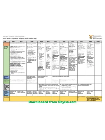
Gr 10 Geo ATP 2023 24
Question paper and memo
Geography Grade 10 Free State March Test 2025 Paper & Memo
Question paper and memo
Geography Grade 10 Paper 1 Limpopo June 2025 Paper & Memo
Question paper and memo
Geography Grade 10 Eastern Cape June 2024 Paper & Memo
Addendum