
Downloaded from hlayiso.com
PROVINCIAL ASSESSMENT
GRADE 10
GEOGRAPHY P1
JUNE 2018
QUESTION PAPER
JUNE 2017
MARKS: 140
TIME: 2 hours
This question paper consists of 9 pages (including cover page) and also Included
ANNEXURE of 8 Pages
1
Skip to contentAll 2018 papers 
View all
Geography Grade 10 North West June 2018 Question Paper
Grade 10 Geography question paper from the North West June 2018, 9 pages. Read online or get the free PDF download, memo linked when available.
Geography · Grade 10 · North West June · 2018. Question paper, 9 pages. Read online or download the PDF.
- Subject
- Geography
- Grade
- Grade 10
- Document type
- Question paper
- Year
- 2018
- Exam period
- North West June
- Curriculum
- CAPS
- Pages
- 9
- File size
- 501.1 KB
Free to read online, no sign-up needed
Loading document…
Loading document…
1 of 9
This exam
North West June 2018
- Other filesQuestion paperAddendumMemo
Document textSearch extracted text and jump to a page.
Downloaded from hlayiso.com
INSTRUCTIONS TO CANDIDATES
1. Answer all questions
2. Write neatly and legibly.
3. Number the questions exactly as they are numbered on the question paper.
2
Downloaded from hlayiso.com
Question 1
1.1 From each of the following lists, write down the ‘ODD ONE OUT’.
Example: Lemons, oranges, apples, limes
Answer: apples (the others are all citrus fruit)
1.1.1 Lopolith, batholiths, lava plateau, magma 1x1(1)
1.1.2 Andes, Cape Fold Mountains, Himalayas, Rockies 1x1(1)
1.1.3 Compression, reverse fault, block mountain, tension 1x1(1)
1.1.4 Trench, subduction zone, oceanic plate, Mid-Atlantic Ridge 1x1(1)
1.1.5 Caldera, epicentre, focus, seismic waves 1x1(1)
1.1.6 Altitude, isotherm, latitude, ocean currents 1x1(1)
1.1.7 Hygrometer, minimum and maximum thermometer, Stevenson Screen, rain
gauge 1x1(1)
1.1.8 Dew, frost, hail, snow 1x1(1)
1.1.9 Condensation, evaporation, precipitation, inversion 1x1(1)
1.1.10 Cold current, large seasonal temperature range, maritime climate, west coast
1x1(1)
[10]
1.2 Refer to ANNEXURE Figure 1.2 showing the layers of the Atmosphere and answer
the following questions
1.2.1 Name the atmospheric layer where all weather occurs. 1x2(2)
1.2.2 Identify the transition layer that occurs between the stratosphere and the
troposphere. 1x2(2)
1.2.3 Describe what happens to the temperature in the layer you have identified in
question 1.2.2 1x2(2)
1.2.4 Identify an atmospheric layer with a negative temperature lapse rate, where the
temperature increases with an increase in altitude. 1 x 2(2)
[8]
3
Downloaded from hlayiso.com
1.3 Refer to Figure 1.3 showing Ocean currents in South Africa and answer the
following questions:
1.3.1 Identify the ocean currents labelled 1 and 2 on the map. 2 x1(2)
1.3.2 Describe how the ocean current labelled 1 on the map will influence the
temperature on the eastern part of South Africa? 2X2 (4)
1.3.3 How does ocean current at 2 influence the temperature on the western part of
South Africa? 2x2(4)
[10]
1.4 Refer to Figure 1.4 Cartoon- Ozone and answer the following questions
1.4.1 A friend who does not study Geography has asked you what the ozone layer is.
Explain to him/her what it is. Use the following sub-headings in your explanation:
1.4.1.1 Where it is located? 1x1(1)
1.4.1.2 What is the importance of Ozone layer? 1x1(1)
1.4.2 Give the two main substances that cause ozone depletion and explain how the
process occurs. 2x1+2(4)
1.4.3 If you were a doctor in the part of the world with the greatest amount of ozone
thinning, what two types of medical conditions would you expect to treat as a result of
this thinning? 1x2(2)
[8]
1.5 Read the Case Study Figure 1.5 on Global Warming on Mount Kilimanjaro, and
answer the questions that follow:
1.5.1 What is happening to the ice cap of Kilimanjaro? 1x1(1)
1.5.2 What is causing this (mentioned in 1.5.1 to happen? 1x1(1)
1.5.3 Is this happening elsewhere? 1x1(1)
1.5.4 How does this affect mountain climbing 1x1(1)
[4]
4
Downloaded from hlayiso.com
1.6 Refer to Figure 1.6 showing The Structure of the earth and answer the questions
that follow:
1.6.1 Label the layers A and C shown on Figure 1.6 2x1(2)
1.6.2 Layer A consists of magma.
1.6.2.1 Explain what magma is. 1x1(1)
1.6.2.2 When magma solidifies, what type of rock does it form? 1x1(1)
1.6.3 The crust is the solid outer layer which consists of the continental crust and
the oceanic crust.
1.6.3.1 Which part is lighter? (1x1)(1)
1.6.3.2 Which material is the lighter part made of? (1x1)(1)
[7]
1.7 Refer to Figure 1.7 The Rock Cycle and answer the following questions
1.7.1. Name the type of rock that forms:
1.7.1.1 from compaction of sediments. 1x1(1)
1.7.1.2 from cooling and crystallisation of magma below the Earth’s surface 1x1(1)
1.7.1.3 from cooling and crystallisation of magma above the Earth’s surface. 1x1(1)
1.7.1.4 when minerals in rocks underground are changed by heat and pressure. 1x1(1)
1.7.2.
1.7.2.1 Give the name for molten rock or semi-molten rock below the Earth’s surface.
1x1(1)
1.7.2.2 Which types of rock become molten rocks? 1x1(1)
[6]
5
Downloaded from hlayiso.com
1.8 Refer to the diagram Figure 1.8 which illustrates different types of plate boundaries
and answer the following questions.
1.8.1 Identify the different plate boundaries labelled A and C. 2 x1(2)
1.8.2 Identify a landform that will develop at plate boundaries as illustrated by sketch
C. 1x1(1)
1.8.3 Explain how a subduction zone develops. 1x1(1) [4]
1.9 Examine Cartoon Figure 1.9 showing the movement of the continents over 50
million years
1.9.1 Name the theory that is described in the cartoon. 1x1(1)
1.9.2 Name the super continent that the two continents in the cartoon belonged to 50
million years ago. 1x1(1)
1.9.3 Explain the difference between divergent and convergent plate boundaries.
2x2(4)
1.9.4 In a paragraph of not more than 4 lines, discuss FOUR pieces of EVIDENCE to
prove that the continents were once joined. 4x2(8)
[14]
6
Downloaded from hlayiso.com
QUESTION 2
2.1 Match the term in COLUMN A with the correct explanation in COLUMN B. Write
down only the number and corresponding letter down. Example 2.1.11 M
COLUMN A COLUMN B
A. Rock which consists of many layers
2.1.1 Conduction B. Rock which is massive and becomes cracked and
2.1.2 Richter scale jointed over time
C. The instrument that measure the level of severity of
2.1.3 Igneous rock earthquakes
2.1.4 Dew point temperature D. The instrument used to measure earthquakes
E. Rainfall experienced during winter in the south
2.1.5 Convection rainfall western parts of South Africa
2.1.6 Sedimentary rock F. Rainfall experienced during summer in the interior of
South Africa
2.1.7 Seismograph G. The temperature at which condensation begins
2.1.8 Frontal rainfall H. When water vapour changes to ice
I. Short wave radiation
2.1.9 Terrestrial radiation J. Long wave radiation
2.1.10 Crystallisation K. Transfer of heat through contact between particles
L. Transfer of heat energy by movement of air as it rises
1x10(10)
2.2 Study Figure 2.2, illustrating relief rain in the Drakensberg, and answer the
questions that follow:
2.2.1 Identify the windward side and the leeward side of the slope by matching the
correct term to the labels A and B on the sketch 1x2 (2)
2.2.2. Explain what a rain shadow is. 1 x 2(2)
2.2.3. The rain that occurs here is called relief or orographic rain. Explain how this rain
develops. 3 x 2(6)
[10]
2.3 Refer to Figure 2.3.The Hydrological cycle and answer the following questions
2.3.1 A is the largest reservoir of water on Earth. 1x1(1)
2.3.2 B is the process whereby water changes to water vapour. 1x1(1)
2.3.3 C is the process whereby water vapour changes to water. 1x1(1)
7
Downloaded from hlayiso.com
2.3.4 D is any form of moisture released from the atmosphere to the Earth's surface.
1x1(1)
2.3.5 E is water that flows on the Earth's surface after it has rained. 1x1(1)
2.3.6 F is the process whereby moisture is released from plants into the atmosphere.
1x1(1)
2.3.7 G is the process whereby water reaches the groundwater. 1x1(1)
[7]
Refer to Figure 2.4 Synoptic Weather Chart and answer the following questions:
2.4.1. What do we call the lines that show the atmospheric pressure? 1x2(2)
2.4.2. Explain why some station models are circles and some are triangles. 1x2(2)
2.4.3. Give the following information from the synoptic weather map:
2.4.3.1 the date 1x1(1)
2.4.3.2 South African Standard Time 1x1(1)
2.4.3.3 the Universal Time 1x1(1)
2.4.4 Standard atmospheric pressure at sea level is 1 000 hPa. Identify:
2.4.4.1 the highest atmospheric pressure 1x1(1)
2.4.4.2 the lowest atmospheric pressure 1x1(1)
2.4.5. Which part of South Africa is experiencing:
2.4.5.1 cloudy conditions 1x1(1)
2.4.5.2 clear, sunny conditions . 1x1(1)
2.4.6. The city of Port Elizabeth has the strongest wind speed. Give the wind speed.
1x2(2) [13]
2.5 Study Figure 2.4 showing a crustal process and answer the following questions:
2.5.1. Name the crustal block labelled A 1x1(1)
2.5.2. Name the crustal block labelled B 1x1(1)
2.5.3. Name the type of fault shown. Give a reason for your answer. 1x1+2 (3)
2.5.4 Name the fault element labelled:
8
Downloaded from hlayiso.com
2.5.4.1 CE 1x1(1)
2.5.4.2 CFGE 1x1(1)
2.5.5. Name the type of rock shown. Give a reason for your answer. 1x1+2(3)
2.5.6. What are the forces responsible for the formation of land forms labelled A
and B? 1x2(2) [12]
2.6
Refer to Figure 2.6 Earthquakes (Case study) and answer the questions that follow:
2.6.1. What was the Richter scale reading for this earthquake? 1x1(1)
2.6.2. What is an epicentre? 1x2(2)
2.6.3. Give two reasons from the extract which shows that the earthquake was
powerful. 2x2(4)
2.6.4. Suppose you are a member of the aid team that helped with the rescue work in
New Zealand after the earthquake. List five matters that would receive your attention.
1x5(5)
2.6.5. Discuss any three strategies that could be followed to make sure that few people
lose their lives in an earthquake. 2x3(6)
[18]
TOTAL=140
9
Study this subject
Recommended for this subject
Addendum
Geography Grade 10 North West June 2018 Addendum
Memorandum
Geography Grade 10 North West June 2018 Memo
Question paper
Geography Grade 10 P1 Eastern Cape November 2018 QP (Afr)
Question paper
Geography Grade 10 P1 Eastern Cape November 2018 QP (Eng)
Question paper
Geography Grade 10 P2 Eastern Cape November 2018 QP (Eng)
Question paper
Geography Grade 10 P2 Eastern Cape November 2018 QP (Afr)
More from Grade 10 Geography
Study guide
Gr10 Geografie OG studyguide LR
Annual teaching plan
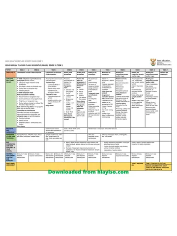
Gr 10 Geo ATP 2023 24
Question paper and memo
Geography Grade 10 Free State March Test 2025 Paper & Memo
Question paper and memo
Geography Grade 10 Paper 1 Limpopo June 2025 Paper & Memo
Question paper and memo
Geography Grade 10 Eastern Cape June 2024 Paper & Memo
Addendum