
Downloaded from hlayiso.com
Page 10f 6
KZN DEPARTMENT OF EDUCATION
GREENBURY SECONDARY SCHOOL
JUNE EXAMINATION - 2018
GEOGRAPHY - GRADE 10 -
EXAMINER —:R. RANGANATHAN/S. SINGH DATE ; nfoefie
MODERATORS : R. RANGANATHAN/S. SINGH DURATION = : 2 HOURS
MAX MARKS : 140
INSTRUCTIONS
1. This paper consists of 2 Questions and_6_ pages + a separate Addendum. oj 3 peqes
2. Answer ALL Questions in black or blue pen.
3. Number your questions as per question paper.
4. Write neatly and legibly.
QUESTION 1 — ATMOSPHERE + GEOMORPHOLOGY
1.1 Match the statements in Column A with the terms in Column B.
Write down only the letter of the correct answer from Column B.
COLUMN A : COLUMN B
1.1.1. Any form of moisture released from the a) Stratus
atmosphere. b) Cumulonimbus
1.1.2 Incoming solar radiation. c) Sublimation
1.1.3 Associated with heavy rain, lightning and d) Dew point temperature
thunder. e) Precipitation
1.1.4 Temperature at which condensation takes f) Evaporation
| place. g) Insolation
1.1.5 Water changes from liquid to gas. h) Crystallization
| 1.1.6 When gas changes to a solid. i) Terrestrial radiation
1.1.7 Layered clouds. j) Albedo
1.1.8 Amount of radiation reflected off the earth.
[8X1=8]
Skip to contentAll 2018 papers 
View all
Geography Grade 10 P1 KwaZulu Natal June 2018 Paper & Memo
Grade 10 Geography Paper 1 question paper and memo from the KwaZulu Natal June 2018, 16 pages. Read online or get the free PDF download.
Geography · Grade 10 · KwaZulu Natal June · 2018. Question paper and memorandum, 16 pages. Read online or download the PDF.
- Subject
- Geography
- Grade
- Grade 10
- Document type
- Question paper and memo
- Year
- 2018
- Exam period
- KwaZulu Natal June
- Paper
- 1
- Curriculum
- CAPS
- Pages
- 16
- File size
- 3.1 MB
Free to read online, no sign-up needed
Loading document…
Loading document…
1 of 16
This exam
KwaZulu Natal June 2018
- Paper 1Paper and memo
- Paper 2Paper and memo
Document textSearch extracted text and jump to a page.
1.2
1.2.1
122
1.2.3
1.2.4
1.2.5
1.62.6
1.2.7
1.3
1.3.1
1:3.2
1S
1.3.4
14
Downloaded from hlayiso.com
Page 2 of 6
State whether the following statements are true or false.
The crust is the outer layer of earth on which people live.
The asthenosphere is a soft layer in the mantle below the hydrosphere.
External forces operate inside the earth.
Mohorovicic discontinuity is the division between the crust and the core.
Sima is the part of the crust that forms the sea floor.
Igneous rocks are known as primary rocks.
Metamorphic rocks are formed from fragments of other rocks.
[7X1=7]
Refer to diagram (Source 1A) and answer the following questions.
Name the layer.
a) That contains 75% of all the air in the atmosphere. 1]
b) Thatis very dry with no clouds. 1]
c) In which the air is very thin. 1]
What is the term used to describe the change in temperature with the
change in height? [2]
The stratosphere contains an important gas.
4.3.3.1. Give the chemical symbol of this gas. [2]
1.3.3.2 Give one important function of the gas you named in 1.3.4.1. [2]
“THE OZONE HOLE OVER ANTARCTICA” has been a subject of
interest to climatologists for many years. With regards to ozone
depletion, write a short paragraph outlining :
a) Causes of ozone depletion. [Two answers] [4]
b) Effects of ozone depletion. [Two answers] [4]
c) Measures to reduce the effects of ozone depletion. [Two answers] [4]
With the aid of a diagram, explain the Hydrological Cycle.
(4 marks — diagram + 4 marks - explanation) [8]
Use the following words in your diagram and explanation :
- Evaporation
- Condensation
- Water bodies
- Clouds
- Precipitation
Downloaded from hlayiso.com
Page 3 of 6
1.5 Refer to the diagram (Source 1B) — Igneous intrusions and answer the
following questions.
1.5.1 Identify features labelled 1, 2, 3, 4, 5 and 6. [6]
1.5.2 What is a monolith? [2]
1.5.3 Differentiate between features labelled 4 and 5 in terms of shape. {4]
1.5.4.1. Name the largest of all the intrusive features? (2]
1.5.4.2 Give a South Africa example of the feature you named in 1.5.4.1. [2]
1.5.5 Why do you think these intrusions form landforms such as mountains
and waterfalls when they are exposed to the surface? {2]
1.6 Write a short paragraph explaining Alfred Wegener's Theory of
Continental drift under the following headings :
a) Theory [2X2=4]
b) Evidence of the theory [2X2=4]
15 + 29 + 26 = [70]
Downloaded from hlayiso.com
Page 4 of 6
QUESTION 2 —- ATMOSPHERE + GEOMORPHOLOGY
2.1. Give the correct term from the statements below.
2.1.1 Gaseous layer that surrounds the earth.
2.1.2 Lines on a map that join places of equal temperature.
2.1.3 Degree of heat or cold.
2.1.4 Minute water droplets that join together.
2.1.5 Chemicals used in aerosol sprays.
2.1.6 Gas that makes up 78% of the atmosphere.
2.1.7 Consists of all forms of water on the planet.
[7X1=7]
2.2 Match the statements in Column A with the concepts in Column B.
Write down only the letter of the correct answer from Column B.
— COLUMN A_ —_ ; COLUMN B
2.2.1 The edge of a crustal plate. a) Mid oceanic ridge |
2.2.2 Central belt of mountain area below the b) Constructive boundary |
ocean. c) Destructive boundary.
2.2.3. Formation of molten rock pushing the d) Sea floor spreading.
| plates apart. e) Subduction zone
2.2.4 One crustal plate being pulled down under f) Plate boundary
the other. g) Oceanic trench
2.2.5 Area where new crust is formed. h) Transform boundary
2.2.6 Area where plates collide. i) Oceanic ridge
2.2.7 Deepest part of the ocean. j) Crustal plate
2.2.8 When 2 plates move sideways past each
other.
[8X1=8]
2.3 Refer to (Source 2A) and answer the following questions.
2.3.1 Identify the slope that is warmer. Give a reason for your answer. [1+1=2]
2.3.2 Identify the slope that is cooler. Give a reason for your answer. (1+1=2]
2.4
2.4.4
Downloaded from hlayiso.com
Page 5 of 6
Refer to (Source 2B) - Newspaper Advertisement.
Explain why the fact that this house faces north,is important to
prospective buyers of this house. [2]
2.4.2 If the owner of the house intends making the front yard a fruit garden,
what type of crops do you think he / she would plant? [2]
2.4.3.1. In what way would the advertisement be different if the house was in
England? [2]
2.4.3.2 Provide an explanation for your answer. (2]
2.5
2.5.3
nh
a
iN
2.6
2.6.1
2.6.2
2.6.3
2.6.4
2.6.5
Refer to (Source 2C) - Synoptic Weather Map and answer the
questions set.
Identify the following :
a) The season represented in the map. [2]
b) Anticyclones labelled X and Y. [2]
c) Fronts labelled A and B. [2]
Refer to the weather station near Cape Town and describe the weather
under the following headings.
a) Air temperature
b) Dew point temperature
c) Cloud cover
d) Wind direction
e) Wind speed
f) Precipitation (6X1=6]
Refer to (Source 2D) — Types of folds and answer the questions set.
Define the term ‘folding’.
Identify the types of folds labelled A, C, D and E. [4]
State the type of rock that folding generally occurs in. [2]
Which is the highest fold mountain in the world? (2]
The Cape Fold Mountain is an example of a South African Fold
Mountain. What effect will this mountain have on the weather patterns
in the South Western Cape? [2]
Downloaded from hlayiso.com
Page 6 of 6
2.7 Refer to the Structure of Earthquake (Source 2E) and answer the
questions set.
2.7.1. Explain your understanding of an earthquake. [2]
2.7.2 Provide labels for B, C and D. [3]
2.7.3 Differentiate between B and C. [4]
2.7.4 Name the instrument used to measure the intensity of an earthquake. [2]
2.8 Refer to (Source 2F) — Case Study on Iceland Volcano.
2.8.1 Define the term ‘Volcano’. [2]
2.8.2 Why did the authorities order 700 people to evacuate their homes? (2]
2.8.3 “Iceland sits on a volcanic Hot Spot”. Explain your understanding of
a “Hot Spot”. [2]
2.8.4 Quote evidence from the source to suggest that this particular volcano
was indeed an active volcano. [2]
2.8.5 State the impact that was caused by the winds which carried the
poisonous gases south. [2]
15 + 26 + 29 = [70]
Question 1 = [70]
Question 2 = [70]
TOTAL = [140]
Geterccrrettan <
p.RAmageyn Of/06 / 15
Downloaded from hlayiso.com
ADDENDUM
GRADE 10
Downloaded from hlayiso.com
Source 4A
= 100 “60 -49 =20 9 20
=
a
=
a
South Pole (S)} «<—— Sun's rays
bakes
> Equator (N)
canal
Southern Hemisphere
Pa
Downloaded from hlayiso.com
Soute. 2B
Study the cutting from a newspaper that is advertising a home in a South
African city.
'
HIGHLAND WINNER
NEW RELEASE. Beautifully restored home
on popular road. This north-facer offers:
2 bright beds (BICs), 2 sparkling bathrooms
(1 en-suite), eat-in kitchen PLUS 45 m*
cottage. Move-in & live condition.
18
Bloemfontein oy“
qua
a —=
“ P2
Downloaded from hlayiso.com
Source Ze
Source 2F
Three craters erupt in Iceland
Voicanic eruptions in southern Iceland spewed lava, black
smoke and white steam into the air and partially melted
a glacier. The plume of smoke rose from a crater buried
beneath 200 metres of ice.
Authorities ordered 700 people to evacuate their
homes because the melting glacier was about to cause
floods. The police declared a state of emergency. Three
Red Cross care centres opened in nearby villages to assist
evacuees. The only deaths reported were two tourists
who died of exposure whilst trying to see the volcano.
Iceland sits on a volcanic hot spot on the Mid-
Atlantic Ridge. This particular volcano, Eyjatjallajékull,
has erupted five times since Iceland was settled in the
ninth ‘century. The worst eruption was in 1783, when
the volcano ejected poisonous gases. This caused the
deaths of 9 000 people in Iceland. Winds then carried
the poisonous gases south, and more than 2 000 people
were killed in England and 16 000 in France.
Pz
Downloaded from hlayiso.com
Mackey Mee + Meclef Jusuee
Grace ff ibe Lune Exaae. — PI
Bhi s bes
jl2 G hie HH
hid. B Lit A
p+ Te aa
12 “True
[22 Felse
[23 Peake
125 Troe
jab Tree
i274 Fae
132 «) He esp here.
gy bee sSphe ie.
6) There iS ‘ple fe
132 babse Rete
1-341. Ozone (02)
pa4a- Metects wo feu the bowbeurcurent of tio Clangeneo uy Kays
135 - oe hee _ aie ete [ohms
Coal foes fact “Cothads
Rano be Paredes
Downloaded from hlayiso.com
}3a- by Came Shui Caucev- / heat Strotey
Mela of Tee of
Sloe | Lenn iay / fivierte Charge.
Lheh ee Altria ks _ cocky ~ Welter por Coucler “te
fon te yf diobets e f Weley — Clove fermotian
- Creuck becesicn hea ty A Lows AR. Raw of pr pre per.
lab Fm Pe A iat
2- pablo lt 5- ord
15-2. ee ba 2 Retue tat cout? ef a
15-3. fectue 4 Chepetl) ts Sewer Shaped
Keesre @Claccolh) 6 — Maahwoeur Shapect
PS], Batholith (2)
psxa. Parl Ret - Weatem Cape.
Downloaded from hlayiso.com
an te the ggaukt Cf ereaievy — Hace Ferns tuewictaticg
cu teter€l = ;
Ngo a Ze a Surface aye much) cooler -" Gldchy fo ena fvcun "tues
L-é. Acterctisg fo Toacuy _ ore hag Cactient 350 wellen yd
ago Called PANGEA- ;
« Tecout fos Rilled apet - Nest ¢ Ssatt - LAURASIA ancl Condy! .
Exidewe - Catinenkt 2 gether lke Gas page
atl A fucSPhere 21.8 CFS
ALB Teanyparectore ALP Hy a sp here
ath Coa [oe .
at (Plede bauclsy) 2725 B
222 A a2kb C6
223. fp gat oC
go# EF QB H-
23g. Slope A - Nort hewg Gkpe) \arwer S Henasphere
232 Shope B- (Seti Fectig Sb ) ~ Coky im Scicbern Hevishlere
ani IF it is Secug Nort, tk sell be Warveer
Aya Covey — ill (aut a : tbat tuave on Wenn cendhona -
~ fut that reget Siucligit fese i fenwg| ty | Sib aad
Downloaded from hlayiso.com —
24 3. Enghudl - N Hewwoplare - force NF Shope wudl be
25 -a) Wer =
by @2-SA-t y- STU
6) A - cold fout
B- Wav Fnent
as a) fi TO = 428
hy pet - jo.
¢) ck - enercagt
ato. A CoedCTeeckeal) Wd. pb - exer fold /oyertumecl
26.3. Sechareurleny
ac 4 Hiialayes
neg. Wwiderert $ ide — Ranirall - upewerel werembut ef bem wcusd cer
- Cloud ferwaten 7 Corclenaten => Ri fell
- hoeward ade — KH#ke or ve urfell ;
27] Vobuct Vibration of tie § €aths Crwat
aja. B- Epicestie
CE — keew
b ~ Seiswic = Wayes
Downloaded from hlayiso.com
24-3 C~Feuo- ft of engw ~ where E ke Carts
B - Epceste- chivectly alee Hea where gralist
QT, Seasaggaph
zs|. Yleais - bike thn 1 ushjebs hot aah, dust lave § tole
(S euniy bea ‘
28.2, “The Me (tog glaccer urn @keat to Cauac fj acl.
AG.3 Hoty st & an ana bat i pe b yokait Erp
~ \Nokwas ur the ploste
a GA, . bho erupted! five huiec SiWCe
l6cce People ty reece :
Downloaded from hlayiso.com
Study this subject
Recommended for this subject
Question paper and memo
Geography Grade 10 P1 KwaZulu Natal June 2017 Paper & Memo
Question paper and memo
Geography Grade 10 P1 KwaZulu Natal June 2016 Paper & Memo
Addendum
Geography Grade 10 P1 Eastern Cape November 2018 Addendum
Addendum
Geography Grade 10 P1 Eastern Cape November 2018 Addendum
Memorandum
Geography Grade 10 P1 Eastern Cape November 2018 Memo (Afr)
Memorandum
Geography Grade 10 P1 Eastern Cape November 2018 Memo (Eng)
More from Grade 10 Geography
Study guide
Gr10 Geografie OG studyguide LR
Annual teaching plan
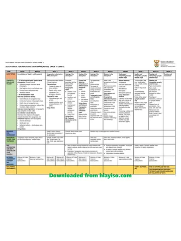
Gr 10 Geo ATP 2023 24
Question paper
Geography Grade 10 P1 North West November 2024 QP (Eng)
Question paper
Geography Grade 10 P2 North West November 2024 QP (Eng)
Question paper
Geography Grade 10 Gauteng March Test 2023 QP (Afr)
Question paper