
Downloaded from hlayiso.com
Page lof3
KZN DEPARTMENT OF EDUCATION
GREENBURY SECONDARY SCHOOL
FIRST QUARTERLY TEST - 2018
GEOGRAPHY - GRADE 10
EXAMINER > R. RANGANATHAN DATE : 20/03/18
MODERATOR : S. SINGH DURATION :1HOUR
MAX MARKS : 75
NAME : GRIDIV. :
INSTRUCTIONS
This paper consists of TWO Sections, A and B.
Answer all questions in both Sections.
Write neatly and legibly and rule off after each question.
- ON
Write down your teacher’s name in full on the top left hand corner of your
answer booklet.
5. Ensure that this paper consists of _3_ printed pages and an Addendum of
2 pages.
P.T.0... P2.
Skip to content
View all
Geography Grade 10 March Test 2018 Paper & Memo
Grade 10 Geography question paper and memo from the March Test 2018, 10 pages. Read online or get the free PDF download.
Geography · Grade 10 · March Test · 2018. Question paper and memorandum, 10 pages. Read online or download the PDF.
- Subject
- Geography
- Grade
- Grade 10
- Document type
- Question paper and memo
- Year
- 2018
- Exam period
- March Test
- Curriculum
- CAPS
- Pages
- 10
- File size
- 2.5 MB
Free to read online, no sign-up needed
Loading document…
Loading document…
1 of 10
Document textSearch extracted text and jump to a page.
Downloaded from hlayiso.com
Page 2 of 3
SECTION A
QUESTION 1
14
Match the statements in Column A with the concepts in Column B.
Write down the numbers 1.1.1 to 1.1.8 and next to it, only the correct LETTER
from column B.
COLUMN A COLUMN B |
1.1.4. Day to day changes of the atmosphere. a) Albedo _
1.1.2 Amount of radiation reflected from a b) Terrestrial radiation
surface. c) Climate
1.1.3 Long wave radiation reflected from the d) Humidity
surface, e) lsotherms
1.1.4 Average weather conditions over a long f) Weather
period. g) Temperature inversion
1.1.5 Lines joining places of equal temperature. h) Solar radiation
1.1.6 Amount of water vapour in the air. i) Smog
1.1.7 A combination of smoke and fog. j) lsobars
1.1.8 When temperature increases with height.
1.2
1.24
1.2.2
L203
1.2.4
1.2.5
1.2.6
L27
[8X1=8]
Refer to Addendum Source 1A — diagram on Water Cycle. Replace the
letters A — G in the statements with the correct geographical term. Write
down the term next to the letter.
A — Largest reservoir of water on earth.
B — Process whereby water changes to water vapour.
C — Process whereby water vapour changes to water.
D — Any form of water released from the atmosphere.
E — Water that flows on the earth’s surface after rainfall.
F — Moisture released from plants into the atmosphere.
G — Process whereby water seeps into the ground.
[7X1=]
P.T.0...P3
Downloaded from hlayiso.com
Page 3 of 3
QUESTION 2
2.1 Refer to the diagram showing the layers of the atmosphere — Addendum
Source 2A and answer the following questions.
2.1.1. Name the layers A ,B, C and D. [4]
2.1.2 Define the term ‘ATMOSPHERE’. (2]
2.1.3 Which layer is responsible for all weather phenomena? [2]
2.1.4 Explain the importance of the ozone layer to man. [2]
2.1.5 Discuss 2 causes of ozone depletion. [2X2=4]
2.1.6 Give one effect of ozone depletion on human beings. [1X2=2]
2.1.7 Suggest 2 measures to reduce the impact of ozone depletion. [2X2=4]
[20]
QUESTION 3
3.1 Refer to the Addendum — Synoptic Weather Map Source 3A and answer the
questions below.
3.1.1. Is this a summer or a winter map? Give a reason for your answer. — [1+2=3]
3.1.2 Identify the high pressure system labelled A, C and E. [6]
3.1.3 Provide labels for fronts X and Y. [4]
3.1.4 Line labelled B is an isobar. Explain your understanding of an isobar. [2]
3.1.5 Refer to the weather station at Cape Town and describe the weather
being experienced around Cape Town. [5X1=5]
[20]
SECTION B- GIS
QUESTION 4
41 What does the acronym GIS stand for? [2]
4.2 List 4 components of GIS. [4]
4.3 Name the 3 types of spatial objects in GIS. [3X2=6]
4.4 Suggest 2 ways in which GIS can be a useful too to man. [2X2=4]
4.5.1 Explain your understanding of a satellite image. [2]
4.5.2 Briefly explain how satellite images can be used in meteorology. [2]
[20]
TOTAL : [75] Pto Fy
Downloaded from hlayiso.com,,,,
ea :
Meteor trails
B« Weather
Zs Balloon
£2 ere Lae
= £ ra lasonde
?
Cumuio
nlmbus Cloud ie
TT eee er ere
4200-100 80-80 Qty 20 40
Temporature (°C)
‘tom = 209
Plo. PS
Downloaded from hlayiso.com
faye 5
Downloaded from hlayiso.com
Downloaded from hlayiso.com
Grace Io Geespeplat
March Gutel Test — 2c.
Mar ka Mewo + Meclel Autwer .
iP 4 (5 bs
ia. A 4 We ao
ia pf at p 7
ne co 7 ie. G. # Bx =(8)
fea A - Sea oceaw) er Water becly 4
i22- B- yaperehon
jaa. C- Guclensatwu
Ina De lect ptatin JA Rawi
}.25 E- Ran- of F
(2.4 F- Trango bow
124 G- TP the tuney
a GN
Fxr = @)
an. A — — [rebosbhere W4
Be marie 4
Mesosphene 7
4
fey
DT Treruesphere
21a. Gaseous bier that Sunmuncla the earth 7
aia “TV roposphere Y
aig. Petects up fon bhenchercluent ef the clayqowus CV Raye 7
aps> — Use of ve-hidgerectors + Aveons / feioref Speysy
— Uce of Cres / De Kreataton 2 ay
- Lactwhies - pollctaucts eg Snolee / Eschauy € ame . ‘
24. - Harwfel fo health —» kha Jat ctebe [ste Caucer Fong j
- dunprect- ingqattyely eu fen laud - Dawage fo CHopd L 2xi
lence we Fed J Sarsechsn /vsc.lradurhon — feel Toseeeny “
Downloaded from hlayiso.com
24 ~ Use OReHe Liewclt i 2 oducts. fo
[Mfvectale ee Hoctuobialegctievr we duc. Peces iholinacteory
~ heeut Wak ef Ke frefaciortord Aivconl i, .. 4
Cw a
~ Use ery - exhauet fume v S 4 axa = (p
~ Left Clube etc
Bad. E “Whaler - Map . a
Date - ~ 6% Mouth - Lune — Water We £. ZF Heat phere }¢2
~ Content Clowinatect by HE. Gl
-~ Cld Fert - cceupies tcrtsrly fe srlioe i- loae h cecluentt
- eee Cue relahvely OW -
~ Antiogclowes Sat 1 StH eceelfy worthy pesilews
ato. A - Kalahan High ao
C- SAL -
e- StH a
3b Ay Tseber a line en d rae that four Ploce
of equal pre Sure +
Z1S. Ag Tewef> ~ jo” a
DPT - 5° a
C/Covex ~ 3% or pt Cfoucly
W/Pweckau - Weatey A f
W/speecl Slacks / 7
5x1 = @)
Downloaded from hlayiso.com
(eater 4 - GES
Al. Geng npliea| TeGmmechot, System v
4 a. thy cluane a
Sefluee
User
AX | “.
Pata
NNN
. a LO
a4, Cite revert S. rue Petfenrs ~atleegk otficgrs mn hotspots .
Meteorology - hack pet of Cycler /uricaiss Gey 2
Re tail tichaty . my Fick fay ~ Pobre avel afle ala - ap chewwgic
. Se uSTronre adyet wooat lecture axa =)
AS.
~ Imiage picture taken Fou; outers pace of earth.
€q rent< Saag ‘ “i
gd
Y
ABA. ote llete waged Can be uated te cketennin
Veattley Henomena, Jot can be tae ch to e
back fhe peti of a cyehie._/Hurncane a
Jom = oJ
Downloaded from hlayiso.com
Study this subject
Recommended for this subject
Question paper and memo
Geography Grade 10 September Test 2018 Paper & Memo
Question paper and memo
Geography Grade 10 March Test 2017 Paper & Memo
Question paper and memo
Geography Grade 10 March Test 2016 Paper & Memo
Question paper and memo
Geography Grade 10 March Test 2015 Paper & Memo
Addendum
Geography Grade 10 P1 Eastern Cape November 2018 Addendum
Addendum
Geography Grade 10 P1 Eastern Cape November 2018 Addendum
More from Grade 10 Geography
Study guide
Gr10 Geografie OG studyguide LR
Annual teaching plan
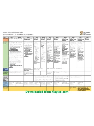
Gr 10 Geo ATP 2023 24
Question paper
Geography Grade 10 P1 North West November 2024 QP (Eng)
Question paper
Geography Grade 10 P2 North West November 2024 QP (Eng)
Question paper
Geography Grade 10 Gauteng March Test 2023 QP (Afr)
Question paper