
NATIONAL
SENIOR CERTIFICATE
GRADE 12
JUNE 2016
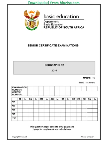
GEOGRAPHY P2
MARKS: 75
TIME: 1½ hours
NAME: ____________________________ GRADE 12 _________
MARKS MOD
TOTAL
Q1 15 MARKS
MOD
Q2 20
Q3 25
*GEOGE2* Q4 15 75 75
This question paper consists of 14 pages.
You're offline
Skip to contentQuestion paper %20June%202025%20Question%20Paper--a52dca5e-efc4-4060-84c3-24f7269a2a79/v1-a9ef6866fc707402ff5a/card.webp)

View all
%20June%202024%20Possible%20Answers_hlayiso.com_--7e728632-059d-401a-ba75-fd45632f6091/v1-269fb55ac60eebf555e6/card.webp)
Geog P2 Qp Eng_hlayiso.com_.pdf
Geography · Grade 12 · EC June · 2016. Question paper, 16 pages. Read online or download the PDF.
- Subject
- Geography
- Grade
- Grade 12
- Document type
- Question paper
- Year
- 2016
- Exam period
- EC June
- Paper
- 2
- Pages
- 16
- File size
- 945.9 KB
Loading document…
Loading document…
1 of 16
Document textSearch extracted text and jump to a page.
2 GEOGRAPHY P2 (EC/JUNE 2016)
RESOURCE MATERIAL
1. An extract from topographic map 2829 DB LADYSMITH
2. Orthophoto map 2829 DB 6 LADYSMITH
3. NOTE: The resource material must be collected by the schools for their
own use.
INSTRUCTIONS AND INFORMATION
1. Write your NAME in the space provided on the cover page.
2. Answer ALL the questions in the spaces provided in this question paper.
3. You are provide with a 1: 50 000 topographic map 2829 DB of LADYSMITH
and an orthophoto map (2829DB 6 LADYSMITH) of a part of the mapped
area.
4. You must hand in the topographical map and the orthophoto map to the
invigilator at the end of this examination session.
5. You must use the blank page at the back of this paper for all rough work. DO
NOT detach this page from the question paper.
6. Show ALL calculations and formulae, where applicable. Marks will be
awarded for these.
7. Indicate the unit of measurement in the final answer of calculations. Ensure
that units are maintained throughout ALL your calculations and final answer.
8. You may use a non-programmable calculator.
9. A glossary of some of the English and Afrikaans words and their
translations appears below.
GLOSSARY
(SOME OF THESE TERMS MAY APPEAR ON THE MAPS.)
ENGLISH AFRIKAANS
Canal/Furrow Kanaal/Voor
Island Eiland
Hiking trail Staproete
River Rivier
North Noord
National park Nasionale Park
Weir Keerwal
Butte Butte
Copyright reserved Please turn over
(EC/JUNE 2016) GEOGRAPHY P2 3
GENERAL INFORMATION ON LADYSMITH
Ladysmith is a city in the Uthukela District of KwaZulu-Natal, South Africa. It is 230
kilometres north-west of Durban and 365 kilometres south of Johannesburg.
Important industries in the area include food processing, textile and tyre production.
Tyres are produced by Dunlop in the nearby town of Sneedville. It is also home to
“The Plunger of Berea” (Formerly known as Dilona Somai).
Ladysmith is the seat for both the Emnambithi-Ladysmith Local Municipality and
the Uthukela District Municipality.
Coordinates: 28°33’35’’S 29°46’50’’E
Copyright reserved Please turn over
4 GEOGRAPHY P2 (EC/JUNE 2016)
QUESTION 1: MULTIPLE-CHOICE QUESTIONS
The question below is based on the 1:50 000 topographical map 2829 DB
LADYSMITH, as well as the orthophoto map of a part of the mapped area. Various
options are provided as possible answers to the following questions. Choose the
answer and write only the letter (A–D) in the block next to each question (1–1.15).
1.1 Route 103 to Harrismith in block C1 is a/an …
A other road.
B secondary road.
C national road.
D main road.
1.2 The highest point of Mbulwana hill in blocks E6/7 and blocks F6/7
is … meters above sea level.
A 1186
B 331
C 1229,1
D 1140
1.3 The built-up area in block E10 is of … density.
A medium
B low
C high
D the highest
1.4 The index orthophoto map sheet north east of 2829 DB 6 LADYSMITH is …
A 2828 DA5.
B 2829 DB11.
C 2829 DB2.
D 2829 DB1.
1.5 The town located 98 km from the mapped area is …
A Newcastle.
B Harrismith.
C Glencoe.
D Colenso.
1.6 The human-made feature K, in blocks G6 and H6 is …
A a railway station.
B Hermanus Kraal farm.
C a railway tunnel.
D a railway bridge.
Copyright reserved Please turn over
(EC/JUNE 2016) GEOGRAPHY P2 5
1.7 The area, 3, on the orthophoto map is a/an …
A industrial area.
B school recreation ground.
C military recreation ground.
D golf course.
1.8 The landform between 1 and 2 on the orthophoto map is a …
A waterfall.
B river valley.
C butte.
D spur.
1.9 The land-use zone 6 on the orthophoto map is a/an …
A industrial zone.
B rural-urban fringe.
C residential zone.
D recreational zone.
1.10 Diggings in block A2 on the topographic map are … economic activities.
A primary
B secondary
C tertiary
D quaternary
1.11 The contour interval on the orthophoto map is … meters.
A 15
B 10
C 20
D 5
1.12 The land use at Cauvins Hope, in block G6, on the topographic map is …
A cultivated land.
B a recreation ground.
C a built up area.
D an industrial area.
1.13 The rural settlement pattern marked S, in block D10, on the topographic map
is …
A linear.
B circular.
C dispersed.
D regular.
Copyright reserved Please turn over
6 GEOGRAPHY P2 (EC/JUNE 2016)
1.14 The topographic map scale of 1:50 000 means that one centimetre on the
map represents ... kilometres in reality.
A 0,1
B 0,05
C 0,5
D 1
1.15 The approximate distance between points 4 and 5 on the orthophoto map is
… kilometres.
A 0,3
B 30
C 1,5
D 15
(15 x 1) [15]
Copyright reserved Please turn over
(EC/JUNE 2016) GEOGRAPHY P2 7
QUESTION 2: MAPWORK CALCULATIONS AND TECHNIQUES
2.1 Refer to the topographic map and orthophoto map to answer the following
questions:
2.1.1 How many kilometres would you travel by train from point U in block
B2 on the topographic map to Harrismith?
(3 x 1) (3)
2.1.2 Determine the true bearing of spot height 1096 in block B9 from the
spot height 1101 in block C9 on the topographic map.
(1 x 1) (1)
2.2 Calculate the average gradient between 4 and 5 on the orthophoto map.
Show ALL calculations. Marks will be awarded for calculations.
𝑉𝑒𝑟𝑡𝑖𝑐𝑎𝑙 𝑖𝑛𝑡𝑒𝑟𝑣𝑎𝑙 (𝑉𝐼)
2.2.1 Formula: 𝑮𝒓𝒂𝒅𝒊𝒆𝒏𝒕 =
𝐻𝑜𝑟𝑖𝑧𝑜𝑛𝑡𝑎𝑙 𝑒𝑞𝑢𝑖𝑣𝑎𝑙𝑒𝑛𝑡 (𝐻𝐸)
(5 x 1) (5)
2.2.2 Describe the gradient you calculated in QUESTION 2.2.1.
(1 x 1) (1)
Copyright reserved Please turn over
8 GEOGRAPHY P2 (EC/JUNE 2016)
2.3 Is there Intervisibility between points 4 and 5 on the orthophoto map? Give
TWO reasons evident on the orthophoto map to support your answer.
(3 x 1) (3)
2.4 A cross-section is drawn between points 4 and 5 on the orthophoto map.
Assume that the vertical scale is 1 cm = 20 m.
2.4.1 What is the importance of drawing cross-sections?
(1 x 1) (1)
2.4.2 Calculate the vertical exaggeration of the cross-section between 4
and 5.
𝑉𝑒𝑟𝑡𝑖𝑐𝑎𝑙 𝑠𝑐𝑎𝑙𝑒 (𝑉𝑆)
Formula: 𝑽𝒆𝒓𝒕𝒊𝒄𝒂𝒍 𝒆𝒙𝒂𝒈𝒈𝒆𝒓𝒂𝒕𝒊𝒐𝒏 =
𝐻𝑜𝑟𝑖𝑧𝑜𝑛𝑡𝑎𝑙 𝑠𝑐𝑎𝑙𝑒 (𝐻𝑆)
(5 x 1) (5)
2.4.3 Suggest ONE reason why the vertical scale in a cross-section is
exaggerated/made bigger?
(1 x 1) (1)
[20]
Copyright reserved Please turn over
(EC/JUNE 2016) GEOGRAPHY P2 9
QUESTION 3: APPLICATION AND INTERPRETATION
Refer to both topographic map and the orthophoto map when answering the
questions below.
3.1 Suggest ONE reason evident on the topographic map that influenced the
engineers to construct the relatively straight course of the railway line in
blocks F4 and F5.
(1 x 1) (1)
3.2 Generally, Ladysmith receives limited rainfall. Give TWO reasons evident on
the map to support the statement.
(2 x 2) (4)
3.3 Suggest ONE piece of topographic map evidence that indicates that the
discharge of the Klipriver fluctuates/changes during the certain times of the
year.
(1 x 2) (2)
3.4 In the South Western part of the mapped area, there is evidence of the
frequency of veld fires. How do Ladysmith residents deal with the threat of
Veld fires? Use ONE map evidence to support your answer.
(1 x 1) (1)
Copyright reserved Please turn over
10 GEOGRAPHY P2 (EC/JUNE 2016)
3.5 Locate the drainage basin labelled V in block A1 and A2 on the topographic
map and then answer the questions below.
3.5.1 Identify the drainage pattern of the drainage basin labelled V.
(1 x 1) (1)
3.5.2 In which general direction is the Bell’s Spruitriver, in blocks A1 and
A2 flowing?
(1 x 1) (1)
3.5.3 Give TWO reasons, evident on the topographic map to support your
answer to QUESTION 3.5.2.
(2 x 2) (4)
3.5.4 Determine the stream order of the Bell’s Spruit at point W, in block
A2 on the topographic map.
(1 x 2) (2)
Copyright reserved Please turn over
(EC/JUNE 2016) GEOGRAPHY P2 11
3.6 Refer to Hillside in block E2/3 on the topographic map and also on the
orthophoto map.
3.6.1 Identify the street pattern at Hillside?
(1 x 1) (1)
3.6.2 Suggest ONE physical factor evident on both topographic and
orthophoto maps that influenced the choice of street pattern in
QUESTION 3.6.1 above.
(1 x 2) (2)
3.6.3 State ONE advantage and ONE disadvantage of the street pattern
(answer to QUESTION 3.6.1).
Advantage:
Disadvantage:
(2 x 1) (2)
3.7 Soil erosion is occurring extensively in block D5 on the topographic map.
Suggest TWO strategies that may be implemented to minimise this problem.
(2 x 2) (4)
[25]
Copyright reserved Please turn over
12 GEOGRAPHY P2 (EC/JUNE 2016)
QUESTION 4: GEOGRAPHICAL INFORMATION SYSTEMS (GIS)
4.1 Match the concepts in COLUMN A with statements in COLUMN B. Write
ONLY the correct letter (A–F) next to the question number (4.1.1–4.1.5), for
example 4.1.6 G.
COLUMN A COLUMN B
4.1.1 Software A A map designed to show a single spatial
distribution pattern, using a specific map type.
4.1.2 Attribute B Data that can be linked to locations in geographic
space, usually via features on the map.
4.1.3 Query C A map data structure using points or nodes.
4.1.4 Thematic D A question, especially if asked to a data base by
map the user via database management systems.
4.1.5 Spatial E Characteristic of a feature that contains
data measurements of value for the feature.
F A computer program application.
(5 x 1) (5)
4.2 Which ONE, the topographic map or the orthophoto map, is an example of
vector data? Explain your answer.
(1 + 2) (3)
4.3 Locate the Klipriver in block G7. Give ONE attribute of the Kliprivier.
(1 x 1) (1)
Copyright reserved Please turn over
(EC/JUNE 2016) GEOGRAPHY P2 13
4.4 Refer to the images A and B below which show different spatial resolution.
A B
4.4.1 With reference to images A and B, define spatial resolution.
(1 x 1) (1)
4.4.2 Several factors determine the spatial resolution of an image.
Explain TWO factors that might have caused images A and B to
have different spatial resolutions.
(2 x 2) (4)
4.4.3 Soil erosion in block G3 is likely to affect the area in F3. Mention
ONE data layer in blocks G3 and F3 that GIS specialist can use to
stop the spread of soil erosion.
(1 x 1) (1)
[15]
TOTAL: 75
Copyright reserved Please turn over
14 GEOGRAPHY P2 (EC/JUNE 2016)
ROUGH WORK
Copyright reserved Please turn over
Recommended for this subject
Published documents with matching subject and grade metadata.
Question paper
Geography P1 (Afrikaans) June 2025 Question Paper.pdf
Question paper
Geography-Grade-12-NSC-P2-QP-September-2025-KZN.pdf
Question paper
Geography P1 May-June 2025 Eng.pdf
Question paper
HARTBEESPOORT DAM1 D FINAL.pdf
Question paper
GEOGRAPHY GR12 QP JUNE 2023_Afrikaans.pdf
Question paper
GEOGRAPHY GR12 QP JUNE 2023_Afrikaans_hlayiso.com_.pdf
Related documents
Matched using subject, grade, language, document type and exam metadata.
Question paper
Geo P1 June 2016 Qp (English)_hlayiso.com_.pdf
Question paper
2016 KZN June P2_hlayiso.com_.pdf
Question paper
Geography P2 May June 2016 Eng_hlayiso.com_.pdf
Question paper
Geography P2 QP Gr12 June 2018 Eng_hlayiso.com_.pdf
Memorandum
GEOGRAFIE P2 GR12 MEMO SEPT2016 Afr_hlayiso.com_.pdf
Memorandum
Geography P2 Nov 2016 Memo Eng_hlayiso.com_.pdf
More from Grade 12 Geography
Explore more published documents in this catalogue.
Memorandum
Geography-Grade-12-NSC-MEMO-P1-May-June-2025-Free-State.pdf
Memorandum
GEOGRAPHY P2 GR12 MEMO SEPT2024_Afrikaans_hlayiso.com_.pdf
Memorandum
Gr 12 Geography (English) June 2024 Possible Answers_hlayiso.com_.pdf
Memorandum
Gr 12 Geography P2 (Afrikaans) 2024 Possible Answers_hlayiso.com_.pdf
Memorandum
GEOGRAPHY GR12 MEMO JUNE 2023_Afrikaans.pdf
Memorandum