
Downloaded from hlayiso.com
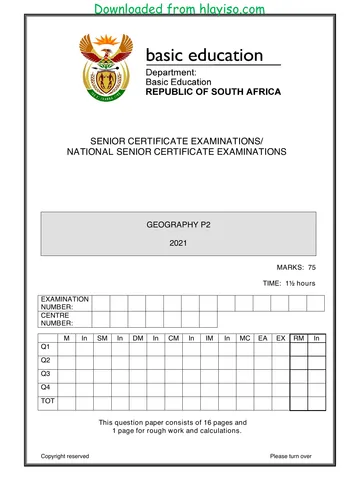
SENIOR CERTIFICATE EXAMINATIONS
GEOGRAPHY P2
2016
MARKS: 75
TIME: 1½ hours
EXAMINATION
NUMBER:
CENTRE
NUMBER:
M In SM In DM In CM In IM In MC EA EX RM In
Q1
Q2
Q3
Q4
TOT
This question paper consists of 12 pages and
1 page for rough work and calculations.
Copyright reserved Please turn over
You're offline
Skip to contentQuestion paper %20June%202025%20Question%20Paper--a52dca5e-efc4-4060-84c3-24f7269a2a79/v1-a9ef6866fc707402ff5a/card.webp)

View all
%20June%202024%20Possible%20Answers_hlayiso.com_--7e728632-059d-401a-ba75-fd45632f6091/v1-269fb55ac60eebf555e6/card.webp)
Geography P2 May June 2016 Eng_hlayiso.com_.pdf
Geography · Grade 12 · NSC June Exam · 2016. Question paper, 13 pages. Read online or download the PDF.
- Subject
- Geography
- Grade
- Grade 12
- Document type
- Question paper
- Year
- 2016
- Exam period
- NSC June Exam
- Paper
- 2
- Pages
- 13
- File size
- 411.3 KB
Loading document…
Loading document…
1 of 13
Document textSearch extracted text and jump to a page.
Downloaded from hlayiso.com
Geography/P2 2 DBE/2016
SCE
RESOURCE MATERIAL
1. An extract from topographical map 2525DC MAFIKENG
2. Orthophoto map 2525 DC 13 MAFIKENG
3. NOTE: The resource material must be collected by schools for their own use.
INSTRUCTIONS AND INFORMATION
1. Write your EXAMINATION NUMBER and CENTRE NUMBER in the spaces
on the cover page.
2. Answer ALL the questions in the spaces provided in this question paper.
3. You are provided with a 1 : 50 000 topographical map (2525DC MAFIKENG)
and an orthophoto map (2525 DC 13 MAFIKENG) of a part of the mapped
area.
4. You must hand the topographical map and the orthophoto map to the
invigilator at the end of this examination session.
5. You may use the blank page at the back of this question paper for all rough
work and calculations. Do NOT detach this page from the question paper.
6. Show ALL calculations and formulae, where applicable. Marks will be
allocated for these.
7. Indicate the correct unit of measurement in the final answer of calculations.
No marks will be allocated for answers with incorrect units.
8. You may use a non-programmable calculator.
9. The area demarcated in RED on the topographical map represents the area
covered by the orthophoto map.
10. The following English terms and their Afrikaans translations are shown on the
topographical map:
ENGLISH AFRIKAANS
Diggings Uitgrawings
Furrow Voor
Gold Mine Goudmyn
Golf Course Gholfbaan
Landing Strip Landingstrook
River Rivier
Sewage Works Rioolwerke
Waterworks Waterwerke
Copyright reserved Please turn over
Downloaded from hlayiso.com
Geography/P2 3 DBE/2016
SCE
GENERAL INFORMATION ON MAFIKENG
Mafikeng, now known as Mahikeng, is the capital city of the province of North West in
South Africa. In 2001 it had a population of 49 300. In 2007 Mafikeng was reported to
have had a population of 250 000. The town is built on open veld at an elevation of
approximately 1 500 m on the banks of the Upper Molopo River. The Madibi Goldfields
are approximately 15 km south of the town. Mafikeng also briefly served as the capital
city of Bophuthatswana in the 1970s. The temperature averages 18,5 °C. Mafikeng
has an average annual rainfall of 559 mm.
[Source: Examiner's map]
Copyright reserved Please turn over
Downloaded from hlayiso.com
Geography/P2 4 DBE/2016
SCE
QUESTION 1: MULTIPLE-CHOICE QUESTIONS
The questions below are based on the 1 : 50 000 topographical map
2525DC MAFIKENG, as well as the orthophoto map of a part of the mapped area.
Various options are provided as possible answers to the following questions. Choose
the answer and write only the letter (A–D) in the block next to each question.
1.1 During the apartheid era Mafikeng was part of the … homeland.
A Ciskei
B Bophuthatswana
C Transkei
D Venda
1.2 The map index/reference of the topographical map to the south-west of
Mafikeng is …
A 2525CD.
B 2625BB.
C 2625AB.
D 2625BA.
1.3 The direction of 1 from 2 on the orthophoto map is …
A north-east.
B south-west.
C south-east.
D north-west.
1.4 The true bearing of spot height 1306 (K) in block G9 from trigonometrical
station 101 (L) in block H9 is …
A 201°.
B 207°.
C 21°.
D 27°.
1.5 The diggings (O) in block J10 indicates that this is a/an …
A archaeological site.
B agricultural area.
C construction site.
D mining area.
1.6 The grid reference/coordinates/position of the excavation in block A6 is …
A 25°46'30''S 25°37'06''E/25°46,5'S 28°37,1'E.
B 25°37'06''S 25°46'30''E/28°37,1'S 25°46,5'E.
C 25°46'48''S 25°37'30''E/25°46,8'S 28°37,5'E.
D 25°37'30''S 25°46'48''E/28°37,5'S 25°46,8'E.
Copyright reserved Please turn over
Downloaded from hlayiso.com
Geography/P2 5 DBE/2016
SCE
1.7 The general street pattern of the urban area in block F7 is …
A radial.
B planned irregular.
C unplanned irregular.
D a gridiron.
1.8 Features are larger on the orthophoto map than on the topographical map
because the orthophoto map …
A is bigger.
B has a smaller scale.
C covers a larger area.
D has a larger scale.
1.9 The actual distance between (P) in block I1 and (Q) in block H4 is …
A 10 km.
B 5 km.
C 12 km.
D 7 km.
1.10 The general direction of the flow of the river in block F2 is …
A north-west.
B south-west.
C north-east.
D south-east.
1.11 Feature 3 on the orthophoto map is a/an …
A main road.
B other road.
C canal.
D railway line.
1.12 Land-use zone 4 on the orthophoto map is a …
A residential area.
B heavy industrial area.
C light industrial area.
D central business district.
1.13 The feature found at 5 on the orthophoto map is …
A a water purification system.
B a man-made lake.
C a water storage facility.
D sewage works.
Copyright reserved Please turn over
Downloaded from hlayiso.com
Geography/P2 6 DBE/2016
SCE
1.14 The stream order at N in block J2 is …
A 2.
B 3.
C 1.
D 4.
1.15 The primary activity in the mapped area is …
A mining.
B forestry.
C crop farming.
D fishing.
(15 x 1) [15]
Copyright reserved Please turn over
Downloaded from hlayiso.com
Geography/P2 7 DBE/2016
SCE
QUESTION 2: MAP CALCULATIONS AND TECHNIQUES
2.1 Refer to the magnetic declination indicated on the topographical map.
2.1.1 Calculate the magnetic declination of 2525DC Mafikeng for the
present year. Indicate the unit of measurement in your final answer.
Show ALL calculations. Marks will be awarded for calculations.
Difference in years: ____________________________________
____________________________________
Mean annual change: ____________________________________
Total change: ____________________________________
____________________________________
Magnetic declination for 2016: ____________________________
____________________________
(5 x 1) (5)
2.1.2 State the importance of calculating the magnetic declination for the
present year.
_______________________________________________________
_______________________________________________________
(1 x 1) (1)
2.2 Refer to the area demarcated in RED on the topographical map, which
represents the area covered by the orthophoto map. Use the demarcated
area to calculate the surface area of the orthophoto map in km². Indicate the
unit of measurement in your final answer. Show ALL calculations. Marks will
be awarded for calculations.
Formula: area = length (L) × breadth (B)
______________________________________________________________
______________________________________________________________
______________________________________________________________
______________________________________________________________
______________________________________________________________
______________________________________________________________
(5 x 1) (5)
Copyright reserved Please turn over
Downloaded from hlayiso.com
Geography/P2 8 DBE/2016
SCE
2.3 Refer to spot height 1306 (K) in block G9 and trigonometrical station 101 (L)
in block H9 on the topographical map.
2.3.1 Calculate the average gradient between spot height 1306 (K) and
trigonometrical station 101 (L). Show ALL calculations. Marks will be
awarded for calculations.
vertical interval (VI)
Formula: gradient =
horizontal equivalent (HE)
______________________________________________________
______________________________________________________
______________________________________________________
______________________________________________________
______________________________________________________
______________________________________________________
(5 x 1) (5)
2.3.2 Is the average gradient between spot height 1306 and
trigonometrical station 101 calculated in QUESTION 2.3.1 a true
reflection of the gradient in reality? Give a reason for your answer.
______________________________________________________
______________________________________________________
______________________________________________________
(1 + 1) (2)
2.3.3 Is spot height 1306 visible from trigonometrical station 101? Give a
reason for your answer.
______________________________________________________
______________________________________________________
(1 + 1) (2)
[20]
Copyright reserved Please turn over
Downloaded from hlayiso.com
Geography/P2 9 DBE/2016
SCE
QUESTION 3: APPLICATION AND INTERPRETATION
3.1 Refer to the table below, the information on Mafikeng (on page 3) and the
topographical map to answer the questions that follow.
Average monthly precipitation (mm) for Mafikeng
Jan. Feb. Mar. Apr. May Jun. Jul. Aug. Sep. Oct. Nov. Dec.
114 81 68 49 21 4 1 5 10 52 72 82
3.1.1 Name the season that experiences the lowest precipitation.
_______________________________________________________
(1 x 1) (1)
3.1.2 Name the high-pressure cell that is responsible for the low
precipitation in the season named in QUESTION 3.1.1.
_______________________________________________________
(1 x 1) (1)
3.1.3 Explain why the high-pressure cell in the answer to QUESTION 3.1.2
causes a low precipitation.
_______________________________________________________
_______________________________________________________
(1 x 2) (2)
3.1.4 State TWO ways, visible on the topographical map, in which farmers
around Mafikeng have prepared for drought conditions often
experienced in South Africa.
_______________________________________________________
_______________________________________________________
(2 x 1) (2)
3.2 The post-apartheid industrial development committee is considering
developing Mafikeng. Refer to the topographical map and the orthophoto map
and discuss TWO favourable factors that they should consider.
______________________________________________________________
______________________________________________________________
______________________________________________________________
______________________________________________________________
(2 x 2) (4)
Copyright reserved Please turn over
Downloaded from hlayiso.com
Geography/P2 10 DBE/2016
SCE
3.3 Compare block F6 on the topographical map with the same area on the
orthophoto map and state ONE way in which the democratic government has
provided the poorer communities with basic needs.
______________________________________________________________
______________________________________________________________
______________________________________________________________
(1 x 2) (2)
3.4 3.4.1 State ONE advantage and ONE disadvantage of the Upper Molopo
River flowing through the town of Mafikeng.
Advantage:______________________________________________
_______________________________________________________
Disadvantage: ___________________________________________
_______________________________________________________
(2 x 1) (2)
3.4.2 Explain TWO ways in which the Mafikeng municipality can limit the
effects of the disadvantage in your answer to QUESTION 3.4.1.
_______________________________________________________
_______________________________________________________
_______________________________________________________
_______________________________________________________
_______________________________________________________
(2 x 2) (4)
3.5 Refer to the industrial area in blocks E6 and E7.
3.5.1 Is this a heavy industrial area or a light industrial area?
_______________________________________________________
(1 x 1) (1)
Copyright reserved Please turn over
Downloaded from hlayiso.com
Geography/P2 11 DBE/2016
SCE
3.5.2 Discuss TWO factors that influenced the location of this industrial
area.
_______________________________________________________
_______________________________________________________
_______________________________________________________
_______________________________________________________
(2 x 2) (4)
3.6 State ONE difference between the settlement pattern at M in block B4 and the
settlement pattern at R in block D2.
M: __________________________________________________________
R: __________________________________________________________
(2 x 1) (2)
[25]
QUESTION 4: GEOGRAPHICAL INFORMATION SYSTEMS (GIS)
4.1 Refer to the topographical map and the orthophoto map of Mafikeng.
4.1.1 Which one, the topographical map or the orthophoto map, is made
up of:
Pixels/Grid cells: __________________________________________
Point, line and polygon symbols: _____________________________
(2 x 1) (2)
4.1.2 State TWO ways in which a high resolution will be of greater
assistance when examining features.
_______________________________________________________
_______________________________________________________
_______________________________________________________
(2 x 1) (2)
Copyright reserved Please turn over
Downloaded from hlayiso.com
Geography/P2 12 DBE/2016
SCE
4.2 Refer to the golf course in block C7.
4.2.1 Explain the term data layer.
_______________________________________________________
_______________________________________________________
(1 x 1) (1)
4.2.2 Name TWO data layers that influenced the location of the golf course.
_______________________________________________________
_______________________________________________________
_______________________________________________________
(2 x 2) (4)
4.3 Spatial data and attribute data are used when examining features on a map.
4.3.1 Differentiate between spatial data and attribute data.
_______________________________________________________
_______________________________________________________
_______________________________________________________
_______________________________________________________
(2 x 2) (4)
4.3.2 State TWO attributes of the stream (N) in block J2 on the
topographical map.
_______________________________________________________
_______________________________________________________
(2 x 1) (2)
[15]
TOTAL: 75
Copyright reserved
Downloaded from hlayiso.com
Geography/P2 DBE/2016
SCE
ROUGH WORK AND CALCULATIONS
(NOTE: Do NOT detach this page from the question paper.)
Copyright reserved
Recommended for this subject
Published documents with matching subject and grade metadata.
Question paper
Geography P1 (Afrikaans) June 2025 Question Paper.pdf
Question paper
Geography-Grade-12-NSC-P2-QP-September-2025-KZN.pdf
Question paper
Geography P1 May-June 2025 Eng.pdf
Question paper
HARTBEESPOORT DAM1 D FINAL.pdf
Question paper
GEOGRAPHY GR12 QP JUNE 2023_Afrikaans.pdf
Question paper
GEOGRAPHY GR12 QP JUNE 2023_Afrikaans_hlayiso.com_.pdf
Related documents
Matched using subject, grade, language, document type and exam metadata.
Question paper
2016 KZN June P2_hlayiso.com_.pdf
Question paper
Geography P2 May June 2022 Afr_hlayiso.com_.pdf
Question paper
Geography P2 May June 2021 Eng_hlayiso.com_.pdf
Question paper
Geography P2 May June 2021 MG Eng_hlayiso.com_.pdf
Question paper
Geography P2 May June 2021 Afr_hlayiso.com_.pdf
Memorandum
GEOGRAFIE P2 GR12 MEMO SEPT2016 Afr_hlayiso.com_.pdf
More from Grade 12 Geography
Explore more published documents in this catalogue.
Memorandum
Geography-Grade-12-NSC-MEMO-P1-May-June-2025-Free-State.pdf
Memorandum
GEOGRAPHY P2 GR12 MEMO SEPT2024_Afrikaans_hlayiso.com_.pdf
Memorandum
Gr 12 Geography (English) June 2024 Possible Answers_hlayiso.com_.pdf
Memorandum
Gr 12 Geography P2 (Afrikaans) 2024 Possible Answers_hlayiso.com_.pdf
Memorandum
GEOGRAPHY GR12 MEMO JUNE 2023_Afrikaans.pdf
Memorandum