
Downloaded from hlayiso.com
GRAAD 12
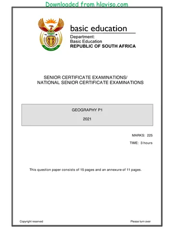
SENIOR CERTIFICATE EXAMINATIONS/
NATIONAL SENIOR CERTIFICATE EXAMINATIONS
GEOGRAPHY P2
2021
MARKS: 75
TIME: 1½ hours
EXAMINATION
NUMBER:
CENTRE
NUMBER:
M In SM In DM In CM In IM In MC EA EX RM In
Q1
Q2
Q3
Q4
TOT
This question paper consists of 16 pages and
1 page for rough work and calculations.
Copyright reserved Please turn over
You're offline
Skip to contentQuestion paper %20June%202025%20Question%20Paper--a52dca5e-efc4-4060-84c3-24f7269a2a79/v1-a9ef6866fc707402ff5a/card.webp)

View all
%20June%202024%20Possible%20Answers_hlayiso.com_--7e728632-059d-401a-ba75-fd45632f6091/v1-269fb55ac60eebf555e6/card.webp)
Geography P2 May June 2021 Eng_hlayiso.com_.pdf
Geography · Grade 12 · NSC June Exam · 2021. Question paper, 17 pages. Read online or download the PDF.
- Subject
- Geography
- Grade
- Grade 12
- Document type
- Question paper
- Year
- 2021
- Exam period
- NSC June Exam
- Paper
- 2
- Pages
- 17
- File size
- 546.1 KB
Loading document…
Loading document…
1 of 17
Document textSearch extracted text and jump to a page.
Downloaded from hlayiso.com
Geography/P2 2 DBE/2021
SC/NSC
RESOURCE MATERIAL
1. An extract from topographic map 3419AC HERMANUS
2. Orthophoto map 3419 AC 20 HERMANUS
3. NOTE: The resource material must be collected by schools for their own use.
INSTRUCTIONS AND INFORMATION
1. Write your EXAMINATION NUMBER and CENTRE NUMBER in the spaces
on the cover page.
2. Answer ALL the questions in the spaces provided in this question paper.
3. You are provided with a 1 : 50 000 topographic map (3419AC HERMANUS)
and an orthophoto map (3419 AC 20 HERMANUS) of a part of the mapped
area.
4. You must hand the topographic map and the orthophoto map to the invigilator
at the end of this examination session.
5. You may use the blank page at the end of this question paper for all rough
work and calculations. Do NOT detach this page from the question paper.
6. Show ALL calculations and formulae, where applicable. Marks will be
allocated for these.
7. Indicate the unit of measurement or compass direction in the final answer of
calculations, e.g. 10 km; 2,1 cm; west of true north.
8. You may use a non-programmable calculator.
9. You may make use of a magnifying glass.
10. The area demarcated in RED and BLACK on the topographic map represents
the area covered by the orthophoto map.
11. The following English terms and their Afrikaans translations are shown on the
topographic map:
ENGLISH AFRIKAANS
Diggings Uitgrawings
Onrus Mountain Onrusberge
Golf Course Gholfbaan
River Rivier
Sewerage Works Rioolwerke
Estate Landgoed
Salt Pan Soutpan
Nature Reserve Natuurreservaat
Copyright reserved Please turn over
Downloaded from hlayiso.com
Geography/P2 3 DBE/2021
SC/NSC
GENERAL INFORMATION ON HERMANUS
Hermanus lies along Walker Bay on the south coast of the Western Cape. It is located
about 115 km southeast of Cape Town and is connected to the Mother City by the R43
highway (or the coastal R44 scenic route) and the N2 freeway.
Hermanus has a Mediterranean climate with warm summers. It receives roughly
520 mm of rainfall per annum, the majority of which occurs during the winter months of
June to August in the form of frontal precipitation. Summer and winter months are
characterised by strong south-easterly and north-westerly winds respectively.
The town of Hermanus occupies a flat plain between the mountains and the sea.
Subsequent lowering of the sea level led to the formation of the cliffs which dominate
the coastline.
N
[Source: http://en.wikipedia.org/wiki/hermanus]
Copyright reserved Please turn over
Downloaded from hlayiso.com
Geography/P2 4 DBE/2021
SC/NSC
QUESTION 1: MULTIPLE-CHOICE QUESTIONS
The questions below are based on the 1 : 50 000 topographic map 3419AC
HERMANUS as well as the orthophoto map 3419 AC 20 HERMANUS of a part of the
mapped area. Various options are provided as possible answers to the following
questions. Choose the answer and write only the letter (A–D) in the block next to each
question.
1.1 Hermanus is situated in …
A the Northern Cape.
B the Eastern Cape.
C the Western Cape.
D Gauteng.
1.2 The main type of rainfall received in Hermanus during winter is …
A orographic.
B convection.
C frontal.
D advection.
1.3 The way in which height is indicated at 34°19ꞌ08ꞌꞌS 19°08ꞌ48ꞌꞌE on the
topographic map is a …
A contour line.
B benchmark.
C spot height.
D trigonometrical station.
1.4 The general direction of flow of the Leeurivier (river) in block C9 on the
topographic map is in a … direction.
A northerly
B southerly
C north-westerly
D south-easterly
1.5 The distance from A to B on the line scale below is … metres.
A 2 600
B 2 400
C 2,6
D 2,4
Copyright reserved Please turn over
Downloaded from hlayiso.com
Geography/P2 5 DBE/2021
SC/NSC
1.6 The true bearing from the place of worship 1 to the school 2 on the orthophoto
map is …
A 38°
B 55°
C 235°
D 252°
1.7 Man-made feature 3 on the orthophoto map is a …
A communication tower.
B windpump.
C secondary road.
D monument.
1.8 The orchards and vineyards at M in block C10 on the topographic map are most
likely frost resistant, because they are found in/on the …
A north-facing slope.
B south-facing slope.
C valley floor.
D shadow zone.
1.9 The high-lying area at N in block D7 on the topographic map is a/an …
A confluence.
B interfluve.
C tributary.
D watershed.
1.10 The main characteristic of the streams in block D8 on the topographic map:
A Erosion dominates
B Water flows in sheets
C Deposition dominates
D Wider channels are found
1.11 The dominant stream pattern in block H8 on the topographic map is …
A radial.
B rectangular.
C trellis.
D dendritic.
1.12 The main activity that causes an environmental injustice in block B5 on the
topographic map is …
A farming.
B fishing.
C hiking.
D excavating.
Copyright reserved Please turn over
Downloaded from hlayiso.com
Geography/P2 6 DBE/2021
SC/NSC
1.13 The main factor that influenced the dispersed pattern of the settlement at 4 on
the orthophoto map is the …
A gradient.
B protected area.
C bridge.
D other road.
1.14 The physical (natural) features responsible for the linear shape of the built-up
areas in blocks J10, K9 and K10 on the topographic map is due to the ...
A arterial route and power line.
B coastal rocks and mountain.
C arterial route and mountain.
D power line and mountain.
1.15 New Harbour at 5 on the orthophoto map is an example of a … economic
activity.
A primary
B secondary
C tertiary
D quaternary
(15 x 1) [15]
Copyright reserved Please turn over
Downloaded from hlayiso.com
Geography/P2 7 DBE/2021
SC/NSC
QUESTION 2: MAP CALCULATIONS AND TECHNIQUES
2.1 Refer to the topographic map.
Calculate the magnetic declination for 2021. Show ALL calculations. Marks
will be awarded for calculations. Clearly indicate the direction in relation to
true north in the final answer.
Difference in years: ________________________________
Mean annual change: ________________________________
Total annual change: ________________________________
Mean magnetic declination for 2021: ________________________________
________________________________
________________________________
(5 x 1) (5)
2.2 Refer to the topographic map.
2.2.1 Calculate the average gradient from trigonometrical station 31 (O)
in block I4 to benchmark 36.4 (P) in block J5. Show ALL
calculations. Marks will be awarded for calculations.
vertical interval (VI)
Formula: Average gradient =
horizontal equivalent (HE)
_____________________________________________________
_____________________________________________________
_____________________________________________________
_____________________________________________________
_____________________________________________________
_____________________________________________________
(5 x 1) (5)
Copyright reserved Please turn over
Downloaded from hlayiso.com
Geography/P2 8 DBE/2021
SC/NSC
2.2.2 (a) Why did the gradient calculated in QUESTION 2.2.1 limit the
construction of a road between O (in block I4) and P (in
block J5) on the topographic map?
________________________________________________
________________________________________________
(1 x 1) (1)
(b) How did engineers construct the R43 from block I4 to
block J5 to overcome the challenge in your answer to
QUESTION 2.2.2(a)?
________________________________________________
________________________________________________
(1 x 1) (1)
Copyright reserved Please turn over
Downloaded from hlayiso.com
Geography/P2 9 DBE/2021
SC/NSC
2.3 The block below consists of a vertical and horizontal scale, as well as the
heights of the contour lines from 6 to 7 found on the orthophoto map.
Use the block below for ALL answers to QUESTION 2.3.1.
2.3.1 (a) Indicate the height of U on the vertical scale of the above
cross-section. (1 x 1) (1)
(b) Complete the above cross-section which represents an area
from 6 to 7 on the orthophoto map, by using the given
contour heights on the horizontal scale. (2 x 1) (2)
(c) Identify man-made feature V on the cross-section. (1 x 1) (1)
Copyright reserved Please turn over
Downloaded from hlayiso.com
Geography/P2 10 DBE/2021
SC/NSC
2.3.2 Calculate the vertical exaggeration of the cross-section drawn in
QUESTION 2.3.1(b). Show ALL calculations. Marks will be
awarded for calculations. Clearly indicate the unit of measurement
in the final answer.
vertical scale (VS)
Formula: Vertical exaggeration =
horizontal scale (HS)
______________________________________________________
______________________________________________________
______________________________________________________
______________________________________________________
______________________________________________________
(4 x 1) (4)
[20]
Copyright reserved Please turn over
Downloaded from hlayiso.com
Geography/P2 11 DBE/2021
SC/NSC
QUESTION 3: APPLICATION AND INTERPRETATION
3.1 Refer to the topographic map.
3.1.1 Does the mapped area generally receive seasonal or annual
rainfall?
Answer: ______________________________________________
(1 x 1) (1)
3.1.2 Give TWO pieces of evidence from the topographic map to support
the answer to QUESTION 3.1.1.
_____________________________________________________
_____________________________________________________
(2 x 1) (2)
3.2 Refer to the topographic map.
Hermanus is located between the ocean and a high-lying area (mountain).
A southerly wind blows during the day.
3.2.1 Is the southerly wind offshore or onshore?
Answer: ______________________________________________
(1 x 1) (1)
3.2.2 Explain your answer to QUESTION 3.2.1.
_____________________________________________________
_____________________________________________________
(1 x 2) (2)
Copyright reserved Please turn over
Downloaded from hlayiso.com
Geography/P2 12 DBE/2021
SC/NSC
3.3 Refer to the Botrivier (river) from block C6 to block D4 on the topographic
map.
3.3.1 In which stage (course) of development is the Botrivier (river)?
_____________________________________________________
(1 x 1) (1)
3.3.2 Give ONE piece of evidence from the topographic map to support
your answer to QUESTION 3.3.1.
_____________________________________________________
_____________________________________________________
_____________________________________________________
(1 x 2) (2)
3.3.3 How did the geomorphological process in this stage (course) of the
river influence the crop farming in the area?
_____________________________________________________
_____________________________________________________
(2 x 2) (4)
3.4 Refer to the land-use zone between Hawston and Fisherhaven in blocks H3
and H4 on the topographic map.
3.4.1 Identify the land-use zone between Hawston and Fisherhaven in
blocks H3 and H4 on the topographic map.
_____________________________________________________
(1 x 1) (1)
3.4.2 Give ONE piece of map evidence to support your answer to
QUESTION 3.4.1.
______________________________________________________
______________________________________________________
(1 x 2) (2)
Copyright reserved Please turn over
Downloaded from hlayiso.com
Geography/P2 13 DBE/2021
SC/NSC
3.5 Refer to 9 on the orthophoto map.
3.5.1 Identify the street plan (pattern) at 9.
_____________________________________________________
(1 x 1) (1)
3.5.2 State ONE advantage of the street plan (pattern) at 9.
_____________________________________________________
_____________________________________________________
(1 x 1) (1)
3.5.3 How did the street plan (pattern) at 9 develop?
_____________________________________________________
_____________________________________________________
(1 x 2) (2)
3.6 Refer to 10 on the orthophoto map, which is an industrial area.
3.6.1 Are the industries heavy or light industries?
Answer: ______________________________________________
(1 x 1) (1)
3.6.2 Discuss why the industries identified in QUESTION 3.6.1 are in a
suitable location.
______________________________________________________
______________________________________________________
______________________________________________________
______________________________________________________
(2 x 2) (4)
[25]
Copyright reserved Please turn over
Downloaded from hlayiso.com
Geography/P2 14 DBE/2021
SC/NSC
QUESTION 4: GEOGRAPHICAL INFORMATION SYSTEMS (GIS)
4.1 The following information on the Klei Dam at Q (block G8) on the topographic
map is provided:
Location: 34°21ꞌ45ꞌꞌS 19°12ꞌ45ꞌꞌE
Depth: 10 m
4.1.1 Is the Klei Dam at Q in block G8 a point, line or polygon feature?
Answer: ______________________________________________
(1 x 1) (1)
4.1.2 State whether the following are spatial data or attribute data:
(a) The depth of the Klei Dam at Q
________________________________________________
(1 x 1) (1)
(b) The location of the Klei Dam at Q
________________________________________________
(1 x 1) (1)
4.1.3 Explain the importance of determining the depth of the Klei Dam at
Q for farming activities in the area.
_____________________________________________________
_____________________________________________________
(1 x 2) (2)
Copyright reserved Please turn over
Downloaded from hlayiso.com
Geography/P2 15 DBE/2021
SC/NSC
4.2 Refer to the enlarged insert of block F4 from the topographic map, showing a
combination of different data layers.
4.2.1 What is a data layer?
______________________________________________________
(1 x 1) (1)
4.2.2 Use the topographic map and identify the data layer that has been
omitted (left out) from the insert.
______________________________________________________
(1 x 1) (1)
4.2.3 What is the importance of the data layer identified in
QUESTION 4.2.2 to the economic development of the farming
community in block F4?
______________________________________________________
______________________________________________________
(2 x 2) (4)
Copyright reserved Please turn over
Downloaded from hlayiso.com
Geography/P2 16 DBE/2021
SC/NSC
4.3 Refer to blocks D4 and D5 on the topographic map. The quality of water in the
identified blocks could be affected by human activities. How would a GIS
specialist use data querying to evaluate the quality of water in this area?
______________________________________________________________
______________________________________________________________
______________________________________________________________
______________________________________________________________
(2 x 2) (4)
[15]
TOTAL: 75
Copyright reserved
Downloaded from hlayiso.com
Geography/P2 DBE/2021
SC/NSC
ROUGH WORK AND CALCULATIONS
(NOTE: Do NOT detach this page from the question paper.)
Copyright reserved
Recommended for this subject
Published documents with matching subject and grade metadata.
Question paper
Geography P1 (Afrikaans) June 2025 Question Paper.pdf
Question paper
Geography-Grade-12-NSC-P2-QP-September-2025-KZN.pdf
Question paper
Geography P1 May-June 2025 Eng.pdf
Question paper
HARTBEESPOORT DAM1 D FINAL.pdf
Question paper
GEOGRAPHY GR12 QP JUNE 2023_Afrikaans.pdf
Question paper
GEOGRAPHY GR12 QP JUNE 2023_Afrikaans_hlayiso.com_.pdf
Related documents
Matched using subject, grade, language, document type and exam metadata.
Question paper
Geography P2 May June 2021 MG Eng_hlayiso.com_.pdf
Question paper
Geography P2 May June 2021 Afr_hlayiso.com_.pdf
Question paper
Geography P1 May June 2021 Eng_hlayiso.com_.pdf
Question paper
Geography P2 Nov 2021 Afr_hlayiso.com_.pdf
Question paper
Geography P2 May June 2022 Afr_hlayiso.com_.pdf
Question paper
Geography P2 May June 2016 Eng_hlayiso.com_.pdf
More from Grade 12 Geography
Explore more published documents in this catalogue.
Memorandum
Geography-Grade-12-NSC-MEMO-P1-May-June-2025-Free-State.pdf
Memorandum
GEOGRAPHY P2 GR12 MEMO SEPT2024_Afrikaans_hlayiso.com_.pdf
Memorandum
Gr 12 Geography (English) June 2024 Possible Answers_hlayiso.com_.pdf
Memorandum
Gr 12 Geography P2 (Afrikaans) 2024 Possible Answers_hlayiso.com_.pdf
Memorandum
GEOGRAPHY GR12 MEMO JUNE 2023_Afrikaans.pdf
Memorandum