
basic education
Department:
Basic Education
REPUBLIC OF SOUTH AFRICA
SENIOR CERTIFICATE EXAMINATION
GEOGRAPHY P1
HIGHER GRADE
2012
ANNEXURE
Copyright reserved
This addendum consists of 11 pages.
CUTAN TA A AA Please tum over
GAUTENG
Skip to contentAll 2012 papers 
View all
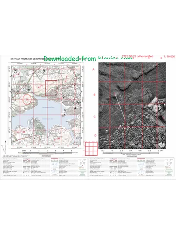
Geography Grade 12 Paper 1 NSC June 2012 Addendum (English)
Grade 12 Geography Paper 1 addendum from the NSC June 2012 (English), 11 pages. Read online or get the free PDF download.
Geography · Grade 12 · NSC June · 2012 · English. Addendum, 11 pages. Read online or download the PDF.
- Subject
- Geography
- Grade
- Grade 12
- Language
- English
- Document type
- Addendum
- Year
- 2012
- Exam period
- NSC June
- Paper
- 1
- Curriculum
- CAPS
- Pages
- 11
- File size
- 2.0 MB
Free to read online, no sign-up needed
Loading document…
Loading document…
1 of 11
This exam
NSC June 2012
Questions in this paper
- Question 1.1Climate and weather30 marks
- Question 1.2Climate and weather10 marks
- Question 1.3Geomorphology20 marks
- Question 1.4Geomorphology15 marks
- Question 2.1Climate and weather10 marks
- Question 2.2Climate and weather20 marks
Show all 32 questions
- Question 2.3Geomorphology10 marks
- Question 2.4Geomorphology20 marks
- Question 2.5Geomorphology15 marks
- Question 3.1Rural and urban settlements12 marks
- Question 3.2Rural and urban settlements18 marks
- Question 3.3Rural and urban settlements12 marks
- Question 3.4Rural and urban settlements22 marks
- Question 3.5Rural and urban settlements11 marks
- Question 4.1Rural and urban settlements12 marks
- Question 4.2Rural and urban settlements30 marks
- Question 4.4Rural and urban settlements21 marks
- Question 4.5Rural and urban settlements12 marks
- Question 5.1Economic geography of South Africa10 marks
- Question 5.2Economic geography of South Africa10 marks
- Question 5.3Geomorphology9 marks
- Question 5.4Economic geography of South Africa8 marks
- Question 5.5Economic geography of South Africa14 marks
- Question 5.6Economic geography of South Africa14 marks
- Question 5.7Economic geography of South Africa10 marks
- Question 6.1Climate and weather10 marks
- Question 6.2Economic geography of South Africa10 marks
- Question 6.3Economic geography of South Africa10 marks
- Question 6.4Economic geography of South Africa16 marks
- Question 6.5Economic geography of South Africa17 marks
- Question 6.6Economic geography of South Africa6 marks
- Question 6.7Economic geography of South Africa6 marks
Document textSearch extracted text and jump to a page.
Geography/HG/P1 2 DBE/2012
SCE — Annexure
FIGURE 1.1
BS ; SYNOPTIC WEATHER MAP 7 : .
Cs A | SINOPTIESE WEERKAART 12:00 UT ~ 14:00 SAST:201 1-06-29
Q 3
he south-westers parts of the country causing a ¥
SES pete ane ae vey cold a cold sa ial naditogy yt Showers aE \ ot
conditions peevailed avec the remulades ot she couaery
DISCUSSION: A cold front was situated over the
BESPREKING: 'n Kouetr idwestelike dele van dit land geleé en bee 7
Feseseedg oe Poa 2 Se SR EA EAE RE za
far dic Wes-Kaap en plet-rlek oor die Noord-Kanp veroorsaaic Hooftaablik sonnige on koel Cot
wart toestande Bet oar die res van die land geheers. \
[Source: South African Weather Services]
cerns TUT 0 a
Geography/HG/P1 3 DBE/2012
SCE — Annexure
FIGURE 1.3 (A)
DRAINAGE PATTERNS
NI
7
[Source: Senior Geography: Grade 12 (Adapted)]
FIGURE 1.3 (B)
DRAINAGE BASINS
s aainaneepeeemnamemmmnn een
DIAGRAM D
[Source: New Window on the World (Adapted)]
Conritesoned NANA Pease tum over
Geography/HG/P1 4 DBE/2012
SCE — Annexure
FIGURE 2.2
eo
3S
S00 mw ~
200m -
Q
50d -600 ken
Cismeter
and seas
[Source: The World in our Hands]
FIGURE 2.4
[Source: Geography Grade 12 (Adapted)]
Conse TTT
Geography/HG/P1 5 DBE/2012
SCE — Annexure
FIGURE 2.5
primary Consumers
(herbivores)
secondary
(carnivores)
[Source: Geography 10 A Handbook for Students]
FIGURE 3.2
~. ; ,
Daan 4
ay ‘
ea
<—— Tiver @e@ huts
—— contour Cattle pen
ey, bush and trees -- -~path Ui 0 100 m
‘",," cultivated land = 4 mosquito infested marsh [> oo
[Source: Focus on Geography]
coos TU
Geography/HG/P1 6
SCE — Annexure
DBE/2012
FIGURE 3.4
[Source: Study and Master]
FIGURE 3.7
~
3
Percentage (%)
e & a 2 ~
8 & 3 8 3
nm
Ss
ray
°
i960 "1970 1980 1990 2000
Years
ween Urbanisation : | Population
[Source: Focus on Geography Grade 12]
Conrintesoned NAAT A Pease tun over
Geography/HG/P1 7
SCE — Annexure
DBE/2012
FIGURE 4.2
[Source: The World in our Hands]
FIGURE 4.4
N
e, O Krag ‘
tL
oD Q a
@ ‘Outer shopping centres. Gees Factories
— (Old residential area ee Rail link
Wiza New residential area Be Bq | Green deit
[Source: New Generation Geography Grade 12]
Coprihtesoved NAN
Please turn over
Geography/HG/P1 8 DBE/2012
SCE — Annexure
FIGURE 4.5
[Source: New Window on the World 7]
FIGURE 5.2
[Source: Google Internet (Adapted)]
cori soe TT
Geography/HG/P1 9
SCE — Annexure
FIGURE 5.3
20 Goo Limpopo
Milion m*/year
~ Miljoen maar
[Source: Geography Gr 12 (Adapted)]
FIGURE 5.4
DBE/2012
a Desert / Woestyn
Karoo Bush / Karoobosse
{T]] Sweet grass / Soetgras
[Source: Geography Gr 12 (Adapted)]
Coprihtesoved A NA
Please turn over
Geography/HG/P1
FIGURE 5.7
10
SCE — Annexure
[Source: Senior Geography (Adapted)]
FIGURE 6.2
fo J “Hy
a _
/ aA
i ah E
i pa -_ el
2 A A A a retoria ;
i —
a d
Johagnosburg “
en
Wa .
|
[Source: New Generation Geography (Adapted)]
Copyright reserved
NA A
Please turn over
DBE/2012
Geography/HG/P1 11 DBE/2012
SCE — Annexure
FIGURE 6.3
soil ervsion and former surface,
seul satting
DEFORESTATION AND
VEGETATION CLEARANCE
High risk
Medien risk
‘dust stormé ard
wind erosion
soil evasion
lithe o
+ no topsoil ae
IRRIGATION WITHOUT &
ADEQUATE DRAINS
OVER CULTIVATION
AND OVERSTOCKING
[Source: Internet (Adapted)]
FIGURE 6.6
Driekioo!
Sterkiontein
[Source: Senior Geography (Adapted)]
Conytresened NA A
Study this subject
Recommended for this subject
Addendum
Geography Grade 12 P1 NSC November 2012 Addendum (English)
Question paper
Geography Grade 12 P1 NSC June 2025 Question Paper (English)
Memorandum
Geography Grade 12 Paper 1 NSC November 2025 Memo (English)
Memorandum
Geography Grade 12 P1 Gauteng Prelim 2024 Memo (English)
Question paper
Geography Grade 12 P1 GP Prelim 2023 Question Paper (Eng)
Question paper
Geography Grade 12 P1 Gauteng Mock 2022 Question Paper (Eng)
More from Grade 12 Geography
Question paper
Geography Grade 12 P2 Gauteng June 2025 Question Paper (Eng)
Memorandum
Geography Grade 12 Paper 2 Gauteng Mock 2025 Memo
Question paper
Geography Grade 12 Paper 1 KZN Mock 2025 Question Paper
Question paper
Geography Grade 12 Paper 2 KZN Mock 2025 Question Paper
Memorandum
Geography Grade 12 Gauteng June 2024 Memo (English)
Question paper