
DBE/2012
SCE — Memorandum
basic education
Department:
Basic Education
REPUBLIC OF SOUTH AFRICA
SENIOR CERTIFICATE EXAMINATION
GEOGRAPHY P2
HIGHER GRADE
2012
MEMORANDUM
MARKS: 100
This memorandum consists of 8 pages.
BBUC:
Copyright reserved
Skip to contentAll 2012 papers 
View all
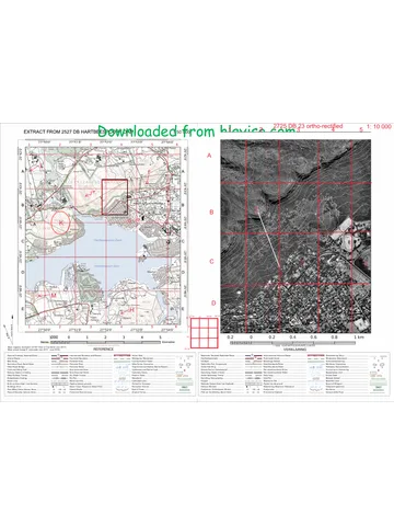
Geography Grade 12 Paper 2 NSC June 2012 Memo (English)
Grade 12 Geography Paper 2 memorandum from the NSC June 2012 (English), 8 pages. Read online or get the free PDF download, question paper linked when available.
Geography · Grade 12 · NSC June · 2012 · English. Memorandum, 8 pages. Read online or download the PDF.
- Subject
- Geography
- Grade
- Grade 12
- Language
- English
- Document type
- Memorandum
- Year
- 2012
- Exam period
- NSC June
- Paper
- 2
- Curriculum
- CAPS
- Pages
- 8
- File size
- 773.8 KB
Free to read online, no sign-up needed
Loading document…
Loading document…
1 of 8
This exam
NSC June 2012
Questions in this paper
- Question 1.1Map work
- Question 1.2Map work
- Question 1.3Map work
- Question 1.4Map work
- Question 1.5Map work
- Question 1.6Map work
Show all 24 questions
- Question 1.7Map work
- Question 1.8Map work
- Question 1.9Map work
- Question 1.10Map work20 marks
- Question 2.1Map work11 marks
- Question 2.2Map work2 marks
- Question 2.3Map work2 marks
- Question 3.1Map work6 marks
- Question 3.2Map work4 marks
- Question 3.3Map work4 marks
- Question 4.1Map work2 marks
- Question 4.2Map work6 marks
- Question 4.3Map work4 marks
- Question 4.4Map work2 marks
- Question 4.5Map work4 marks
- Question 4.6Map work2 marks
- Question 4.7Map work4 marks
- Question 4.8Map work2 marks
Document textSearch extracted text and jump to a page.
Geography/HG/P2 2
SCE
QUESTION 1: MULTIPLE-CHOICE QUESTIONS
DBE/2012
The questions below are based on the 1:50 000 topographical map 3227CD KING
WILLIAM'S TOWN, as well as the 1:10 000 orthophoto map 3227CD14 KING
WILLIAM'S TOWN.
Various options are provided as possible answers to the following questions. Choose
the answer and write only the letter (A—D) in the block next to each question number
(1.1-1.10).
J The mean annual change in the magnetic declination on the topographical
map is...
A 7' eastwards.
B 23°12' west.
Cc 7' westwards.
D =. 23°42! east.
1.2 The contour interval on the topographical map is ... metres.
A 10
B20
Cc 50
D 60
1.3 The two types of scale shown on the topographical map are the ...
A _ ratio scale and word scale.
B__ Richter scale and line scale.
C_ word scale and line scale.
D line scale and ratio scale.
1.4 The drainage pattern found in block F7 is ...
A atrellis.
B radial.
C dendritic.
D rectangular.
1.5 The primary activity found in block C10 on the topographical map is ...
A __ orchards and vineyards. :
B mining. i DEPARTMENT OF BASIC
C fishing. EDUCATION
D excavations.
Copyright reserved
Please turn over
tf
e
CY¥vY
BYY
DvvY
C¥v
D/B
G
Geography/HG/P2 3
SCE
1.6 The orthophoto number 3227 refers to ...
A longitude and contour lines.
B latitude and longitude.
C latitude and contour lines.
D contour lines and isobars.
DBE/2012
BYY
1.7 The recreational facility found in block E10/E11 on the topographical map is a...
A golf course.
B horse riding club.
C caravan park. Avy
D model aircraft club.
1.8 The type of slope south of Kwa Jubisa in block J4 leading to the farmland is a
.. slope.
A _ horizontal
B terrace
C concave Cv
D convex
1.9 An aerial photograph which shows contour lines, spot heights, trigonometrical
stations and other labelled features, is called a/an ...
A oblique aerial photograph.
B topographical map.
C orthophoto map. cvy
D vertical aerial photograph.
1.10 The index of the map sheet northwest of King William's Town is ...
-
-_
C 3327BA. BYY
D 3327AA.
(10 x 2) [20]
DEPART MERE; Fe
é NT OF BASIE
EDUCAT) roa ASHES |
‘enter mraae,
i
0611 |
AG 110 |
PUBL E EX; ae i
CARINAT! NATIONS}
Copyright reserved 7 fl
Please turn over
al
ae
Geography/HG/P2 4 DBE/2012
SCE
QUESTION 2: MAPWORK TECHNIQUES AND CALCULATIONS
_ Locate trigonometrical station 77 at X in block I 2 and benchmark 557.0 at Q
in block I 4 when answering the questions below.
2.1.1 What is the direction of trigonometrical station 77 from benchmark
Q?
West South West/West/South WestvV
(1x2) @
2.1.2 Measure the true bearing of benchmark Q from trigonometrical
station 77.
(78°-82°) VV _ (2)
2.1.3 Calculate the average gradient between benchmark Q and
trigonometrical station 77.
Gradient=VI Vv oH Rise
HE D Run
Yo Fe sey
HE = 56mm v x 50 000
|
2800 ¥
= 1:52,04vv (6)
[Range 1:50 to 1:54]
2.1.4 You are travelling to Grahamstown from King William's Town on
the N2 and stop at benchmark Q. Is benchmark Q@ and
trigonometrical station 77 intervisible? Explain your answer.
Yes” V There is no relief obstruction between these points VV
(2x2) (4)
_) Give the approximate height of the runway at the Bisho Airport in block E2/3,
F2.
581-599 mv Vv
(1 x 2) (2)
Copyright reserved the
Please turn over
Geography/HG/P2 5 DBE/2012
2.3
2.4
SCE
Give ONE reason for the site chosen for the construction of Bisho Airport.
Flat land or gentle slopev Vv
No high lying areas or mountainsvY¥
Away from built-up areasV ¥
Reducing the effect of noise and air pollution to avoid accidentsv V
(Any ONE) (1 x2) (2)
Identify the feature found at grid reference 32°55'42"S; 27°21'50"E.
Dam/Perennial waterv ¥ (1x2) (2)
[20]
QUESTION 3: RELIEF AND DRAINAGE
3.1 Study the section of the Buffalo River between R and S$ on the topographical
map and identify the following fluvial (river) features:
T flood plain’ Y
U braided stream/ meander / straight stream channel’ V
V meander/slip-off slopev ¥ (3x2) (6)
3.2 In which direction is the Buffalo River flowing? Give a reason for your answer.
Answer: Buffalo river is flowing in a southerly /south-easterly
direction’ ¥ (x2) @)
Reason: Dam wall is built downstream/spot heights indicate VV
river flowing from high (eg «366 in block C9) to low’ v
altitude(eg «316 in block 115) Vv
Contour head points upstream’ ¥
Tributaries point with acute angle pointing downstream V¥
(Any ONE) (x2) (2)
3.3 Identify the natural landform/feature W in block G8 and flow feature Y in block
E/F1:
W spur/ridgeyv ¥
; | BEPARTME MENT OF SAS?
vv TOFS. (4)
Y marsh and viei EDUCATION" ASIC | (2 x 2)
H |
Copyright reserved ft
7a
Please turn over ra
a)
ee
Geography/HG/P2 6 DBE/2012
SCE
3.4 Rainfall in the mapped area is seasonal. Give THREE pieces of evidence
from the topographical map to prove this statement.
Non-perennial streamsv V
Presence of large number of farm dams./ Storage damsVvV
Presence of reservoirs / water towersv ¥
Presence of wind pumpsVv
Cultivated land near riversV
Lack of natural vegetation’ V (6)
(Any THREE) (3 x 2) [20]
QUESTION 4: LAND-USE AND ECONOMIC ACTIVITIES
44 Identify the type of road entering the mapped area from East London.
National road/National freeway/N2 VV (1 x 2) (2)
4.2 Identify the land use below by referring to both the orthophoto map and the
topographical map. Letters L, M, N and O have been printed on the
orthophoto map. Identify the land use found at:
L cemetery/graveyardv¥
M university/educational/ Ford Hare UniversityWY
N excavationsv ¥
fe) reservoir’ ¥ (4x 2) (8)
4.3 Fort Hill in block D10 is high income residential area. Give TWO reasons from
the topographical map to prove this statement.
Large stands/plotsV ¥
Large housesv ¥
Close to the recreational areav V
More trees visible/ GreenerywvV
Away from the industriesV Vv
Scenic viewW¥
(Any TWO)
(4)
4.4 Refer to the industrial area Schornville in block E9/10. Identify THREE factors
on the topographical map that will attract tourists to the town.
Visiting the factory shopv¥
Tours to factoriesv V
[Accept any other]
(Any THREE) (8 x 2) (6)
Please turn over ch EF
Copyright reserved
Geography/HG/P2 Zz DBE/2012
45
46
AT
48
SCE
The town of King William's Town has a good tourist potential. Identify and
name THREE features found on the topographical map that will attract
tourists to the town.
House of Steven BikovV
Golf coursev¥ \
Fort Murrayv¥ 9012 -08- 11
Dam/ Laing Damvv :
River’ ¥ PRIVATE BAG
Presidential Residencev ¥ enema eee TTPO TTS
Air strip — (with motivation) VV [PUBLIC EXAMINA) a
(Any THREE) (3 x 2) (6)
The dominant type of activity being practised over the mapped area is
commercial farming. Give TWO reasons to prove this statement.
Row of trees/Wind breaksV V
Irrigation takes place (windpump, dams) VV
Large farmsv¥
Name of farmsv ¥
Farm boundariesv ¥
EstatesV ¥
Good infrastructurev V (4)
(Any TWO) (2 x 2)
Towns and cities can be divided into three main categories on the basis of the
type of factor that determines their location.
4.7.4 What type of town can King William's Town be classified as?
Central place town’ ¥ (1 x 2) (2)
4.7.2 Give a reason for your answer.
The town provides a range of urban services to surrounding areav V
[Concept] (1 x 2) (2)
Why are several recreation grounds found on the banks of the Buffalo River?
During times of floods they will act as a buffer between the river and the
houses VV
The land is also flat on the banks of the river making it easy to construct
recreation facilitiesV ¥
Water for irrigation’ Y
Close to water for recreational activities like swimming, fishing, canoeing, etc.
vv
{Accept others] (2)
(Any ONE reason) (1 x 2)
Copyright reserved fe
Please turn over
an
ue
Geography/HG/P2 8 DBE/2012
SCE
4.9 The railway shows a higher level of detour than the roads on the east of the
map. Give a possible reason for this.
The railway line requires a gentle gradient thus there is a greater detour to
avoid the high lying areasv V
Roads can be built on steeper gradientsV V
Railway lines follow the contours VV
(Any ONE) (1 x 2) (2)
4.10 Most of the built-up area to the west of King William's Town on the
topographical map has developed recently. Give ONE piece of evidence to
prove this statement.
Most of the settlements have a planned irregular street pattern VV
This is a recent feature in town planning thus these settlements have been
recently developedv V
Topographical map is a later addition VV (x2) @)
[40]
TOTAL: 100
Copyright reserved
Please turn over Ue
ale
ue
Study this subject
Recommended for this subject
Memorandum
Geography Grade 12 P2 Eastern Cape Mock 2022 Memo (English)
Memorandum
Geography Grade 12 P2 Eastern Cape Mock 2020 Memo (English)
Memorandum
Geography Grade 12 P2 Eastern Cape Mock 2018 Memo (English)
Question paper
Geography Grade 12 P2 Gauteng June 2025 Question Paper (Eng)
Question paper
Geography Grade 12 P2 Eastern Cape Mock 2018 QP (Eng)
Question paper
Geography Grade 12 P2 NSC November 2012 Question Paper (Afr)
More from Grade 12 Geography
Question paper
Geography Grade 12 Paper 1 KZN Mock 2025 Question Paper
Question paper
Geography Grade 12 Paper 2 KZN Mock 2025 Question Paper
Question paper
Geography Grade 12 P1 NSC June 2025 Question Paper (English)
Question paper
Geography Grade 12 Eastern Cape June 2023 Question Paper
Question paper
Geography Grade 12 GAU June 2023 Question Paper
Question paper