
Downloaded from hlayiso.com
NATIONAL
SENIOR CERTIFICATE
GRADE 11
NOVEMBER 2018
GEOGRAPHY P2
MARKS: 75
TIME: 1½ hours
NAME:
MARKS HOD CLUSTER PROVINCIAL
Q1 15
Q2 20
Q3 25
Q4 15
TOTAL
MOD.
MARKS
75 75
This question paper consists of 17 pages, including a page
for rough work and calculations.
Skip to contentAll 2018 papers 
View all
Geography Grade 11 P2 Eastern Cape November 2018 QP (Eng)
Grade 11 Geography Paper 2 question paper from the Eastern Cape November 2018 (English), 17 pages. Read online or download the free PDF.
Geography · Grade 11 · Eastern Cape November · 2018 · English. Question paper, 17 pages. Read online or download the PDF.
- Subject
- Geography
- Grade
- Grade 11
- Language
- English
- Document type
- Question paper
- Year
- 2018
- Exam period
- Eastern Cape November
- Paper
- 2
- Curriculum
- CAPS
- Pages
- 17
- File size
- 1.1 MB
Free to read online, no sign-up needed
Loading document…
Loading document…
1 of 17
This exam
Eastern Cape November 2018
Questions in this paper
Document textSearch extracted text and jump to a page.
2
Downloaded from hlayiso.com
GEOGRAPHY P2 (EC/NOVEMBER 2018)
RESOURCE MATERIAL
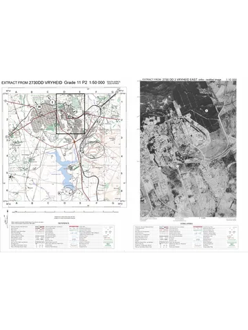
1. An extract from topographic map 2926AB MASELSPOORT.
2. Orthophoto map 2926 AB 6 MASELSPOORT.
3. NOTE: The resource material must be collected by schools for their own use.
INSTRUCTIONS AND INFORMATION
1. Write your NAME and SURNAME in the space provided on the cover page.
2. Answer ALL the questions in the spaces provided on this question paper.
3. You are provided with a 1 : 50 000 topographic map (2926AB
MASELSPOORT) and an orthophoto map (2926 AB 6 MASELSPOORT) of a
part of the mapped area.
4. You must hand in the topographic map and the orthophoto map to the
invigilator at the end of this examination session.
5. You must use the blank page at the back of this paper for all rough work and
calculations. DO NOT detach this page from the question paper.
6. Show ALL calculations and formulae, where applicable. Marks will be awarded
for these.
7. Indicate the unit of measurement in the final answer of calculations. Ensure
that units are maintained throughout ALL your calculations and final answer.
8. You may use a non-programmable calculator and a magnifying glass.
9. The area demarcated in RED on the topographic map represents the area
covered by the orthophoto map.
10. A glossary of some of the English words and their Afrikaans translations
appears below.
ENGLISH AFRIKAANS
Landing strip Landingstrook/Aanloopbaan
Furrow Voor
Caravan Park Karavaanpark
Canal Kanaal
Sewerage works Rioolwerke
Golf Course Gholfbaan
Excavation Uitgrawing
Nature reserve Natuurreservaat
Rifle Range Skietbaan
Aerodrome Vliegveld
Communication tower Kommunikasietoring
Copyright reserved Please turn over
(EC/NOVEMBER 2018)
Downloaded from hlayiso.com
GEOGRAPHY P2 3
GENERAL INFORMATION ON MASELSPOORT
Maselspoort is a town in Mangaung, in the Free State province, South Africa. Maselspoort
is situated on the banks of the Modder River, 23 km from Bloemfontein. Maselspoort
normally receives about 540 mm rain per year, with most rainfall occurring mainly during
mid-summer. Mesas, buttes and conical hills surround the landscape. It is a popular resort
town for Bloemfontein since the 1930’s. A fisherman's paradise, Maselspoort offers a
choice of leisure facilities.
Coordinates: 29°01'40" S 26°24'11" E / 29°01,6' S 26°24,1' E.
[Adapted from https://en.m.wikipedia.org]
Copyright reserved Please turn over
4
Downloaded from hlayiso.com
GEOGRAPHY P2 (EC/NOVEMBER 2018)
QUESTION 1: MULTIPLE-CHOICE QUESTIONS
The questions below are based on the 1 : 50 000 topographic map (2926AB
MASELSPOORT), as well as the orthophoto map (2926AB 6 MASELSPOORT) of
a part of the mapped area. Various options are provided as possible answers to
the following questions. Choose the answer and write only the letter (A–D) in the
block next to each question.
1.1 The map index/reference of the topographic map to the south-east of
Maselpoort is …
A 2926 AC.
B 2926 AD.
C 2926 BC.
D 2826 DC.
1.2 Ground water is used around Maselspoort for agricultural purposes. One
piece of evidence to prove the use of ground water is the presence of ...
A windpumps.
B dams.
C rivers.
D taps.
1.3 The railway line (block A5) passes through a …
A saddle.
B ravine.
C gap.
D gorge.
1.4 The direction of flow of the Bloemspruit/Bloem River in block H3 is …
A south.
B east-northeast.
C north-east.
D south-northwest.
1.5 The contour interval on the orthophoto map is ... metres.
A 5
B 10
C 15
D 20
Copyright reserved Please turn over
(EC/NOVEMBER 2018)
Downloaded from hlayiso.com
GEOGRAPHY P2 5
1.6 The landform labelled B (block C2) on the topographic map is a …
A plateau.
B cuesta.
C mesa.
D conical hill.
1.7 The approximate time the orthophoto was taken would be …
A between 08:00–10:00
B between 11:00–13:00
C between 14:00–17:00
D between 17:00–19:00
1.8 The feature labelled C in block F3 is a …
A windpump.
B communication tower.
C grave.
D monument.
1.9 The human-made feature at 1 on the orthophoto map is a …
A school.
B cemetery.
C golf course.
D hospital.
1.10 The landform between 9 and 10 on the orthophoto map is a …
A gap.
B spur.
C gorge.
D valley.
1.11 The location (co-ordinates) of the De Bloem station labelled D (block E1)
is …
A 29°05'00"S 26°02'12"E / 29°05,0'S 26°02,2'E.
B 26°15'52"E 29°04'45"S / 26°15,9'E 29°04,8'S.
C 29°04'45"E 26°28'36"S / 29°04,8’E 26°28,6’S.
D 29°04'45"S 26°15'52"E / 29°04,8'S 26°15,9'E.
1.12 The true bearing of spot height 1402 in block D2 from trigonometrical station
171 in block F5 is …
A 129°.
B 309°.
C 38°.
D 116°.
Copyright reserved Please turn over
6
Downloaded from hlayiso.com
GEOGRAPHY P2 (EC/NOVEMBER 2018)
1.13 The scale of the orthophoto map is … than that of the topographic map.
A 5 times smaller
B 5 times larger
C 40 times larger
D 40 times smaller
1.14 Maselspoort is … from Bloemfontein.
A 5 km
B 13 km
C 23 km
D 40 km
1.15 The railway line labelled F on the topographic map from De Bloem station D
(block E1) to Glen passes under … bridges.
A 0
B 1
C 2
D 3
(15 x 1) (15)
[15]
Copyright reserved Please turn over
(EC/NOVEMBER 2018)
Downloaded from hlayiso.com
GEOGRAPHY P2 7
QUESTION 2: MAPWORK CALCULATIONS AND TECHNIQUES
2.1 Refer to the cross-section below from 4 to 5 on the orthophoto map and
answer the questions that follow. The vertical scale for the cross-section is
1 cm represents 5 m.
[Source: Examiner’s extract]
2.1.1 Name the landform X on the cross-section above.
(1 x 1) (1)
2.1.2 (a) Identify the slope type labelled Y on the cross-section above.
(1 x 1) (1)
(b) Refer to orthophoto map evidence to motivate your answer to
QUESTION 2.1.2 (a).
(1 x 1) (1)
Copyright reserved Please turn over
8
Downloaded from hlayiso.com
GEOGRAPHY P2 (EC/NOVEMBER 2018)
2.1.3 (a) Name the man-made feature Z between points 4 and 5.
(1 x 1) (1)
(b) The height at which the feature identified in QUESTION 2.1.3 (a)
is located/found ...
(1 x 1) (1)
2.1.4 Calculate the vertical exaggeration of the cross-section. Show ALL
calculations. Marks will be awarded for calculations.
Formula: VE = Vertical scale / Horizontal scale
(4 x 1) (4)
2.2 Refer to the area demarcated in RED on the topographic map, which
represents the area covered by the orthophoto map.
2.2.1 Calculate the above area in km2. Show ALL calculations. Marks will be
awarded for calculations.
Formula: Area = Length x Breadth
(5 x 1) (5)
2.2.2 What would the area be in metres?
(1 x 1) (1)
Copyright reserved Please turn over
(EC/NOVEMBER 2018)
Downloaded from hlayiso.com
GEOGRAPHY P2 9
2.3 Calculate the average gradient between the trigonometric station 11 (1428) to
spot height 12 (1409) on the orthophoto map.
Show ALL calculations. Marks will be awarded for calculations.
(5 x 1) (5)
[20]
Copyright reserved Please turn over
10
Downloaded from hlayiso.com
GEOGRAPHY P2 (EC/NOVEMBER 2018)
QUESTION 3: APPLICATION AND INTERPRETATION
3.1 Refer to the graph below, the information on page 2 and the topographic
map to answer the questions that follow.
3.1.1 Does Maselspoort receive summer or winter rainfall?
(1 x 1) (1)
3.1.2 Give TWO points of evidence from the graph to support your answer
to QUESTION 3.1.1.
1.
2.
(2 x 1) (2)
3.2 Refer to number 3 on the orthophoto map. Study it together with the
topographic map and answer the questions that follow.
3.2.1 Identify any ONE type of mass wasting that could possibly affect the
small farming settlements at the base of Olive Hill at 8 on the
orthophoto map.
(1 x 1) (1)
Copyright reserved Please turn over
(EC/NOVEMBER 2018)
Downloaded from hlayiso.com
GEOGRAPHY P2 11
3.2.2 Explain the negative impact of mass wasting identified in
QUESTION 3.2.1 on the surrounding farming community.
(2 x 2) (4)
3.3 Study the photograph of the Maselspoort Resort (block B10) along the side
of the Modder River and answer the following questions.
[Source: Google earth]
3.3.1 Is this a high oblique or a low oblique photograph?
(1 x 1) (1)
3.3.2 (a) In what direction do you think the camera is pointing?
(1 x 1) (1)
(b) Give a reason for the answer to QUESTION 3.3.2 (a).
(1 x 1) (1)
3.3.3 Identify the feature at X.
(1 x 1) (1)
Copyright reserved Please turn over
12
Downloaded from hlayiso.com
GEOGRAPHY P2 (EC/NOVEMBER 2018)
3.3.4 Refer to the topographic map in block B10.
(a) What direction is the Modder River flowing?
(1 x 1) (1)
(b) Provide TWO reasons evident from the photograph and
topographic map to support your answer to QUESTION 3.3.4 (a).
(2 x 2) (4)
3.4 Maselspoort generally receives low rainfall. Mention ONE measure evident on
the topographic map that farmers have adopted to overcome water shortages.
3.4.1
(1 x 1) (1)
3.4.2 Identify the environmental problem labelled H (block C6).
(1 x 1) (1)
3.4.3 Explain any TWO management strategies to prevent and control the
environmental problem identified in QUESTION 3.4.2.
(2 x 2) (4)
Copyright reserved Please turn over
(EC/NOVEMBER 2018)
Downloaded from hlayiso.com
GEOGRAPHY P2 13
3.5 Refer to blocks D6/7 on the topographic map.
(a) Identify feature G.
(1 x 1) (1)
(b) What method is used to bring water to this area?
(1 x 1) (1)
[25]
Copyright reserved Please turn over
14
Downloaded from hlayiso.com
GEOGRAPHY P2 (EC/NOVEMBER 2018)
QUESTION 4: GEOGRAPHICAL INFORMATION SYSTEMS (GIS)
4.1 State THREE processes when working with GIS.
(3 x 1) (3)
4.2 Classify the following data as spatial data or attribute data.
4.2.1 A map showing lay-out of residential area.
(1 x 1) (1)
4.2.2 The shape of a marsh and vlei.
(1 x 1) (1)
Copyright reserved Please turn over
(EC/NOVEMBER 2018)
Downloaded from hlayiso.com
GEOGRAPHY P2 15
4.3 Study the map extract below from the topographic map (blocks F3/4 and
G3/4), which is not drawn to scale.
[Source: topographic map extract Maselspoort]
4.3.1 (a) Is the topographic map extract a vector or raster map?
(1 x 1) (1)
(b) Give ONE reason for your answer to QUESTION 4.3.1 (a).
(1 x 1) (1)
4.3.2 Classify each of the following spatial objects from the topographic
map extract:
(a) Dam –
(b) Trignometric station 171 –
(2 x 1) (2)
4.3.3 State the spatial referencing data for the airport marked X on the
topographic map extract.
(2 x 1) (2)
Copyright reserved Please turn over
16
Downloaded from hlayiso.com
GEOGRAPHY P2 (EC/NOVEMBER 2018)
4.4 Differentiate between spatial resolution and spectral resolution.
Spatial resolution:
(1 x 1) (1)
Spectral resolution:
(1 x 1) (1)
4.5 Explain in what situation a person would use a high resolution.
(1 x 2) (2)
[15]
TOTAL: 75
Copyright reserved Please turn over
(EC/NOVEMBER 2018)
Downloaded from hlayiso.com
GEOGRAPHY P2 17
ROUGH WORK AND CALCULATIONS
NOTE: DO NOT remove this page from question paper.
Copyright reserved Please turn over
Study this subject
Recommended for this subject
Question paper
Geography Grade 11 P2 Eastern Cape November 2022 QP (Eng)
Question paper
Geography Grade 11 P2 Eastern Cape November 2020 QP (Eng)
Question paper
Geography Grade 11 P2 Eastern Cape November 2018 QP (Afr)
Memorandum
Geography Grade 11 P2 Eastern Cape November 2022 Memo (Eng)
Addendum
Geography Grade 11 P2 Eastern Cape November 2020 Addendum
Memorandum
Geography Grade 11 P2 Eastern Cape November 2020 Memo (Eng)
More from Grade 11 Geography
Memorandum
Geography Grade 11 P1 Eastern Cape November 2025 Memo (Eng)
Memorandum
Geography Grade 11 P2 Eastern Cape November 2025 Memo (Eng)
Question paper and memo
Geography Grade 11 Free State March Test 2025 Paper & Memo
Memorandum
Geography Grade 11 P1 Eastern Cape November 2024 Memo (Afr)
Memorandum
Geography Grade 11 P1 Eastern Cape November 2023 Memo (Eng)
Question paper