
_. GREEN BURY oS
Geography P1 June 2017 Common Test
2
NSC — Memorandum
SECTION A: CLIMATE AND WEATHER AND GEOMORPHOLOGY
Education QUESTION 1
KwaZulu-Natal Department of Education 14
REPUBLIC OF SOUTH AFRICA 1.4.4 4mb/hpav
1.1.2 gentle pressure gradient ”
4113 4v
8
1.1.4 23°C v
1.1.5 15knots “
weeeswensseen8”
1.1.6 (a) _ tropical cyclone/TropicalcycloneEmest ~
(b) clockwise ¥
| 1.1.7. cold front” (8x 1)(8)
1.2
1.2.1. Interfluve ~
1.2.2 Watershed / drainage divide “
1.2.3 Confluence ¥
MARKS: 225 ,
1.2.4 Perennial river/Permanent rivery
1.2.5 Turbulent flow ~
This memorandum consists of 14 pages.
1.2.6 Sealevel/ocean/sea Vv
1.2.7 Levee Vv 7x1)
Copyright Reserved Please Tum Over Copyright Reserved Please Tum Over
Skip to contentAll 2017 papers 
View all





Geography Grade 12 Paper 1 KZN June 2017 Memo
Grade 12 Geography Paper 1 memorandum from the KZN June 2017, 8 pages. Read online or get the free PDF download, question paper linked when available.
Geography · Grade 12 · KZN June · 2017. Memorandum, 8 pages. Read online or download the PDF.
- Subject
- Geography
- Grade
- Grade 12
- Document type
- Memorandum
- Year
- 2017
- Exam period
- KZN June
- Paper
- 1
- Curriculum
- CAPS
- Pages
- 8
- File size
- 376.0 KB
Free to read online, no sign-up needed
Loading document…
Loading document…
1 of 8
This exam
KZN June 2017
Questions in this paper
- Question 1.1Climate and weather8 marks
- Question 1.2Geomorphology7 marks
- Question 1.3Climate and weather16 marks
- Question 1.4Climate and weather13 marks
- Question 1.5Geomorphology16 marks
- Question 1.6Geomorphology15 marks
Show all 18 questions
- Question 2.1Climate and weather7 marks
- Question 2.2Climate and weather8 marks
- Question 2.3Climate and weather15 marks
- Question 2.4Climate and weather15 marks
- Question 2.5Geomorphology15 marks
- Question 2.6Geomorphology15 marks
- Question 3.1Rural and urban settlements8 marks
- Question 3.2Rural and urban settlements7 marks
- Question 3.3Rural and urban settlements13 marks
- Question 3.4Economic geography of South Africa18 marks
- Question 3.5Rural and urban settlements14 marks
- Question 3.6Rural and urban settlements15 marks
Document textSearch extracted text and jump to a page.
Geography Pt 3 June 2017 Common Test
NSC— Memorandum
1.3. SATELITE IMAGE OF A MID-LATITUDE CYCLONE
4.3.1 South western part/South western cape” (1x1) (1)
1.3.2 Winter ¥ (1x1) (1)
4.3.3. Mid-latitude cyclone very close to the subcontinent vv” (4x2) 2)
Copyright Reserved
134
1.3.5
Temperature drops ¥ “— arrival of cold air with cold front ¥ v
Pressure increases Vv— with drop in temperaturey¥
Humidity decreases “ “— warm air replaced by cold air’ ¥
Cumulonimbus clouds formed “”— as warm air condenses” ¥
Heavy rains vv — towering cumulonimbus clouds” ~
Wind speed increasesY “ because of steeper pressure gradient” (2 x 2) (4)
(Any ONE)
Farmers
‘Winter rain ideal for farming in Western Cape V“
Frost and snow impact negatively v “
Very low temperature retards production and may affect food security” ~
Very cold weather may result in the death of animals~ ”
Reduced income for farmers” ¥
Dam levels may rise ensuring greater water supplyY “
Inhabitants
Cold conditions not ideal for inhabitants vv
High rainfall may result in floods causing loss of human fives wv
‘Snowfall will attract touristy
Heavy rain may result in a drop in tourismy ¥
Outdoor activities may be affectedv ¥
(Any FOUR) (4x2) (8)
(Leamers may give three points on farmers and one point on inhabitants
and vice vesa to achieve full marks)
Please Tum Over
Geography P1 4
NSC — Memorandum
1.4 VALLEY CLIMATE
4.4.1 A temperature inversion means an increase in temperature with
an increase in altitude”
[Concept]
4.4.2 When cold air sinks under the influence of gravity to the valley
bottom and forces warm air to risev¥
1.4.3. It results in the formation of fogy “”
It leads to the development of frost/frost pocket in the valley”
{Any ONE)
1.4.4 No clouds ”
No wind /calm conditions ¥
Temperature must drop below freezing point”
Cold air sinks down the valley sides
4.4.5 Crops that are frost-resistant are planted at the foot of the
slope. (A) “¥
Crops that are sensitive to frost are planted higher up the
slope. (B) ¥¥
Thin skinned fruits are fo be grown on the warmer north facing
slopes (C} “WW
Thick skinned fruits are to be grown on the cooler south facing
slopes (8) “~~
Forestry is recommended on the cooler south facing slopes (B) “~~”
(Any THREE)
Copyright Reserved
June 2017 Common Test
(1x1) (1)
(1x2)(2)
(1x29)
(2x 1) (2)
(3x2)6)
Please Turn Over
Geography P41
1.5
Copyright Reserved
§ June 2017 Common Test
NSC — Memorandum
RIVER PROFILE
1.5.1
4.5.2
153
154
155
156
Source ¥
(1x1) (1)
Multi— Concave
(x1) (1)
A longitudinal profile is the shape of the river from its source
to the mouthy ‘while a cross profile is the shape of the river
channel from bank to banky
longitudinal profile shows length and gradient of a river coursev Y
cross profile shows width and depthv” (2x 2)(4)
The river has sufficient energy to flow, with erosion rates in
balance with deposition rates. v”
A tiver flowing in a channel without obstruction. v”
A river having a smooth concave profile” ”
(Any ONE) (1x 2) (2)
The upper course is steep and speed increases resulting in greater
downcuttingy ¥
The lower course is gentle and speed decreases resulting in lateral
erosion’ Y (2x2)4)
A knickpoint is a break in the slope of a river profile caused bya
rejuvenated river. A knickpoint is often a waterfall. “~~
When rejuvenation of a river flowing on a wide valley occurs, a
new valley is carved into the old valley. “~~
The floor of the old valley forms a terrace on either side of the
valley after rejuvenation. vv
Incised meanders form when rejuvenation occurs in a stream
which is already meandering “¥
incised meanders can also form oxbow lakes and cut-off
meander scars. ¥”
{Any TWO) (2x2)(4)
Please Tum Over
Geography P1 6
NSC —Memorandum
1.6 RIVER SYSTEM
1.6.1 Main river and its tributaries ~
[Concept]
1.6.2 Meandering Winding river channel”
1.6.3 Oxbow lake ¥
1.6.4 Soils may be clay preventing infiltration’ ¥
Higher water table vv"
Continuous flooding V~
[Any ONE]
1.6.5 Can be intensely cultivated because it is fertile vv
Machinery can be used because the land is flat “”
Regular supply of water for cultivation from nearby river VY
[Any ONE]
1.6.6 River carries huge amounts of material to the sea Vv”
Most of the material is deposited in the oceans V”
The saline conditions in the sea cause fine clay particles to stick
together making the particles larger and heavier Vv“
The particles sink to the bottom in the mouth of the river Vv
Layer upon layer is deposited until the sand and the mud may build
upwards and outwards vv
‘The river deposits its sediments faster than the sea removes it Vv”
It forms a roughly triangular deltav Vv
‘The river divides into smatier channels crossing the delta to
Teach the sea Vv"
[Any FOUR]
Copyright Reserved
June 2017 Common Test
(1x1) (1)
(x1) (1)
(1x 1) (1)
(1x2) @)
(1x2) @)
4x2) @)
[75]
Please Tum Over
Geography Pt
7
NSC ~ Memorandum
QUESTION 2
24
2.2
244
214
215
2.1.6
2.2.1
2.22
223
224
2.25
226
2.2.7
2.2.8
A (South Atlantic High) ~
B (Kalahari High/Continental High) “
B (Kalahari High / Continental High) ~
A (South Atlantic High / St Helena) ”
A (South Atlantic High / St Helena) ~
‘A (South Atlantic High /St Helena) v
¢ (South Indian High / Mauritian High)
C tributary ¥
E river capture ¥
A antecedent ¥
G periodic
H suspension ~
D abstraction ¥
F superimposed ¥
| water table
Copyright Reserved
dune 2017 Common Test
7x1)
(8x1) @)
Please Tum Over
Geography Pt Neco e rand June 2017 Common Test
23 TROPICAL CYCLONE
2.3.1 7/03/2017% (1x1) (1)
23.2 4v (1x1) (1)
2.3.3 Sea surface temperatures of 27°C and above/extremely high
temperatures “
Unstable atmospheric conditions/rising warm moist air “
Developed between 5° and 20° south of the equator
Coriolis force is required for spiraling action of air “
Upper-air divergence V
High rate of evaporation/sufficient moisture content ~
Release of latent heat v
Winds that are light and variable V
Calm conditions ~
Litile friction over the ocean
Rapid convection “
[Any ONE]
2.3.4 Category four is the second most destructive storm ”
Extensive damage to property ~
Extensive damage to infrastructure Vv
Loss of lives ¥
Damage to environment ¥
Farms destroyed Vv
Destructive winds/wind speed of over 230 km/h ¥
High wave swells
Torrential rain “
fAny TWO]
2.3.5 (a) There was a raging storm and suddenly the storm calmed
down [candidates must emphasise the quick/abrupt/sudden
change] “7
Clear weather /no clouds vv”
No wind “v
(b) — Subsiding/descending/sinking air causes stable clear and
caim conditions Vv”
Artifical wall caused by the spiralling upward movement of
air preventing surface air entering the eye’
2.3.6 Tracked for a long time over the rugged terrain of madagascar
from north fo south” ¥
The cyclone moved inland for a long time VY
(1x1) (1)
2x1) 2)
(1x2)Q)
(1x 2)(2)
(1x2)@)
2.3.7 Enawo’s rains will help break the drought and restore ecosystemsv ”
Water available for crop farming ““
Break the faminevY
Ensure food security
Copyright Reserved
2x24)
Please Tum Over
Geography P4
24
25
Copyright Reserved
8 June 2017 Commen Test
NSC — Memorandum
BERG WIND
241
24.2
243
244
245
Winter “ (1x 1) (1)
Coastal iow “ (1x 1) (1)
Clear cloud conditions “ (1x 1) (4)
Air is compressed and warms through surface friction as it
descends the escarpment v~
Wind originates from the interior of the country vv
The air warms adiabatically (DALR) ~~ (2x2) (4)
Fire precautions ¥~
Wamings~ ¥
Use of Fire Danger Indexv ¥
Fire breaks”
Construction of farm damsv~
Controlled bumingy ”
Specialised fire fighting teams in placevv
(4x 2) (8)
{Any FOUR)
GROUND WATER
25.1
2.5.3
25.4
255
Waiter that is found below the surface. “
(Concept) (x1) (1)
Infiltration refers to the soaking of water into the ground. “
Run-off refers to water flowing over the land. v
(Concept) (2x1) (2)
it will add water to the stream to allow it to continue flowing. “~~ (1 x2) (2)
Waier table will drop/lowered v~
The growth of the natural vegetation will be negatively affected which
may result in the extinction of certain indigenous species vv (2x 2) (4)
Genile slopes promotes infiltration of water and leads to a higher
water table vv
Permeable rock promotes infiltration and will lead to high water
table vv
Dry soil leads to high water table due to infiltration “v
Saturated soil feeds the waier table and causes it rise vv’
Protonged and gentle rain leads to a higher water table vv
Lots of/dense vegetation promotes infiltration and leads to high
water table vv
Please Tum Over
Geography P1
26
Copyright Reserved
10 June 2077 Common Test
NSC— Memorandum
Low evaporation rates increases the rate of infiltration and leads
to a rise of the water table vv
(Any THREE) (3x2) 6)
CATCHMENT MANAGEMENT AND CONSERVATION
26.1
26.2
26.3
26.4
Catchment management refers to proper strategies formulated to
maintain drainage basins in good condition. “
Catchment management refers to the protection of the catchment
areas in order to promote sustainability. “
(Concept) (1x1) 1)
Contains the source of many rivers vv”
Natural purity of water is the highest in this point of the river. v“
‘The inhabitants of the drainage basin depend on the catchment area
for quality water supply for both indutsrial and domestic use ““ (2x 2) (4)
(Any ONE)
Water quality is reduced vv
Ecosystems are affected vv (1.x 2) (2)
Fencing or protecting river catchments area/buffering ~~”
Prevent deforestation vv
Revegetate with indigenous plants/afforestation v~
Protection against soil erosion Vv“
‘Treat industrial effluents before released into the river “~
Treat sewage before released into the river vw”
Use natural fertilizers/compost “Y
Practice scientific/proper farming methods Vv”
Monitor water usage by various economic.sectors “”
Legislation on water usage “VY
Raise public awareness Vv”
(Any FOUR) 4x2)@)
75]
Please Tum Over
Geography P71
co
NSC — Memorandum
QUESTION 3
34
3.14
3.1.2
3.2
3.2.1
3.22
3.23
324
3.2.5
3.26
3.2.7
AY
Dv
EY
AY
AY
3 Cv
BY
AY
F — (Urban growth)
G — (Urban ribbon development) “
C—(Urban sprawl) “
A-— (Urban profile) ”
E—(Urban. morphology) v
B ~ (Urban expansion) ¥
D - (Urbanisation) ~
Copyright Reserved
June 2017 Common Test
(8x 1) (8)
7x1)
Please Tum Over
Geography P1 June 2017 Common Test
12
NSC— Memorandum
3.3. RURAL SETTLEMENT ISSUES
3.3.1. It refers to the decrease in the number of people living in rural areas. ~”
3.3.2 Better standard of living. ”
Availability of entertainment facilities. v
Better infrastructure.
Better employment opportunities.
Beiter housing. ~
Better provision of basic services such as clean water. “ (1x1) (1)
[Any TWO]
3.3.3 Abandoned farm houses/ghost towns develop.
Drop in agricultural production. vv
Many services close down. Vv”
Ageing of population in rural areas. Vv“ (2x2) (4)
[Any TWO]
3.34 Improve social servicés. Vv”
Provide better infrastructure. Vv“
Create employment through industrial decentralization. v~
Establishment of game parks to promote tourism. Vv“
Train young farmers to become commercial farmers.
Provide incentives to keep farmers on their farms. vv" (2x3) 6)
[Any THREE]
3.4
3.4.1. To bring about equitable distribution and access to land. (1x 4) (1)
3.4.2 Land restitution — To restore land and compensate individuals and
communities who lost land as a result of Apartheid policies v’ .
[Concept] (1x1) (1)
Tenure reform — To secure the rights of people living under
insecure conditions on land owned by others
[Concept] (1x1) (1)
3.4.3 Credit finance ¥
Technical services ¥
[Any ONE] (1x1) (1)
Copyright Reserved Please Tum Over
Geography P1
Copyright Reserved
34.4
345
3.4.6
3.5.1
3.54
3.5.5
13 June 2047 Common Test
NSC — Memorandum
Department of land Affairs is responsible for surveying and
mapping. vv” (1x 2) (2)
To win trust of communities vw
To get full cooperation vv
[Any ONE] (1x2) 2)
Very cosily process Vv“
Takes time to resolve land claim disputes v~
The willing buyer/seller clause causes delays in negotiating prices v”
There are grey areas(gaps) in the land reform policies “”
Lack of training and support for new owners Vv”
Land has been redisiributed to some people who have no interest
or knowledge of agriculture ¥“
Disagreement between government and traditional leaders in terms
of restoring land to communities Vv“
The anticipated move from subsistence to commercial farming
has not taken place Vv
Land reform has not stimulated the economic growth of rural
areas and reduced poveriy vv
[Any FOUR] (4x2) (8)
Specific areas set aside in urban areas to fulfill particular functions (1x1) (1)
[Concept]
Sector model/Hoyt ~ (1x1) (1)
Concentric pattern with wedges expanding outwards vv
Sectors develop along the main routes Vv”
‘The CBD has a circular shape v~”
(1x2) (2)
[Any ONE]
Close to recreational areas “”
Away from factories/industries vv (2x2) (4)
Service provision issues Vv“
Lack of parking space Vv“
High rentals vv
Access is difficult v“
High crime rates v~
Pollution “~
Overcrowded vv
(8x2) 6)
[Any THREE]
Please Tum Over
Geography Pt
3.6
3.6.1
3.6.2
3.6.3
3.6.4
3.6.5
44 June 2017 Common Test
NSC — Memorandum
Informal settlement: usually unplanned and tack of services
houses built from corrugated iron (shacks) “ (1x1) (1)
Lack of funds to build homes due to the rapid influx of people to
urban areas ¥
Poverty v
Unemployment “
(Any ONE) (1x1) (1)
Prone to flooding because of being located on the banks of the
river, v
(1x 1) (1)
They cannot afford formal housing vv
Need to be close to the place of employment Vv
Ownership of land outside the urban settlement is not clearly
dermacated vv (2x2) (4)
Unsightly and can cause a drop in tourism vv
Crime in areas vv
Health risks due to spread of diseases VY”
Urban infrastructure cannot cope vv
Fire hazards due to illegal connections “~
Poor infrastructure makes monitoring of the area difficult ~~
Emergency services are hampered in their duties Vv”
[Any FOUR] (4x 2) (8)
TOTAL MARKS: 225
Copyright Reserved
Study this subject
Recommended for this subject
Memorandum
Geography Grade 12 P1 Eastern Cape Mock 2017 Memo (English)
Memorandum
Geography Grade 12 Paper 1 KZN March 2017 Memo
Memorandum
Geography Grade 12 Paper 1 NSC November 2017 Memo (English)
Memorandum
Geography Grade 12 P1 NSC Supplementary 2017 Memo (English)
Errata
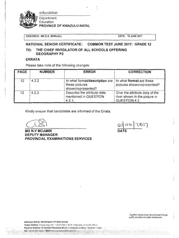
Geography Grade 12 Paper 2 KZN June 2017 Errata
Addendum
Geography Grade 12 P1 Eastern Cape Mock 2017 Addendum (Afr)
More from Grade 12 Geography
Question paper
Geography Grade 12 P1 Gauteng June 2025 Question Paper (Afr)
Question paper
Geography Grade 12 P2 Gauteng June 2025 Question Paper (Eng)
Question paper
Geography Grade 12 Paper 1 KZN Mock 2025 Question Paper
Question paper
Geography Grade 12 Paper 2 KZN Mock 2025 Question Paper
Question paper
Geography Grade 12 P1 NSC June 2025 Question Paper (English)
Memorandum