
Geography/P2, 2 June 2017 Common Test.
NSG
RESOURCE MATERIAL
Education 1. An extract from topographical map 2729BD VOLKSRUST.
KwaZulu-Natal Department of Education 2 Orthophoto map 2729 BD 13 VOLKSRUST
REPUBLIC OF SOUTH AFRICA 3. NOTE: The resource material must be collected by schools for their own use.
INSTRUCTIONS AND INFORMATION
%
x 1. Write your NAME and DIVISION in the spaces on the cover page.
7
"
2. Answer ALL the questions in the spaces provided in this question paper.
5
co 3. You are provided with a 1 : 50 000 topographical map (2729BD VVOLKSRUST)
oom and an orthophoto map (2729 BD 13 VOLKSRUST) of a part of the mapped
4 area.
=
4, You must hand the topographical map and the orthophoto map to the
invigilator at the end of this examination session.
NATIONAL 5. You may use the blank page at the end of this question paper for all rough
work and calculations. Do NOT detach this page from the question paper.
SENIOR CERTIFICATE | ps sueston Pa
6. Show ALL calculations and formutae, where applicable. Marks will be
allocated for these.
7. Indicate the unit of measurement in the final answer of calculations.
8. You may use a non-programmable calculator.
MARKS: 75 i 9. The area demarcated in RED on the topographical map represents the area
covered by the orthophoto map.
This memorandum consists of 11 pages. 10 tomers regen terms and their Afrikaans translations are shown on the
ENGLISH AFRIKAANS
Aerodrome Viiegveld
Diggings Uitgrawings
Furrow Voor
Golf Course Gholfbaan
Rifle Range Skietbaan
River Rivier
Sawmills Saagmeule
Sewerage Works Rioolwerke
Silos Graansuiers
Weir Stuwal
Copyright Reserved Please Turn Over | Copyright Reserved Please tum over
Skip to contentAll 2017 papers 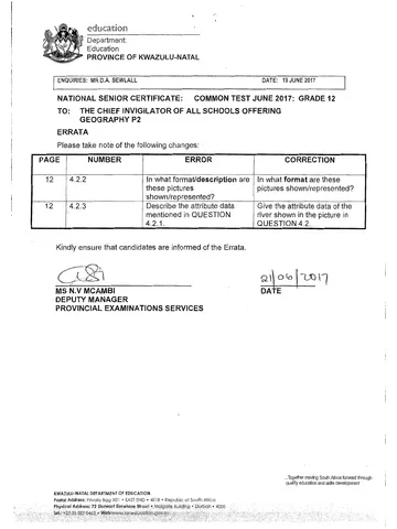
View all





Geography Grade 12 Paper 2 KZN June 2017 Question Paper
Grade 12 Geography Paper 2 question paper from the KZN June 2017, 8 pages. Read online or get the free PDF download, memo linked when available.
Geography · Grade 12 · KZN June · 2017. Question paper, 8 pages. Read online or download the PDF.
- Subject
- Geography
- Grade
- Grade 12
- Document type
- Question paper
- Year
- 2017
- Exam period
- KZN June
- Paper
- 2
- Curriculum
- CAPS
- Pages
- 8
- File size
- 515.9 KB
Free to read online, no sign-up needed
Loading document…
Loading document…
1 of 8
This exam
KZN June 2017
Questions in this paper
- Question 1.1Map work
- Question 1.2Map work
- Question 1.3Map work
- Question 1.4Map work
- Question 1.5Rural and urban settlements
- Question 1.6Map work
Show all 38 questions
- Question 1.7Geomorphology
- Question 1.8Map work
- Question 1.9Map work
- Question 1.10Map work
- Question 1.11Rural and urban settlements
- Question 1.12Map work
- Question 1.13Map work
- Question 1.14Map work
- Question 1.15Map work15 marks
- Question 2.1Map work4 marks
- Question 2.2Map work2 marks
- Question 2.3Map work6 marks
- Question 2.4Map work1 marks
- Question 2.5Map work1 marks
- Question 2.6Map work1 marks
- Question 2.7Map work1 marks
- Question 2.8Map work2 marks
- Question 2.9Map work2 marks
- Question 3.1Geomorphology2 marks
- Question 3.2Rural and urban settlements2 marks
- Question 3.3Rural and urban settlements3 marks
- Question 3.4Geomorphology4 marks
- Question 3.5Rural and urban settlements4 marks
- Question 3.6Rural and urban settlements4 marks
- Question 3.7Rural and urban settlements2 marks
- Question 3.8Map work2 marks
- Question 3.9Geomorphology2 marks
- Question 4.1Map work1 marks
- Question 4.2Map work5 marks
- Question 4.3Map work4 marks
- Question 4.4Map work2 marks
- Question 4.5Map work3 marks
Document textSearch extracted text and jump to a page.
Geography/P2 3 June 2017 Common Test
GENERAL INFORMATION ON VOLKSRUST
Volksrust is a town in Mpumalanga on the border of KwaZulu-Naial. It is located
240 km southeast of Johannesburg. The town has important beef, dairy, maize,
sorghum, wool and sunflower seed industries. Volksrust has an average annual rainfall
of 648 mm, with the lowest rainfall (1 mm) in July and the highest rainfall (117 mm) in
January. Most of the rain falls in the summer. The average midday temperatures for
Volksrust range from 15,9 °C in June to 24,3 °C in January. June is the coldest period
when the mercury can drop to an average of 0,5 °C during the night.
[Source: Examiner's map]
FIGURE 1
Copyright Reserved Please tum over
Geography/P2 4 June 2017 Common Test
QUESTION 1: MULTIPLE-CHOICE QUESTIONS
The questions below are based on the 1:50 000 topographic map 2729BD VOLKSRUST,
as well as the orthophoto map of a part of the mapped area.
Various options are provided as possible answers to the following questions. Choose the
answer and write only the letter (A-D) in the block next to each other.
1.1. The map index/reference of the topographic map west of Volksrust is ...
A 2729BB
B 2729BC
Cc 2729BA B
D 2729DB
4.2 The orthophoto map scale of 1:10 000 means that one centimeter on the
map represents ... kilometres on the ground.
A 04
B 0.01
c 0.05 A
D 05
1.3 The diréction of spot height 1687 from spot height 1691 both ini block B3
on topographical map is ...
A south-east
B south-west
C north-west e
D north-east
4.4 The Voiksrust aerodrome in block D2 is found in the ...
A slum zone
B rural-urban fringe
Cc high residential zone
D CBD B
1.5 Volksrust is a good example of a .
A dormitory town
B mining area
Cc specialized town D
D central place town:
Copyright Reserved Please tum over
Geography/P2 5 June 2017 Common Test
NSC
1.6 The human made feature at 2 on the orthophoto map:
A Waterworks.
B Recreation.
Cc Sewage works. c
D Cultivated land.
1.7 The dams that are found in the rural areas of Volksrust are mainly used for ...
A industrial purposes
B irrigation purposes
Cc domestic purposes B
D recreation purposes
1.8 The human made feature found at 4 on the orthophoto map is a ...
A cemetery
B golf course
Cc sewage works D
D purification plant
1.9 The length of a runway at Volksrust aerodrome in block D2 in metres is cee
A 1400m
B 1350m
Cc 2100m A
D 2150m
1.10 The true bearing of spot height 1613 in block GS from reservoir in block G4
iS...
A 154°
Bo 124°
Cc 164° B
D 1449
1.41 The dominant type of rural settlement in block J9/10 on the topographic
map is a/an ... rural settlement.
A circular
B nucleated
Cc linear D
D dispersed
Copyright Reserved Please tum over
GeographyiP2 6
NSC
1.12 The type of road one will use from Volksrust to Wakkerstroom is ...
A main road.
B national freeway.
Cc secondary road.
D other road.
1.13 The orthophoto map was last edited in ...
A 2004.
B 2007.
Cc 2010.
D 2011.
1.14 An orthophoto map is a... photograph with a map scale of 4: 10 000
A high oblique.
B low oblique.
Cc vertical aerial.
D horizontal.
1.15 The spot height 1671 in block H7 is ona...
A south-facing slope
B west-facing slope
Cc north-facing slope
D east-facing slope
Copyright Reserved
June 2017 Common Test
Cc
15x 4 [15]
Please tum over
Geography/P2 7
June 2017 Common Test
QUESTION 2: MAP CALCULATIONS AND INTERPRETATION
24
22
Copyright Reserved
Calculate the area of the feature marked 4 (in m?) on the orthophoto map
Show ALL the calculations. Clearly indicate the unit of measurement in your
answer.
Area =LxBY
L = 1.4em/x 10 000 (Range 0,9¢m — 1,2cm)
100
= 110m
B = 0,9 cmy“x 10 000 (Range 0,7¢m— 1,1cm)
100
=90m
Area. = 110m x 90m
=9900n? ~
(Range 6 300m? ~ 13 200m’)
OR
Area = Lx BY
L=141mmyx 10 000 (Range 9mm — 12mm)
1000
=110m
B= gmmyx 70 000 (Range 7mm — 11mm)
7000
= 90m
Area = 110m x 90m
=9 900m? ~
(Range 6 300m’ — 13 200m”) (4)
The average gradient between spot height 1705 in block B6 and spot height
4716 in block B7 was 1:104,5. Account for the location of cultivated land
between the two spot heights.
Flat land/Gentle slope/contours are far apart ~~"
Fertile soil “
Close to water source/irrigation possible v"
Gentle slope facilitates the use of machineryy”
[Any ONE] 2)
Please tum over
Geography/P2 ES
23
24
25
26
27
28
29
Copyright Reserved
June 2017 Common Test
Calculate the magnetic bearing of wind pump from trig beacon 241 both in block
G10 for the year 2014. Show ALL calculations.
Difference in years: 2014 — 2010 = 4 years
Mean annual change: 3’W x 4 = 12W~
Magnetic declination for 2014: 20° 37'W +” 12;W
= 20° 49 Wy
Magnetic bearing = true bearing + magnetic declination. a
Magnetic bearing = 20° 49'w + 228°”
(Range for true bearing: 226° — 230°)
= 248° 49°“ (Range 246°49’ — 250°497) 6x1) ©
Which one, the topographic map or the orthophoto map, has a smaller
scale?
Topographical map “ (1x1) (1)
Give ONE reason to support the answer mentioned in QUESTION 2.4
Features appear smaller on the topographic map vw (1x 1)(1)
By how much is the scale of the map that you selected in QUESTION 2.4
smaller?
5 times ¥ (1x1) (1)
Wyou were walking from spot height 1876 towards wind pump both in
block A6, would you be walking upslope or downslope?
downslope “” (1x1)(1)
Give ONE reason for the answer mentioned in QUESTION 2.7.
Contour heights decrease towards wind pump/height decreases
as one moves towards the wind pump. “” (1x 2)(2)
\s there any intervisibility between spot height 1656 in block G7 and the
dam in block F7? Give one reason for your answer.
Answer: Yes
Reason: There is no obstruction between the two features. ~
The slope is gentle/land is flat between the two features. Y
[ANY ONE] (1 +1)(2)
[20]
Please tum over
Geography/P2 9 June 2017 Common Test GeographyiP2 40 June 2017 Common Test
NSC NSC
QUESTION 3: APPLICATION OF THEORY/MAP AND PHOTO INTERPRETATION 3.4 _ Refer to block A9/10 and B9/10 to answer the following question.
Refer to both the topographical map and the orthophoto map when answering the
questions below.
3.1 Provide TWO pieces of map evidence of. Strategies farmers have
adopted to conserve and supplement their water supplies in block F9.
Presence of windpump. ~~
Presence of dam. ” (2 x 1) (2)
3.2 The area Vukuzakhe on the orthophoto map is a low income residential
area. Give TWO pieces of evidence from the map to prove this statement.
Small stands, ~
Houses are small.
Houses are of the same style/shape. ~
High density/clustered, “
No vegetation/few trees. ~ 3.5
[ANY Two] (2x1) (2)
3.3 Refer to the picture below of a typical settlement to be found at Belfast in
block H2.
3.6
[Source: Google Image} 37
3.3.1 1s Belfast a rural or urban settlement?
Rural (1x4) (1)
3.3.2 Give ONE reason for the answer mentioned to QUESTION 3.3.1.
No urban functions/services shown. *”
Buildings are far apart. “~~”
Primary Activities practised:/Farming /Forestry is practiced, “
Unifunctional’~
[ANY ONE] (1x2)(2)
3.4.1. Identify the predominant stream pattern in the blocks mentioned
above.
Radial/centrifugal. ~ (x 1)(1)
3.4.2 Give ONE reason for the answer mentioned in QUESTION 3.4.1.
Rivers flow from the mountain outwards. Vv” (1x2) (2)
3.4.3 What is the underlying rock structure for the stream patiern
mentioned in QUESTION 3.4.1?
Massive igneous rocks/ Sedimentary Rocks. ”
(1x 1) (1)
Suggest TWO recreational activities tourists could Participate in when
visiting Mahawane Dam in block A5 and B5.
Boating v~
Fishing “~~
Swimming “~
Skiing vv"
ANY Two] (2x2) (4)
Refer to the sewage works in block D4. Assess the impact that the sewage
works may have in the area.
Close to residential area and it may cause bad odour/smell. “i”
Too close to the source of water, e.g. reservoir and river and may
cause water pollution. “~~ (2x2) (4)
Name TWO services that the Volksrust town offers.
Educational services. “
Medical services. ~”
Recreational facilities. “
Employment opportunities. ~
High-order functions”
Shopping centre. ~
[ANY TWoj 2x 1)Q2)
Copyright Reserved Please tum over Copyright Reserved Please tum over
Geography/P2 une 2017 Common Test
11
NSC_
3.8 Howdid the engineers overcome the challenge of steep slopes when they
were constructing railway line in the mapped area?
The railway line is winding to avoid steep slopes/hilly areas. we (1x 2)(2)
3.9 Briefly discuss the importance for the row of trees along the edge of the
cultivated lands?
To reduce/drop the speed of the wind. ~
To reduce soil erosion. ~
To prevent damage to crops.
[ANY TWO] (1x 2)(2)
. [25]
Copyright Reserved Please tum over
Geography/P2 12 June 2017 Common Test
NSC
QUESTION 4: GEOGRAPHIC INFORMATION SYTEMS (GIS)
4.1. Whatis a Geographic Information System?
GIS is a computer-based technology and method for collecting,
analyzing, managing, modelling and presenting geographical data
for a wide range of users. ~
[CONCEPT] : (1x 1)(1)
4.2 Below are the typical pictures of line objects in the mapped area.
= oe
jource: Google Images]
4.2.1 Name any line object found in block A10.
Non-perennial river
Fence or wall ~
[ANY ONE] (1x)(1)
4.2.2 Refer to pictures in QUESTION 4.2. In what format are these pictures
shown/represented? Give ONE reason for your answer.
Raster. ~
Reason: pictures are shown in real image/features are shown
by means of pixels. “”
(1 + 2)(3)
4.2.3 Give the altribute data of the river shown in the picture in QUESTION 4.2.
River is winding /meandering
It has a Slip off/ It-has an undercut slope”
[ANY ONE] (1x 1)(1)
Copyright Reserved Please tum over
GeographyiP2
43
44
45
13
NSC
You intend to open a Bed and Breakfast (B&B) in Clavis area, in block G3.
June 2017 Common Test
How could you make use of GIS to ensure that your business is successful?
Establish the total population in order to analyse the potential market. ~~"
Determine demand for business.
Find information about other existing business to establish
Competition. vi
Work out routes for accessibility to the business. ¥””
Determine crime hotspot areas. “”
[ANY Two]
Data integration is combining different types of data for the purpose of
decision-making. Discuss ONE type of data that a farmer in block D7
will consider before cultivation.
Relief/slope of the land. “~~”
Availability of water. v~
Fertility of the soil. Vv“
Access fo transport.
Access to infrastructure. v“"
[ANY ONE}
Refer to Photograph A and B below to answer the following questions.
hotograph A Photograph B
(Source: Platinum Geography]
4.5.1. Which photograph has a low resolution?
BY
4.5.2 Explain why the clarity of the picture you selected in
QUESTION 4.5.1 is poor/has a low resolution?
Pixels are big v“
Fewer pixels per photograph. “~
(2x 2) (4)
(2x 1} (2)
(x1) (1)
[ANY ONE]
(2x 1)(2)
[15]
TOTAL MARKS: 75
Copyright Reserved
Study this subject
Recommended for this subject
Errata
Geography Grade 12 Paper 2 KZN June 2017 Errata
Question paper
Geography Grade 12 Paper 2 Gauteng Mock 2017 Question Paper
Question paper
Geography Grade 12 P2 Gauteng Mock 2017 Question Paper (Afr)
Question paper
Geography Grade 12 P2 NSC June 2017 Question Paper (Afr)
Question paper
Geography Grade 12 P2 NSC November 2017 Question Paper (Eng)
Question paper
Geography Grade 12 Paper 2 KZN June 2016 Question Paper
More from Grade 12 Geography
Memorandum
Geography Grade 12 P1 Gauteng June 2025 Memo (Afrikaans)
Memorandum
Geography Grade 12 Paper 2 Gauteng Mock 2025 Memo
Memorandum
Geography Grade 12 Paper 1 NSC November 2025 Memo (English)
Memorandum
Geography Grade 12 P2 Eastern Cape Prelim 2024 Memo (Afr)
Memorandum
Geography Grade 12 Gauteng June 2024 Memo (English)
Memorandum