
Downloaded from hlayiso.com
NATIONAL
SENIOR CERTIFICATE
GRADE 11
NOVEMBER 2022
GEOGRAPHY P1
MARKS: 150
TIME: 3 hours
This question paper consists of 15 pages.
Skip to contentAll 2022 papers 
View all
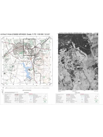
Geography Grade 11 P1 Eastern Cape November 2022 QP (Eng)
Grade 11 Geography Paper 1 question paper from the Eastern Cape November 2022 (English), 15 pages. Read online or download the free PDF.
Geography · Grade 11 · Eastern Cape November · 2022 · English. Question paper, 15 pages. Read online or download the PDF.
- Subject
- Geography
- Grade
- Grade 11
- Language
- English
- Document type
- Question paper
- Year
- 2022
- Exam period
- Eastern Cape November
- Paper
- 1
- Curriculum
- CAPS
- Pages
- 15
- File size
- 1.3 MB
Free to read online, no sign-up needed
Loading document…
Loading document…
1 of 15
This exam
Eastern Cape November 2022
Questions in this paper
Document textSearch extracted text and jump to a page.
Downloaded from hlayiso.com
(EC/NOVEMBER 2022) GEOGRAPHY P1 2
INSTRUCTIONS AND INFORMATION
1. This question paper consists of TWO SECTIONS.
SECTION A:
QUESTION 1: The Atmosphere (60)
QUESTION 2: Geomorphology (60)
SECTION B:
QUESTION 3: Geographical Skills and Techniques (30)
2. Answer all THREE questions.
3. ALL diagrams are included in the QUESTION PAPER.
4. Leave a line between subsections of questions answered.
5. Start EACH question at the top of a NEW page.
6. Number the questions correctly according to the numbering system used in
this question paper.
7. Do NOT write in the margins of the ANSWER BOOK.
8. Draw fully labelled diagrams when instructed to do so.
9. Answer in FULL SENTENCES, except when you have to state, name, identify
or list.
10. Units of measurement MUST be indicated in your final answer, for example
1 020 hPa, 14 °C and 45 m.
11. You may use a non-programmable calculator.
12. You may use a magnifying glass.
13. Write neatly and legibly.
SPECIFIC INSTRUCTIONS AND INFORMATION FOR SECTION B
14. A 1 : 50 000 topographical map (3025AD PHILIPPOLIS) and an orthophoto
map of a part of the mapped area are provided.
15. The area demarcated in RED/BLACK on the topographic map represents the
area covered by the orthophoto map.
16. Show ALL calculations. Marks will be allocated for this.
17. You must hand in the topographic and the orthophoto map to the invigilator at
the end of this examination session.
Copyright reserved Please turn over
Downloaded from hlayiso.com
3 GEOGRAPHY P1 (EC/NOVEMBER 2022)
SECTION A: CLIMATE AND WEATHER AND GEOMORPHOLOGY
QUESTION 1: THE ATMOSPHERE
1.1 The FIGURE shows global air circulation. Match the descriptions below with a
term/concept from the diagram. You may use a term/concept more than once.
Write only the term/concept next to question numbers (1.1.1 to 1.1.7) in the
ANSWER BOOK, for example 1.1.8 polar belt.
[Source: studyhash.com]
1.1.1 The Ferrel Cell is associated with these winds
1.1.2 ITCZ is associated with this belt of pressure
1.1.3 Very cold winds
1.1.4 The Hadley Cell is associated with these winds
1.1.5 Very low temperatures in this pressure belt results in snow
1.1.6 This pressure belt is located between 25°–35°
1.1.7 Winds converge at this pressure belt resulting in thunderstorms
(7 x 1) (7)
Copyright reserved Please turn over
Downloaded from hlayiso.com
(EC/NOVEMBER 2022) GEOGRAPHY P1 4
1.2 Refer to the FIGURE that shows the relationship between pressure gradient
and Coriolis force. Choose the correct word(s)/letter(s) from those given in
brackets which will make each statement geographically CORRECT. Write only
the word(s)/letter(s) next to the question numbers (1.2.1 to 1.2.8) in the
ANSWER BOOK.
[Source: wwzoloatmos.vicc.ede]
1.2.1 Winds blow flow from (A to B/B to A).
1.2.2 (Coriolis/Pressure gradient) force determines the speed at which air
moves.
1.2.3 A (coriolis/pressure gradient) force causes winds to deflect or change
direction.
1.2.4 In the northern hemisphere winds deflect to the (left/right).
1.2.5 Subsidence is associated with a (high/low) pressure.
1.2.6 A (geostrophic/berg) wind blows when the pressure gradient and the
Coriolis force is equal in strength.
1.2.7 Convergence is associated with a (low/high) pressure.
1.2.8 The pressure gradient is (steep/gentle) when isobars are far apart.
(8 x 1) (8)
Copyright reserved Please turn over
Downloaded from hlayiso.com
5 GEOGRAPHY P1 (EC/NOVEMBER 2022)
1.3 Refer to the FIGURE showing a synoptic weather map of Southern Africa.
[Source: www.weathersa.co.za]
Copyright reserved Please turn over
Downloaded from hlayiso.com
(EC/NOVEMBER 2022) GEOGRAPHY P1 6
1.3.1 Give evidence that the synoptic weather map represents winter
conditions. (1 x 1) (1)
1.3.2 Determine the isobaric interval on the synoptic weather map. (1 x 1) (1)
1.3.3 Give the weather conditions of the weather station at Port Elizabeth.
(4 x 1) (4)
1.3.4 Name the high-pressure cell at A. (1 x 1) (1)
1.3.5 How will the position of A decrease the rainfall over the eastern part of
the country? (2 x 2) (4)
1.3.6 Explain how the warm and cold ocean currents on the eastern and
western side of South Africa would control the temperature of South
Africa in winter. (2 x 2) (4)
1.4 Study the FIGURE based on a diagram showing warm, dry winds that blow
over the North American and European continents.
[Source: Examiner]
1.4.1 Provide the local names of the warm, dry winds indicated by A and B
on the different continents. (2 x 1) (2)
1.4.2 Is the wet adiabatic lapse rate found on the windward or leeward side?
(1 x 1) (1)
1.4.3 Why is the wind dry at A and B on the maps? (2 x 2) (4)
1.4.4 In a paragraph of approximately EIGHT lines, explain the influence that
these warm, dry winds have on economic activities in the areas
indicated on the different maps. (4 x 2) (8)
Copyright reserved Please turn over
Downloaded from hlayiso.com
7 GEOGRAPHY P1 (EC/NOVEMBER 2022)
1.5 Below is an extract on the effects of desertification in the Sahel Region.
THE EFFECTS OF DESERTIFICATION IN AFRICA
Desertification is a process that destroys fertile land. This can be caused by
drought, overpopulation, over-farming, deforestation and climate change. The
most vulnerable region is a 3 000-mile stretch of land that includes ten
countries in the Sahel region of Africa. The Sahel is the area between the
Sahara Desert and the Sudanian Savannah. This region is under constant
stress due to frequent droughts and soil erosion. A dense forest can become
a field of dust in a matter of years, making mass migrations inevitable. Africans
frequently migrate south in search of fertile land.
Agriculture in Africa tends to result in low productivity, as most of the land is
characterised as a semi-desert. Clearing the land of trees also reduces the
structure of the soil. Coupled with wind erosion, the topsoil blows away and
leaves a desert-like land.
The country that is arguably the most damaged by desertification is Senegal.
Migrations in Senegal are common, as wind erosion, deforestation and
climate change wreaks havoc on farms and livestock. Those most affected
by desertification in Senegal move to Gabon, a country in West Africa, or even
to Europe or South America. More than half of Senegalese work in agriculture,
and desertification forces those with meagre profits to move elsewhere to
escape poverty.
[Source: borgenprojects.org/desertification-in-africa]
1.5.1 According to the extract, state ONE human cause of desertification.
(1 x 1) (1)
1.5.2 Name the region most vulnerable to desertification in Africa. (1 x 1) (1)
1.5.3 Why is fertile soil so important to the people of Africa? (1 x 1) (1)
1.5.4 What social impact would a lack of fertile soil have on the people of
Africa? (2 x 2) (4)
1.5.5 How does desertification in Senegal have a negative economic impact
on other countries in Africa? (2 x 2) (4)
1.5.6 Suggest TWO management strategies that could be implemented to
combat (reduce) the spread of desertification. (2 x 2) (4)
[60]
Copyright reserved Please turn over
Downloaded from hlayiso.com
(EC/NOVEMBER 2022) GEOGRAPHY P1 8
QUESTION 2: GEOMORPHOLOGY
2.1 Various options are provided as possible answers to the following questions.
Choose the answer and write only the letter (A–D) next to the question numbers
(2.1.1 to 2.1.7) in the ANSWER BOOK, for example 2.1.8 A.
2.1.1 Table Mountain is an example of a …
A canyon.
B hogsback.
C butte.
D mesa.
2.1.2 … are the largest of all intrusive forms.
A Lopoliths
B Batholiths
C Laccoliths
D Domes
2.1.3 A … is a horizontal intrusion of igneous rock that forms a sheet.
A sill
B pipe
C volcano
D dyke
2.1.4 An asymmetrical ridge with a steep dip slope of more than 45° is a …
A canyon.
B hogsback.
C butte.
D mesa.
2.1.5 A … is a vertical intrusion of igneous rock.
A dyke
B pipe
C volcano
D sill
2.1.6 The extensive flat surface of a Karoo landscape is called a …
A knickpoint.
B pediment.
C pediplain.
D peneplain.
2.1.7 … form when rivers incise into joints in rocks.
A Canyons
B Domes
C Mountains
D Hills (7 x 1) (7)
Copyright reserved Please turn over
Downloaded from hlayiso.com
9 GEOGRAPHY P1 (EC/NOVEMBER 2022)
2.2 Refer to FIGURE 2.2 that shows slope elements. Write only the slope element
that matches the description next to the question numbers (2.2.1 to 2.2.8) in
the ANSWER BOOK, for example, 2.2.9 cliff. You can choose a slope element
more than once.
FIGURE 2.2: SLOPE ELEMENTS
[Source: easymapwork.blogspot.com]
2.2.1 Ideal for farming because of a gentle slope
2.2.2 Steep vertical slope formed by resistant rock
2.2.3 Constant slope where deposition occurs
2.2.4 Convex in shape and found at the top of a hill/mountain
2.2.5 Flat slope with an angle of 1° to 7°
2.2.6 The angle of this slope element is usually greater than 80°
2.2.7 A sharp break in angle in this slope element causes the knickpoint to
form
2.2.8 Weathering occurs on this slope under the force of gravity (8 x 1) (8)
Copyright reserved Please turn over
Downloaded from hlayiso.com
(EC/NOVEMBER 2022) GEOGRAPHY P1 10
2.3 Refer to the photograph showing the Drakensberg Mountain as an example of
a basaltic plateau.
[Source: www.bing.com]
2.3.1 Name the type of topography associated with a basaltic plateau.
(1 x 1) (1)
2.3.2 What evidence on the photograph indicates that the basaltic plateau
rocks are uniform in resistance to erosion? (1 x 2) (2)
2.3.3 Why are the slopes of the basaltic plateau rugged (uneven)? (1 x 2) (2)
2.3.4 How do basaltic plateaus form? (2 x 2) (4)
2.3.5 What physical (natural) impact does the Drakensberg basaltic
plateau have on human activity? (3 x 2) (6)
Copyright reserved Please turn over
Downloaded from hlayiso.com
11 GEOGRAPHY P1 (EC/NOVEMBER 2022)
2.4 Refer to the FIGURE showing a cuesta.
[Source: www.bing.com]
2.4.1 Name a type of sedimentary rock depicted in the sketch. (1 x 1) (1)
2.4.2 What evidence in the sketch indicates that this is a cuesta? (2 x 1) (2)
2.4.3 Identify the slopes at A and B. (2 x 1) (2)
2.4.4 Why will the slope at B be steeper than the slope at A? (1 x 2) (2)
2.4.5 How will a cuesta dome form? (2 x 2) (4)
2.4.6 Explain how cuestas are of benefit for human activities. (2 x 2) (4)
Copyright reserved Please turn over
Downloaded from hlayiso.com
(EC/NOVEMBER 2022) GEOGRAPHY P1 12
2.5 Study the FIGURE which illustrates tors.
A
A
[Source: researchgate.net]
2.5.1 Name ONE igneous intrusion that tors can originate from. (1 x 1) (1)
2.5.2 What are the rocks at A known as during the process of tor formation?
(1 x 1) (1)
2.5.3 Name the type of igneous rock that A consists of. (1 x 1) (1)
2.5.4 How did weathering in the vertical and horizontal joints of igneous
rocks determine the shape of the rocks at A? (2 x 2) (4)
2.5.5 In a paragraph of approximately EIGHT lines, explain how tors develop.
(4 x 2) (8)
[60]
Copyright reserved Please turn over
Downloaded from hlayiso.com
13 GEOGRAPHY P1 (EC/NOVEMBER 2022)
SECTION B
QUESTION 3: GEOGRAPHICAL SKILLS AND TECHNIQUES
The questions below are based on the 1 : 50 000 topographical map 3025AD
PHILIPPOLIS, as well as the orthophoto map of a part of the mapped area.
GENERAL INFORMATION ON PHILIPPOLIS
Philippolis is a small town situated
in the Motheo and Xhariep region of
the Free State Province in South
Africa. In 1823 it served as a
missionary outpost for the
Bushman. This makes Philippolis
the oldest settlement in the Free
State Province.
Seventy-five of Philippolis’s
buildings have been declared as
national monuments.
Philippolis’s climate is
characterised by warm to hot
summers and cool to cold winters.
This semi-desert area also brings
fluctuations of temperature from
day to night with an average
amount of annual precipitation of
353,0 mm.
Coordinates: 30° 15' S 25° 16' E
The following English terms and their translations are shown on the topographic map:
ENGLISH AFRIKAANS
Diggings Delwery/Uitgrawings
Furrow Voor
Sewerage works Rioolwerke
3.1 MAP SKILLS AND CALCULATIONS
3.1.1 Bearing:
(a) The true bearing of trigonometrical station 275, M in block D4,
from spot height 1 404, N in block C4, on the topographical map
is … (1 x 1) (1)
(b) Determine the magnetic bearing of QUESTION 3.1.1 (a) for 2017.
Show ALL calculations. Marks will be awarded for calculations.
(2 x 1) (2)
Copyright reserved Please turn over
Downloaded from hlayiso.com
(EC/NOVEMBER 2022) GEOGRAPHY P1 14
3.1.2 Refer to the main road (717) between O and P on the topographical map.
(a) Calculate the gradient along the main road (717) between
bench-marks 1 357,5 and 1 326,7. Show ALL calculations.
Marks will be awarded for calculations.
Vertical Interval (VI)
Formula: Gradient =
Horizontal Equivalent (HE)
(5 x 1) (5)
(b) Explain with the help of the topographical map and your answer
to QUESTION 3.1.2 (a), why it would be easy to construct the
transport routes in the area. (2 x 1) (2)
3.2 MAP INTERPRETATION
3.2.1 The feature at 3 on the orthophoto map is/a …
A library.
B diggings.
C cemetery.
D sewerage works. (1 x 1) (1)
3.2.2 The feature along the line labelled R on the topographical map is a …
A spur.
B saddle.
C ridge.
D valley. (1 x 1) (1)
3.2.3 Study the landforms marked 1 and 2 on the orthophoto map.
(a) Name the landforms 1 and 2 respectively. (2 x 1) (2)
(b) Which landform, 1 or 2, on the orthophoto map has been
exposed to erosion the longest? Give a reason for your answer
evident on the orthophoto map. (1 + 2) (3)
3.2.4 Extensive erosion occurs in blocks D2 and E3 on the topographical
map. State TWO strategies that were put in place upstream by the
farmer in block C5 to reduce the impact of the erosion. (2 x 1) (2)
3.2.5 Was this aerial photograph used to produce the orthophoto map taken
between 09:00 and 10:00 or 14:00 and 15:00? Give a reason for your
answer. (1 + 2) (3)
Copyright reserved Please turn over
Downloaded from hlayiso.com
15 GEOGRAPHY P1 (EC/NOVEMBER 2022)
3.3 GEOGRAPHICAL INFORMATION SYSTEMS (GIS)
FIGURE 3.3.1: COMPONENTS OF GIS
[Adapted from Google Images]
3.3.1. FIGURE 3.3.1 shows the different components of a GIS.
(a) Identify components A and B. (2 x 1) (2)
(b) What role do people play in GIS? (1 x 1) (1)
3.3.2 In order to do a paper GIS, it is important to familiarise oneself with the
different layers of information. Refer to FIGURE 3.3.1 and the
topographical map to answer the questions that follow.
(a) Are the thematic layers at B raster data or vector data in
FIGURE 3.3.1? (1 x 1) (1)
(b) Name TWO thematic layers you would find in block B1. (2 x 1) (2)
3.3.3 The orthophoto map has a high resolution. Give ONE reason for this
statement. (1 x 2) (2)
[30]
TOTAL: 150
Copyright reserved Please turn over
Study this subject
Recommended for this subject
Question paper
Geography Grade 11 P2 Eastern Cape November 2022 QP (Eng)
Question paper
Geography Grade 11 P1 Eastern Cape November 2020 QP (Eng)
Question paper
Geography Grade 11 P1 Eastern Cape November 2017 QP (Eng)
Memorandum
Geography Grade 11 P2 Eastern Cape November 2022 Memo (Eng)
Addendum
Geography Grade 11 P1 Eastern Cape November 2020 Addendum
Memorandum
Geography Grade 11 P1 Eastern Cape November 2020 Memo (Eng)
More from Grade 11 Geography
Memorandum
Geography Grade 11 P1 Eastern Cape November 2025 Memo (Eng)
Memorandum
Geography Grade 11 P2 Eastern Cape November 2025 Memo (Eng)
Question paper and memo
Geography Grade 11 Free State March Test 2025 Paper & Memo
Memorandum
Geography Grade 11 P1 Eastern Cape November 2024 Memo (Afr)
Memorandum
Geography Grade 11 P1 Eastern Cape November 2023 Memo (Eng)
Question paper