
Mock
hlayiso mock exams
Practice Series:
Grade 12 NSC Preparation
WWW.HLAYISO.COM
NATIONAL
SENIOR CERTIFICATE
GRADE 12
GEOGRAPHY P1
MOCK EXAMINATION 2026
MARKS: 150
TIME: 3 hours
This question paper consists of 16 pages.
Copyright reserved Please turn over
Skip to contentAll 2026 papers 



View all



Geography Grade 12 P1 NSC November Mock 2026 QP (Eng)
Grade 12 Geography Paper 1 question paper from the NSC November Mock Exam 2026 (English), 16 pages. Read online or download the free PDF.
Geography · Grade 12 · NSC November Mock Exam · 2026 · English. Question paper, 16 pages. Read online or download the PDF.
- Subject
- Geography
- Grade
- Grade 12
- Language
- English
- Document type
- Question paper
- Year
- 2026
- Exam period
- NSC November Mock Exam
- Paper
- 1
- Publisher
- Hlayiso
- Curriculum
- CAPS
- Pages
- 16
- File size
- 168.5 KB
Free to read online, no sign-up needed
Loading document…
Loading document…
1 of 16
This exam
NSC November Mock Exam 2026
- Paper 1Question paperAddendumMemo
- Paper 2Question paperAddendumMemo
Document textSearch extracted text and jump to a page.
Geography/P1 2 Hlayiso/Mock 2026
NSC Mock
INSTRUCTIONS AND INFORMATION
1. This question paper consists of TWO sections.
SECTION A
QUESTION 1: CLIMATE AND WEATHER (60)
QUESTION 2: GEOMORPHOLOGY (60)
SECTION B
QUESTION 3: GEOGRAPHICAL SKILLS AND TECHNIQUES (30)
2. Answer ALL THREE questions.
3. ALL diagrams are included in the question paper.
4. Leave a line between the subsections of questions answered.
5. Start EACH question at the top of a NEW page.
6. Number the answers correctly according to the numbering system used in this question
paper.
7. Do NOT write in the margins of the ANSWER BOOK.
8. Draw fully labelled diagrams when instructed to do so.
9. Answer in FULL SENTENCES, except when you have to state, name, identify or list.
10. Units of measurement MUST be indicated in your final answer, e.g. 1 020 hPa, 14 ◦ C
and 45 m.
11. You may use a non-programmable calculator.
12. You may use a magnifying glass.
13. Write neatly and legibly.
SPECIFIC INSTRUCTIONS AND INFORMATION FOR SECTION B
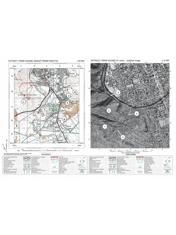
14. A 1 : 50 000 topographical map extract of 3320BB LAINGSBURG and a 1 : 10 000
orthophoto map extract of LAINGSBURG are used in this section. The map sheet is
supplied with this mock as Geography P1 Mock 2026 Map (3320BB Laingsburg); it
was first used in the 2025 Eastern Cape preparatory examination. Ignore the letters
and numbers already printed on the maps unless a question refers to them.
15. The area demarcated in RED on the topographical map represents the area covered
by the orthophoto map.
16. Show ALL calculations. Marks will be allocated for steps in calculations.
Copyright reserved Please turn over
Geography/P1 3 Hlayiso/Mock 2026
NSC Mock
SECTION A: CLIMATE AND WEATHER AND GEOMORPHOLOGY
QUESTION 1: CLIMATE AND WEATHER
1.1 Refer to the synoptic weather map below. Complete the statements in
COLUMN A with the options in COLUMN B. Write only Y or Z next to the
question numbers (1.1.1 to 1.1.8) in the ANSWER BOOK, e.g. 1.1.9 Y.
N
1020
C
H
E
1024 L
A
H
B
1028
H
F
Atlantic Ocean
D
Indian Ocean
[Source: Examiner’s own sketch]
COLUMN A COLUMN B
1.1.1 The high-pressure cell at A is the Y South Indian High
… Z South Atlantic
High
1.1.2 The season represented on the Y winter
synoptic weather map is … Z summer
1.1.3 Air in the high-pressure cell at B Y anticlockwise
circulates in an … direction. Z clockwise
1.1.4 The weather over the interior at C Y thunderstorms
will most likely be … Z clear and dry
1.1.5 The front at D is a … front. Y warm
Z cold
1.1.6 The low-pressure system at E is a Y coastal low
… Z tropical cyclone
1.1.7 The pressure system at E moves Y west to east
along the coast from … Z east to west
1.1.8 The wind direction at station F is … Y north-westerly
Z south-easterly
(8 x 1) (8)
Copyright reserved Please turn over
Geography/P1 4 Hlayiso/Mock 2026
NSC Mock
1.2 Refer to the sketch below showing an urban heat island. Various options
are provided as possible answers to the following questions. Choose
the answer and write only the letter (A–D) next to the question numbers
(1.2.1 to 1.2.7) in the ANSWER BOOK, e.g. 1.2.8 D.
temperature (◦ C)
P
park
distance
Rural Suburban CBD Suburban Rural
[Source: Examiner’s own sketch]
1.2.1 An urban heat island refers to …
A a city with lower temperatures than the surrounding rural
areas.
B a city with higher temperatures than the surrounding rural
areas.
C a layer of polluted air above a city.
D an area of high pressure over a city.
1.2.2 The highest temperature at P occurs over the …
A rural area.
B suburbs.
C central business district.
D park.
1.2.3 The temperature drops over the park because …
A vegetation absorbs heat for evapotranspiration.
B tall buildings trap heat.
C there is more traffic.
D concrete stores heat.
1.2.4 The factors that cause the urban heat island are … and …
(i) heat generated by vehicles and industries (ii) more
vegetation (iii) dark surfaces with a low albedo (iv) more water
bodies
A (i) and (ii)
B (ii) and (iv)
C (i) and (iii)
D (iii) and (iv)
Copyright reserved Please turn over
Geography/P1 5 Hlayiso/Mock 2026
NSC Mock
1.2.5 The urban heat island is most intense on … nights.
A cloudy and windy
B clear and calm
C rainy
D cloudy and calm
1.2.6 A … forms when warm, polluted air is trapped below a
temperature inversion over the city.
A smog/pollution dome
B thermal belt
C frost pocket
D heat low
1.2.7 A sustainable strategy to reduce the urban heat island is to …
A build more parking lots.
B use dark roofing materials.
(7 x 1) (7)
C establish green roofs and plant trees.
D increase the number of tall buildings.
Copyright reserved Please turn over
Geography/P1 6 Hlayiso/Mock 2026
NSC Mock
1.3 Refer to the sketch below of a mid-latitude cyclone.
X
M N
L
996
Y
direction of movement
[Source: Examiner’s own sketch]
1.3.1 In which hemisphere is this mid-latitude cyclone located? (1 x 1) (1)
1.3.2 Give ONE reason from the sketch for your answer to
QUESTION 1.3.1. (1 x 1) (1)
1.3.3 Name the sector labelled X. (1 x 1) (1)
1.3.4 Explain why the mid-latitude cyclone moves in the direction
shown. (1 x 2) (2)
1.3.5 Describe the weather conditions that a place will experience as
the cold front passes over it. (2 x 2) (4)
1.3.6 In the ANSWER BOOK, draw a labelled cross-section along
line M–N. Clearly indicate the following:
(a) Cold front and warm front (b) Warm sector (c) ONE cloud
type (d) Direction of movement (4 x 1) (4)
1.3.7 Explain how the cold front will eventually catch up with the warm
front to form an occlusion. (1 x 2) (2)
Copyright reserved Please turn over
Geography/P1 7 Hlayiso/Mock 2026
NSC Mock
1.4 Refer to the infographic below on Tropical Cyclone Neha (a fictional
cyclone based on real cyclones in the Mozambique Channel).
5◦ S
Day 1
Day 2
MOZAMBIQUE
Day 3
MADAGASCAR
Day 4 (landfall)
20◦ S
Day 5
Day 6
SOUTH AFRICA
Day 1 2 3 4 5 6
Central pressure (hPa) 998 985 962 955 990 1 002
Maximum wind speed (km/h) 70 120 175 190 85 45
[Source: Examiner’s own sketch and data]
1.4.1 Give TWO conditions in the Mozambique Channel that
favoured the development of Tropical Cyclone Neha. (2 x 1) (2)
1.4.2 In which stage of development was Tropical Cyclone Neha on
Day 4? (1 x 1) (1)
1.4.3 Give TWO pieces of evidence from the table to support your
answer to QUESTION 1.4.2. (2 x 1) (2)
1.4.4 Explain why Tropical Cyclone Neha weakened rapidly after Day
4. (2 x 2) (4)
1.4.5 Explain why the forward left-hand quadrant of a tropical cyclone
in the Southern Hemisphere is the most dangerous. (1 x 2) (2)
1.4.6 Discuss the negative impact that Tropical Cyclone Neha could
have had on the people of central Mozambique. (2 x 2) (4)
Copyright reserved Please turn over
Geography/P1 8 Hlayiso/Mock 2026
NSC Mock
1.5 Refer to the sketch below showing a valley climate on a clear winter
night.
A
C
inversion layer
B
farm
[Source: Examiner’s own sketch]
1.5.1 Name the wind labelled A. (1 x 1) (1)
1.5.2 Identify the zone of cold air labelled B. (1 x 1) (1)
1.5.3 Name the warmer zone labelled C on the valley slopes. (1 x 1) (1)
1.5.4 Explain how the zone labelled C develops. (2 x 2) (4)
1.5.5 In a paragraph of approximately EIGHT lines, explain the
negative impact of the conditions at B on the farmer on the
valley floor, and suggest strategies that the farmer can use to
reduce this impact. (4 x 2) (8)
[60]
Copyright reserved Please turn over
Geography/P1 9 Hlayiso/Mock 2026
NSC Mock
QUESTION 2: GEOMORPHOLOGY
2.1 Refer to the sketch below of a drainage basin. Complete the statements
in COLUMN A with the options in COLUMN B. Write only Y or Z next to
the question numbers (2.1.1 to 2.1.8) in the ANSWER BOOK, e.g. 2.1.9
Y.
D
F
E
G
A
B
C
[Source: Examiner’s own sketch]
COLUMN A COLUMN B
2.1.1 The point where the main river Y mouth
begins, at A, is the … Z source
2.1.2 The point where two rivers meet at Y confluence
B is the … Z watershed
2.1.3 The point at C where the river Y mouth
enters the sea is the … Z source
2.1.4 The dashed line at D represents Y interfluve
the … Z watershed
2.1.5 The high ground between two Y interfluve
tributaries at E is the … Z catchment
2.1.6 The stream at F is a … stream. Y first-order
Z third-order
2.1.7 The entire area at G drained by the Y drainage basin
main river and its tributaries is the Z river system
…
2.1.8 An area with many streams per Y high
km2 has a … drainage density. Z low
(8 x 1) (8)
Copyright reserved Please turn over
Geography/P1 10 Hlayiso/Mock 2026
NSC Mock
2.2 Refer to the sketches below of drainage patterns. Various options are
provided as possible answers to the following questions. Choose the
answer and write only the letter (A–D) next to the question numbers
(2.2.1 to 2.2.7) in the ANSWER BOOK, e.g. 2.2.8 D.
dome
P Q R
[Source: Examiner’s own sketch]
2.2.1 Drainage pattern P is a … pattern.
A radial
B trellis
C dendritic
D centripetal
2.2.2 Pattern P develops in areas with …
A uniform, horizontal rock layers.
B a dome-shaped landform.
C folded sedimentary rocks with alternating hard and soft
layers.
D a basin.
2.2.3 The tributaries in pattern P join the main river at …
A acute angles.
B right angles.
C obtuse angles.
D random angles.
2.2.4 Pattern Q is a … pattern.
A radial
B centripetal
C dendritic
D rectangular
2.2.5 Pattern R develops on … and … rock.
(i) homogeneous (ii) jointed (iii) equally resistant (iv) folded
A (i) and (ii)
B (i) and (iii)
C (ii) and (iv)
D (iii) and (iv)
Copyright reserved Please turn over
Geography/P1 11 Hlayiso/Mock 2026
NSC Mock
2.2.6 The highest stream order in pattern R is …
A 1.
B 2.
C 3.
D 4.
2.2.7 A river system with a high stream order is likely to have …
A a small drainage basin.
B a large volume of water.
(7 x 1) (7)
C few tributaries.
D a low drainage density.
Copyright reserved Please turn over
Geography/P1 12 Hlayiso/Mock 2026
NSC Mock
2.3 Refer to the sketch below showing a longitudinal profile and a
cross-profile of a rejuvenated river.
height
T
K old profile T
river
distance
LONGITUDINAL PROFILE CROSS-PROFILE
[Source: Examiner’s own sketch]
2.3.1 Define the term river rejuvenation. (1 x 2) (2)
2.3.2 Identify the landform labelled K on the longitudinal profile. (1 x 1) (1)
2.3.3 Name the landforms labelled T on the cross-profile. (1 x 1) (1)
2.3.4 State TWO causes of river rejuvenation. (2 x 1) (2)
2.3.5 Is the new longitudinal profile graded or ungraded? (1 x 1) (1)
2.3.6 Explain how landform K will migrate upstream over time. (2 x 2) (4)
2.3.7 Explain why the landforms labelled T are suitable for farming
and settlement. (2 x 2) (4)
2.4 Refer to the sketch below showing landforms in the lower course of a
river.
U
V
sea
W
[Source: Examiner’s own sketch]
2.4.1 Identify the type of stream at U. (1 x 1) (1)
2.4.2 State TWO conditions that lead to the formation of the stream
at U. (2 x 1) (2)
2.4.3 Name the raised banks labelled V. (1 x 1) (1)
2.4.4 Explain how the landform labelled V is formed. (2 x 2) (4)
2.4.5 Identify landform W. (1 x 1) (1)
2.4.6 Give ONE condition necessary for the formation of landform W. (1 x 2) (2)
Copyright reserved Please turn over
Geography/P1 13 Hlayiso/Mock 2026
NSC Mock
2.4.7 Explain why landform W is suitable for agriculture but poses a
risk to settlements. (2 x 2) (4)
Copyright reserved Please turn over
Geography/P1 14 Hlayiso/Mock 2026
NSC Mock
2.5 Refer to the extract below on catchment and river management.
RIVERS UNDER PRESSURE
A study of a river that flows through a large South African
metropolitan area found high levels of E. coli bacteria downstream
of an informal settlement. Raw sewage from overflowing sewer
pipes, solid waste dumped on the riverbanks, and run-off from
nearby industries all enter the river. Residents downstream use the
river water for washing and irrigating food gardens. During heavy
summer thunderstorms, the cleared riverbanks erode and the river
regularly floods low-lying homes.
[Source: Examiner’s own extract based on news reports]
2.5.1 Define the term catchment and river management. (1 x 2) (2)
2.5.2 Identify TWO sources of river pollution mentioned in the extract. (2 x 1) (2)
2.5.3 Name the South African law that governs the protection and
use of water resources. (1 x 1) (1)
2.5.4 Explain why the removal of vegetation along the riverbanks
increases the risk of flooding. (1 x 2) (2)
2.5.5 In a paragraph of approximately EIGHT lines, suggest
sustainable strategies that the local municipality and
community can implement to improve the management of
this river. (4 x 2) (8)
[60]
TOTAL SECTION A: 120
Copyright reserved Please turn over
Geography/P1 15 Hlayiso/Mock 2026
NSC Mock
SECTION B
QUESTION 3: GEOGRAPHICAL SKILLS AND TECHNIQUES
GENERAL INFORMATION ON LAINGSBURG
Laingsburg is a small town in the Great Karoo, on the N1 national road between Cape
Town and Johannesburg. It lies on the banks of the Buffels River, close to where the
Wilgehout River joins it. The area has a semi-arid climate with hot summers, cold winters
and low, unreliable rainfall, mostly from summer thunderstorms. On 25 January 1981, a
catastrophic flood of the Buffels River destroyed most of the town.
[Adapted from various sources]
3.1 MAP SKILLS AND CALCULATIONS
3.1.1 Laingsburg is located in the … province.
A Eastern Cape
B Northern Cape
(1 x 1) (1)
C Western Cape
D Free State
3.1.2 Calculate the difference in height between trigonometrical
station 104 in block B4 and trigonometrical station 106 in block
A2 on the topographical map. (2 x 1) (2)
3.1.3 Calculate the average gradient from trigonometrical station 102
in block A3 to spot height 668 in block B3 on the orthophoto
map.
Vertical Interval (VI)
Use the formula: Gradient = (4 x 1) (4)
Horizontal Equivalent (HE)
3.1.4 Explain why the area between trigonometrical station 102 and
spot height 668 is not built up. (1 x 2) (2)
3.1.5 In which general direction does the Buffels River flow through
the area shown on the topographical map? (1 x 1) (1)
3.2 MAP INTERPRETATION
3.2.1 Laingsburg has a semi-arid climate. Give evidence from the
topographical map to support this statement. (1 x 2) (2)
3.2.2 Refer to the Wilgehout River between 7 and 8 in block A1 on
the orthophoto map. Identify the fluvial landform at this point. (1 x 1) (1)
3.2.3 Explain the role of river rejuvenation in the formation of the
landform identified in QUESTION 3.2.2. (1 x 2) (2)
3.2.4 Identify the drainage pattern formed by the streams in blocks
A2 and B2 on the topographical map. (1 x 1) (1)
3.2.5 In which course (upper, middle or lower) is the Buffels River at
Laingsburg? (1 x 1) (1)
3.2.6 Give evidence from the orthophoto map to support your answer
to QUESTION 3.2.5. (1 x 2) (2)
Copyright reserved Please turn over
Geography/P1 16 Hlayiso/Mock 2026
NSC Mock
3.2.7 Explain why the town of Laingsburg is at risk of flooding. Refer
to the location of the town in your answer. (2 x 2) (4)
3.3 GEOGRAPHICAL INFORMATION SYSTEMS (GIS)
3.3.1 The N1 national road on the orthophoto map is an example of
a … feature.
A point
B line
(1 x 1) (1)
C polygon
D raster
3.3.2 Define the term data layer. (1 x 2) (2)
3.3.3 Explain how the municipality could use buffering in GIS to
reduce the impact of future floods in Laingsburg. (1 x 2) (2)
3.3.4 Which map, the topographical map or the orthophoto map, has
the higher resolution? (1 x 1) (1)
3.3.5 Identify ONE human-made line feature in block C3 on the
topographical map. (1 x 1) (1)
[30]
TOTAL SECTION B: 30
GRAND TOTAL: 150
Copyright reserved
Study this subject
Recommended for this subject
Question paper
Geography Grade 12 P1 GP Prelim 2023 Question Paper (Eng)
Question paper
Geography Grade 12 P1 Gauteng Mock 2022 Question Paper (Eng)
Question paper
Geography Grade 12 P1 Eastern Cape Mock 2019 QP (Eng)
Question paper
Geography Grade 12 P1 EC June 2016 Question Paper (English)
Memorandum
Geography Grade 12 Paper 1 NSC November 2025 Memo (English)
Memorandum
Geography Grade 12 P1 Gauteng Prelim 2024 Memo (English)
More from Grade 12 Geography
Memorandum
Geography Grade 12 Paper 2 Gauteng Mock 2025 Memo
Memorandum
Geography Grade 12 Gauteng June 2024 Memo (English)
Memorandum
Geography Grade 12 Paper 1 KZN Prelim 2023 Memo
Question paper
Geography Grade 12 Paper 2 KZN Prelim 2023 Question Paper
Question paper
Geography Grade 12 MAPS 2023 Question Paper
Question paper