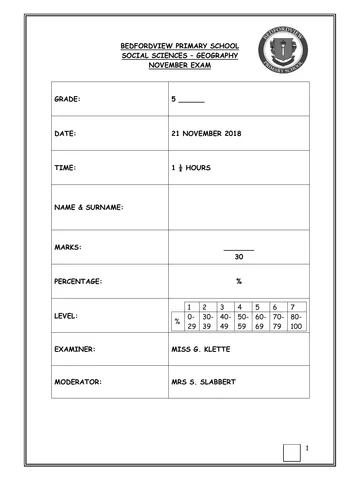
Bedfordview Primary School
Geography TERM TEST Memo
~~~~~~~~~~~~~~~~~~~~~~~~~~~~~~~~~~~~~~~~~~~~~~~~~~~~~~~~~~~~~~~~~~~~~~~~~~
SECTION A – KNOWLEDGE /10
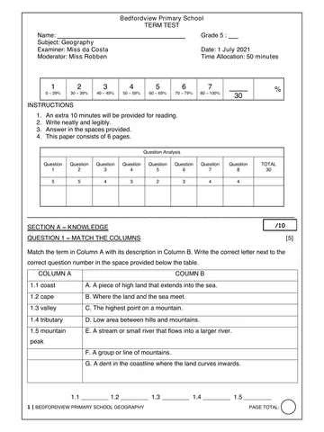
QUESTION 1 – MATCH THE COLUMNS [5]
1.1 B 1.2 A 1.3 D 1.4 E 1.5 C
QUESTION 2 – MULTIPLE CHOICE [5]
Choose the correct answer by highlighting/circling the correct letter:
2.1 The imaginary line which goes around the Earth like a belt is called the (1)
A. axis
B. North Pole
C. equator
D. South Pole
2.2 A landlocked country is a country that has ________________ (1)
A. a coastline
B. no access to the sea or ocean
C. its borders closed
D. many borders
2.3 A _________________ is a naturally formed feature on the earths surface. (1)
A. border
B. city
C. landscape
D. landform
2.4 _______________ is a semi-desert region in South Africa where fields of beautiful flowers
bloom annually. (1)
A. Namaqualand
B. Highveld
C. Kalahari
D. Lowveld
2.5 The_________________ is a dessert found in part of South Africa , Botswana and Namibia.(1)
A. Namaqualand
1 | BEDFORDVIEW PRIMARY SCHOOL GEOGRAPHY PAGE TOTAL:
You're offline
Skip to contentMemorandum
21 G5 Geography Test T2 Memo
Geography · Grade 5 · June Exam · 2021. Memorandum, 3 pages. Read online or download the PDF.
- Subject
- Geography
- Grade
- Grade 5
- Document type
- Memorandum
- Year
- 2021
- Exam period
- June Exam
- Pages
- 3
- File size
- 163.4 KB
Loading document…
Loading document…
1 of 3
Document textSearch extracted text and jump to a page.
B. Highveld
C. Kalahari
D. Lowveld
SECTION B-SOURCE-BASED QUESTIONS /20
QUESTION 3 – TRUE OR FALSE [4]
3.1 Table Mountain is a landform located in the Western Cape province.
TRUE
3.2 The source of a river is the place where a river starts e.g. in the mountains.
TRUE
3.3 The largest river in South Africa is the Limpopo river.
FALSE
The Orange-Gariep river is the longest river in South Africa.
QUESTION 4 - THE BUILD OF SOUTH AFRICA [3]
A: Coastal plain (1)
B: Escarpment (1)
C: Plateau (1)
QUESTION 5-WORLD MAP SKILLS [2]
5.1 Name the continent at C
North America (1)
5.2 Name a continent that is north east of the continent that you live on.
Europe/Asia (1)
QUESTION 6-MAP SKILLS [3]
6.1 This is a map of Africa which is in the Southern hemisphere. (1)
6.2 Name a mountain peak in Angola. (1)
Sera da Neve/Moro de Moco
6.3 Fill in the missing direction:
a. Madagascar is south east of Democratic Republic of Congo. (1)
QUESTION 7-MAP SKILLS [4]
7.1 Name the ‘mouth’ of the Limpopo River.
Indian Ocean (1)
7.2 Name one of the tributaries of the Limpopo river.
Olifants or Crocodile river (1)
7.3 In which of South Africa’s neighbouring countries is the source of the Orange-Gariep river ?
2 | BEDFORDVIEW PRIMARY SCHOOL GEOGRAPHY PAGE TOTAL:
Lesotho (1)
7.4 The Orange-Gariep river forms the border for which of our neighbouring countries in block
A3?
Namibia (1)
QUESTION 8 – CASE STUDY [4]
8.1 Briefly explain how a dam is built. (1)
People build a concrete wall across the river. The wall holds back the water. The area
behind the wall becomes flooded. The flooded area is the dam.
8.2 In a paragraph , discuss the ways in which human activities affect physical landscape. (3)
Human activities affect the physical landscape and natural environment around us. Two
examples of human activities that affect the natural environment are dams and road building.
Dams affect the natural environment because_ When the dam is built, trees and other plants
are flooded and die. Animals and birds lose their homes and food supply. Dams also affect
the natural flow of water and can cause flooding or the drying up of the river. The building
of roads affects the natural environment by causing soil or mud to wash down steep slopes
when it rains or cutting through natural mountains to make tunnels. Therefore, dams and the
building of roads are two examples of human activities that prove that some human activities
can negatively affect the physical landscape and natural environment around us.
3 | BEDFORDVIEW PRIMARY SCHOOL GEOGRAPHY PAGE TOTAL:
Recommended for this subject
Published documents with matching subject and grade metadata.
Related documents
Matched using subject, grade, language, document type and exam metadata.