Downloaded from hlayiso.com
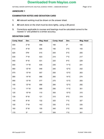
NATIONAL SENIOR CERTIFICATE EXAMINATION
NOVEMBER 2017
NAUTICAL SCIENCE: PAPER II
MARKING GUIDELINES
Time: 3 hours Marks: 150
These marking guidelines are prepared for use by examiners and sub-examiners,
all of whom are required to attend a standardisation meeting to ensure that the
guidelines are consistently interpreted and applied in the marking of candidates'
scripts.
The IEB will not enter into any discussions or correspondence about any marking
guidelines. It is acknowledged that there may be different views about some
matters of emphasis or detail in the guidelines. It is also recognised that,
without the benefit of attendance at a standardisation meeting, there may be
different interpretations of the application of the marking guidelines.
IEB Copyright © 2017 PLEASE TURN OVER
You're offline
Skip to contentMemorandum 
View all
Nautical Science P2 MG 2017 hlayiso.com
Nautical Science · Grade 12 · 2017. Memorandum, 7 pages. Read online or download the PDF.
- Subject
- Nautical Science
- Grade
- Grade 12
- Document type
- Memorandum
- Year
- 2017
- Paper
- 2
- Publisher
- IEB
- Pages
- 7
- File size
- 182.8 KB
Loading document…
Loading document…
1 of 7
Document textSearch extracted text and jump to a page.
Downloaded from hlayiso.com
NATIONAL SENIOR CERTIFICATE: NAUTICAL SCIENCE: PAPER II – MARKING GUIDELINES Page 2 of 7
SECTION A SEAMANSHIP
QUESTION 1
1.1 Keeping a constant watch on the target vessel to monitor the relative
bearing and distance, or by using the compass binnacle to measure the
bearing.
Risk of collision may also be ascertained on the radar by taking a series of
compass bearings, and ranges carefully noting the time and range of each
bearing.
1.2 (a) This is the day signal of a vessel engaged in dredging, surveying or
underwater operations, and she is restricted in her ability to
manoeuvre.
(b) If seen right ahead of my own ship, my action would be to sound two
short blasts on the ship's whistle and make a bold alteration of
course to port to pass the vessel well clear on the safe side of its
operations indicated by two black diamonds.
By the very nature of the vessel's operations she would most likely
be operating in shallow water. Therefore, action taken by my own
vessel must take this into consideration and it will be safe.
1.3 (a) The black cone indicates that the sailing vessel is underway being
propelled by sail and machinery (power) with the engine operational
(Rule 25).
(b) In accordance with the regulations the vessel is considered to be a
power-driven vessel, and as such will exhibit the lights, shapes and
sound signals for a power-driven vessel of its length.
In this case, one long blast at intervals of not more than two minutes.
1.4 (a) The term "give-way vessel" means that every vessel which is
directed to keep out of the way of another vessel shall, as far as is
practical, take early and substantial action to keep well clear of the
other vessel (Rule 16).
(b) The term "stand-on vessel" means that where one of two vessels is
to keep out of the way, the other shall keep her course and speed
(Rule 17 (a) (i)).
1.5 The Regulations are applicable to all vessels upon the high seas and in all
the waters connected therewith navigable by seagoing vessels (Rule 1(a)).
IEB Copyright © 2017 PLEASE TURN OVER
Downloaded from hlayiso.com
NATIONAL SENIOR CERTIFICATE: NAUTICAL SCIENCE: PAPER II – MARKING GUIDELINES Page 3 of 7
1.6 (a) A "vessel not under command" shall exhibit:
(1) two all-round red lights in a vertical line where they can best be
seen;
(2) two balls or similar shapes in a vertical line where they can best
be seen.
Red Red
Red Red
Green Red
White
From ahead From astern
Underway
(b) Fog signal is one prolonged blast followed by two short blasts at
intervals of not more than two minutes.
QUESTION 2
2.1 • Prepare all lifeboats and rafts for launching.
• Muster the ship's complement wearing life jackets.
• Transmit the distress message (refer Annex IV).
• Shut down the main engine.
• Close all watertight doors.
• Display NUC signals.
• Assemble any additional equipment such as extra blankets, water, first-aid
kit, flares, Aldis lamp and battery, emergency radio sets (GMDSS),
charts and navigational equipment, SARTs and EPIRBs.
Or whatever additional items to above the candidate may list within
reason and pertinent to the task.
2.2 Once the boats or rafts are launched with the full complement of people on
board:
• Cut the painter and clear away from the ship's side to a safe distance.
• Recover any survivors from the water.
• The motor boat or rescue craft must gather all boats and rafts together
and secure them together by their painters/lines.
• Once all personnel, boats and rafts have been accounted for, assess
the situation and attend to injuries.
• Ensure all boats are closed up and a routine is set for lookouts and
safety of personnel, keeping all craft together.
• Set up communications and use the SART & EPIRB.
Or any other acceptable actions the candidate may list (at least 4).
IEB Copyright © 2017 PLEASE TURN OVER
Downloaded from hlayiso.com
NATIONAL SENIOR CERTIFICATE: NAUTICAL SCIENCE: PAPER II – MARKING GUIDELINES Page 4 of 7
QUESTION 3
3.1 Moving fuel or weights from the forward tank to the aft central tank will
change the trim of the vessel. The aft draught will increase and the forward
draught will decrease.
3.2 Moving ballast from a top-side tank to a double bottom lower tank will alter
the centre of gravity (G) of the vessel. In this case G will move downwards,
increasing the GM and decreasing the KG. At the same time the ballast will
have shifted weight from the port to the starboard side causing the vessel to
list to starboard.
3.3 Shifting cargo weight from the lower hold to the hatch top will alter the
centre of gravity (G) of the vessel. In this case G will move upwards
decreasing the GM and increasing the KG. At the same time shifting weight
from the starboard to the port side will cause the vessel to list to port.
QUESTION 4
4.1 See attached plotting sheet.
RADAR TRANSFER PLOTTING SHEET
4.2 Target identification 'A'
Time of initial plot 10:00
Initial range & bearing 324º (T) × 11,4 miles
CPA 1,0 mile or nearest
Time of CPA 10:41
Target's true course 121º or nearest
Target's true speed 18,0 knots or nearest
4.3 Stop vessel and navigate with caution. OR Bold alteration of course to
starboard, steer 110º (T).
Continue to monitor the vessel's course and speed till she has passed
clear. When clear, resume the original course and speed.
IEB Copyright © 2017 PLEASE TURN OVER
Downloaded from hlayiso.com
NATIONAL SENIOR CERTIFICATE: NAUTICAL SCIENCE: PAPER II – MARKING GUIDELINES Page 5 of 7
QUESTION 5
• A break-bulk vessel carries smaller packages of cargo, which are loaded and
discharged piece by piece.
• There is greater amount of cargo-handling than in a container ship where the
cargo is unitised.
• A break-bulk vessel can load small parcels of bulk cargoes.
• A container ship does not have cranes, and relies on shore gantries to load
and discharge cargo.
• Break-bulk vessels can load containers and normally have cranes to handle
the containers.
• A break-bulk vessel lower hold is designed to stow large consignments of steel
or timber products, while a container ship will be restricted to specialised
container bolsters or flat racks for these cargoes.
• A break-bulk vessel is not restricted to specialised berths, whereas a container
ship will berth at a specialised container terminal.
Or any other acceptable differences the candidate may list (at least 5).
IEB Copyright © 2017 PLEASE TURN OVER
Downloaded from hlayiso.com
NATIONAL SENIOR CERTIFICATE: NAUTICAL SCIENCE: PAPER II – MARKING GUIDELINES Page 6 of 7
SECTION B COMMUNICATIONS AND METEOROLOGY
QUESTION 6
GMDSS (Global Maritime Distress and Safety System) facilitates the ability for a
vessel in distress to alert search and rescue (SAR) authorities ashore as well as
shipping in the vicinity to ensure a rapid and coordinated response. Shore-based
authorities now have the primary role of coordinating assistance and rescue
operations.
In the GMDSS the initial acknowledgment of a distress alert should be by the
shore-based authorities. Subsequent actions and communications should be
controlled by the Rescue Coordination Centre (RCC). It also provides Maritime
Safety Information (MSI) enabling vessels to receive valuable maritime information
to help prevent potential distress. Such information would be in the form of Navtex
weather and navigation information.
Any or all the above, or any alternative pertinent answer the candidate may give.
QUESTION 7
7.1 (a) Cumulus cloud – when air is heated by the surface of the Earth it
expands, becomes lighter and rises. As the air rises, it expands
further because of the drop in atmospheric pressure and cools
because of the expansion. If the cooling continues beyond the point
at which the air is saturated (dew point), cumulous (Cu) clouds
result.
(b) Stratus clouds – when two masses of air from different sources with
different characteristics meet, boundary lines or fronts are formed
where the colder, heavier air runs under the warmer, lighter air
causing it to rise. The warmer air will expand and cool as it rises,
which results in the formation of cloud that spreads as a more or
less continuous layer. This is classified as stratiform or stratus type
cloud.
7.2 Features of the trade winds:
• Steady, persistent winds with little variation in direction throughout the
year; the NE trades north of the equator and the SE trades south of the
equator.
• Occur in latitudes 10º N to 10º S.
• The average wind force is BS 3–4, but they can freshen to BS 5–6, or
lull to BS 1.
• They are interrupted briefly at times by tropical storms.
• They do not occur in the northern Indian Ocean or the western side of
the North Pacific, where they are replaced by seasonal monsoon winds.
Any of the above or any other pertinent features the candidate may
answer.
IEB Copyright © 2017 PLEASE TURN OVER
Downloaded from hlayiso.com
NATIONAL SENIOR CERTIFICATE: NAUTICAL SCIENCE: PAPER II – MARKING GUIDELINES Page 7 of 7
SECTION C SAILINGS
QUESTION 8
8.1 LAT M. Parts LONG
Vigo W.P. 42º 00' N 2766.05 009º 30' W
Recife W.P. 08º 00' S 478.31 034º 40' W
Dif 50º 00' S DMP 3244.36 25º 10' W
3,000' 1,510'
Tan Course = d'Long / DMP
= 1,510 / 3244,36
= 0,465423072
Course = S025º W
= 205º (T)
Distance = d'Lat / Cos Course
= 3,000 / Cos 25º
= 3,310 Nautical Miles
8.2 Steaming time at 18 knots = Dist / Speed
= 3,310 / 18
= 7 d 16 hrs
Total: 150 marks
IEB Copyright © 2017
Recommended for this subject
Published documents with matching subject and grade metadata.
Memorandum
Nautical Science P1 Memo 2019 hlayiso.com
Memorandum
Nautical Science P2 Memo 2019 hlayiso.com
Memorandum
Nautical Science P1 Memo 2018 hlayiso.com
Memorandum
Nautical Science P2 Memo 2018 hlayiso.com
Memorandum
Nautical Science P1 MG 2017 hlayiso.com
Question paper
Nautical Science P1 2019 hlayiso.com
Related documents
Matched using subject, grade, language, document type and exam metadata.
Question paper
Nautical Science P2 2017 hlayiso.com
Question paper
Nautical Science P1 2017 hlayiso.com
Question paper
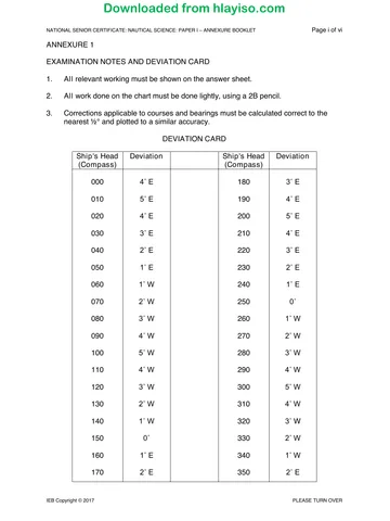
Nautical Science P1 Annexure Booklet 2017 hlayiso.com
Question paper
Nautical Science P2 2019 hlayiso.com
Question paper
Nautical Science P2 2018 hlayiso.com
Question paper
Nautical Science P1 Annexure Booklet 2019 hlayiso.com
More from Grade 12 Nautical Science
Explore more published documents in this catalogue.