
()
Downloaded from hlayiso.com
1
KZN - DEPARTMENT OF EDUCATION
GREENBURY SECONDARY SCHOOL
JUNE EXAMINATION 2016
GEOGRAPHY P2 pp7
GRADE: 10 DATE: 07/06/16
EXAMINER: D. RAMASAMI TIME: 1.5 HOURS
MODERATOR: S. SINGH MARKS: 60
NAME:
GRADE/
DIV:
EDUCATOR
QUESTION CONTENT MARKS
ONE Multiple choice questions 10
TWO Map calculations 22
THREE Map and photo interpretation 18
FOUR Geographical Information System 10
MARKS:
60
PTO: PAGE 2
Skip to contentAll 2016 papers 
View all
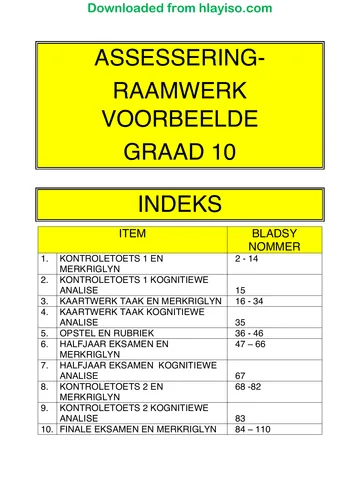
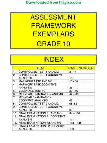
Geography Grade 10 P2 KwaZulu Natal June 2016 Paper & Memo
Grade 10 Geography Paper 2 question paper and memo from the KwaZulu Natal June 2016, 16 pages. Read online or get the free PDF download.
Geography · Grade 10 · KwaZulu Natal June · 2016. Question paper and memorandum, 16 pages. Read online or download the PDF.
- Subject
- Geography
- Grade
- Grade 10
- Document type
- Question paper and memo
- Year
- 2016
- Exam period
- KwaZulu Natal June
- Paper
- 2
- Curriculum
- CAPS
- Pages
- 16
- File size
- 469.6 KB
Free to read online, no sign-up needed
Loading document…
Loading document…
1 of 16
This exam
KwaZulu Natal June 2016
- Paper 1Paper and memo
- Paper 2Paper and memo
Document textSearch extracted text and jump to a page.
Downloaded from hlayiso.com
2
INSTRUCTIONS AND INFORMATION
RESOURCE MATERIAL
1.
2.
3.
An extract from topographical map 2930CA MERRIVALE
Orthophoto map 2930 CA 5 MERRIVALE
NOTE: The resource material must be collected by schools for their
own use,
INSTRUCTIONS AND INFORMATION
1.
5.
Write your REGISTER NUMBER and NAME __.. in the spaces
on the cover page. .
Answer ALL the questions in the spaces provided in this question paper.
You are supplied with a 1:50000 topographical map 2930CA of
MERRIVALE and an orthophoto map of a part of the mapped area.
You must hand the topographical map and the orthophoto map to the
invigitator at the end of this examination session.
You must use the blank page at the back of this paper for all rough work and
calculations. Do NOT detach this page from the question paper.
Show ALL calculations and formulae, where applicable. Marks will be
awarded for these.
You may use a non-programmable calculator.
The following English terms and their Afrikaans translations are shown on the
topographical map.
ENGLISH AFRIKAANS
Diggings Uitgrawings
Caravan park Karavaanpark
Sewage works Rioolwerke
Golf course Gholfbaan
Wetland Vlei
PLO: PAGE 3
14.
(42,
1.3.
» 14,
1.5.
Downloaded from hlayiso.com
3
QUESTION ONE
MULTIPLE CHOICE QUESTIONS
The following questions are based on the 1:50 000 topographical map, as well
as the orthophoto map. Various options are provided as possible answers to the
following questions. Choose the answer and circle only the letter (A — D) of the
correct answer.
The contour interval of the orthophoto map is ...
A) 5M
B) 10M
C) 20M
D) 15M
The map projection used on the topographical map is ...
A) Gauss Conform Projection
B) Lamberts Projection
C) Mercator
D) Universal Transverse.
The scale of the orthophoto map means that 1 cm on the map represents ..
A) 0,1 Km
B) 10Km
C) 0,5 Km
D) 50 Km
The man-made feature 8 on the orthophoto map is a ...
A) bridge
B) road
C) railway station
D) bus stop
The map reference to the NE of Merrivale is...
]
A) 2929BD
B) 2930AD |
C) 2930CD |
D) 2929DD
The direction of A from Dis...
A) South west
B) North east
C) North west
D) North
PTO....PAGE 4
Downloaded from hlayiso.com
1.7. Feature A on the topographic map is a...
A) Road
B) Perennial river
C) Non-perennial river
D) Permanent river
1.8. The main landuse in the South Western corner of the mapped region is ...
A) Forestry
B) Recreation
C) Dam
D) Residential
)
1.9. The scale of the topographic map is .... Times smaller than the orthophoto map. (
A) 10
B) 5
C) 0.5
D) 0.1
1.10. The magnetic bearing will be ... the true bearing for 2002.
A) Bigger than
B) Smaller than
C) Same as
D) No difference
QUESTION TWO
MAP CALCULATIONS
(10x 1) = 10¢
2.1. Calculate the distance in km between spot height 1405 (F10) and trig beacon 156 (E10).
Use the topographic map
(3)
PTO... PAGE 5
2.2.
2.3,
2.4,
2.5,
2.6.
2.7.
3.2.1.
Downloaded from hlayiso.com
How is height shown in (F5)
(2),
Calculate the true bearing of spot height 1405 from trig beacon 156 on the topographic.
map.
(3)
Calculate the magnetic bearing of spot height 1405 from trig beacon 156 for 2002..
(3)
State the height of the trig beacon in E10
(2)
State the grid reference of spot height 1079 (D5) (use degrees, minutes and direction).
latitude.
longitude (6)
Calculate the difference in height between the trig beacons in E10 and F6.
(3)
[22]
QUESTION 3
MAP AND PHOTO INTERPRETATION
. Quote two pieces of evidence fro the topographic map which suggests that
Merrivale receives relatively low rainfall. :
a)
b) (4)
3.2. Refer to the topographic map and orthophoto map:
Give a reason why no farming takes. place in E10.
(2)
PTO... PAGE 6
Downloaded from hlayiso.com
3.2.2. Name two recreational activities that can be done in the Midmar dam (A6,A7).
(4)
3.2.3. Identify and describe the type of slope represented by 1-2 on the orthophoto map
(2)
3.2.4, Refer to the topographic map and the orthophoto map and indentify the following land uses.
Cc
3 a ©
3.2.5. State the recreational activity in D10
(2)
[18]
QUESTION 4
GEOGRAPHICAL INFORMATION SYSTEM
4.1. | What is Geographical Information system?
(2)
4.2, Give two advantages of GIS over normal paper maps.
a) ( '
b)
(2)
4,3. Differentiate between the following:
4.3.1. Raster and vector data
(2)
PTO... PAGE 7
()
Downloaded from hlayiso.com
4.3.2. Active and passive remote sensing
{2)
4.3.3. Explain how GIS can be used in crime prevention.
(2)
[10]
TOTAL. = 60
ROUGH WORK
|
GREENBURY SECONDARY SCHOOL |
gS
DEPARTMENT OF HSS
4.0.0. MR D RAMASAMI
Downloaded from hlayiso.com
Downloaded from hlayiso.com
1
KZN - DEPARTMENT OF EDUCATION
GREENBURY SECONDARY SCHOOL
JUNE EXAMINATION 2016
GEOGRAPHY P2 pp7
GRADE: 10 DATE: 07/06/16
EXAMINER: D. RAMASAMI TIME: 1.5 HOURS
MODERATOR: S. SINGH MARKS: 60
NAME:
MEMo
GRADE! ‘
DIV: Te)
EDUCATOR
“QUESTION CONTENT MARKS
ONE Multiple choice questions 10
TWO Map calculations 22
THREE Map and photo interpretation 18
FOUR Geographical Information System 10
MARKS:
60
PTO: PAGE 2
Downloaded from hlayiso.com
2
INSTRUCTIONS AND INFORMATION
RESOURCE MATERIAL
1.
2.
3.
An extract from topographical map 2930CA MERRIVALE
Orthophoto map 2930 CA 5 MERRIVALE
NOTE: The resource material must be collected by schools for their
own use,
INSTRUCTIONS AND INFORMATION
1.
Write your REGISTER} NUMBER and NAME . in the spaces
on the cover page. oo
Answer ALL the questions in the spaces provided in this question paper.
You are supplied with a 1:50000 topographical map 2930CA_ of
MERRIVALE and an orthophoto map of a part of the mapped area.
You must hand the topographical map and the orthophoto map to the
invigilator at the end of this examination session.
You must use the blank page at the back of this paper for all rough work and
calculations. Do NOT detach this page from the question paper.
Show ALL calculations and formulae, where applicable. Marks will be
awarded for these.
You may use a non-programmable calculator.
The following English terms and their Afrikaans translations are shown on the
topographical map.
ENGLISH AFRIKAANS
Diggings Uitgrawings
Caravan park Karavaanpark
Sewage works Rioolwerke
Golf course Gholfbaan
Wetland Viei
PTO: PAGE 3
a
Downloaded from hlayiso.com
3
QUESTION ONE
MULTIPLE CHOICE QUESTIONS
The following questions are based on the 1:50 000 topographical map, as well
as the orthophoto map. Various options are provided as possible answers to the
following questions. Choose the answer and circle only the letter (A — D) of the
correct answer.
1.1. The contour interval of the orthophoto map is...
() 4.2. The map projection used on the topographical map is...
A) Gauss Conform Projection
B) Lamberts Projection
C) Mercator
D) Universal Transverse. A
1.3. The scale of the orthophoto map means that 1 cm on the map represents ..
A) 0,1 Km
B) 10 Km
C) 0,5 Km
D) 50 Km A
. 1.4. The man-made feature 8 on the orthophoto map is a...
A) bridge
B) road
C) railway station
D) bus stop 8
1.5. | The map reference to the NE of Merrivale is...
A) 2929BD
B) 2930AD
C) 2930CD
b) 2929DD Bo
1.6, The direction of A from Dis ....
A) South west
B) North east
C) North west
D) North Cc
PTO....PAGE 4
Downloaded from hlayiso.com
1.7. Feature A on the topographic map is a...
A) Road
B) Perennial river
C) Non-perennial river
D) Permanent river Cc
1.8. The main landuse in the sw corner of the mapped region is ...
A) Forestry
B) Recreation
C) Dam
D) Residential A
1.9. The scale of the topographic map is .... Times smaller than the orthophoto map. ¢ ‘
A) 10
B) 5
C) 0.8
D) 0.1 bo
1.10, The magnetic bearing will be ... the true bearing for 2002.
A) Bigger than
B) Smaller than
C) Same as
D) No difference A
(10x 1)=10
QUESTION TWO
MAP CALCULATIONS
2.1, Calculate the distance in km between spot height 1405 (F10) and trig beacon 156 (E10).
Mb= S5mm 2 65cm ~ €5)3~-8,1)
Gb = 55 +a2km
2 ans km (2,09 ~ 2,85)
PTO... PAGE 5
2.2,
2.3.
24,
2.5.
2.6.
2.7.
3.1.1.
3.2.
Downloaded from hlayiso.com
5
State the method used to show height in (F5)
Grow neg (2)
Caloulate the true bearing of spot height 1405 from trig beacon 156.
7
8° 6% = 1g4e~ Cisy? = ieee) (3)
Calculate the magnetic bearing of spot height 1405 from trig beacon 156 for 2002..
MR: Te + My a
= 196° (ie4r- ieee) 4 g9° yor
= 208° yr! — — (2iv-49! ~ 206° 4a’) (3)
State the height of the trig beacon in E10
13620 or 1382 m~ (2)
74 Cbs)
State the grid reference of spot height 1266 (C4) (use degrees, minutes and direction).
latitude__24° 33' 24" § (20-30) C60 = 24")
wa v4
longitude _30° ov! ig" & C026) CShavboe yo") (6)
Calculate the difference in height between the trig beacons in E10 and F6.
IFHO 4 ~ 1382.0 <
= 1584 09
(3)
[22]
QUESTION 3
MAP AND PHOTO INTERPRETATION
Quote two pieces of evidence fro the topographic map which suggests that
Merrivale receives relatively low rainfall.
a
a)_lovge number of nem pereanuel Rivers
b) Large number _ of fourm clams (4)
Refer to the topographic map and orthophoto map:
3.2.1. Give a reason why no farming takes place in E10.
Stee slopes (2)
PTO... PAGE 6
3.2.2.
3.2.3,
3.2.4,
3.2.5,
Ad.
4.2.
4.3.
4.3.1.
Downloaded from hlayiso.com
6
Name two recreational activities that can be done in the Midmar dam (A6,A7).
Fishing a
oa
A
Identify and describe the type of slope represented by 1-2 on the orthophoto map
Covey
Changes from steep fo Gentle cs we go ngher Up (2)
Refer to the topographic map and the orthophoto map and indentify the following land uses.
C__ Gillwoted land ~
3__ ham 27 (4)
State the recreational activity in D10
Sheoking A (2)
[18]
QUESTION 4
GEOGRAPHICAL INFORMATION SYSTEM
What is Geographical Information system?
Use_of computer techno logy do_study Geogrephical info (2)
Give two advantages of GIS over normal paper maps.
a)_(fore durable C:
b)_Con be changes frequently Cary reasonable ens.ev )
(2)
Differentiate between the following:
Raster and vector data
Roster — in _ghown as pixels a
Vector ~ info shown by pounds . tiaes and polygons: (2)
oS ul id
PTO... PAGE 7
Downloaded from hlayiso.com
7
4.3.2. Active and passive remote sensing
Ache - a Sign! is sent out and innage copturedl: a
fssive- Rashobwn of the earth 1s preked up (2)
4.3.3. Explain how GIS can be used in crime prevention.
lccale cocess/ eer poinls = any reasonable answer 7
(2)
[10]
TOTAL = 60
ROUGH WORK
Downloaded from hlayiso.com
Study this subject
Recommended for this subject
Question paper and memo
Geography Grade 10 P1 KwaZulu Natal June 2016 Paper & Memo
Question paper and memo
Geography Grade 10 P2 KwaZulu Natal June 2017 Paper & Memo
Question paper and memo
Geography Grade 10 March Test 2016 Paper & Memo
Question paper and memo
Geography Grade 10 NSC Prelim 2016 Paper & Memo
Question paper and memo
Geography Grade 10 September Test 2016 Paper & Memo
Question paper and memo
Geography Grade 10 P1 KwaZulu Natal June 2017 Paper & Memo
More from Grade 10 Geography
Study guide
Gr10 Geografie OG studyguide LR
Annual teaching plan
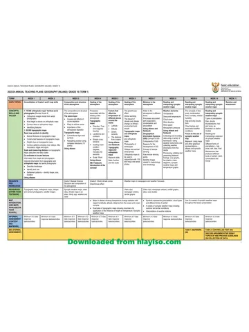
Gr 10 Geo ATP 2023 24
Question paper
Geography Grade 10 P1 North West November 2024 QP (Eng)
Question paper
Geography Grade 10 P2 North West November 2024 QP (Eng)
Question paper
Geography Grade 10 Gauteng March Test 2023 QP (Afr)
Question paper