
Downloaded from hlayiso.com
NATIONAL SENIOR CERTIFICATE EXAMINATION
NOVEMBER 2019
GEOGRAPHY: PAPER I
MARKING GUIDELINES
Time: 3 hours 200 marks
These marking guidelines are prepared for use by examiners and sub-examiners,
all of whom are required to attend a standardisation meeting to ensure that the
guidelines are consistently interpreted and applied in the marking of candidates'
scripts.
The IEB will not enter into any discussions or correspondence about any marking
guidelines. It is acknowledged that there may be different views about some
matters of emphasis or detail in the guidelines. It is also recognised that,
without the benefit of attendance at a standardisation meeting, there may be
different interpretations of the application of the marking guidelines.
IEB Copyright © 2019 PLEASE TURN OVER
Skip to contentMemorandum 
View all
Geography Grade 12 IEB Paper 1 2019 Memo
IEB Grade 12 Geography Paper 1 memorandum from the 2019, 19 pages. Read online or get the free PDF download, question paper linked when available.
Publisher: IEB
Geography · Grade 12 · 2019. Memorandum, 19 pages. Read online or download the PDF.
- Subject
- Geography
- Grade
- Grade 12
- Document type
- Memorandum
- Year
- 2019
- Paper
- 1
- Publisher
- IEB
- Curriculum
- IEB
- Pages
- 19
- File size
- 399.6 KB
Loading document…
Loading document…
1 of 19
Document textSearch extracted text and jump to a page.
Downloaded from hlayiso.com
NATIONAL SENIOR CERTIFICATE: GEOGRAPHY: PAPER I – MARKING GUIDELINES Page 2 of 19
QUESTION 1 INTEGRATED QUESTION: THE GEOGRAPHY OF SOUTH
WESTERN CAPE – GEORGE AND SURROUNDS
1.1 Subtropical anticyclones and associated weather conditions
1.1.1 (a) South Indian anticyclone
(b) cold front
(c) coastal low
(d) berg winds
1.1.2 ANY TWO OF THE FOLLOWING ANSWERS
• approaching cold front
• cooler temperatures over the interior
• the clear conditions over the interior
• high pressure over the land / interior
• South Indian anticyclone in line with SA/moved north
• berg winds along the coast
• large difference in dew point temperature and air temperature
(inland)
1.1.3 ANY TWO OF THE FOLLOWING ANSWERS
• wind will back / change
• wind speed will increase
• temperature will drop
• rainfall at the front
• air pressure will increase
• general concept of weather changes occurring (wind / pressure /
temperature)
• humidity increases
• change in dew point temperature
• increase in cloud cover (cumulonimbus)
1.1.4 Air temperature 31 ºC
Dew-point temperature 3 ºC
Wind speed 20 knots (36-40 km/h)
Wind direction north-north-westerly / NW
Atmospheric pressure 1017 – 1020 hPa
IEB Copyright © 2019 PLEASE TURN OVER
Downloaded from hlayiso.com
NATIONAL SENIOR CERTIFICATE: GEOGRAPHY: PAPER I – MARKING GUIDELINES Page 3 of 19
1.1.5
Interior/ Kalahari High over land
Air sinks on the plateau
Air moves towards the coastal
low
Air sinks down the escarpment
Air heats up adiabatically
and dries out
Marks for
• correct drawing
• concept of air moving from
interior to coastal low
• air heating up as air moves
down the escarpment
OR
Interior/ Kalahari High pressure
Air sinks on the plateau
Air moving from high
pressure to coastal low
Escarpment
Air heats up Coastal low pressure
adiabatically
IEB Copyright © 2019 PLEASE TURN OVER
Downloaded from hlayiso.com
NATIONAL SENIOR CERTIFICATE: GEOGRAPHY: PAPER I – MARKING GUIDELINES Page 4 of 19
1.2 1.2.1 1,3 ºC
1.2.2 This is due to the thermal belt within the valley, which creates a
temperature inversion.
Concept of air changing with altitude (referring to point E and F)
Aspect – change of temperature on slopes
1.2.3 All the cold air collects at the bottom of the valley making it very cold
and any moisture collected on the ground will become frost.
1.2.4 Katabatic / mountain / downvalley wind / descending air / downslope
1.3 1.3.1 False
1.3.2 True
1.3.3 False
1.3.4 True
1.3.5 True
1.4 1.4.1 G – watershed / drainage basin boundary / drainage divide /
catchment area
H – confluence
I – meander / ox-bow lake / meander loop
J – mouth
1.4.2 A superimposed drainage pattern forms when a stream's original
rock surface was removed by erosion and the stream now flows over
newly exposed rocks and structures of which it is quite independent.
Landscape is older than the river
(Candidates may draw this.)
1.4.3
Rainy season water table
Dry season water table
Periodic river – water in the channel
Permanent River – water in only in the wet season
channel all year round
IEB Copyright © 2019 PLEASE TURN OVER
Downloaded from hlayiso.com
NATIONAL SENIOR CERTIFICATE: GEOGRAPHY: PAPER I – MARKING GUIDELINES Page 5 of 19
1.4.4 Trellis drainage pattern: smaller tributaries feed into the river from the
steep slopes on the sides of mountains such as fold mountains.
These tributaries enter the main river at approximately 90-degree
angles.
Alternating bands of hard and soft rock with parallel mountain
ranges.
1.4.5 ANY TWO of the following answers
• soil moisture
• the gradient of the slope
• type of rainfall
• type of rock
• type of soil
• vegetation coverage
• type of vegetation
• porosity and permeability
• land use
1.4.6 ANY TWO RELEVANT POINTS
The candidate is expected to DISCUSS and should, therefore,
expand on and explain each point.
• Recreation
Dams provide prime recreational facilities. Boating, skiing, camping,
picnicking, and boat-launching facilities are all supported by dams.
• Flood control
In addition to helping farmers, dams help prevent the loss of life
and property caused by flooding. Flood control dams impound
floodwaters and then either release them under control to the
river below the dam or store or divert the water for other uses. For
centuries, people have built dams to help control devastating
floods.
• Water storage
Dams create reservoirs that supply water for many uses, including
industrial, municipal, and agricultural.
• Irrigation
Cropland is irrigated using water stored in dams. Thousands of
jobs are tied to producing crops grown with irrigated water.
• Electricity generation
Hydropower is considered clean because it does not contribute to
global warming, air pollution, acid rain, or ozone depletion.
• Debris control
In some instances, dams provide enhanced environmental
protection, such as the retention of hazardous materials and
detrimental sedimentation.
1.5 1.5.1 K – planned irregular
L – gridiron / grid / rectangular
IEB Copyright © 2019 PLEASE TURN OVER
Downloaded from hlayiso.com
NATIONAL SENIOR CERTIFICATE: GEOGRAPHY: PAPER I – MARKING GUIDELINES Page 6 of 19
1.5.2 The candidate is expected to DISCUSS and should, therefore,
expand on and explain each point.
L – ANY ONE OF THE FOLLOWING:
• easy to navigate around
• easy to extend streets
• easy to subdivide stands and to build on
• easy to add in services
K – ANY ONE OF THE FOLLOWING:
• interesting pattern
• better traffic flow
• less traffic lights
• follows relief
1.5.3 (a) ANY TWO RELEVANT POINTS
• tall buildings
• usually gridiron street patterns
• most accessible / converging transport routes
• most businesses (commercial) are found in the CBD
• high land value
• congestion / busy / overcrowding
(b) This is due to the high price of land and the taxes that need to
be paid. So to maximise, the buildings are built taller.
Concept of lack of space
1.5.4 (a) ANY TWO RELEVANT POINTS
• road network
• bus routes
• rivers and water
• built-up area /suburbs
• railways
• topography / relief
• bus stops
• transport routes
(b) ANY ONE FOR EACH
• Bus stop
– coordinate
– altitude
– types of bus
– times of buses
– name of bus stop
– name of road
– how many passengers per day
IEB Copyright © 2019 PLEASE TURN OVER
Downloaded from hlayiso.com
NATIONAL SENIOR CERTIFICATE: GEOGRAPHY: PAPER I – MARKING GUIDELINES Page 7 of 19
• Road
– length
– coordinate
– altitude
– type of road
– the material used to build a road
– number of cars using the road
1.5.5 (a) ANY TWO RELEVANT POINTS
The candidate is expected to EXPLORE and should,
therefore, expand on and explain each point.
• access to the CBD
• access to the industrial areas
• access to the highway
• shorter commutes
• cheaper for the commuter
• reduced traffic congestion
• increases mobility
• makes the roads safer
• encourages healthier habits
(b) It is a city that was planned to segregate people of different
races and there was a deliberate design to make sure they
would develop separately. Could be evidence of a buffer zone.
1.6 1.6.1 Invasion and succession
1.6.2 ANY TWO RELEVANT POINTS
The candidate is expected to COMMENT ON and should, therefore,
expand on and explain each point.
• the needs of an area change
• gentrification
• filtering
• change in traffic patterns
• introduction of a public transport system
• main roads change the needs of a land
• higher rental
• higher taxes
• densification
• urban renewal – boosts economy / reduces crime / uplifts area
IEB Copyright © 2019 PLEASE TURN OVER
Downloaded from hlayiso.com
NATIONAL SENIOR CERTIFICATE: GEOGRAPHY: PAPER I – MARKING GUIDELINES Page 8 of 19
1.6.3 ANY TWO RELEVANT POINTS
The candidate is expected to DISCUSS and should, therefore,
expand on and explain each point.
• increase in property value
• decrease in property value
• could spark gentrification
• people could move in / out of the area
• more traffic on the roads
• more crime
• improve land use
• blight
1.7 • Discuss the importance of hops agriculture to the South African economy.
NB: Examples of each of these points and the elaboration on these points
makes a fair essay great.
– new jobs
– new farmers
– more exports
– new microbreweries
– beverages and herbal medicine
– new research facilities
– tourism will bring in foreign exchange to an area
• Explain how the growth of local hops production will boost linked
industries.
– this will add to beer production
– the bottling industry will benefit
– glass industry will benefit
– label production
– commercial and marketing industries
– export and import companies
– there will be an improvement in the trade balance
– new business opportunities
– new skills development centres/universities
– fertilizer companies would benefit
– the transport industry would benefit
– the advertising industry
– paper and board industries could be developed
– barley and wheat farming would benefit
– tea and soft drink factories
– artificial light industries
– irrigation companies
– pillow-making businesses (sedative effect)
– hops is anti-bacterial so can be used to make herbal medication (this
could include medication for sleeplessness)
IEB Copyright © 2019 PLEASE TURN OVER
Downloaded from hlayiso.com
NATIONAL SENIOR CERTIFICATE: GEOGRAPHY: PAPER I – MARKING GUIDELINES Page 9 of 19
• Analyse some of the challenges faced by hops farmers and beer-brewing
companies.
– Hops
o not ideal climate for hops farming
o climate change
o drought and variable rainfall
o land claims
o costly to set up and costly training of workers
o limited suitable land
o labour unrest
o costly transport through the mountains (since hops is mainly
cultivated in George)
o farm attacks in South Africa are on the increase
o skimming of hops and theft could be a problem
o artificial light is very expensive
o suitable storage facilities are needed
o pests and disease could impact yields
– Brewing
o high taxes
o sin taxes
o lack of skills
o lack of government support
o SA is a water-scarce country as it is and a large amount of water
is required for the brewing process
o water restrictions in South Africa will increase the costs of
production
o load shedding could lead to large amounts of beer having to be
discarded
o because South Africa has very few suitable areas in which to
grow hops, there may be a large need to import hops. This leads
to high import costs for breweries
o hops has a short self-life
o small businesses/micro-breweries will be impacted upon
because of the difficulty of competing in this industry (because of
the challenges)
• Discuss the importance of the brewing industry to the South African
economy.
– create new jobs
– create new opportunities for linked industries
– create new centres of development
– development of SDIs or IDZs
– foreign income
– better trade balance (exporting more)
– development or bettering of ports at which exports occur (e.g. PE for
the export of hops)
IEB Copyright © 2019 PLEASE TURN OVER
Downloaded from hlayiso.com
NATIONAL SENIOR CERTIFICATE: GEOGRAPHY: PAPER I – MARKING GUIDELINES Page 10 of 19
CRITERIA MARKS
Writing skills
• Take into consideration structure and presentation.
5
• Use of brief introduction and conclusion.
• Logical discussion and use of subheadings.
Content knowledge
• Correct use of geographical terminology and concepts. 14
• Adherence to topic and subheadings.
Supporting evidence – analysis and understanding
• The ability to analyse and evaluate the topic is assessed in this category.
• Reference made to case study material/ fact file/ source material 5
provided.
• If appropriate, reference must be made to familiar/ local or other
examples.
• Please DO NOT tick when marking an essay – this confuses the
checkers.
• Rather, underline valid and appropriate points and use the code system
below.
GEOGRAPHY CONTENT:
ESSAY CODES
__________ Underline relevant points if correct
E – Excellent
G – Good Circle incorrect points
V – Vague
R – Repetition EVIDENCE:
I – Irrelevant
F – Fair () Bracket evidence
IEB Copyright © 2019 PLEASE TURN OVER
Downloaded from hlayiso.com
NATIONAL SENIOR CERTIFICATE: GEOGRAPHY: PAPER I – MARKING GUIDELINES Page 11 of 19
(Level 3) (Level 2) (Level 1)
Criteria
Excellent – Good Satisfactory Poor
Writing skills Suitable introduction and Introduction and Writing is weak and almost
• Taking into conclusion. conclusion present, unintelligible.
consideration Sophisticated, coherent although not ideal. No introduction or
structure and and structured writing. Attempts to adhere to conclusion provided. No
presentation. Subheadings and subheadings and use of use/adherence to
• Use of brief paragraphs have been paragraphs. subheadings.
introduction and effectively used. Report deviates from the Long sentences, poor
conclusion. The report is concise, point in places and lacks grammar and ineffective use
• Logical discussion well-structured and brevity. of paragraphs.
and use of succinct. The report is repetitive.
subheadings. Bullet points may have been
used.
1 = must be awarded for any
form of written attempt/
effort.
[5 marks allocated to this
component] (4–5 marks) (3 marks) (0–2 marks)
Content knowledge Relevant content and Some relevant content. Digression from the topic.
• Correct use of detailed discussion of An overview/ general Weak grasp of concepts and
geographical the topic. discussion of key issues. terminology.
terminology and Good usage of Basic usage of Superficial/poor discussion.
concepts. geographical geographical concepts Almost no relevant
• Adherence to topic terminology and and terminology. facts/subheading.
and subheadings. concepts. (50–60% of required
An appropriate number facts presented/
of facts presented/ subheading).
subheading. 1 point/sub-heading, or
Min of 2 points for every 2 points provided and
sub-heading will earn only 2 paragraphs.
candidate 10 marks.
Extension work will
provide a further
4 marks.
[14 marks be allocated
here] (10–14 marks) (6–9 marks) (0–5 marks)
Supporting evidence – The candidate is able to Superficial links made to Limited to no reference
analysis and argue and evaluate case study/ made to case study/ fact
understanding appropriately. fact file/source material. file/source material.
• The ability to analyse There is strong evidence Although reference to Examples not provided.
and evaluate the topic of accurate application supporting examples Has little to no geographical
is assessed in this of understanding and has been made, it is not meaning.
category. evidence provided. clear that the candidate Little analysis or
• Reference made to The report demonstrates has a good understanding.
case study material/ the understanding and understanding of the Demonstrates minimal
fact file/source integration of relevant example/case study understanding of the topic.
material provided. case study/fact file/ material.
• If appropriate, source material into the Supporting evidence
reference must be context of the report. does not always relate
made to familiar/local Looking for evidence of appropriately to the
or other examples. unpacking content and subheading or context of
high-order integration. the discussion.
Discussion lacks depth.
[5 marks allocated to this
component] (4–5 marks) (3 marks) (0–2 marks)
IEB Copyright © 2019 PLEASE TURN OVER
Downloaded from hlayiso.com
NATIONAL SENIOR CERTIFICATE: GEOGRAPHY: PAPER I – MARKING GUIDELINES Page 12 of 19
QUESTION 2 CLIMATE, WEATHER AND GEOMORPHOLOGY
2.1 2.1.1 C
2.1.2 F
2.1.3 E
2.1.4 B
2.1.5 A
2.2 2.2.1 (a)
Cumulonimbus clouds Eye
wall
Rain
bands
Eye
• 2 marks for the basic drawing (airflow and clouds on
either side of eye)
• If plan view drawn, then 0 for diagram
• 2 marks for 4 labels (½ mark each)
(b) Any answer between east and north-east.
Accept TOWARDS the W and SW
2.2.2 (a) ANY ONE RELEVANT ANSWER
• eye
• eyewall
• heavy rain
• strong winds
• intense LP (Below 1000 hPa)
• vortex
• the system has been named
IEB Copyright © 2019 PLEASE TURN OVER
Downloaded from hlayiso.com
NATIONAL SENIOR CERTIFICATE: GEOGRAPHY: PAPER I – MARKING GUIDELINES Page 13 of 19
(b) • Tropical cyclone needs to be over warm water to feed the
system.
• there is also no friction over the ocean (only 1 mark)
• latent heat/energy
• high levels of evaporation
• high humidity
• instability
(c) The candidate gets rewarded for correctly naming two hazards
and correctly describing how these two hazards caused the
damage. MUST link to buildings
• Strong wind
– winds of over 150 km/h will take roofs off and make
debris fly everywhere
• Heavy rain
– this will cause flooding and the rivers with break their
banks
• Storm surge
– strong waves caused by the storm coming off the ocean
will cause damage to roads and beachfront properties
2.3 2.3.1 When temperature increases with altitude.
2.3.2 Kalahari or Interior High Pressure or Continental HP (NOT KHP)
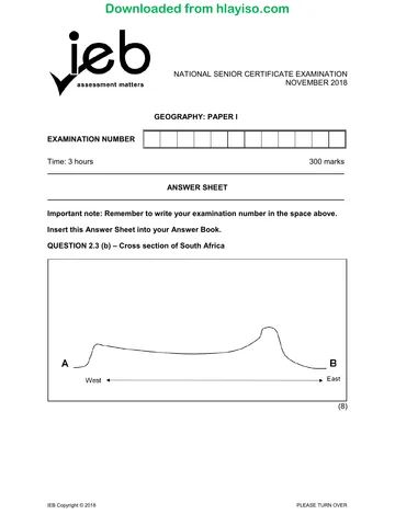
2.3.3
Sinking air from Interior/
Kalahari High pressure. Can Correct position of the inversion
show using arrows only
Shape
2.3.4 The candidate is expected to EXPLAIN and should, therefore,
expand on and explain each point.
• During winter the land is cool so the inversion layer is close to the
ground and below the escarpment.
OR
• During summer the inversion layer is pushed higher due to the
land being warm.
IEB Copyright © 2019 PLEASE TURN OVER
Downloaded from hlayiso.com
NATIONAL SENIOR CERTIFICATE: GEOGRAPHY: PAPER I – MARKING GUIDELINES Page 14 of 19
2.4 2.4.1 abrasion
2.4.2 bankfull
2.4.3 interfluve
2.4.4 knickpoint
2.4.5 sinuosity
2.5 2.5.1 Terracing/ valley in a valley / new flood plain / stepped
2.5.2 The candidate is expected to DISCUSS and should, therefore,
expand on and explain each point.
Velocity:
• The higher the velocity the greater the size of particles moved
• As the river flows faster, it is capable of carrying more and larger
sediment.
Particle size:
• Small particles deposited last
• Smaller particles are easier for the river to carry.
• The larger loads will deposit first
Deposition at Q
• Due to friction, water slows on the inner bank and therefor
deposition
2.6 2.6.1 ANY TWO RELEVANT ANSWERS
• destroy homes
• wash away possessions
• loss of life
• spread of pollution and debris
• people having to relocate
• damage to vegetation
• spread of disease
• riverbanks washed away
• mudslides
2.6.2 ANY TWO RELEVANT ANSWERS
• build dams
• weirs
• wetlands management
• flood-line management
• unblocking drains
• canalise the river
• redirect the river
• plant vegetation
IEB Copyright © 2019 PLEASE TURN OVER
Downloaded from hlayiso.com
NATIONAL SENIOR CERTIFICATE: GEOGRAPHY: PAPER I – MARKING GUIDELINES Page 15 of 19
2.6.3 The candidate could say flooding can be accurately predicted or
flooding cannot be accurately predicted.
The candidate is expected to SUGGEST and should, therefore,
expand on and explain each point.
Can be accurately predicted Cannot be accurately predicted
Recording rainfall Cannot predict where the water
will go
Historical highs
Use of storm hydrographs
2.64 The candidate is expected to EXPLAIN and should, therefore,
expand on and explain each point. 2 marks for each point / idea:
• Community projects
− river clean-ups / education of the community / using NGOs
• Remote sensing
− monitoring the river levels from afar, such as satellite webcams
or drones
• GIS mapping (Focus is on application of concept. Not
terminology)
− Buffer
− flood-prone areas
− mapping of variable areas
− data layering
− monitor change
IEB Copyright © 2019 PLEASE TURN OVER
Downloaded from hlayiso.com
NATIONAL SENIOR CERTIFICATE: GEOGRAPHY: PAPER I – MARKING GUIDELINES Page 16 of 19
QUESTION 3 RURAL AND URBAN SETTLEMENT AND ECONOMIC
GEOGRAPHY OF SOUTH AFRICA
3.1 3.1.1 C dry-point site
3.1.2 D gap town
3.1.3 C dormitory town
3.1.4 B settlement classification
3.1.5 C the maximum distance people are willing to travel for a service.
3.2 3.2.1 An area on the outskirts of an urban area, interface between town
and country.
OR
The transition zone where urban and rural uses mix and often clash.
3.2.2 ANY ONE RELEVANT ANSWER
• fertile soil
• good climate
• water nearby
• good access to roads
• relief
• aspect
• building or fuel materials
• historical – defence, tradition
• trade and transport node
3.2.3 ANY TWO RELEVANT ANSWERS
• wind break
• good road
• buildings formal and well built
• structure to the farmland / regular texture indicating monoculture
• large/ extensive farmland
• irrigation system available/ own water source available
3.2.4 ANY TWO RELEVANT ANSWERS
The candidate is expected to ANALYSE and should, therefore, expand
on and explain each point.
• fewer people to work the land / decreased productivity /
decreased food security
• smaller market / economic decline
• more money to be spent on mechanisation
• less opportunity to develop skills
• under-utilisations of services, close down
• decrease in services provided
• isolation increasing vulnerability to crime / increase in crime
• demographic changes / families split up
• poverty
• rural decline and decay
IEB Copyright © 2019 PLEASE TURN OVER
Downloaded from hlayiso.com
NATIONAL SENIOR CERTIFICATE: GEOGRAPHY: PAPER I – MARKING GUIDELINES Page 17 of 19
3.2.5 ANY TWO RELEVANT ANSWERS
The candidate is expected to SUGGEST and should, therefore, expand
on and explain each point.
• create jobs
• develop skills
• keep people in rural areas
• counterurbanisation
• stop people moving to urban areas
• improves infrastructure
• attracts more services into the region
• promotes tourism in area – stimulating the economy
• improved farm productivity/ better methods
• SDIs – improve standard of living in area through economic
stimulation
3.3 3.3.1 On the outskirts of an urban area / near industrial areas / open land
3.3.2 ANY ONE RELEVANT ANSWER
The candidate is expected to DISCUSS and should, therefore,
expand on and explain each point.
• movement of people into urban areas
• nowhere else to go/ formal housing unavailable
• poor/poverty/unemployment resulting in no money for formal
housing
• influx of poor foreigners or refugees
• higher birth rates in the settlement
3.3.3 ANY TWO RELEVANT ANSWERS
The candidate is expected to ASSESS and should, therefore, expand
on and explain each point.
• more infrastructure
• more sanitation
• increase the functions and services available (utilities / formal
housing / refuse / sanitation)
• move business to the region (decentralisation)
• tax incentives
• improved education provision / upskilling
• improved security
• better pay / increasing minimum wage
• job creation
• security increases through food gardens or programmes
• microloans for small businesses
IEB Copyright © 2019 PLEASE TURN OVER
Downloaded from hlayiso.com
NATIONAL SENIOR CERTIFICATE: GEOGRAPHY: PAPER I – MARKING GUIDELINES Page 18 of 19
3.4 3.4.1 F
3.4.2 D
3.4.3 E
3.4.4 G
3.4.5 B
3.5 3.5.1 (a) 1986: 18 000 – 20 000 km2
(b) 2016: 5000 km2
3.5.2 It has generally decreased / negative correlation to years
3.5.3 ANY ONE RELEVANT ANSWER
The candidate is expected to EVALUATE and should, therefore,
expand on and explain each point.
• better farming methods, mechanisation
• more fertiliser and pesticides
• more irrigation schemes
• better irrigation methods
• more commercial farmers
• consolidation of farms to use the land and equipment more
productively
• GMOs and hybrid seeds
3.5.4 ANY TWO RELEVANT ANSWERS
• used to make bread
• used in most baking products
• used for cereals
• used as the main binding agent in food production (gluten)
• staple diet / nutritious
• food source for humans and animals
• inexpensive to grow
• easy to grow
3.6 3.6.1 (a) Finance, real estate and business services.
(b) Between 70 billion and 80 billion rand.
IEB Copyright © 2019 PLEASE TURN OVER
Downloaded from hlayiso.com
NATIONAL SENIOR CERTIFICATE: GEOGRAPHY: PAPER I – MARKING GUIDELINES Page 19 of 19
3.6.2 ● Hinder
– lack of water/ drought/ climate change/ unreliable rainfall
– no mineral resources
– far from the markets (Gauteng)
– ageing infrastructure
– labour issues
– fluctuating foreign exchange
– transport-related issues
– land is expensive
– load shedding / unreliable power
– illness/ HIV/AIDs – lowering productivity
– overpopulated – causing strain on resources and area
– corruption / crime
• Promote
– highly skilled labour/ large labour source
– harbour
– good infrastructure
– access to large markets
– investor interest
– abundance of raw materials (agro-processing)
– nuclear/ alternative power sources
– tourism promotes link industries
– water transfer schemes
– available flat land
– industrial inertia
3.6.3 The candidate is expected to DISCUSS and should, therefore, expand on
and explain each point.
• possibly more unemployment / AR mechanisation
• new possibilities for skilled workers
• economic growth in sectors
• new linked industries
• strikes and protests from unions
• increased productivity and efficiency
• stabilise the economy causing sustainability
• upskilling and education improves
• creates more products to export – increasing foreign exchange
• reducing operational costs (more productive)
Total: 200 marks
IEB Copyright © 2019
Study this subject
Revise the topics in this paper, then practise them question by question.
- Grade 12 Geography notes
CAPS revision notes with worked examples.
- Geography questions by topic
Past exam questions sorted by CAPS topic, with memos where available.
- Grade 12 Geography quizzes
Short topic quizzes with instant feedback.
- All Grade 12 Geography past papers
Past papers by year, with memos where available.
- Grade 12 IEB past papers
More Geography and other subjects in this collection.
Recommended for this subject
More papers and memos for this grade and subject.
MemorandumIEB
Geography Grade 12 IEB Paper 2 2019 Memo
MemorandumIEB
Geography Grade 12 IEB Paper 1 2018 Memo
MemorandumIEB
Geography Grade 12 IEB Paper 2 2018 Memo
MemorandumIEB
Geography Grade 12 IEB Paper 1 2018 Memo
MemorandumIEB
Geography Grade 12 IEB Paper 1 2017 Memo
MemorandumIEB
Geography Grade 12 IEB Paper 2 2017 Memo
Related documents
Question paperIEB
Geography Grade 12 IEB Paper 1 2019 Question Paper
Question paperIEB
Geography Grade 12 IEB Paper 1 2019 Question Paper (Afrikaans)
Question paperIEB
Geography Grade 12 IEB Paper 1 2019 Question Paper (Afrikaans)
MemorandumIEB
Geography Grade 12 IEB Paper 1 2017 Memo
MemorandumIEB
Geography Grade 12 IEB Paper 1 2016 Memo
Question paperIEB
Geography Grade 12 IEB Paper 2 2019 Question Paper
More from Grade 12 Geography
Question paperIEB
Geography Grade 12 IEB Paper 2 2019 Question Paper (Afrikaans)
Question paperIEB
Geography Grade 12 IEB Paper 2 2019 Question Paper (Afrikaans)
Question paperIEB
Geography Grade 12 IEB Paper 2 2019 Question Paper
Question paperIEB
Geography Grade 12 IEB Paper 1 2018 Question Paper
Question paperIEB
Geography Grade 12 IEB Paper 2 2018 Question Paper
AddendumIEB