
Mock
hlayiso mock exams
Practice Series:
Grade 11 Exam Preparation
WWW.HLAYISO.COM
NATIONAL
SENIOR CERTIFICATE
GRADE 11
GEOGRAPHY P1
NOVEMBER EXAMINATION 2026 (MOCK)
MARKS: 150
TIME: 3 hours
This question paper consists of 16 pages.
Copyright reserved Please turn over
Skip to contentAll 2026 papers 


View all


Geography Grade 11 P1 November Mock 2026 QP (Eng)
Grade 11 Geography Paper 1 question paper from the November Mock Exam 2026 (English), 16 pages. Read online or download the free PDF.
Geography · Grade 11 · November Mock Exam · 2026 · English. Question paper, 16 pages. Read online or download the PDF.
- Subject
- Geography
- Grade
- Grade 11
- Language
- English
- Document type
- Question paper
- Year
- 2026
- Exam period
- November Mock Exam
- Paper
- 1
- Publisher
- Hlayiso
- Curriculum
- CAPS
- Pages
- 16
- File size
- 747.9 KB
Free to read online, no sign-up needed
Loading document…
Loading document…
1 of 16
This exam
November Mock Exam 2026
- Paper 1Question paperAddendumMemo
- Paper 2Question paperAddendumMemo
Document textSearch extracted text and jump to a page.
Geography/P1 2 Hlayiso/Mock 2026
NSC Mock
INSTRUCTIONS AND INFORMATION
1. This question paper consists of TWO sections.
SECTION A
QUESTION 1: THE ATMOSPHERE (60)
QUESTION 2: GEOMORPHOLOGY (60)
SECTION B
QUESTION 3: GEOGRAPHICAL SKILLS AND TECHNIQUES (30)
2. Answer ALL THREE questions.
3. ALL diagrams are included in the QUESTION PAPER.
4. Leave a line between the subsections of questions answered.
5. Start EACH question at the top of a NEW page.
6. Number the answers correctly according to the numbering system used in this question
paper.
7. Do NOT write in the margins of the ANSWER BOOK.
8. Draw fully labelled diagrams when instructed to do so.
9. Answer in FULL SENTENCES, except when you have to state, name, identify or list.
10. Units of measurement MUST be indicated in your final answer, e.g. 1 020 hPa, 14 ◦ C
and 45 m.
11. You may use a non-programmable calculator.
12. You may use a magnifying glass.
13. Write neatly and legibly.
SPECIFIC INSTRUCTIONS AND INFORMATION FOR SECTION B
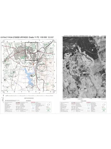
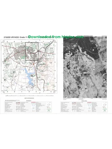
14. A 1 : 50 000 topographical map extract of 3224BC GRAAFF-REINET (SOUTH) and a
1 : 10 000 orthophoto map extract of a part of the mapped area are provided on one
A3 sheet, supplied with this mock as Geography Gr11 P1 Mock 2026 Map (3224BC
Graaff-Reinet). The map sheet was first used in the 2023 Eastern Cape Grade 12
preparatory examination. Print it on A3 paper at 100% (actual size).
15. The area demarcated in RED on the topographical map represents the area covered
by the orthophoto map.
16. Ignore the letters and numbers already printed on the maps (e.g. F, G, H, J, L, X, Y and
1 to 4), unless a question refers to them.
17. Show ALL calculations. Marks will be allocated for steps in calculations.
Copyright reserved Please turn over
Geography/P1 3 Hlayiso/Mock 2026
NSC Mock
SECTION A
QUESTION 1: THE ATMOSPHERE
1.1 Refer to the sketch below showing the earth’s energy balance. Complete
the statements in COLUMN A with the options in COLUMN B. Write only
Y or Z next to the question numbers (1.1.1 to 1.1.8) in the ANSWER
BOOK, e.g. 1.1.9 Y.
incoming solar radiation (insolation)
A
SUN
top of atmosphere
B
gases and dust
D
heat
C
E
EARTH’S SURFACE
[Source: Examiner’s own sketch]
COLUMN A COLUMN B
1.1.1 Insolation reflected back to space Y counter-radiation
by clouds at A is part of the earth’s Z albedo
…
1.1.2 The process at B, where gases Y absorption
and dust in the atmosphere take in Z scattering
energy, is called …
1.1.3 Insolation (C) reaching the earth’s Y long-wave
surface is mainly … radiation. Z short-wave
1.1.4 The energy given off by the earth’s Y solar
surface at D is … radiation. Z terrestrial
1.1.5 The transfer of heat from the Y conduction
earth’s surface to the air in direct Z convection
contact with it is …
1.1.6 Energy that greenhouse gases Y counter-radiation
send back to the earth’s surface at Z insolation
E is …
1.1.7 Surfaces with a high albedo, such Y absorb most of the
as fresh snow, … insolation. Z reflect most of the
1.1.8 The area between approximately Y surplus
38◦ N and 38◦ S has an energy … Z deficit
(8 x 1) (8)
Copyright reserved Please turn over
Geography/P1 4 Hlayiso/Mock 2026
NSC Mock
1.2 Refer to the sketch below showing the high-pressure cells that influence
South Africa’s weather. Various options are provided as possible
answers to the following questions. Choose the answer and write only the
letter (A–D) next to the question numbers (1.2.1 to 1.2.7) in the ANSWER
BOOK, e.g. 1.2.8 D.
N
2 1 028
H
1 024
1 026
1
H
3
H
Atlantic Ocean
Indian Ocean
[Source: Examiner’s own sketch]
1.2.1 The high-pressure cell at 1 is the …
A South Indian High.
B Kalahari High.
C South Atlantic High.
D Antarctic High.
1.2.2 The season shown in the sketch is … because high-pressure
cell 2 is over the interior.
A summer
B winter
C spring
D autumn
1.2.3 Air in the high-pressure cells blows in an … direction and …
A clockwise; converges
B anticlockwise; diverges
C clockwise; diverges
D anticlockwise; converges
1.2.4 The subtropical high-pressure cells form where air … at
approximately 30◦ S.
A rises from the Ferrel cell
B rises at the polar front
C sinks from the Hadley cell
D sinks from the polar cell
Copyright reserved Please turn over
Geography/P1 5 Hlayiso/Mock 2026
NSC Mock
1.2.5 The weather over the interior under the influence of
high-pressure cell 2 will be …
A cloudy with widespread rain.
B clear and dry with cold nights and frost.
C hot and humid with thunderstorms.
D misty with drizzle.
1.2.6 The high-pressure cells are positioned further north in this
season because of the …
A apparent movement of the overhead sun to the northern
hemisphere.
B warm Agulhas Current.
C cold Benguela Current.
D rotation of the earth from west to east.
1.2.7 Sinking air in high-pressure cell 2 forms a temperature inversion
that …
A causes heavy thunderstorms.
B traps smoke and pollution close to the surface.
(7 x 1) (7)
C increases cloud cover over the interior.
D forms tropical cyclones.
Copyright reserved Please turn over
Geography/P1 6 Hlayiso/Mock 2026
NSC Mock
1.3 Refer to the sketch below showing the global air circulation in the
southern hemisphere.
tropopause
A Ferrel cell
polar cell
0◦ 30◦ S 60◦ S 90◦ S
C
L B D H
[Source: Examiner’s own sketch]
1.3.1 What is the Coriolis force? (1 x 2) (2)
1.3.2 Name the circulation cell labelled A. (1 x 1) (1)
1.3.3 Identify the pressure belt that forms at B. (1 x 1) (1)
1.3.4 Name the surface winds at C. (1 x 1) (1)
1.3.5 Explain why air sinks at B. (2 x 2) (4)
1.3.6 Explain how the seasonal shift of the intertropical convergence
zone (ITCZ) affects the rainfall of southern Africa. (3 x 2) (6)
Copyright reserved Please turn over
Geography/P1 7 Hlayiso/Mock 2026
NSC Mock
1.4 Refer to the sketch below showing a moisture front and line
thunderstorms over South Africa.
N
X air from the
Indian Ocean
Y
moisture front
H
H
Atlantic Ocean Indian Ocean
[Source: Examiner’s own sketch]
1.4.1 Define the term moisture front. (1 x 2) (2)
1.4.2 In which season do moisture fronts and line thunderstorms
usually develop over the interior of South Africa? (1 x 1) (1)
1.4.3 Describe the moisture content of the air at X and at Y. (2 x 1) (2)
1.4.4 Explain why the thunderstorms develop on the eastern (X) side
of the moisture front. (1 x 2) (2)
1.4.5 In a paragraph of approximately EIGHT lines, discuss the
negative impact of severe line thunderstorms on farming
communities in the interior of South Africa. (4 x 2) (8)
Copyright reserved Please turn over
Geography/P1 8 Hlayiso/Mock 2026
NSC Mock
1.5 Refer to the graph and the extract below on drought in a district of the
Northern Cape.
120
104
96 long-term
100 average
88
Rainfall as % of the
81
80 72
63
58
60
long-term average
40
20
0
2019 2020 2021 2022 2023 2024 2025
DRY YEARS IN THE KAROO
Farmers in the district have had below-average rainfall in most
years since 2019. Dams and boreholes are drying up, grazing has
disappeared and many farmers have had to sell part of their sheep
flocks at low prices. Fodder has to be bought and transported from
other provinces at a high cost. Meteorologists link the dry conditions
to strong, persistent high-pressure cells over the interior that block
moist air from reaching the area.
[Source: Examiner’s own graph and extract (fictional data)]
1.5.1 Define the term drought. (1 x 2) (2)
1.5.2 In which year did the district receive the lowest rainfall? (1 x 1) (1)
1.5.3 Give TWO pieces of evidence from the extract that the district
experienced a drought. (2 x 1) (2)
1.5.4 Explain how strong, persistent high-pressure cells over the
interior cause drought. (1 x 2) (2)
1.5.5 Explain the negative economic impact of the drought on the
sheep farmers in the district. (2 x 2) (4)
1.5.6 Suggest strategies that farmers in the district can use to reduce
the impact of future droughts. (2 x 2) (4)
[60]
Copyright reserved Please turn over
Geography/P1 9 Hlayiso/Mock 2026
NSC Mock
QUESTION 2: GEOMORPHOLOGY
2.1 Complete the statements in COLUMN A with the options in COLUMN
B. Write only Y or Z next to the question numbers (2.1.1 to 2.1.8) in the
ANSWER BOOK, e.g. 2.1.9 Y.
COLUMN A COLUMN B
2.1.1 Rock that forms when magma Y intrusive igneous
cools and solidifies below the Z extrusive igneous
earth’s surface is … rock.
2.1.2 Rock layers that lie at an angle to Y horizontal
the horizontal are … strata. Z inclined
2.1.3 The steep slope of a cuesta that Y dip
cuts across the rock layers is the Z scarp
… slope.
2.1.4 A ridge with a dip slope and scarp Y hogsback
slope that are almost equally steep Z cuesta
is a …
2.1.5 Outer layers of granite domes peel Y carbonation
off due to … Z exfoliation
2.1.6 The steep, bare rock face near the Y free face (cliff)
top of a hill slope is the … Z pediment
2.1.7 The gentle, concave slope at the Y talus slope
foot of a hill is the … Z pediment
2.1.8 A very slow, almost unnoticeable Y soil creep
movement of soil down a slope is Z rockfall
…
(8 x 1) (8)
Copyright reserved Please turn over
Geography/P1 10 Hlayiso/Mock 2026
NSC Mock
2.2 Refer to the sketch below showing landforms associated with massive
igneous rocks. Various options are provided as possible answers to the
following questions. Choose the answer and write only the letter (A–D)
next to the question numbers (2.2.1 to 2.2.7) in the ANSWER BOOK,
e.g. 2.2.8 D.
P
Q
granite
joints
sedimentary rock
R
[Source: Examiner’s own sketch]
2.2.1 Landform P is a …
A tor.
B dome (bornhardt).
C mesa.
D cuesta.
2.2.2 Landform Q, made up of a pile of rounded granite blocks, is a
…
A tor.
B butte.
C hogsback.
D lava plateau.
2.2.3 The large intrusive mass of igneous rock at R is a …
A sill.
B dyke.
C batholith.
D volcano.
Copyright reserved Please turn over
Geography/P1 11 Hlayiso/Mock 2026
NSC Mock
2.2.4 The rounded shape of landform P results mainly from …
A exfoliation (pressure release).
B solifluction.
C deposition by rivers.
D wind erosion of sand dunes.
2.2.5 Landform Q forms when weathering takes place along … in the
granite.
A bedding planes
B joints
C pores
D fossils
2.2.6 Massive igneous rocks are resistant to erosion because they
…
A consist of many soft layers.
B are crystalline with few joints.
C are highly permeable.
D contain many bedding planes.
2.2.7 An example of a granite dome in South Africa is …
A Paarl Rock.
B the Drakensberg basalt cliffs.
(7 x 1) (7)
C the Karoo mesas.
D the Magaliesberg cuesta.
Copyright reserved Please turn over
Geography/P1 12 Hlayiso/Mock 2026
NSC Mock
2.3 Refer to the sketch below showing a landscape associated with
horizontally layered rocks.
C A B
E
D soft sedimentary layers
[Source: Examiner’s own sketch]
2.3.1 Identify landforms A and B. (2 x 1) (2)
2.3.2 Name the resistant igneous rock that usually forms the cap rock
(E) of these landforms in the Karoo. (1 x 1) (1)
2.3.3 Explain why landforms A, B and C have flat tops. (1 x 2) (2)
2.3.4 Explain how landform A will change into landform B over time. (2 x 2) (4)
2.3.5 Explain why the landscape in the sketch is better suited to
extensive sheep farming than to crop farming. (3 x 2) (6)
Copyright reserved Please turn over
Geography/P1 13 Hlayiso/Mock 2026
NSC Mock
2.4 Refer to the cross-section below showing landforms associated with
inclined strata.
X Y
Q
P
resistant rock softer rock layers
[Source: Examiner’s own sketch]
2.4.1 What are inclined strata? (1 x 2) (2)
2.4.2 Identify landforms X and Y. (2 x 1) (2)
2.4.3 Name the slope labelled P. (1 x 1) (1)
2.4.4 Why is the dip slope of landform Y steeper than the dip slope
(Q) of landform X? (1 x 2) (2)
2.4.5 In a paragraph of approximately EIGHT lines, discuss the
advantages and disadvantages of landforms such as X for
human activities. (4 x 2) (8)
2.5 Refer to the extract below on mass movement.
ROCKS CLOSE MOUNTAIN PASS
A mountain pass in the Eastern Cape was closed on Monday after
large boulders crashed down a steep slope onto the road. The area
had received more than 120 mm of rain over the weekend after
several weeks of hot, dry weather. A geologist explained that water
had seeped into the many cracks (joints) in the sandstone cliffs
above the road. The slope had been cut back steeply when the road
was widened two years ago, and much of the natural vegetation
was removed. No one was injured, but motorists face a 60 km
detour while the road is cleared and the slope is made safe.
[Source: Examiner’s own extract]
2.5.1 Define the term mass movement. (1 x 2) (2)
2.5.2 Identify the type of mass movement described in the extract. (1 x 1) (1)
2.5.3 Give TWO natural factors from the extract that contributed to
the mass movement. (2 x 1) (2)
2.5.4 Explain how heavy rainfall increases the risk of mass
movement on steep slopes. (2 x 2) (4)
Copyright reserved Please turn over
Geography/P1 14 Hlayiso/Mock 2026
NSC Mock
2.5.5 Explain how human activity, as mentioned in the extract,
increased the risk of mass movement. (1 x 2) (2)
2.5.6 Suggest measures that the roads authority can take to prevent
similar mass movements on the pass in future. (2 x 2) (4)
[60]
TOTAL SECTION A: 120
Copyright reserved Please turn over
Geography/P1 15 Hlayiso/Mock 2026
NSC Mock
SECTION B
QUESTION 3: GEOGRAPHICAL SKILLS AND TECHNIQUES
GENERAL INFORMATION ON GRAAFF-REINET
Co-ordinates: 32◦ 15′ S; 24◦ 32′ E
Graaff-Reinet, founded in 1786, is one of the oldest towns in South Africa. It lies in the
Eastern Cape Karoo on the banks of the Sundays River (Sondagsrivier) and is almost
completely surrounded by the Camdeboo National Park. The area has a semi-arid climate
with hot summers, cold winters and a low, mainly summer rainfall that often falls during
thunderstorms. The landscape consists of horizontally layered sedimentary rocks of the
Karoo, capped in many places by resistant dolerite.
[Adapted from various sources]
The following Afrikaans terms appear on the maps:
AFRIKAANS ENGLISH
Sondagsrivier Sundays River
Munnikspas Munnik’s Pass
Kontoertussenruimte Contour interval
Verklaring Reference (key)
3.1 MAP SKILLS AND CALCULATIONS
3.1.1 The contour interval on the orthophoto map is …
A 5 m.
B 10 m.
(1 x 1) (1)
C 20 m.
D 50 m.
3.1.2 Calculate the difference in height between trigonometrical
station 87 in block A1 and trigonometrical station 91 in block
D4 on the topographical map. (2 x 1) (2)
3.1.3 Calculate the straight-line distance in kilometres (km) between
trigonometrical station 87 in block A1 and trigonometrical
station 90 on Spandaukop in block C2 on the topographical
map. (2 x 1) (2)
3.1.4 Calculate the average gradient from trigonometrical station 90
on Spandaukop (block C2) to spot height 805 in block C1 on
the topographical map.
Vertical Interval (VI)
Use the formula: Gradient = (4 x 1) (4)
Horizontal Equivalent (HE)
3.1.5 Use the information below the topographical map to calculate
the magnetic declination of Graaff-Reinet for 2026. Show ALL
calculations.
Difference in years:
Mean annual change: 7′ westwards
(3 x 1) (3)
Total change:
Magnetic declination for 2026:
Copyright reserved Please turn over
Geography/P1 16 Hlayiso/Mock 2026
NSC Mock
3.2 MAP INTERPRETATION
3.2.1 Spandaukop (trigonometrical station 90) in block C2 is an
example of a …
A cuesta.
B hogsback.
(1 x 1) (1)
C butte.
D tor.
3.2.2 Explain why Spandaukop has remained high while the land
around it has been lowered by erosion. (1 x 2) (2)
3.2.3 Name the rock structure associated with the landscape around
Graaff-Reinet. (1 x 1) (1)
3.2.4 Give TWO pieces of evidence from the topographical map that
Graaff-Reinet has a semi-arid climate. (2 x 1) (2)
3.2.5 Refer to the eroded area (brown symbol) in blocks C4 and C5
on the topographical map. Give TWO reasons why soil erosion
is common in this area. (2 x 1) (2)
3.2.6 Refer to the N9 national route through Munnikspas in block C2
on the topographical map. Explain why this section of the road
is at risk of rockfalls. (1 x 2) (2)
3.2.7 Suggest ONE measure that could protect motorists on this
section of the N9 against rockfalls. (1 x 2) (2)
3.3 GEOGRAPHICAL INFORMATION SYSTEMS (GIS)
3.3.1 Define the term remote sensing. (1 x 2) (2)
3.3.2 The orthophoto map is an example of a … photograph.
A low-oblique
B high-oblique
(1 x 1) (1)
C vertical aerial
D ground-level
3.3.3 Will the N9 national route be shown as a point, line or polygon
feature in GIS? (1 x 1) (1)
3.3.4 Explain how overlaying data layers in a GIS could help the
roads authority to identify sections of the N9 that are at risk
of mass movement. (1 x 2) (2)
[30]
TOTAL SECTION B: 30
GRAND TOTAL: 150
Copyright reserved
Study this subject
Recommended for this subject
Question paper
Geography Grade 11 P1 Eastern Cape November 2022 QP (Eng)
Question paper
Geography Grade 11 P1 Eastern Cape November 2020 QP (Eng)
Question paper
Geography Grade 11 P1 Eastern Cape November 2017 QP (Eng)
Memorandum
Geography Grade 11 P1 Eastern Cape November 2023 Memo (Eng)
Memorandum
Geography Grade 11 P1 Eastern Cape November 2022 Memo (Eng)
Addendum
Geography Grade 11 P1 Eastern Cape November 2020 Addendum
More from Grade 11 Geography
Memorandum
Geography Grade 11 P1 Eastern Cape November 2025 Memo (Eng)
Memorandum
Geography Grade 11 P2 Eastern Cape November 2025 Memo (Eng)
Question paper and memo
Geography Grade 11 Free State March Test 2025 Paper & Memo
Memorandum
Geography Grade 11 P1 Eastern Cape November 2024 Memo (Afr)
Question paper
Geography Grade 11 Paper 2 MAPS 2023 Question Paper
Question paper