
Downloaded from hlayiso.com
PROVINCIAL ASSESSMENT
GRADE 10
GEOGRAPHY P1
NOVEMBER 2019
MARKS: 225
TIME: 3 hours
This question paper consists of 17 pages and a 13-page annexure.
Copyright reserved Please turn over
Skip to contentAll 2019 papers 
View all
Geography Grade 10 P1 North West November 2019 QP (Eng)
Grade 10 Geography Paper 1 question paper from the North West November 2019 (English), 17 pages. Read online or download the free PDF.
Geography · Grade 10 · North West November · 2019. Question paper, 17 pages. Read online or download the PDF.
- Subject
- Geography
- Grade
- Grade 10
- Document type
- Question paper
- Year
- 2019
- Exam period
- North West November
- Paper
- 1
- Curriculum
- CAPS
- Pages
- 17
- File size
- 345.2 KB
Free to read online, no sign-up needed
Loading document…
Loading document…
1 of 17
This exam
North West November 2019
Questions in this paper
- Question 1.1The atmosphere8 marks
- Question 1.2The atmosphere7 marks
- Question 1.3The atmosphere15 marks
- Question 1.4Geomorphology15 marks
- Question 1.5The atmosphere15 marks
- Question 1.6The atmosphere15 marks
Show all 24 questions
- Question 2.1The atmosphere8 marks
- Question 2.2Geomorphology7 marks
- Question 2.3The atmosphere15 marks
- Question 2.4Geomorphology15 marks
- Question 2.5The atmosphere15 marks
- Question 2.6Geomorphology15 marks
- Question 3.1Population8 marks
- Question 3.2Population7 marks
- Question 3.3Population15 marks
- Question 3.4Water resources15 marks
- Question 3.5Population15 marks
- Question 3.6Water resources15 marks
- Question 4.1Population8 marks
- Question 4.2Water resources7 marks
- Question 4.3Water resources15 marks
- Question 4.4Water resources15 marks
- Question 4.5Population15 marks
- Question 4.6Water resources15 marks
Document textSearch extracted text and jump to a page.
Downloaded from hlayiso.com
Geography/P1 2 NW/November 2019
NSC – Grade 10
INSTRUCTIONS AND INFORMATION
Read the following instructions carefully before answering the questions.
1. This paper consists of FOUR questions.
2. Answer ANY THREE questions of 75 marks each.
3. All diagrams are included in the attached ANNEXURE.
4. Leave a line between the subsections of the questions answered.
5. Start EACH question at the top of a NEW page.
6. Number the answers correctly according to the numbering system used in this
question paper.
7. Number the answers in the centre of the line.
8. Do NOT write in the margins of this ANSWER BOOK.
9. Draw fully labelled diagrams when instructed to do so.
10. Answer in FULL SENTENCES, except where you have to state, name identify
or list.
11. Units of measurement MUST be indicated in your final answers, e.g.
1020 hPa, 14 C˚ or 45 m.
12. Write neatly and legibly.
Copyright reserved Please turn over
Downloaded from hlayiso.com
Geography/P1 3 NW/November 2019
NSC – Grade 10
SECTION A: ATMOSPHERE AND GEOMORPHOLOGY
Answer at least ONE question from this section. If you answer ONE question in
SECTION A, you must answer TWO questions in SECTION B.
QUESTION 1
1.1 Various options are provided as possible answers to the following questions.
Choose the correct answer and write only the letter (A–D) next to the question
number (1.1.1–1.1.8) in the ANSWER BOOK, e.g. 1.1.9 D.
1.1.1 The boundary that is formed when two crustal plates move towards
each other is known as the ... boundary.
A divergent
B constructive
C convergent
D normal
1.1.2 … refers to the heat of the sun.
A Respiration
B Reflection
C Radiation
D Insolation
1.1.3 This part of the atmosphere shields the earth from the harsh UV
rays.
A Ionosphere
B Troposphere
C Ozonosphere
D Atmosphere
1.1.4 A … has a cone that is formed by alternative layers of volcanic ash
and lava.
A shield volcano
B cinder cone
C composite volcano
D caldeira
Copyright reserved Please turn over
Downloaded from hlayiso.com
Geography/P1 4 NW/November 2019
NSC – Grade 10
1.1.5 The diagram below shows…
A ozone.
B oxygen.
C water.
D helium.
1.1.6 A constant gas in the atmosphere.
A Helium
B Carbon dioxide
C Methane
D Nitrogen
1.1.7 A … is a very large igneous intrusion.
A batholith
B lopolith
C laccolith
D dyke
1.1.8 Loss of solar radiation as incoming sunlight bounces off clouds.
A Photosynthesis
B Absorption
C Reflection
D Insolation (8 x 1) (8)
Copyright reserved Please turn over
Downloaded from hlayiso.com
Geography/P1 5 NW/November 2019
NSC – Grade 10
1.2 Give the correct TERM for each of the following descriptions. Write only the
term next to the question number (1.2.1 to1.2.7) in the ANSWER BOOK.
1.2.1 When heat is transferred from one molecule to another
through contact.
1.2.2 The temperature at which condensation takes place.
1.2.3 Side of the mountain range where a rain shadow forms.
1.2.4 The molten material that is still below the earth’s surface.
1.2.5 The outermost layer of the atmosphere, furthest away from
the surface of the earth.
1.2.6 Rock built up in layers.
1.2.7 A downward fold in rock layers. (7 x 1) (7)
1.3 Refer to FIGURE 1.3(a) showing the condensation level of the clouds.
1.3.1 State the condensation level of Cloud 1 in kilometers. (1 x 1) (1)
1.3.2 Comment on the relation between humidity and (1 x 1) (1)
condensation level.
1.3.3 Determine the temperature range below Cloud 2. (1 x 1) (1)
1.3.4 Name the high clouds that are wispy in appearance and that
can precede bad weather. (1 x 1) (1)
1.3.5 Name the type of rain that will develop at Cloud 1. (1 x 2) (2)
1.3.6 Briefly discuss the climate conditions and the area where
the type of rain mentioned in QUESTION 1.3.5 will occur in
South Africa. (2 x 2) (4)
1.3.7 Label the cloud types A–E in FIGURE 1.3(b) (5 x 1) (5)
Copyright reserved Please turn over
Downloaded from hlayiso.com
Geography/P1 6 NW/November 2019
NSC – Grade 10
1.4 Study FIGURE 1.4 based on earthquakes.
1.4.1 Explain what the term epicenter means. (1 x 1) (1)
1.4.2 Give the magnitude of the earthquake that struck east-
northeast of San Juan Raboso. (1 x 1) (1)
1.4.3 Name the instrument that is used to compare the strength of
different earthquakes. (1 x 1) (1)
1.4.4 Name TWO strategies which the people of Mexico City
could have used to reduce the impact of the earthquake. (2 x 2) (4)
1.4.5 In a paragraph of approximately EIGHT lines, explain the
effects of and earthquake on the people of Mexico. (4 x 2) (8)
1.5 Study FIGURE 1.5 based on the heating of the atmosphere.
1.5.1 Define the term insolation. (1 x 1) (1)
1.5.2 Give the term that is used to describe the process at A. (1 x 1) (1)
1.5.3 Provide the natural direction of movement of warm air. (1 x 2) (2)
1.5.4 Some of the heat energy given off by the sun is lost before it
reaches the earth’s surface. Identify THREE processes
associated with heat loss. (3 x 1) (3)
1.5.5 Name TWO greenhouse gasses that cause ozone
depletion. (2 x 2) (4)
1.5.6 State TWO ways in which the loss of ozone affects humans. (2 x 2) (4)
Copyright reserved Please turn over
Downloaded from hlayiso.com
Geography/P1 7 NW/November 2019
NSC – Grade 10
1.6 Study FIGURE 1.6 based on the synoptic weather map.
1.6.1 Name the pressure cell at A. (1 x 1) (1)
1.6.2 Give the isobaric pressure reading of the cell at A. (1 x 1) (1)
1.6.3 Indicate the type of front labelled C. (1 x 1) (1)
1.6.4 Make use of the data on this synoptic map and determine
the season depicted. (1 x 2) (2)
1.6.5 Describe the weather conditions at Port Elizabeth by making
reference to:
(a) Air temperature
(b) Wind direction
(c) Cloud cover
(d) Wind speed
(e) Precipitation (5 x 2) (10)
[75]
QUESTION 2
2.1 Choose the correct term from those given in brackets to make the statements
below TRUE. Write down ONLY the correct term in your ANSWER BOOK.
2.1.1 The (thermosphere/troposphere) is the most important layer
of the atmosphere from a climatic point of view.
2.1.2 The (stratosphere/thermosphere) is found between the
troposphere and mesosphere.
2.1.3 A low temperature of -90° is reached in the
(mesosphere/stratosphere).
2.1.4 Carbon dioxide and (water vapour/hydrogen) in the
atmosphere are responsible for the absorption of energy.
2.1.5 The ozone layer absorbs the (X-rays/ultraviolet rays) of the
sun.
Copyright reserved Please turn over
Downloaded from hlayiso.com
Geography/P1 8 NW/November 2019
NSC – Grade 10
2.1.6 Ozone depletion occurs in the (thermosphere/stratosphere).
2.1.7 (Temperature inversion/positive lapse rate) means that
temperature increases with height above the surface of the
earth.
2.1.8 Reflection at the snow-capped Polar regions.
(Albedo/Aleno) (8 x 1) (8)
2.2 Refer to FIGURE 2.2 based on a cross section of the earth.
2.2.1 Name layer B, which is 2 900 km thick and consists of
molten rock.
2.2.2 The core, labelled E, is solid and consists of nickel and …
2.2.3 Name ONE reason why layer C is important for humans.
2.2.4 Name the boundary between layers C and D.
2.2.5 Layer C is broken into smaller segments known as …
2.2.6 State the estimated temperature of layer B.
2.2.7 Name the layer that is composed of peridotite. (7 x 1) (7)
2.3 Read the article on global warming in FIGURE 2.3.
2.3.1 Define the term global warming. (1 x 1) (1)
2.3.2 Name the main contributor to greenhouse gasses,
according to the report by the Food and Agricultural
Organisation. (1 x 2) (2)
2.3.3 Quote from the article to explain why methane gas is a
bigger threat to the environment than carbon dioxide. (1 x 2) (2)
2.3.4 Name ONE negative impact from the article that the
growing herds of cattle have on the environment. (1 x 2) (2)
2.3.5 In a paragraph of approximately EIGHT lines, give
sustainable ways in which global warming can be slowed
down. (4 x 2) (8)
Copyright reserved Please turn over
Downloaded from hlayiso.com
Geography/P1 9 NW/November 2019
NSC – Grade 10
2.4 Refer to FIGURE 2.4 based on boundary margins and plate tectonics.
2.4.1 Name the meteorologist who first suggested that the
continents were not fixed in one place. (1 x 1) (1)
2.4.2 State the difference between plate boundaries A and B. (1 x 2) (2)
2.4.3 Name the plate boundaries labelled A and B. (2 x 2) (4)
2.4.4 Refer to the theory of plate tectonics and explain why the
broken pieces of the crust of the earth moves. (2 x 2) (4)
2.4.5 Provide TWO pieces of evidence that Africa and South
America were once linked. (2 x 2) (4)
2.5 Study FIGURE 2.5 based on climate change.
2.5.1 Define the term climate change. (1 x 1) (1)
2.5.2 Name the reason why the Ward Hunt Ice Shelf started
fragmenting. (1 x 2) (2)
2.5.3 Explain the effect of such fragmenting on the marine
ecosystem. (1 x 2) (2)
2.5.4 Give the estimated age of the Ward Hunt Ice Shelf. (1 x 2) (2)
2.5.5 In a paragraph of approximately EIGHT lines outline the
consequences of global warming. (4 x 2) (8)
2.6 Read the Case Study in FIGURE 2.6(a) as well as FIGURE 2.6(b) based on
volcanic eruptions.
2.6.1 State the number of people that were evacuated after the
Puyehue Volcano erupted in 2011. (1 x 1) (1)
2.6.2 Explain why there was an agricultural emergency in the
Patagonian region. (1 x 2) (2)
2.6.3 Classify the Puyehue Volcano as either a composite or
shied volcano. (1 x 2) (2)
Copyright reserved Please turn over
Downloaded from hlayiso.com
Geography/P1 10 NW/November 2019
NSC – Grade 10
2.6.4 Explain what the difference is between an active volcano
and a dormant volcano. (1 x 2) (2)
2.6.5 Name the TWO continents that have been affected by the
eruption. (2 x 2) (4)
2.6.6 FIGURE 2.6(b) illustrates intrusive landforms. Identify
labels A, C, D and E. (4 x 1) (4)
[75]
SECTION B: POPULATION AND WATER RESOURCES
Answer at least ONE question from this section. If you answer ONE question in
SECTION B, you must answer TWO questions in SECTION A.
QUESTION 3
3.1 Give ONE word/term for each of the following descriptions by choosing from
the list below. Write only the word/term next to the question number in the
ANSWER BOOK.
Depopulation; Life expectancy; Pull factors;
Emigration; Population density; Literacy rate;
Population distribution; Marti culture; Push factors;
3.1.1 The number of years a person can expect to live.
3.1.2 The movement of people from their home land to another
country.
3.1.3 The farming of fish and shellfish in sheltered water.
3.1.4 Things in cities that attract people who live in the rural
areas.
3.1.5 The number of people per unit area.
3.1.6 The percentage of the total population that can read and
write.
3.1.7 Decline in the population of rural areas.
Copyright reserved Please turn over
Downloaded from hlayiso.com
Geography/P1 11 NW/November 2019
NSC – Grade 10
3.1.8 The way people are spread out across the surface of the
world. (8 x 1) (8)
3.2 Select a word/term from COLUMN B to match the description in COLUMN A.
Write ONLY the letter of your choice next to the question number in the
ANSWER BOOK. E.g. 3.2.8 K
COLUMN A COLUMN B
3.2.1 The depletion of the ocean’s fish stocks. A Warm current
B Zero growth
3.2.2 The overflow of a river soon after heavy rains. C Ecumene
D Cold current
3.2.3 Pushing back of the sea with barrier walls. E Reclamation
F Negative growth
3.2.4 Benguela ocean current. G Abiotic
H Storm surge
3.2.5 People live where conditions are favourable. I Overfishing
J Flash flood
3.2.6 Human-made factors that affect where people
settle.
3.2.7 There are more deaths than births in a country. (7 x 1) (7)
3.3 Study FIGURE 3.3 based on population pyramids.
3.3.1 Define the term population pyramid. (1 x 1) (1)
3.3.2 State the age-group interval for the pyramid. (1 x 1) (1)
3.3.3 Give the shape of the pyramid. (1 x 1) (1)
3.3.4 The base of the pyramid can be described as (wide/narrow) (1 x 2) (2)
3.3.5 The pyramid represents a LEDC (country). Provide TWO
reasons for this statement. (2 x 2) (4)
3.3.6 Classify the age groups represented by labels A–C. (3 x 2) (6)
Copyright reserved Please turn over
Downloaded from hlayiso.com
Geography/P1 12 NW/November 2019
NSC – Grade 10
3.4 Study FIGURE 3.4 based on the water crisis in South Africa.
3.4.1 Identify ONE reason given in the article, as to why a water
crisis is expected by the year 2020. (1 x 1) (1)
3.4.2 Name TWO water transfer schemes that has been
developed to supplement the water in Gauteng. (2 x 1) (2)
3.4.3 State TWO disadvantages associated with the construction
of dams in South Africa. (2 x 2) (4)
3.4.4 In a paragraph of approximately EIGHT lines suggest
measures that can be implemented by the government to
conserve and manage the water supply of South Africa. (4 x 2) (8)
3.5 Study FIGURE 3.5 based on population growth.
3.5.1 State the population problem that Norway is facing at the
moment. (1 x 1) (1)
3.5.2 Give ONE reason why your answer in QUESTION 3.5.1. is
a problem. (1 x 2) (2)
3.5.3 According to the article the current population figures do
not look bad. Provide a reason why it does not look bad. (1 x 2) (2)
3.5.4 Provide ONE piece of evidence from the Demographic
Transition Model in FIGURE 3.5 that Norway is a MEDC
country. (1 x 2) (2)
3.5.5 Discuss the possible economic results of a low growth rate
for a country such as Norway. (2 x 2) (4)
3.5.6 State ONE negative and ONE positive impact of the influx
of foreigners on Norway. (2 x 2) (4)
Copyright reserved Please turn over
Downloaded from hlayiso.com
Geography/P1 13 NW/November 2019
NSC – Grade 10
3.6 Study FIGURE 3.6 based on access to clean water.
3.6.1 Based on graph B, give the percentage of unimproved
water sources for the second poorest community in 2008. (1 x 1) (1)
3.6.2 Based on graph A, state the difference between the
poorest population percentage and richest population
percentage that had access to piped water on the premises
in 2008. (1 x 2) (2)
3.6.3 Discuss the importance of piped water rather than
unimproved water from dams, rivers and lakes to South
African communities. (2 x 2) (4)
3.6.4 Briefly explain the consequences of unsafe levels of
bacteria for people that drink unimproved river water. (2 x 2) (4)
3.6.5 Suggest TWO sustainable strategies the government
should put in place to solve the problem of water pollution
in dams. (2 x 2) (4)
[75]
QUESTION 4
4.1 Various options are provided as possible answers to the following questions.
Choose the answer and write ONLY the letter (A–D) next to the question
number (4.1.1 to 4.1.8) in the ANSWER BOOK, for example 4.1.9 D.
4.1.1 The graphical representation of the percentage of males and
females in different age groups.
A population pyramid
B population bar graph
C population line graph
D population pie graph
4.1.2 Choose the correct statement to fit with the following sentence.
Life choices that can help to increase life expectancy.
A Healthy meals and alcohol abuse.
B Fast foods and good medical care.
C Good medical care and exercise.
D Smoking and regular exercise.
Copyright reserved Please turn over
Downloaded from hlayiso.com
Geography/P1 14 NW/November 2019
NSC – Grade 10
4.1.3 The human immune-deficiency virus is better known as …
A TB
B HIV
C AIDS
D STD
4.1.4 A fear of foreigners resulting in unwarranted attacks to scare them
into leaving.
A Xenophobia
B Xeroderma
C Xylography
D Xerothermic
4.1.5 High birth rate and high death rate results in … population growth.
A high
B zero
C rising
D low
4.1.6 The … of a country refers to the total number of babies that are
born per 1000 of the population per year.
A population growth
B death rate
C fertility rate
D demography
4.1.7 When skilled and highly educated people leave a country to work in
another it is called …
A talent recycling.
B brain drain.
C skills migration.
D brain loss.
4.1.8 Unregistered and informal entry into a country.
A Refugee immigration
B Asylum seeking
C Illegal immigration
D Alien migration (8 x 1) (8)
Copyright reserved Please turn over
Downloaded from hlayiso.com
Geography/P1 15 NW/November 2019
NSC – Grade 10
4.2 Refer to FIGURE 4.2 which illustrates the hydrological cycle. Provide the
CORRECT GEOGRAPHICAL TERMS for EACH of the following statements,
which correspond with the labels on the diagram.
4.2.1 The process whereby moisture is released from plants into
the atmosphere.
4.2.2 The process whereby water vapour changes to water.
4.2.3 Any form of moisture released from the atmosphere to the
earth’s surface.
4.2.4 The process whereby water reaches the permeable rock.
4.2.5 Water that flows on the surface of the earth after it has
rained.
4.2.6 The water deep underneath the surface of the earth.
4.2.7 The process whereby water turns into vapour. (7x 1) (7)
4.3 Study FIGURE 4.3 based on economic migrants.
4.3.1 Define the term migrant. (1 x 1) (1)
4.3.2 State what is meant by the term ‘brain drain’. (1 x 1) (1)
4.3.3 Describe ONE effect emigration has on South Africa. (1 x 1) (1)
4.3.4 Explain why unskilled people lose their jobs as a result of
skilled people emigrating. (1 x 2) (2)
4.3.5 Give TWO reasons for professionals leaving South Africa. (2 x 2) (4)
4.3.6 Transhumance is a way of movement.
(a) Fully explain the term trancehumance. (2 x 2) (4)
(b) Provide ONE example of a country where
trancehumance still takes place. (1 x 2) (2)
Copyright reserved Please turn over
Downloaded from hlayiso.com
Geography/P1 16 NW/November 2019
NSC – Grade 10
4.4 Study FIGURE 4.4(a) based on desalination in South Africa and FIGURE
4.4(b) based on water availability in South Africa.
4.4.1 State what the term desalination means. (1 x 1) (1)
4.4.2 Provide ONE other country, mentioned in the article, which
is very successful with desalination. (1 x 1) (1)
4.4.3 Give ONE negative fact that makes desalination difficult in
South Africa. (1 x 1) (1)
4.4.4 According to the article, what lead to desalination being
seen as a solution to South Africa’s water problems? (1 x 2) (2)
4.4.5 Using your own knowledge, describe the purification
process currently used in towns like Mossel Bay and
Saldanha. (1 x 2) (2)
4.4.6 According to FIGURE 4.4(b), which river will have the
highest availability level by 2025? (1 x 2) (2)
4.4.7 Refer to the table in FIGURE 4.4(b) and give ONE reason
why so much water needs to be transferred into the Upper
Vaal river. (1 x 2) (2)
4.4.8 Use your own knowledge to explain why South Africa
experiences water shortages. (2 x 2) (4)
4.5 Study FIGURE 4.5 based on HIV and AIDS.
4.5.1 State what the following acronyms stand for:
(a) HIV
(b) AIDS (2 x 1) (2)
4.5.2 According to the graph, how has AIDS affected the
population growth rate in Africa? (1 x 1) (1)
4.5.3 State what the annual growth rate for South Africa would
be if AIDS did not exist. (1 x 2) (2)
4.5.4 Provide ONE other country which has exactly the same
statistics as South Africa. (1 x 2) (2)
4.5.5 In a paragraph of not more than EIGHT lines describe the
social and economic effects of HIV and AIDS on a country. (4 x 2) (8)
Copyright reserved Please turn over
Downloaded from hlayiso.com
Geography/P1 17 NW/November 2019
NSC – Grade 10
4.6 Study FIGURE 4.6(a) based on overfishing.
4.6.1 Explain the term fish quota. (1 x 1) (1)
4.6.2 Give the combined percentage of overexploited and
depleted fish stocks. (1 x 1) (1)
4.6.3 Provide a reason for overfishing leading to job losses. (1 x 2) (2)
4.6.4 SASSI is a South African organization that aims to regulate
fish population in South African waters.
(a) Use your own knowledge and explain the acronym (1 x 2) (2)
SASSI.
(b) Describe TWO management strategies of SASSI
with which they try to improve the stock levels of fish
in South Africa. (2 x 2) (4)
4.6.5 FIGURE 4.6(b) shows the flood hydrograph for Boscastle.
Provide the following readings from the graph:
(a) The highest rainfall (in mm) recorded.
(b) The time the highest rainfall was recorded.
(c) The highest discharge (in cumecs) recorded.
(d) The time that (c) was recorded.
(e) Calculate the lag time between (a) and (c). (5 x 1) (5)
[75]
GRAND TOTAL: 225
Copyright reserved Please turn over
Study this subject
Recommended for this subject
Question paper
Geography Grade 10 P1 North West November 2019 QP (Afr)
Question paper
Geography Grade 10 P1 North West November 2019 QP (Afr)
Addendum
Geography Grade 10 P1 North West November 2019 Addendum
Memorandum
Geography Grade 10 P1 North West November 2019 Memo (Afr)
Memorandum
Geography Grade 10 P1 North West November 2019 Memo (Eng)
Question paper
Geography Grade 10 P1 Eastern Cape November 2019 QP (Eng)
More from Grade 10 Geography
Study guide
Gr10 Geografie OG studyguide LR
Annual teaching plan
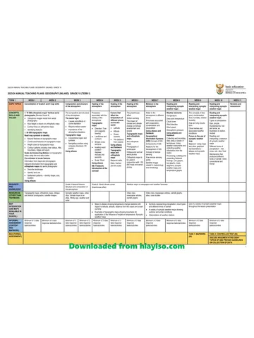
Gr 10 Geo ATP 2023 24
Question paper and memo
Geography Grade 10 Free State March Test 2025 Paper & Memo
Question paper and memo
Geography Grade 10 Paper 1 Limpopo June 2025 Paper & Memo
Question paper and memo
Geography Grade 10 Eastern Cape June 2024 Paper & Memo
Addendum