
Downloaded from hlayiso.com
NATIONAL
SENIOR CERTIFICATE
GRADE 12
SEPTEMBER 2024
GEOGRAPHY P2
MARKS: 150
TIME: 3 hours
This question paper consists of 17 pages.
Hosted by www.ecexams.co.za.
Skip to contentAll 2024 papers 



View all




Geography Grade 12 P2 Eastern Cape Prelim 2024 QP (Eng)
Grade 12 Geography Paper 2 question paper from the Eastern Cape Prelim Exam 2024 (English), 17 pages. Read online or download the free PDF.
Geography · Grade 12 · Eastern Cape Prelim Exam · 2024 · English. Question paper, 17 pages. Read online or download the PDF.
- Subject
- Geography
- Grade
- Grade 12
- Language
- English
- Document type
- Question paper
- Year
- 2024
- Exam period
- Eastern Cape Prelim Exam
- Paper
- 2
- Curriculum
- CAPS
- Pages
- 17
- File size
- 2.8 MB
Free to read online, no sign-up needed
Loading document…
Loading document…
1 of 17
This exam
Eastern Cape Prelim Exam 2024
Questions in this paper
- Question 1.1Rural and urban settlements8 marks
- Question 1.2Rural and urban settlements7 marks
- Question 1.3Rural and urban settlements15 marks
- Question 1.4Rural and urban settlements15 marks
- Question 1.5Rural and urban settlements15 marks
- Question 2.1Economic geography of South Africa7 marks
Show all 13 questions
Document textSearch extracted text and jump to a page.
Downloaded from hlayiso.com
2 GEOGRAPHY P2 (EC/SEPTEMBER 2024)
INSTRUCTIONS AND INFORMATION
1. This question paper consists of TWO SECTIONS.
SECTION A:
QUESTION 1: Rural and urban settlements (60)
QUESTION 2: Economic geography of South Africa (60)
SECTION B:
QUESTION 3: Geographical skills and techniques (30)
2. Answer all THREE questions.
3. ALL diagrams are included in the QUESTION PAPER.
4. Leave a line between subsections of questions answered.
5. Start EACH question at the top of a NEW page.
6. Number the questions correctly according to the numbering system used in
this question paper.
7. Do NOT write in the margins of the ANSWER BOOK.
8. Draw fully labelled diagrams when instructed to do so.
9. Answer in FULL SENTENCES, except when you have to state, name, identify
or list.
10. Units of measurement MUST be indicated in your final answer, e.g.
1 020 hPa, 14 °C and 45 m.
11. You may use a non-programmable calculator.
12. You may use a magnifying glass.
13. Write neatly and legibly.
SPECIFIC INSTRUCTIONS AND INFORMATION FOR SECTION B
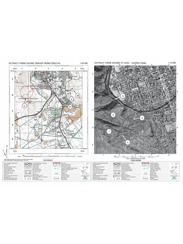
14. A 1 : 50 000 topographical map of 2527DB HARTBEESPOORT and a
orthophoto map 1 : 10 000 2527DB 23HARTBEESPOORT of a part of the
mapped area are provided.
15. The area demarcated in RED/BLACK on the topographic map represents the
area covered by the orthophoto map.
16. Marks will be allocated for steps in calculations.
17. You must hand in the topographical and the orthophoto map to the invigilator
at the end of this examination session.
Copyright reserved Please turn over
Hosted by www.ecexams.co.za.
Downloaded from hlayiso.com
(EC/SEPTEMBER 2024) GEOGRAPHY P2 3
SECTION A: RURAL AND URBAN SETLEMENTS AND THE ECONOMIC
GEOGRAPHY OF SOUTH AFRICA
QUESTION 1: RURAL AND URBAN SETTLEMENT
1.1 The sketch below shows the classification of rural settlements. Match the
descriptions in QUESTIONS 1.1.1 to 1.1.8 with letters A‒F. Write only the
letters (A‒F) next to the question numbers (1.1.1 to 1.1.8) in the ANSWER
BOOK, for example 1.1.9 G. Letters can be repeated.
[Source: Examiner’s own sketch]
1.1.1 A wet-point settlement.
1.1.2 A nucleated settlement that relies on a primary economic activity.
1.1.3 An isolated settlement that is an easy target for criminals.
1.1.4 A star-shaped crossroad settlement.
1.1.5 A farmstead that requires large amounts of capital.
1.1.6 A T-shaped settlement.
1.1.7 A settlement that is linear in shape.
1.1.8 A settlement located in a meander loop for security reasons. (8 x 1) (8)
Copyright reserved Please turn over
Hosted by www.ecexams.co.za.
Downloaded from hlayiso.com
4 GEOGRAPHY P2 (EC/SEPTEMBER 2024)
1.2 Various options are provided as possible answers to the following questions.
Choose the answer and write only the letter (A‒D) next to the question
numbers (1.2.1 to 1.2.7) in the ANSWER BOOK, for example 1.2.8 D.
Refer to the sketch below showing the urban hierarchy to answer
QUESTIONS 1.2.1 to 1.2.3.
[Adapted from: www.buddinggeographers.com/rural-and-urban-settlement]
1.2.1 Settlements are ranked according to …
A function.
B population.
C range.
D shape.
1.2.2 In comparison to a town, a city has a … population with … functions.
(i) larger
(ii) smaller
(iii) fewer
(iv) more
A (i) and (iii)
B (ii) and (iii)
C (i) and (iv)
D (ii) and (iv)
1.2.3 A megalopolis is characterised by:
A Being plentiful in a specific area
B Being the least complex
C Conurbations growing and joining together
D Having the smallest population
Copyright reserved Please turn over
Hosted by www.ecexams.co.za.
Downloaded from hlayiso.com
(EC/SEPTEMBER 2024) GEOGRAPHY P2 5
Refer to the sketch showing range and total population in different settlements
to answer QUESTIONS 1.2.4 and 1.2.5.
1.2.4 The range for low-order goods and services is smallest in a …
A town.
B city.
C metropolis.
D village.
1.2.5 The type of urban settlement that serves the highest number of
people.
A Town
B City
C Metropolis
D Village
Refer to the sketch below showing the central place theory to answer
QUESTIONS 1.2.6 and 1.2.7.
[Adapted from https://geography.name/classical-central-place-theory]
1.2.6 The lowest order settlement place is the … central place.
A first order
B second order
C third order
D fourth order
Copyright reserved Please turn over
Hosted by www.ecexams.co.za.
Downloaded from hlayiso.com
6 GEOGRAPHY P2 (EC/SEPTEMBER 2024)
1.2.7 The … central place has the largest sphere of influence.
A first order
B second order
C third order
D fourth order (7 x 1) (7)
1.3 Refer to the extract below on land reform as a rural settlement issue.
WHY SOUTH AFRICA’S LAND REFORM POLICIES ARE FAILING
The government has spent over R56 billion towards buying property for land
restitution efforts since 1994. This significant amount of money highlights the
importance the government places on land reform in post-apartheid South
Africa.
Through land restitution programmes, beneficiaries have the potential to
develop agricultural farms, driving rural development through increased
employment, wealth creation and economic growth.
However, there appears to be inadequate success of land reform
programmes. Arguably, this has not been due to financial constraints as
billions of funds have been allocated to it. The primary causes are attributed
to the failure of policy implementation and provision of post-settlement
support to beneficiaries.
[Adapted from www.foodformzansi.co.za/]
1.3.1 What is land restitution? (1 x 2) (2)
1.3.2 How much money has the South African government spent on land
restitution since 1994? (1 x 1) (1)
1.3.3 According to the extract, what are the benefits of well-managed land
restitution? (2 x 1) (2)
1.3.4 Why is the success of land reform programmes a social justice issue?
(1 x 2) (2)
1.3.5 In a paragraph of approximately EIGHT lines, suggest strategies that
government can put into place to provide post-settlement support to
beneficiaries. (4 x 2) (8)
Copyright reserved Please turn over
Hosted by www.ecexams.co.za.
Downloaded from hlayiso.com
(EC/SEPTEMBER 2024) GEOGRAPHY P2 7
1.4 Refer to the sketch and photographs showing an urban profile.
[Examiner’s own sketch]
1.4.1 The residential area A is a (high/low)-income residential area. (1 x 1) (1)
1.4.2 What evidence shows that land-use zone (answer to
QUESTION 1.4.1) is compatible with the land-use zones around it?
(2 x 1) (2)
1.4.3 Account for land-use zone (B) being located on the outskirts. (2 x 2) (4)
1.4.4 Why is the greenbelt an important land-use in the urban profile?
(2 x 2) (4)
1.4.5 Explain why the CBD, despite its central location in this urban profile,
is no longer as accessible to consumers (customers). (2 x 2) (4)
Copyright reserved Please turn over
Hosted by www.ecexams.co.za.
Downloaded from hlayiso.com
8 GEOGRAPHY P2 (EC/SEPTEMBER 2024)
1.5 Refer to the urban issue of urban sprawl.
JOHANNESBURG IS A TIMEBOMB AS URBAN SPRAWL CONTINUES
The urban sprawl, which has given birth to new ‘cities’ such as Waterfall City,
Steyn City and Cosmo City, was always going to be a part of Johannesburg.
Being South Africa’s economic hub, Johannesburg has more than tripled its
physical footprint in the past 30 years and is expected to become a ‘megacity’
by 2030.
In reality, the rapid urbanisation worldwide is creating more cities like
Johannesburg, and the environmental costs are mounting. The problem with
the urban sprawl in South Africa is that people living on the periphery bear the
cost of the state’s failure to plan for the rapid urbanisation.
[Adapted from www.news24.com/fin24/money/property/johannesburg]
1.5.1 Give evidence from the sketch that urban sprawl has taken place.
(1 x 1) (1)
1.5.2 What is the main cause of rapid urbanisation? (1 x 2) (2)
1.5.3 How has rapid urbanisation contributed to urban sprawl? (1 x 2) (2)
1.5.4 Why do local authorities find it difficult to control urban sprawl?
(2 x 2) (4)
1.5.5 What unfavourable environmental conditions are caused by urban
sprawl in the rural-urban fringe? (3 x 2) (6)
[60]
Copyright reserved Please turn over
Hosted by www.ecexams.co.za.
Downloaded from hlayiso.com
(EC/SEPTEMBER 2024) GEOGRAPHY P2 9
QUESTION 2: ECONOMIC GEOGRAPHY OF SOUTH AFRICA
2.1 Refer to the map and data based on coal mining. Complete the statements in
COLUMN A with the options in COLUMN B. Write only X or Z next to question
numbers (2.1.1 to 2.1.7) in the ANSWER BOOK, e.g. 2.1.8 Z.
COAL MINING 2022 2023
Direct employees 91 790 94 531
Employee earnings (billions) R32,1 R33,9
Production (million tonnes) 230,1 228,5
Total sales (billions) R2 347 R1 922
[Adapted from mineralscouncil.org.za/sa-mining/coal]
COLUMN A COLUMN B
2.1.1 The province accounting for over 80% X Mpumalanga
of coal production. Z Gauteng
2.1.2 The main coal-port terminal through X Port Elizabeth
which coal is exported. Z Richards Bay
2.1.3 The main use of coal in the PWV X electricity generation
industrial region is for … Z steel production
2.1.4 Physical factors favouring coal mining:X Cheap, abundant labour
Z Shallow, high-quality coal
2.1.5 The process of coal beneficiation is X primary
classified as a … economic activity. Z secondary
2.1.6 From 2022 to 2023 there has been a/an X decrease
… of 2,9% in direct employment. Z increase
2.1.7 The 2022–2023 trend in coal sales will X positively
… affect foreign exchange earnings. Z negatively
(7 x 1) (7)
Copyright reserved Please turn over
Hosted by www.ecexams.co.za.
Downloaded from hlayiso.com
10 GEOGRAPHY P2 (EC/SEPTEMBER 2024)
2.2 The photographs below show examples of different industries. Match each
description in QUESTIONS 2.2.1 to 2.2.8 with the photographs. Write only OIL
REFINERY or BAKERY next to the question numbers (2.2.1 to 2.2.8) in the
ANSWER BOOK, for example 2.2.9 Bakery.
[Source: https://www.iol.co.za/business-report/economy]
2.2.1 Break of bulk industry
2.2.2 Large-scale mass production
2.2.3 Occupies a small area of land
2.2.4 Located on urban periphery
2.2.5 Market oriented industry
2.2.6 Relies on road transportation
2.2.7 Associated with low levels of pollution
2.2.8 Requires larger amounts of energy and water (8 x 1) (8)
Copyright reserved Please turn over
Hosted by www.ecexams.co.za.
Downloaded from hlayiso.com
(EC/SEPTEMBER 2024) GEOGRAPHY P2 11
2.3 Refer to the infographic on beef farming in South Africa.
PROVINCIAL BEEF
PRODUCTION (%)
Western Cape 4%
Northern Cape 3,6%
North West 12,8%
Mpumalanga 9,6%
Limpopo 7,2%
Kwa-Zulu Natal 20%
Gauteng 2%
Free State 16,8%
Eastern Cape 24%
[Adapted from http: webapps1.daff.gov.za]
With 80% of South Africa’s agricultural land considered to be suitable for extensive grazing,
beef farming contributes to 34,1% to the total domestic agricultural production. But recently
South Africa’s beef industry has been hit with increased operational costs and the spread of
disease such as foot-and-mouth.
Fortunately, beef exports in 2024 are set to increase following Saudi Arabia’s decision in 2023
to lift the ban on beef products from South Africa. The opening of this new export market will
positively affect the country’s economy.
[Adapted from www.arc.agric.za/]
2.3.1 Identify the TWO provinces that contribute the highest percentages to
South Africa’s beef production. (2 x 1) (2)
2.3.2 State the general trend with regard to South Africa’s beef exports
between 2019 to 2023, as shown on the graph. (1 x 1) (1)
2.3.3 Give evidence from the extract that in recent years the South African
beef industry was negatively influenced (affected) by:
(a) A physical factor
(b) An economic factor (2 x 1) (2)
2.3.4 How can small-scale beef farming contribute to household food
security? (2 x 2) (4)
2.3.5 Why will a new beef export market positively affect the country’s
economy? (3 x 2) (6)
Copyright reserved Please turn over
Hosted by www.ecexams.co.za.
Downloaded from hlayiso.com
12 GEOGRAPHY P2 (EC/SEPTEMBER 2024)
2.4 Refer to the extract and map on the Saldanha Bay Industrial Development Zone
(IDZ).
INFRASTRUCTURE INVESTMENT: KEY FOR ECONOMIC DEVELOPMENT
The Saldanha Bay Industrial Development (IDZ) is located within the port of
Saldanha Bay, the largest natural, deep-water port in the Southern Hemisphere.
The provision of world-class port infrastructure, specifically designed to attract
investments, is dedicated to maritime, energy, logistics and engineering
industries.
Recently, the access road to the IDZ, at a cost of R24 million, was completed
and will provide a more direct road for industrial traffic to the IDZ with improved
mobility and safety.
[Adapted from businesstech.co.za]
2.4.1 In which province is the Saldanha Bay IDZ located? (1 x 1) (1)
2.4.2 From the extract, state TWO industries that the IDZ’s port infrastructure
supports. (2 x 1) (2)
2.4.3 What positive social contributions do these industries (answer to
QUESTION 2.4.2) make? (2 x 2) (4)
2.4.4 Explain how the infrastructure makes industries more competitive in
the South-Western Cape industrial region. (4 x 2) (8)
Copyright reserved Please turn over
Hosted by www.ecexams.co.za.
Downloaded from hlayiso.com
(EC/SEPTEMBER 2024) GEOGRAPHY P2 13
2.5 Refer to the extract on the informal sector.
SOUTH AFRICA’S INFORMAL SECTOR IS BOOMING
The South Africa informal sector, estimated to be valued at R750 billion, has
always played a vital role in absorbing South Africa’s large unemployed
population, providing a living for those who cannot find a job and supplementing
the income of those on low wages.
The South African informal sector is dominated by spaza shops* estimated to be
worth around R180 billion annually. With more than 150 000 spaza shops,
research shows that around 11,1 million South African’s do their grocery shopping
at these stores, citing convenience and lower prices as the main pull factor.
The informal economy is growing strongly, and it is estimated that the growth of
its retail sector to be almost double that of its formal counterpart.
Glossary:
A spaza shop is an informal convenience shop business, usually run from home.
[Adapted from https://dailyinvestor.com/south-africa/56895/south-africas-hidden-r750-billion-
economy]
2.5.1 What is an informal sector? (1 x 2) (2)
2.5.2 How much is the estimated value of the South African informal sector?
(1 x 1) (1)
2.5.3 According to the extract, how does the informal sector benefit South
African consumers (shoppers)? (2 x 1) (2)
2.5.4 Why are spaza shops easy businesses to own? (2 x 1) (2)
2.5.5 How will the growth of spaza shops benefit South Africa’s formal sector?
(2 x 2) (4)
2.5.6 Explain the economic challenges faced by spaza shop owners in South
Africa. (2 x 2) (4)
[60]
TOTAL SECTION A: 120
Copyright reserved Please turn over
Hosted by www.ecexams.co.za.
Downloaded from hlayiso.com
14 GEOGRAPHY P2 (EC/SEPTEMBER 2024)
SECTION B
QUESTION 3: GEOGRAPHICAL SKILLS AND TECHNIQUES
GENERAL INFORMATION ON HARTBEESPOORT
N
Coordinates: 25°43′32″S 27°50′54″E
Hartbeespoort, informally also known as “Harties”, is a small resort town in the North
West Province of South Africa, situated on the banks of the Hartbeespoort Dam.
Hartbeespoort is the collective name of a few smaller towns situated around the
Hartbeespoort, including the towns of Meerhof, Ifafi, Melodie, Schoemansville, and
Kosmos. A number of high-income residential estates can be found alongside its
shores.
Because of its location (approximately 35 kilometers north west of Johannesburg and
20 kilometers west of Pretoria), Hartbeespoort has become a very popular holiday and
weekend destination. It is the principal water recreation area of Northern Gauteng and
many types of water sports are enjoyed on the dam.
[Source: https://en.wikipeda.org/wiki/Hartbeespoort]
The following English terms and their translations are shown on the topographic map:
ENGLISH AFRIKAANS
Golf course Gholfbaan
Holiday resort Vakansie-oord
Copyright reserved Please turn over
Hosted by www.ecexams.co.za.
Downloaded from hlayiso.com
(EC/SEPTEMBER 2024) GEOGRAPHY P2 15
3.1 MAP SKILLS AND CALUCATIONS
3.1.1 Hartbeespoort is classified as a(n) … specialised town.
A mining
B military
C resort
D industrial (1)
3.1.2 Johannesburg is in a(n) … direction from Haartbeespoort.
A north-westerly
B easterly
C westerly
D south-easterly (1)
Refer to the topographical map to answer QUESTION 3.1.3 to 3.1.5.
3.1.3 Calculate the true bearing from trigonometrical station 66 in block A5 to
spot height 1465 in block B3. (1 x 1) (1)
3.1.4 The magnetic declination in 2024 is 24°46’ west of true north.
Use your answer from QUESTION 3.1.3 to calculate the present magnetic
bearing from trigonometrical station 66 in block A5 to spot height 1465 in
block B3. (2 x 1) (2)
3.1.5 Why will the magnetic bearing in 2024, between these two points, be
larger than in 2017? (1 x 1) (1)
Refer to 1 and 2 on the orthophoto map.
3.1.6 Which graph (Y or Z) represents the cross-profile of 1 to 2? (1 x 1) (1)
3.1.7 Calculate the vertical exaggeration (VE) of the cross profile if the vertical
scale is 1 cm represents 20 m.
(3 x 1) (3)
Copyright reserved Please turn over
Hosted by www.ecexams.co.za.
Downloaded from hlayiso.com
16 GEOGRAPHY P2 (EC/SEPTEMBER 2024)
3.2 MAP INTERPRETATION
Refer to blocks A1 and A2 on the topographical map
3.2.1 What is the dominant primary economic activity? (1 x 1) (1)
3.2.2 Name TWO site factors that favoured the primary economic activity
(answer to QUESTION 3.2.1). (2 x 1) (2)
Refer to the demarcated area X (in blocks C1 and C2) on the topographical map
and the photograph below which shows the same area (X) to answer
QUESTIONS 3.2.3 and 3.2.4.
HOLIDAY
RESORT
GOLF
COURSE
YACHT
JETTY
[Adapted from https://www.google.com/map]
3.2.3 Name ONE tertiary activity that is associated with the Hartbeespoort
Dam. (1 x 1) (1)
3.2.4 How does this tertiary activity contribute to the area’s economy?
(1 x 2) (2)
Refer to the built-up area of Kosmos at Y (blocks C2 and C3) on the
topographical map.
3.2.5 Identify ONE characteristic of the irregular (planned) street pattern.
(1 x 1) (1)
3.2.6 How has this street pattern accommodated the surrounding natural
environment? (1 x 2) (2)
Refer to the Pecanwood Golf Estate (D3 and E3) on the topographical map.
3.2.7 Based on what attraction feature has this high-income residential estate
been built? (1 x 1) (1)
3.2.8 What social factor has contributed to the growing trend of gated
communities such as Peacanwood Golf Estate? (1 x 2) (2)
Copyright reserved Please turn over
Hosted by www.ecexams.co.za.
Downloaded from hlayiso.com
(EC/SEPTEMBER 2024) GEOGRAPHY P2 17
3.3 GEOGRAPHICAL INFORMATION SYSTEMS (GIS)
Refer to the photograph showing a plot of land for sale (Z in block B5 on the
topographical map).
[Adapted from www.remax.co.za/property/for-sale/south-africa/north-west/hartbeespoort/]
3.3.1 The photograph is a (vertical / oblique) aerial photograph. (1 x 1) (1)
3.3.2 What is remote sensing? (1 x 2) (2)
3.3.3 The photograph is a (raster or vector) image. (1 x 1) (1)
3.3.4 What type of spatial object is the demarcated plot that is for sale?
(1 x 1) (1)
3.3.5 The R511 road is a tarred road. From this statement, what attribute
data can be obtained? (1 x 1) (1)
3.3.6 Explain why an urban developer, who is interested in expanding the
shopping centre, would choose to use an aerial photograph (such as
this one) to obtain more information. (1 x 2) (2)
[30]
TOTAL: 150
Copyright reserved Please turn over
Hosted by www.ecexams.co.za.
Study this subject
Recommended for this subject
Question paper
Geography Grade 12 P2 Eastern Cape Mock 2018 QP (Eng)
Memorandum
Geography Grade 12 Gauteng June 2024 Memo (English)
Memorandum
Geography Grade 12 P1 Gauteng Prelim 2024 Memo (English)
Memorandum
Geography Grade 12 P2 Eastern Cape Mock 2022 Memo (English)
Memorandum
Geography Grade 12 P2 Eastern Cape Mock 2020 Memo (English)
Memorandum
Geography Grade 12 P2 Eastern Cape Mock 2018 Memo (English)
More from Grade 12 Geography
Memorandum
Geography Grade 12 Paper 2 Gauteng Mock 2025 Memo
Memorandum
Geography Grade 12 Paper 1 NSC November 2025 Memo (English)
Question paper
Geography Grade 12 P1 GP Prelim 2023 Question Paper (Eng)
Memorandum
Geography Grade 12 Paper 1 KZN Prelim 2023 Memo
Question paper
Geography Grade 12 Paper 2 KZN Prelim 2023 Question Paper
Question paper