
Mock
hlayiso mock exams
Practice Series:
Grade 10 Exam Preparation
WWW.HLAYISO.COM
NATIONAL
SENIOR CERTIFICATE
GRADE 10
GEOGRAPHY P2
NOVEMBER EXAMINATION 2026 (MOCK)
MARKS: 150
TIME: 3 hours
This question paper consists of 14 pages.
Copyright reserved Please turn over
Skip to contentAll 2026 papers 
View all
Geography Grade 10 P2 November Mock Exam 2 2026 QP (Eng)
Grade 10 Geography Paper 2 question paper from the November Mock Exam 2 2026 (English), 14 pages. Read online or download the free PDF.
Geography · Grade 10 · November Mock Exam 2 · 2026 · English. Question paper, 14 pages. Read online or download the PDF.
- Subject
- Geography
- Grade
- Grade 10
- Language
- English
- Document type
- Question paper
- Year
- 2026
- Exam period
- November Mock Exam 2
- Paper
- 2
- Publisher
- Hlayiso
- Curriculum
- CAPS
- Pages
- 14
- File size
- 167.6 KB
Free to read online, no sign-up needed
Loading document…
Loading document…
1 of 14
This exam
November Mock Exam 2 2026
- Paper 1Question paperAddendumMemo
- Paper 2Question paperAddendumMemo
Document textSearch extracted text and jump to a page.
Geography/P2 2 Hlayiso/Mock 2026
NSC Mock
INSTRUCTIONS AND INFORMATION
1. This question paper consists of TWO sections.
SECTION A
QUESTION 1: POPULATION (60)
QUESTION 2: WATER RESOURCES (60)
SECTION B
QUESTION 3: GEOGRAPHICAL SKILLS AND TECHNIQUES (30)
2. Answer ALL THREE questions.
3. ALL diagrams are included in the QUESTION PAPER.
4. Leave a line between the subsections of questions answered.
5. Start EACH question at the top of a NEW page.
6. Number the answers correctly according to the numbering system used in this question
paper.
7. Do NOT write in the margins of the ANSWER BOOK.
8. Draw fully labelled diagrams when instructed to do so.
9. Answer in FULL SENTENCES, except when you have to state, name, identify or list.
10. Units of measurement MUST be indicated in your final answer, e.g. 1 020 hPa, 14 ◦ C
and 45 m.
11. You may use a non-programmable calculator.
12. You may use a magnifying glass.
13. Write neatly and legibly.
SPECIFIC INSTRUCTIONS AND INFORMATION FOR SECTION B
14. An extract from the 1 : 50 000 topographical map 3025AD PHILIPPOLIS and an extract
from the 1 : 10 000 orthophoto map 3025AD 01 PHILIPPOLIS are provided on one
A3 sheet, supplied with this mock as Geography Gr10 P2 Mock 2026 Map (3025AD
Philippolis). The map sheet was first used in the Eastern Cape Grade 12 September
2022 (preparatory) examination. Print it on A3 paper at 100% (actual size).
15. The area demarcated in RED on the topographical map represents the area covered
by the orthophoto map.
16. Ignore the letters and numbers already printed on the maps (e.g. F, S, T and 1), unless
a question refers to them.
17. Show ALL calculations. Marks will be allocated for steps in calculations.
Copyright reserved Please turn over
Geography/P2 3 Hlayiso/Mock 2026
NSC Mock
SECTION A: POPULATION AND WATER RESOURCES
QUESTION 1: POPULATION
1.1 Choose the term/concept in COLUMN B that matches the description
in COLUMN A. Write only the letter (A–I) next to the question numbers
(1.1.1 to 1.1.8) in the ANSWER BOOK, e.g. 1.1.9 J.
COLUMN A COLUMN B
1.1.1 The scientific study of the size, A ecumene
structure and growth of human
populations
1.1.2 The parts of the earth’s surface B urbanisation
that are permanently inhabited by
people
1.1.3 The number of babies per 1 000 C remittances
live births who die before their first
birthday
1.1.4 An intense dislike or fear of people D demography
from other countries
1.1.5 The movement of people from one E infant mortality rate
place to another within the borders
of the same country
1.1.6 A person who has fled his or F internal migration
her country and has applied for
protection, but whose refugee
status has not yet been decided
1.1.7 An increase in the percentage of G xenophobia
a country’s population that lives in
towns and cities
1.1.8 Money that migrant workers send H asylum seeker
back to their families in their home
areas
I birth rate
(8 x 1) (8)
Copyright reserved Please turn over
Geography/P2 4 Hlayiso/Mock 2026
NSC Mock
1.2 Refer to the population pyramids of Country A and Country B below.
Write only A or B next to the question numbers (1.2.1 to 1.2.7) in the
ANSWER BOOK, e.g. 1.2.8 B.
COUNTRY A Age COUNTRY B
Males Females (years) Males Females
65+
60–64
55–59
50–54
45–49
40–44
35–39
30–34
25–29
20–24
15–19
10–14
5–9
0–4
8 4 0 0 4 8 8 4 0 0 4 8
Percentage of population Percentage of population
[Source: Examiner’s own sketch (fictional countries)]
1.2.1 The country with the highest birth rate
1.2.2 The country with the highest life expectancy
1.2.3 The population pyramid that is regressive (contracting)
1.2.4 A typical less economically developed country (LEDC)
1.2.5 The government must spend most of its budget on schools and
child health care
1.2.6 The country with the largest percentage of elderly dependants
(65 years and older)
1.2.7 The country where most women are educated, work outside the
home and use family planning (7 x 1) (7)
Copyright reserved Please turn over
Geography/P2 5 Hlayiso/Mock 2026
NSC Mock
1.3 Refer to the graph below showing the growth of the world’s population
from 1800 to 2050.
11
10 9,7
9
8,2
8
World population
7
6,1
6
(billions)
5
4,1
4
3 2,5
2 1,6
1,0 1,2
1
0
1800 1850 1900 1950 1975 2000 2025 2050*
Year (* projected)
Note: the intervals are not equal (50-year steps up to 1950, then 25-year steps)
[Source: Adapted from United Nations world population estimates and
projections (rounded figures)]
1.3.1 Define the term population explosion. (1 x 2) (2)
1.3.2 What was the world’s population in 1950? (1 x 1) (1)
1.3.3 Calculate the increase in the world’s population between 1950
and 2025. Show your calculation. (2 x 1) (2)
1.3.4 Explain why the world’s population grew so rapidly after 1950. (2 x 2) (4)
1.3.5 Explain TWO negative impacts of rapid population growth on
the natural resources of a country. (2 x 2) (4)
1.3.6 Suggest ONE strategy that governments of countries with very
high birth rates can use to slow down population growth. (1 x 2) (2)
Copyright reserved Please turn over
Geography/P2 6 Hlayiso/Mock 2026
NSC Mock
1.4 Refer to the table and extract below on the population of Country K, a
fictional highly developed country.
Population indicator 1990 2025
Birth rate (per 1 000 per year) 14,0 7,5
Death rate (per 1 000 per year) 9,0 11,5
Life expectancy (years) 74 84
Population aged 0–14 years (%) 21 11
Population aged 15–64 years (%) 67 60
Population aged 65 years and older (%) 12 29
FEWER BABIES, MORE GRANDPARENTS
In Country K schools in small towns are closing because there are
too few children, while the demand for old-age homes, nurses and
pensions keeps rising. Most young couples live in small city
apartments, both partners work long hours and raising a child is
very expensive. Many couples marry late and decide to have only
one child or none at all. Factories now struggle to find enough
young workers.
[Source: Examiner’s own data and extract (fictional country)]
1.4.1 What is meant by an ageing population? (1 x 2) (2)
1.4.2 Calculate the natural increase (as a percentage) of Country K
in 2025. Show your calculation.
Birth rate − Death rate
Formula: Natural increase (%) = (2 x 1) (2)
10
1.4.3 Use your answer to QUESTION 1.4.2 to state whether the
population of Country K is growing or declining naturally. (1 x 1) (1)
1.4.4 Calculate the dependency ratio of Country K in 2025. Show
your calculation.
% 0–14 yrs + % 65 + yrs
Formula: Dependency ratio = × 100 (2 x 1) (2)
% 15–64 yrs
1.4.5 Explain, with reference to the extract, why the birth rate of
Country K is so low. (2 x 2) (4)
1.4.6 Explain TWO economic problems that an ageing population
creates for the government of Country K. (2 x 2) (4)
Copyright reserved Please turn over
Geography/P2 7 Hlayiso/Mock 2026
NSC Mock
1.5 Refer to the extract below on refugees in South Africa.
A NEW LIFE, BUT NOT WITHOUT FEAR
Amani (28) was a teacher in a country in Central Africa. When
armed groups attacked her town, burnt the school and threatened
families who refused to join them, she fled with her two children.
They travelled for six weeks by bus and on foot before reaching
South Africa, where she applied for asylum. While she waits for her
papers, she sells fruit at a taxi rank in Durban because she may not
teach in South African schools. Last year a crowd accused
foreigners of “taking our jobs” and looted several shops owned by
foreign nationals near the rank. Amani’s stall was not damaged, but
her children were too afraid to go to school for a week. “I did not
come here to take anything,” she says. “I came here to stay alive.”
[Source: Examiner’s own extract (fictional person)]
1.5.1 Distinguish between a refugee and an economic migrant. (1 x 2) (2)
1.5.2 Give TWO push factors from the extract that forced Amani to
leave her country. (2 x 1) (2)
1.5.3 Is Amani an internal or an international migrant? (1 x 1) (1)
1.5.4 Explain ONE reason why some South Africans blame foreign
nationals for their problems, as suggested in the extract. (1 x 2) (2)
1.5.5 In a paragraph of approximately EIGHT lines, suggest ways
in which the government and local communities can reduce
xenophobia and help refugees to live safely in South Africa. (4 x 2) (8)
[60]
Copyright reserved Please turn over
Geography/P2 8 Hlayiso/Mock 2026
NSC Mock
QUESTION 2: WATER RESOURCES
2.1 Refer to the diagram below showing the hydrological (water) cycle.
Choose the correct process from the list below for each of the processes
labelled A to G in the diagram. Write only the term next to the question
numbers (2.1.1 to 2.1.7) in the ANSWER BOOK, e.g. 2.1.8 interception.
evaporation; condensation; precipitation; surface run-off;
infiltration; transpiration; groundwater flow; sublimation;
interception
wind
B
C
F
A E
D
water table
OCEAN G
[Source: Examiner’s own sketch (not to scale)]
2.1.1 A
2.1.2 B
2.1.3 C
2.1.4 D
2.1.5 E
2.1.6 F
2.1.7 G (7 x 1) (7)
Copyright reserved Please turn over
Geography/P2 9 Hlayiso/Mock 2026
NSC Mock
2.2 Various options are provided as possible answers to the following
questions. Choose the answer and write only the letter (A–D) next to
the question numbers (2.2.1 to 2.2.8) in the ANSWER BOOK, e.g. 2.2.9
D.
2.2.1 A layer of permeable rock that stores groundwater is a/an …
A aquifer.
B estuary.
C reservoir.
D wetland.
2.2.2 The upper level of the saturated zone below the ground surface
is the …
A watershed.
B water table.
C floodplain.
D river bed.
2.2.3 Collecting rainwater from roofs and storing it in tanks for later
use is called …
A desalination.
B irrigation.
C rainwater harvesting.
D water recycling.
2.2.4 South Africa is regarded as a water-scarce country mainly
because …
A its rivers are very long.
B it has low and unreliable rainfall and high evaporation.
C it is surrounded by oceans.
D it has too many dams.
2.2.5 The longest river in South Africa is the … River.
A Limpopo
B Vaal
C Thukela
D Orange
2.2.6 An example of a waterborne disease is …
A malaria.
B cholera.
C tuberculosis.
D HIV.
Copyright reserved Please turn over
Geography/P2 10 Hlayiso/Mock 2026
NSC Mock
2.2.7 Limits that a municipality places on the use of water during a
drought are known as water …
A restrictions.
B harvesting.
C transfers.
D tariffs.
2.2.8 The farming of fish, mussels and oysters in sea water is known
as …
A overfishing.
B irrigation.
(8 x 1) (8)
C mariculture.
D trawling.
2.3 Refer to the extract below on water supply in a fictional municipality.
DRY TAPS IN MABALENG
For the third week in a row, residents of Mabaleng have had running
water for only a few hours a day. The municipality blames old pipes
that burst and leak, pumps that break down during power cuts and
illegal connections. It also says that many households and
businesses do not pay their water accounts, so there is too little
money for repairs. Poor households that are registered with the
municipality are entitled to 6 000 litres (6 kl) of free basic water per
month, but in the informal settlement on the edge of town families
still queue at a single tanker or collect water from the river.
Meanwhile, the local dam is only 30% full after a dry summer.
[Source: Examiner’s own extract (fictional municipality)]
2.3.1 Give TWO causes of the water shortage in Mabaleng,
according to the extract. (2 x 1) (2)
2.3.2 How much free basic water is a registered poor household
entitled to each month? (1 x 1) (1)
2.3.3 Explain ONE health risk for families who collect water from the
river. (1 x 2) (2)
2.3.4 Why is it difficult for municipalities to provide free basic water
to all poor households? (1 x 2) (2)
2.3.5 In a paragraph of approximately EIGHT lines, suggest ways
in which the municipality and the residents of Mabaleng can
conserve water and secure a reliable water supply in the future. (4 x 2) (8)
Copyright reserved Please turn over
Geography/P2 11 Hlayiso/Mock 2026
NSC Mock
2.4 Refer to the graph below showing the annual catch of a fish species (Fish
X) off the coast of South Africa.
100
81
80 75
Catch
62
60 58
41
(thousand tonnes)
40 33
27
20
0
2000 2004 2008 2012 2016 2020 2024
Year
[Source: Examiner’s own data (fictional fish stock)]
2.4.1 Define the term overfishing. (1 x 2) (2)
2.4.2 In which year was the catch of Fish X the highest? (1 x 1) (1)
2.4.3 Calculate the percentage decrease in the catch of Fish X
between 2008 and 2024. Show your calculation. (2 x 1) (2)
2.4.4 State TWO causes of overfishing. (2 x 1) (2)
2.4.5 Explain how the decline in fish stocks will affect people living in
coastal fishing communities. (2 x 2) (4)
2.4.6 Suggest TWO measures that the government can use to
ensure that fish stocks are used sustainably. (2 x 2) (4)
Copyright reserved Please turn over
Geography/P2 12 Hlayiso/Mock 2026
NSC Mock
2.5 Refer to the storm hydrograph below. It shows the rainfall and the
discharge of a river at a town during a storm that started at 06:00.
Rainfall
70 0
60 peak discharge 10
River discharge (m3 /s)
50 20 (mm per hour)
bankfull discharge
40
30
20
10 base flow
0
06:00 12:00 18:00 00:00 06:00 12:00 18:00 00:00
Time (24-hour clock; minor ticks every 3 hours)
[Source: Examiner’s own sketch (fictional river)]
2.5.1 What is meant by the lag time of a storm hydrograph? (1 x 2) (2)
2.5.2 Use the hydrograph to determine the lag time of this storm.
Show how you obtained your answer. (2 x 1) (2)
2.5.3 Did the river overflow its banks during the storm? Give evidence
from the hydrograph. (1 x 1) (1)
2.5.4 Explain how the lag time would change if large parts of the
river’s catchment were covered by new roads and buildings. (1 x 2) (2)
2.5.5 Explain how dams and wetlands in the catchment can reduce
the risk of floods downstream. (2 x 2) (4)
2.5.6 Discuss TWO ways in which floods have a negative impact on
people living in the town. (2 x 2) (4)
[60]
TOTAL SECTION A: 120
Copyright reserved Please turn over
Geography/P2 13 Hlayiso/Mock 2026
NSC Mock
SECTION B
QUESTION 3: GEOGRAPHICAL SKILLS AND TECHNIQUES
GENERAL INFORMATION ON PHILIPPOLIS
Co-ordinates: 30◦ 16′ S; 25◦ 16′ E
Philippolis is a small town in the southern Free State. It was founded in 1823 as a mission
station and is regarded as the oldest town in the Free State. The surrounding area is
semi-arid, with low and unreliable summer rainfall, and most farms keep sheep and cattle.
Farms and settlements depend largely on boreholes, windpumps and small dams for their
water. Like many small Karoo towns, Philippolis has few job opportunities, and many young
people leave to look for work and further education in larger cities.
[Adapted from various sources]
The following Afrikaans terms appear on the orthophoto map:
AFRIKAANS ENGLISH
Verklaring Reference (key)
Kontoertussenruimte Contour interval
Windpomp Windpump
Reservoir Reservoir
3.1 MAP SKILLS AND CALCULATIONS
3.1.1 Philippolis is located in the … province.
A Eastern Cape
B Northern Cape
(1 x 1) (1)
C Free State
D North West
3.1.2 The index of the 1 : 50 000 map sheet directly SOUTH of
3025AD is …
A 3025AC.
B 3025BC.
(1 x 1) (1)
C 3025CA.
D 3025CB.
3.1.3 The contour interval of the topographical map is …
A 5 m.
B 10 m.
(1 x 1) (1)
C 20 m.
D 100 m.
3.1.4 Calculate the straight-line distance in kilometres (km) from
trigonometrical station 249 (block A2) to trigonometrical station
275 (block D4) on the topographical map.
Formula: Actual distance = Map distance × Map scale (2 x 1) (2)
3.1.5 Determine the true bearing of trigonometrical station 275 (block
D4) from trigonometrical station 251 (block B2, on the boundary
with C2) on the topographical map. (1 x 2) (2)
Copyright reserved Please turn over
Geography/P2 14 Hlayiso/Mock 2026
NSC Mock
3.1.6 Use the information below the topographical map to calculate
the magnetic declination of Philippolis for 2026. Show ALL
calculations.
Difference in years:
Mean annual change:
(5 x 1) (5)
Total change:
Magnetic declination for 2026:
3.2 MAP INTERPRETATION
3.2.1 Name TWO sources of water that farmers in the mapped area
use, as shown on the topographical map. (2 x 1) (2)
3.2.2 Refer to the settlement of Waterkloof in block D3 on
the topographical map. Explain why many households in
Waterkloof have their own reservoirs. (1 x 2) (2)
3.2.3 Give ONE piece of evidence from block D3 on the topographical
map that some people have moved away from Waterkloof. (1 x 1) (1)
3.2.4 Explain TWO negative effects on small farming settlements,
such as Waterkloof and Langkloof (block C4), when young
people leave them to live in large cities. (2 x 2) (4)
3.2.5 Refer to the orthophoto map. Compare the density of houses in
Poding-tse-Rolo (blocks B4 and C4) with the density of houses
in the older part of Philippolis (block D2), and give ONE piece
of evidence from the orthophoto map for your answer. (2 x 1) (2)
3.3 GEOGRAPHICAL INFORMATION SYSTEMS (GIS)
3.3.1 Define the term remote sensing. (1 x 2) (2)
3.3.2 The orthophoto map is an example of (raster/vector) data. (1 x 1) (1)
3.3.3 Name TWO components of a GIS. (2 x 1) (2)
3.3.4 Identify ONE point feature and ONE polygon feature in block
D3 on the topographical map. (2 x 1) (2)
[30]
TOTAL SECTION B: 30
GRAND TOTAL: 150
Copyright reserved
Study this subject
Recommended for this subject
Question paper
Geography Grade 10 P2 National November 2018 QP (Eng)
Question paper
Geography Grade 10 P2 National November 2017 QP (Eng)
Addendum
Geography Grade 10 P2 Eastern Cape November 2020 Addendum
Memorandum
Geography Grade 10 P2 Eastern Cape November 2020 Memo (Eng)
Memorandum
Geography Grade 10 P2 Eastern Cape November 2019 Memo (Eng)
Memorandum
Geography Grade 10 P2 National November 2019 Memo (English)
More from Grade 10 Geography
Study guide
Gr10 Geografie OG studyguide LR
Annual teaching plan
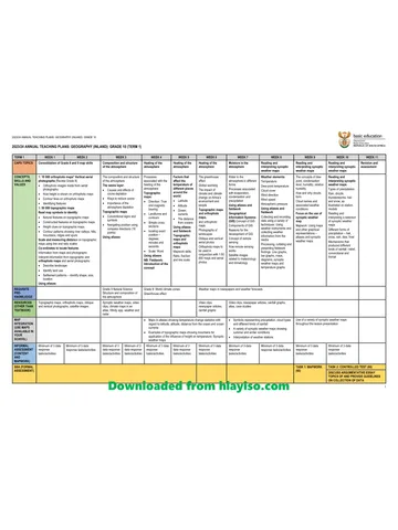
Gr 10 Geo ATP 2023 24
Question paper and memo
Geography Grade 10 Free State March Test 2025 Paper & Memo
Question paper and memo
Geography Grade 10 Paper 1 Limpopo June 2025 Paper & Memo
Question paper and memo
Geography Grade 10 Eastern Cape June 2024 Paper & Memo
Addendum