
Downloaded from hlayiso.com
KZN DEPARTMENT OF EDUCATION
JUNE EXAMS - 2015
GEOGRAPHY - GRADE 10 PAPER TWO
EXAMINER: R Ranganathan
MODERATOR: F.Paruk
DURATION: 1% HOURS MAX. MARKS: 60
NAME OF LEARNER: GR.DIV: _
INSTRUCTIONS TO CANDIDATES:
1. Check that this paper has } printed pages and 4 questions.
2. Answer all questions in the spaces provided on the question
paper.
8. You are supplied with 1:50000 topographical map 3424BB
HUMANSDORP and an orthophoto map. Refer to both maps.
. Show all calculations.
5. Write neatly and legibly. |
EN
P.t.o. QUESTION ONE
Py
Pio fe Wy 2
Skip to contentAll 2015 papers 
View all
Geography Grade 10 Paper 2 KZN June 2015 Paper & Memo
Grade 10 Geography Paper 2 question paper and memo from the KZN June Exam 2015, 12 pages. Read online or get the free PDF download.
Geography · Grade 10 · KZN June Exam · 2015. Question paper and memorandum, 12 pages. Read online or download the PDF.
- Subject
- Geography
- Grade
- Grade 10
- Document type
- Question paper and memo
- Year
- 2015
- Exam period
- KZN June Exam
- Paper
- 2
- Curriculum
- CAPS
- Pages
- 12
- File size
- 690.0 KB
Free to read online, no sign-up needed
Loading document…
Loading document…
1 of 12
This exam
KZN June Exam 2015
- Paper 1Paper and memo
- Paper 2Paper and memo
Document textSearch extracted text and jump to a page.
Downloaded from hlayiso.com
QUESTION ONE
Choose the correct answer and write down only the letter of the correct
answer in the block next to the question.
1.1. The reference number of the topographical map directly north
west of the map 3424BB Humansdorp is...
B) 3324DC
B) 8424BA
C) 3325CC
D) 3324DD
1.2. The landform found at P( B11) isa
A) rocky outcrop
B) cape
C) sandy beach
D) coastal rock
1.3. The contour interval of the topographical map is
A) 10x
B) 5m
C) 20m
D) 2m.
1.4. The scale of the orthophoto map is ..... than that of the
topographical map.
A) 5 times larger
B) 5 times smaller
C) 10 times larger
D) 15 times larger
O UU U
Pz
Pro bh 3
7)
Downloaded from hlayiso.com
1,5 The type of slope numbered 8-6 on the orthophoto map is a
slope.
A) concave
B) convex
C) steep
D) gentle
a
1.6 Anorthophotomapisa___ photograph with a map scale of
1:10000
A) Vertical aerial
B) High oblique
C) Low oblique
D) Horizontal
a
1.7 The man made feature numbered 2 on the orthophoto map is
a/an.
A) cemetery
B) dam
C) excavation
D) cultivated land
a
1.8 The type of road that links Humansdorp and Knysna on the
orthophoto map is
A) Arterial road
B) Secondary road
C) Other road.
D) Main road
(8)
Pz
PTo te lai
Downloaded from hlayiso.com sas
QUESTION TWO [Mapwork calculations] (16 marks)
2.1. A group of learners decide to embark on a hiking expedition from
Humansdorp at trignometrical station A140 (block B3) and proceed to
A139(block A5).
2.1.1. In what direction will they be travelling? (2)
2.1.2, Calculate the true bearing of the start of the hike from A139(A5).
(4)
2.1.3. Calculate the magnetic bearing of A140(B3) from A1 39(A5). for July 2001
(4)
2.2. State the grid reference of A294(Block F1).
(4)
Ps
Downloaded from hlayiso.com
2.3. Calculate the straight line distance between R(D4) and $(A7) in ;
kilometers. (3)
Total (17)
QUESTION THREE
Analysis and interpretation of Topographical maps and orthophoto map.
3.1. Identify the type of map projection in both orthophoto and topographical
map. (2)
3.2.1 Identify the landform marked 3-4 on the orthophoto map.
(2)
3.2. 2 Draw a simple cross — section of the land form marked 3-4 that you
identified in 3.2.1 Clabel x and Y axis)
(5)
Ps
PTO b&b
Downloaded from hlayiso.com
3.3 Give one significance of the Swartrivier dam to Ashton Bay (E9/10) and its
surrounding areas. (2)
34 Name the ocean on the east coast of Humansdorp and give two significances
of this ocean to the people living in Humansdorp.
Name: (2)
Significance
i) (2)
it x (2)
3.5 Differentiate between vertical aerial photographs and oblique photographs.
(4)
3.6 State one advantage of oblique photographs
(2)
(Total = 23) “
Pe
Pro th F
Downloaded from hlayiso.com
QUESTION FOUR - GIS (12 Marks )
4.1. Define the following terms:
a) GIS
(2)
b) Remote Sensing
(2)
4.2. Give two reasons for the development of GIS.
i (2)
ii (2)
4.3. Differentiate between vector and raster data maps.
Vector Data
Raster Data
2x2= (4)
[ TOTAL MARKS = 60] .
(iz
Pz GREENBURY SECONDARY SCHOOL
DEPARTMENT OF HSS
H.0.D, MAD RAMAS AM
tk edi
(2406 jis
Downloaded from hlayiso.com
Downloaded from hlayiso.com
-_7F ee ee _.
3. MB = TB 4 Mp Mp tr geo! ~ 25%9'w of tw.
TB = [Orie
= 255°" — MB = 255° 445°
= 290°29/ Ww of “TN. -
4 y bo Is v.60 | Aru: 34°05/23 "e 3445 24 el
at 7 3; |
a3" 2 ag Tgglea le egal.
lAcun. ov. |x OS
123,
= _—
= Thu. _. ee _
QR
Downloaded from hlayiso.com
a6. Vertoe! — Dechy “above — Refindicale_ fo gaind Cao oy Be
| Ohge Angle — Toy Secb-Ore1s Shafer of bulge fad
Ce ee oe —
£m A A SIC BEY MDE EAI ORS EIONE
= Shafee oP bugs coc Tcl rue con Te recegplted
Downloaded from hlayiso.com
Sh negara Canton
Ad a) CIS _ 4 Systew ee te fet. 2 stormy, L.
__atelisihg © lbh” aagoaphic o a
by Remote Seng dey Tavohes Captureg — clete_ ef
“dace, usually cuter
fe. GIS ais fe h wrechiole cuflge (ai
rf fist upcleted GIS hiked fp Setellde
senmnnene net OG OGES “renrte sensng _
reseed bu.
TRE Le ta 2 a at =
- each poel aa
Downloaded from hlayiso.com
Study this subject
Recommended for this subject
Question paper and memo
Geography Grade 10 Paper 1 KZN June 2015 Paper & Memo
Question paper and memo
Geography Grade 10 March Test 2015 Paper & Memo
Question paper and memo
Geography Grade 10 NSC Prelim 2015 Paper & Memo
Question paper and memo
Geography Grade 10 September Test 2015 Paper & Memo
Question paper and memo
Geography Grade 10 P2 KwaZulu Natal June 2017 Paper & Memo
Question paper and memo
Geography Grade 10 P2 KwaZulu Natal June 2016 Paper & Memo
More from Grade 10 Geography
Study guide
Gr10 Geografie OG studyguide LR
Annual teaching plan
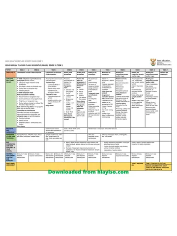
Gr 10 Geo ATP 2023 24
Question paper
Geography Grade 10 P1 North West November 2024 QP (Eng)
Question paper
Geography Grade 10 P2 North West November 2024 QP (Eng)
Question paper
Geography Grade 10 Gauteng March Test 2023 QP (Afr)
Question paper