
Downloaded from hlayiso.com
NATIONAL
SENIOR CERTIFICATE
GRADE 11
NOVEMBER 2016
GEOGRAPHY P1
MARKS: 225
TIME: 3 hours
*IGEOGE1*
This question paper consists of 16 pages.
Skip to contentAll 2016 papers 
View all

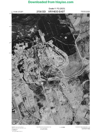
Geography Grade 11 P1 Eastern Cape November 2016 QP (Eng)
Grade 11 Geography Paper 1 question paper from the Eastern Cape November 2016 (English), 16 pages. Read online or download the free PDF.
Geography · Grade 11 · Eastern Cape November · 2016. Question paper, 16 pages. Read online or download the PDF.
- Subject
- Geography
- Grade
- Grade 11
- Document type
- Question paper
- Year
- 2016
- Exam period
- Eastern Cape November
- Paper
- 1
- Curriculum
- CAPS
- Pages
- 16
- File size
- 892.2 KB
Free to read online, no sign-up needed
Loading document…
Loading document…
1 of 16
This exam
Questions in this paper
- Question 1.1The Atmosphere8 marks
- Question 1.2Geomorphology7 marks
- Question 1.3The Atmosphere16 marks
- Question 1.4The Atmosphere14 marks
- Question 1.5Geomorphology15 marks
- Question 1.6Geomorphology15 marks
Show all 24 questions
- Question 2.1The Atmosphere7 marks
- Question 2.2Geomorphology8 marks
- Question 2.3The Atmosphere15 marks
- Question 2.4The Atmosphere15 marks
- Question 2.5Geomorphology13 marks
- Question 2.6Geomorphology17 marks
- Question 3.1Development geography16 marks
- Question 3.2Development geography14 marks
- Question 3.3Development geography15 marks
- Question 3.4Development geography15 marks
- Question 3.5Resources and sustainability15 marks
- Question 3.6Resources and sustainability15 marks
- Question 4.1Development geography7 marks
- Question 4.2Resources and sustainability8 marks
- Question 4.3Development geography16 marks
- Question 4.4Development geography14 marks
- Question 4.5Resources and sustainability13 marks
- Question 4.6Resources and sustainability17 marks
Document textSearch extracted text and jump to a page.
Downloaded from hlayiso.com
2 GEOGRAPHY P1 (EC/NOVEMBER 2016)
INSTRUCTIONS AND INFORMATION
1. This question paper consists of four questions.
2. Answer any THREE questions of 75 marks each.
3. All diagrams are included in the ANNEXURE.
4. Number the questions correctly according to the numbering system used in this
question paper. Number all your questions in the CENTRE of the line.
5. Leave a line between subsections of questions answered.
6. Start EACH question on a NEW page.
7. Do NOT write in the margins of the ANSWER BOOK.
8. Illustrate your answers with labelled diagrams, where possible.
9. Mark allocation is as follows: 2 × 1 = 2 means that TWO facts are required for
ONE mark each
2 × 2 = 4 means that TWO facts are required for
TWO marks each
10. If words/action verbs like Name, Identify, Provide, Classify, are used in a
question, ONE word answers are acceptable.
If words/action verbs like Discuss, Define, Explain, Comment, Evaluate,
Justify, Suggest and Substantiate are used in a question, FULL sentences or
phrases are required.
All paragraph questions must be answered in FULL sentences.
11. Write neatly and legibly.
Copyright reserved Please turn over
Downloaded from hlayiso.com
(EC/NOVEMBER 2016) GEOGRAPHY P1 3
SECTION A: PHYSICAL GEOGRAPHY: THE ATMOSPHERE AND
GEOMORPHOLOGY
Answer at least ONE question in this section. If you answer ONE question in
SECTION A, you MUST answer TWO questions from SECTION B.
QUESTION 1
1.1 FIGURE 1.1 is a synoptic weather map, compiled during a particular season.
Various options are given as possible answers to the multiple-choice questions
below. Choose the correct answer and write only the letter (A to D) next to the
question number (1.1.1 to 1.1.8) in your ANSWER BOOK.
1.1.1 Air pressure is measured in …
A millimetres.
B millibars.
C degrees celsius.
D kilometre per hour.
1.1.2 The lines which depict atmospheric pressure on synoptic weather maps
are known as …
A isotherms.
B isohyets.
C isobars.
D contours.
1.1.3 The atmospheric pressure reading at the letter A, is approximately …
hectopascals.
A 1028
B 1030
C 1024
D 1000
1.1.4 The air movement around weather system B is …
A clockwise.
B anticlockwise.
C descending.
D out blowing.
1.1.5 The atmospheric pressure system being depicted by the letter C is a …
A wedge.
B trough.
C saddle.
D low pressure.
Copyright reserved Please turn over
Downloaded from hlayiso.com
4 GEOGRAPHY P1 (EC/NOVEMBER 2016)
1.1.6 The atmospheric pressure systems A and D are part of the … belt.
A polar high pressure
B sub-polar low pressure
C sub-tropical high pressure
D equatorial low pressure
1.1.7 The winds at weather station E are geostrophic because …
A the high pressure dominates the movement of air.
B it is overcast at both weather stations.
C coriolis force and pressure gradient force are in balance.
D the weather stations are very close to one another.
1.1.8 The synoptic weather map represents summer conditions in South Africa
because of the following indicators on the map. Choose the indicator
that does NOT fit.
A High temperatures over the interior
B ITCZ is on the Tropic of Cancer
C Low pressure over the interior
D High pressure systems moved more southwards (8 × 1) (8)
1.2 Provide the names of the intrusive igneous rock that the descriptions below refer
to. Write only the letter (A to F) from the sketch (FIGURE 1.2) next to the
question number (1.2.1 to 1.2 7). A letter may be used more than once, for e.g.
1.2.8 G.
1.2.1 The Bushveld igneous complex is an example of this intrusion.
1.2.2 This intrusion is still connected to the magma chamber.
1.2.3 Provide the letter that represents a sill.
1.2.4 Solitary hills are being exposed after exogenous forces removed the top
layers.
1.2.5 The landform that occurs after extrusive igneous activity.
1.2.6 The intrusion that developed because of the weight of the overlaying
strata on the magma.
1.2.7 One of the characteristics of this intrusion is that it has a mushroom
shape. (7 × 1) (7)
Copyright reserved Please turn over
Downloaded from hlayiso.com
(EC/NOVEMBER 2016) GEOGRAPHY P1 5
1.3 Use the information in FIGURE 1.3 showing global air circulation and answer the
questions that follow.
1.3.1 Name the air pressure belt at A. (1 × 1) (1)
1.3.2 Identify the wind belt at B. (1 × 1) (1)
1.3.3 Explain why the wind at B moves in a westerly direction. (1 × 2) (2)
1.3.4 Explain the role of the winds at B in the development of the
cumulonimbus clouds. (2 × 2) (4)
1.3.5 In a paragraph of approximately EIGHT lines discuss how the air
circulation cell at C developed. (4 × 2) (8)
1.4 Read the article, Agriculture minister has renewed hope SA will survive drought,
FIGURE 1.4 and answer the following questions.
1.4.1 What is a drought? (1 × 1) (1)
1.4.2 Differentiate between a meteorological and agricultural drought. (1 + 1) (2)
1.4.3 Name ONE short term effect, mentioned in the article, that the drought
has on the economy of South Africa. (1 × 1) (1)
1.4.4 Explain what the Minister meant when he stated that the “drought has hit
the poorest the hardest”. (2 × 2) (4)
1.4.5 Suggest THREE ways how the government can help to manage the
negative consequences of droughts in South Africa. (3 × 2) (6)
1.5 Study FIGURE 1.5 providing information of the Deccan plateau which is a
basaltic plateau in India and answer the questions that follow.
1.5.1 What type of rocks are associated with basaltic mountains? (1 × 1) (1)
1.5.2 Name the mountain ranges on either side of the Deccan plateau.
(2 × 1) (2)
1.5.3 How do basaltic plateaus originate? (2 × 2) (4)
1.5.4 Line A on the photo represents the height of the mountain range.
Explain why the height stayed the same over time. (1 × 2) (2)
1.5.5 Explain why basaltic plateaus receive low rainfall. (1 × 2) (2)
1.5.6 Evaluate the economic importance of horizontal landscapes like the
basaltic plateaus. (2 × 2) (4)
Copyright reserved Please turn over
Downloaded from hlayiso.com
6 GEOGRAPHY P1 (EC/NOVEMBER 2016)
1.6 Study FIGURE 1.6, which illustrate tors and answer the questions that follows:
1.6.1 Name ONE igneous intrusion that tors can originate from. (1 × 1) (1)
1.6.2 What is the rocks at A known as during the process of tor formation?
(1 × 1) (1)
1.6.3 Name the type of igneous rock that A consists of. (1 × 1) (1)
1.6.4 Comment on the reasons as to why there is a difference in the current
height of the surface although the original height was the same. (2 × 2) (4)
1.6.5 In a paragraph of approximately EIGHT lines, explain how tors develop.
(4 × 2) (8)
[75]
Copyright reserved Please turn over
Downloaded from hlayiso.com
(EC/NOVEMBER 2016) GEOGRAPHY P1 7
QUESTION 2
2.1 Study the sketch, FIGURE 2.1, which indicates the development of Föhn winds.
Choose the correct answer between brackets to make the statement true. Write
ONLY the correct answer next to the question number (2.1.1 to 2.1.7), for
e.g. 2.1.8 climatology
2.1.1 The descending air at A is on the (windward/leeward) side of the
mountain.
2.1.2 The lapse rate at B is called the (wet adiabatic/dry adiabatic) lapse rate.
2.1.3 The lapse rate at C is (0,5 ⁰C per 100 m/1 ⁰C per 100 m).
2.1.4 The dew point temperature is reached at approximately (500 m/800 m).
2.1.5 The air temperature at D will be (16 ⁰C/18 ⁰C).
2.1.6 The continent where the Föhn wind occurs is (North America/Europe).
2.1.7 A similar type of wind as the one at A occurs on the coastal regions of
South Africa, and is called a (berg wind/chinook). (7 × 1) (7)
2.2 FIGURE 2.2 is a sketch which depicts structural landscapes found in horizontally
layered and inclined strata. Choose the correct letter between brackets which
represents the feature being described. Write ONLY the letter from the sketch
next to the question number (2.2.1 to 2.2.8), for e.g. 2.2.9 Geomorphology.
2.2.1 Landform (A/B) is known as a butte.
2.2.2 Homoclinal ridges are found at (D/E).
2.2.3 The landform at (F/G) is associated with inclined strata.
2.2.4 (X/Y) is the dip slope of the landform at D.
2.2.5 The landforms at (A/D) developed out of a canyon landscape.
2.2.6 The rocks at (X/Y) are less resistant.
2.2.7 Forestry will occur at (X/Y).
2.2.8 Scarp retreat will dominate at (C/D). (8 × 1) (8)
Copyright reserved Please turn over
Downloaded from hlayiso.com
8 GEOGRAPHY P1 (EC/NOVEMBER 2016)
2.3 FIGURE 2.3 is a representation of monsoon conditions over the sub-continent of
India.
2.3.1 What is the ITCZ? (1 × 1) (1)
2.3.2 Explain how the ITCZ plays a role in the formation of monsoon
conditions over India. (2 × 2) (4)
2.3.3 Why does the wind at A change direction from south east to south west?
(2 × 2) (4)
2.3.4 Comment on the fact that the summer monsoon is both a blessing and
a curse for the people of India. (3 × 2) (6)
2.4 FIGURE 2.4 is a cartoonist’s impression of the atmospheric conditions regarding
the El-Niño occurrence. Refer to the images to answer the following questions.
2.4.1 Name the global winds represented by the blowing of the person in the
sketch. (1 × 1) (1)
2.4.2 Explain the role that these winds (answer to QUESTION 2.4.1) play in
the development of the El-Niño occurrence. (2 × 2) (4)
2.4.3 Discuss how the shifting of the clouds influences the farming activities
in countries like Australia and Indonesia around A. (1 × 2) (2)
2.4.4 In a paragraph of approximately 8 lines, evaluate the impact of the
different upwelling situations in the sketches, on the fishing industry of
Chili and Peru at B. (4 × 2) (8)
2.5 Study FIGURE 2.5, showing the different slope elements, and answer the
questions that follow.
2.5.1 Identify the slope element at A and provide the type of mass movement
that will dominate on this slope. (1 + 1) (2)
2.5.2 Name the geomorphological process responsible for the formation of
the talus slope. (1 × 1) (1)
2.5.3 Explain why the talus slope maintains a constant gradient. (1 × 2) (2)
2.5.4 Comment on the difference between vegetation covers at B and C
respectively. (2 × 2) (4)
2.5.5 Evaluate the impact of slope B for human activity. (2 × 2) (4)
Copyright reserved Please turn over
Downloaded from hlayiso.com
(EC/NOVEMBER 2016) GEOGRAPHY P1 9
2.6 Different types of mass movements are being illustrated by FIGURE 2.6. Refer
to the sketches and answer the questions that follow.
2.6.1 Define the term mass movement. (1 × 1) (1)
2.6.2 Comment on the possible cause of this type of mass movement
at A. (1 × 2) (2)
2.6.3 Explain how the deforestation at B increased the mass movement
illustrated on the sketch. (1 × 2) (2)
2.6.4 Comment on the dangers that the type of mass movement at C has for
the people living at the base of the slope. (2 × 2) (4)
2.6.5 In a paragraph of approximately eight lines, discuss strategies you
would implement to stabilise the area at C. (4 × 2) (8)
[75]
Copyright reserved Please turn over
Downloaded from hlayiso.com
10 GEOGRAPHY P1 (EC/NOVEMBER 2016)
SECTION B: DEVELOPMENT AND NATURAL RESOURCES
Answer at least ONE question from this section. If you answer ONE question from
SECTION B, you MUST answer TWO questions from SECTION A.
QUESTION 3
3.1 FIGURE 3.1 shows the different stages of Rostow’s economic development
model. Name the stage of the model that the following descriptions refer to.
ONLY write the correct stage next to question number (3.1.1 to 3.1.8) for e.g.
3.1.9 Rostow.
3.1.1 Agriculture becomes commercialised and industrialised.
3.1.2 Number of people working in agriculture decreases.
3.1.3 Rapid urbanisation occurs.
3.1.4 Little capital for development.
3.1.5 Production of consumer goods increases.
3.1.6 A country with a human development index (HDI) of 0,9.
3.1.7 Number and type of industries increase.
3.1.8 Subsistence agricultural economy dominates. (8 × 1) (8)
3.2 Choose a term from COLUMN B that matches the description in COLUMN A.
Write only word the letter (A to H) next to the question number (3.2.1 to 3.2.7),
for e.g. 3.2.8 J.
COLUMN A COLUMN B
3.2.1 The amount of carbon a person contributes to A Thermal
polluting the atmosphere through his/her daily energy
lifestyle.
3.2.2 A substance that releases atomic radiation. B Kinetic energy
3.2.3 Conference of the United Nations regarding C Carbon footprint
climate change in Durban.
3.2.4 Energy which is released when heat is D Conventional
transferred from one source to another. energy sources
3.2.5 Stored energy which is released due to E Radioactive
movement.
3.2.6 The measures taken to regulate the type and F COP 17
amount of energy being used.
3.2.7 Consists of fossil fuels and other non-renewable G Energy
resources. management
H Kyoto protocol
(7 × 1) (7)
Copyright reserved Please turn over
Downloaded from hlayiso.com
(EC/NOVEMBER 2016) GEOGRAPHY P1 11
3.3 Refer to FIGURE 3.3, illustrating the inequalities in development between
developing and developed countries.
3.3.1 How do the illustrations depict inequality in development? (1 × 1) (1)
3.3.2 Name TWO living conditions illustrated by the cartoonist regarding
people in developing countries. (2 × 1) (2)
3.3.3 By using the information on the sketches, differentiate between the
countries by referring to ONE economic indicator and TWO social
indicators of development. (3 × 2) (6)
3.3.4 Use both the sketches and the triangular graph to answer the following
questions.
(a) Which of the letters on the graph (X or Y) represents the workforce
of developed countries? (1 × 2) (2)
(b) Explain your answer to QUESTION 3.3.4(a). (2 × 2) (4)
3.4 The extract and map in FIGURE 3.4 shows contradictory viewpoints on
globalisation and multinational corporations. Study these viewpoints carefully
and answer the following questions.
3.4.1 What is a multinational corporation? (1 × 1) (1)
3.4.2 Name TWO negative viewpoints that people have of multinational
corporations according to the extract. (2 × 1) (2)
3.4.3 Explain the contradictory (opposing) viewpoints regarding globalisation
illustrated in the extract and map. (2 × 2) (4)
3.4.4 In a paragraph of approximately eight lines, evaluate the positive impact
that multinational corporations might have on improving both the
economy and services of Third World countries. (4 × 2) (8)
3.5 The illustrations in FIGURE 3.5 show methods being used to prevent soil
erosion.
3.5.1 Name the soil erosion prevention practices at A and B respectively.
(2 × 1) (2)
3.5.2 Why is soil a non-renewable resource? (1 × 1) (1)
3.5.3 Explain TWO advantages of method A in protecting the soil. (2 × 2) (4)
3.5.4 The sustainable management of soil erosion is important for countries
like South Africa. Discuss in a paragraph of approximately EIGHT lines
the negative effects that soil erosion will have on the broader economy
of South Africa. (4 × 2) (8)
Copyright reserved Please turn over
Downloaded from hlayiso.com
12 GEOGRAPHY P1 (EC/NOVEMBER 2016)
3.6 The extract in FIGURE 3.6 comes from president Zuma’s, State of the Nations
Address of 2015.
3.6.1 Name ONE short and medium term plans the government wants to
implement to deal with South Africa’s electricity challenges. (1 × 1) (1)
3.6.2 “The longterm plan involves finalising our long-term energy security
masterplan”, according to president Zuma. Explain TWO measures that
should be included in such a ‘masterplan’ to increase the energy output
in South Africa. (2 × 2) (4)
3.6.3 Eskom is forced to use load shedding as a measure to reduce the burden
on power stations. Discuss the effects that loadshedding has on small
businesses. (2 × 2) (4)
3.6.4 The use of diesel generators by Eskom, to fill the gap when power supply
runs low, is common practice. Evaluate how sustainable this process is
for the country as a whole. (3 × 2) (6)
[75]
Copyright reserved Please turn over
Downloaded from hlayiso.com
(EC/NOVEMBER 2016) GEOGRAPHY P1 13
QUESTION 4
4.1 Provide the term from the list below, which matches the descriptions with the
questions that follow. Write ONLY the correct term next to the question number
(4.1.1 to 4.1.7), for e.g. 4.1.8 Development.
Embargo Humanitarian aid Import quotas
Balance of trade Bilateral aid Economic development
Protectionism Balance of payment
4.1.1 The ability of a country to have access to its resources to create
economic wealth.
4.1.2 The balance between the monetary value of a country’s exports and
imports.
4.1.3 Restrictions put on imported goods, regarding its weight, volume and
amount.
4.1.4 The import of goods from other countries is restricted.
4.1.5 Trade blockages are used to prevent the influx of commodities that might
threaten local production.
4.1.6 Direct aid from one country to another.
4.1.7 Aid for individuals or countries in times of natural disasters or civil
conflict. (7 × 1) (7)
`
4.2 FIGURE 4.2 are sketches of different energy sources for electricity/power
generation. Various options are given as possible answers to the multiple-
choice questions below. Choose the correct answer and write only the letter
(A to D) next to the question number (4.2.1 to 4.2.8) in your ANSWER BOOK.
4.2.1 Which of the sources is not a renewable resource?
A Biomass
B Water
C Natural gas
D Wind
4.2.2 Which type of electricity is produced in volcanic areas where the heat of
the rocks is used to create enough energy?
A Petroleum
B Coal
C Geo thermal
D Hydroelectricity
Copyright reserved Please turn over
Downloaded from hlayiso.com
14 GEOGRAPHY P1 (EC/NOVEMBER 2016)
4.2.3 Provide the name of the energy which produces ethanol fuel through the
use of sugar and maize.
A Biomass
B Geo thermal
C Nuclear power
D Thermal power
4.2.4 Which of the following sources is not a fossil fuel?
A Oil
B Natural gas
C Uranium
D Coal
4.2.5 Where panels are used to produce electrical energy.
A Coal
B Solar
C Geo thermal
D Wind
4.2.6 The source which produces nuclear energy.
A Uranium
B Coal
C Petroleum
D Natural gas
4.2.7 Which of the following sources has high potential, but is currently
underutilised in South Africa?
A Uranium
B Coal
C Water
D Geo thermal
4.2.8 Which of the sources causes more acid rain in urban areas?
A Natural gas
B Biomass
C Uranium
D Coal (8 × 1) (8)
Copyright reserved Please turn over
Downloaded from hlayiso.com
(EC/NOVEMBER 2016) GEOGRAPHY P1 15
4.3 Read the extract on Fair trade (FIGURE 4.3) and answer the following questions.
4.3.1 Define the term Fair trade. (1 × 1) (1)
4.3.2 Name ONE way in which fair trade benefits farmers in developing
countries. (1 × 1) (1)
4.3.3 Explain how fair trade can help consumers reduce poverty, through
everyday shopping, as stated in the extract. (1 × 2) (2)
4.3.4 Discuss TWO similarities between fair trade and free trade. (2 × 2) (4)
4.3.5 To be certified as fair trade, producers need to maintain good
environmental protection when developing sustainable agriculture. In a
paragraph of approximately eight lines, provide FOUR criteria that
producers need to maintain, to uphold environmental standards in fair
trade. (4 × 2) (8)
4.4 Study FIGURE 4.4, a bar graph depicting the gender differences between
working minutes in some countries, and answer the following questions.
4.4.1 What is gender equality? (1 × 1) (1)
4.4.2 Which country shows a fair balance between paid and unpaid working
minutes for women? (1 × 1) (1)
4.4.3 Discuss visible characteristics shown on the graph regarding paid and
unpaid working minutes between men and women. (2 × 2) (4)
4.4.4 Comment on the attitude by some governments of third world countries
towards women’s access to resources. (2 × 2) (4)
4.4.5 Explain why women are important to the economic development of third
world countries. (2 × 2) (4)
4.5 The photo, FIGURE 4.5, illustrates the non-sustainable use of a resource. Use
the photo to answer the following questions.
4.5.1 Which term is used to describe the process in the photo? (1 × 1) (1)
4.5.2 Explain why the resource in the photo, can be seen as a renewable
resource. (1 × 2) (2)
4.5.3 Why do you think the use of the resource as observed (seen) on the
photo can be seen as resource depletion rather than resource
exploitation? (1 × 2) (2)
4.5.4 Discuss the impact that this non-sustainable use of the resource will
have on the environment. (2 × 2) (4)
4.5.5 How can the resource in the photo help the local community with
economic development? (2 × 2) (4)
Copyright reserved Please turn over
Downloaded from hlayiso.com
16 GEOGRAPHY P1 (EC/NOVEMBER 2016)
4.6 Refer to the diagram, FIGURE 4.6, illustrating the different power plants
contributing to the national grid in South Africa.
4.6.1 Name the types of power stations A, B and C respectively. (3 × 1) (3)
4.6.2 From the sketch, identify TWO uses of electricity in South Africa.
(2 × 1) (2)
4.6.3 Discuss the impact of power station B on the environment. (2 × 2) (4)
4.6.4 Use the diagram which shows how power is generated at B to explain in
a paragraph of eight lines, the process of generating thermal
electricity. (4 × 2) (8)
[75]
TOTAL: 225
Copyright reserved Please turn over
Study this subject
Recommended for this subject
Question paper
Geography Grade 11 P1 Eastern Cape November 2016 QP (Afr)
Question paper
Geography Grade 11 P1 Eastern Cape November 2016 QP (Afr)
Question paper
Geography Grade 11 P1 Eastern Cape November 2016 QP (Eng)
Memorandum
Geography Grade 11 P1 Eastern Cape November 2016 Memo (Afr)
Question paper
Geography Grade 11 P2 Eastern Cape November 2016 QP (Afr)
Question paper
Geography Grade 11 P1 Eastern Cape November 2022 QP (Eng)
More from Grade 11 Geography
Memorandum
Geography Grade 11 P1 Eastern Cape November 2025 Memo (Eng)
Memorandum
Geography Grade 11 P2 Eastern Cape November 2025 Memo (Eng)
Question paper and memo
Geography Grade 11 Free State March Test 2025 Paper & Memo
Memorandum
Geography Grade 11 P1 Eastern Cape November 2024 Memo (Afr)
Memorandum
Geography Grade 11 P1 Eastern Cape November 2023 Memo (Eng)
Question paper