
Downloaded from hlayiso.com
NATIONAL
SENIOR CERTIFICATE
GRADE 11
NOVEMBER 2013
GEOGRAPHY P1
MARKS: 225
TIME: 3 hours
This question paper consists of 14 pages.
Skip to contentAll 2013 papers 
View all
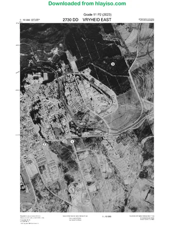
Geography Grade 11 P1 Eastern Cape November 2013 QP (Eng)
Grade 11 Geography Paper 1 question paper from the Eastern Cape November 2013 (English), 16 pages. Read online or download the free PDF.
Geography · Grade 11 · Eastern Cape November · 2013. Question paper, 16 pages. Read online or download the PDF.
- Subject
- Geography
- Grade
- Grade 11
- Document type
- Question paper
- Year
- 2013
- Exam period
- Eastern Cape November
- Paper
- 1
- Curriculum
- CAPS
- Pages
- 16
- File size
- 777.3 KB
Free to read online, no sign-up needed
Loading document…
Loading document…
1 of 16
This exam
Eastern Cape November 2013
Questions in this paper
- Question 1.1The Atmosphere15 marks
- Question 1.2The Atmosphere12 marks
- Question 1.3The Atmosphere18 marks
- Question 1.4Geomorphology16 marks
- Question 1.5Geomorphology14 marks
- Question 2.1The Atmosphere15 marks
Show all 20 questions
- Question 2.2The Atmosphere18 marks
- Question 2.3The Atmosphere12 marks
- Question 2.4Geomorphology16 marks
- Question 2.5Geomorphology14 marks
- Question 3.1Resources and sustainability15 marks
- Question 3.2Development geography14 marks
- Question 3.3Development geography16 marks
- Question 3.4Resources and sustainability14 marks
- Question 3.5Resources and sustainability16 marks
- Question 4.1Resources and sustainability15 marks
- Question 4.2Development geography16 marks
- Question 4.3Development geography14 marks
- Question 4.4Resources and sustainability16 marks
- Question 4.5Resources and sustainability14 marks
Document textSearch extracted text and jump to a page.
Downloaded from hlayiso.com
2 GEOGRAPHY P1 (NOVEMBER 2013)
INSTRUCTIONS AND INFORMATION
1. This question paper consists of TWO sections, namely SECTION A and
SECTION B.
2. Answer THREE questions to be chosen as follows:
ONE question from SECTION A
ONE question from SECTION B
A THIRD question from SECTION A or SECTION B (Which has NOT been
answered already)
3. All diagrams are included in the annexure.
4. Leave a line between subsections answered.
5. Start EACH question on a NEW page.
6. Number the answers correctly according to the numbering system used in this
question paper.
7. Do NOT write in the margins of the ANSWER BOOK.
8. Encircle the numbers of the questions that you have answered on the cover
page of the ANSWER BOOK.
9. Where possible, illustrate your answer with labelled diagrams.
10. Write neatly and legibly.
11. Mark If marks are given as follows – 3 x 2 = 6, it means that
Allocation: THREE facts should be given for TWO marks each.
If marks are given as follows – 3 x 1 = 3, it means that
THREE facts should be given for ONE mark each.
Essay type questions must be answered in FULL
SENTENCES. LISTING will result in marks being deducted.
Downloaded from hlayiso.com
(NOVEMBER 2013) GEOGRAPHY P1 3
SECTION A: PHYSICAL GEOGRAPHY: THE ATMOSPHERE AND
GEOMORPHOLOGY
Answer at least ONE question from this section.
QUESTION 1
1.1 State whether the following statements are TRUE or FALSE. Write only True
or False next to the question number (1.1.1–1.1.15.) for example 1.1.16 True.
1.1.1 The southwest monsoonwinds bring heavy rains to India during the
winter of the North.
1.1.2 El Niño is the change in climate resulting from cooler conditions in
the eastern Pacific Ocean.
1.1.3 The Tropical Rainforest biome is hot throughout the year with high
rainfall.
1.1.4 A föhnwind is a rain-shadow wind warmed by adiabatic descent.
1.1.5 Oceans cool the land when it is hot and warm the land when it is
cold.
1.1.6 A sea breeze is an offshore wind that warms the land during the night
and in winter.
1.1.7 The earth absorbs long-wave heat and radiates short-wave light back
into the atmosphere.
1.1.8 A geostrophic wind blows parallel to the isobars when the pressure
gradient force and Coriolus force are in balance.
1.1.9 Erosion is the slow breakdown of rock that is exposed to the earth’s
atmosphere.
1.1.10 Sheetwash refers to the widespread surface erosion caused by run-
off during heavy rainfall.
1.1.11 A basaltic plateau is a high-lying area produced by the horizontal flow
of lava.
1.1.12 The gentle concave slope at the base of a hill is the pediplain.
1.1.13 A hogsback is a ridge tilted at an angle of more than 45°.
1.1.14 Regolith consists of solid rock and soil.
1.1.15 Solifluction is the slow flow of water-logged soil in cold regions.
(15 x 1) (15)
Downloaded from hlayiso.com
4 GEOGRAPHY P1 (NOVEMBER 2013)
1.2 FIGURE 1.2 illustrates two seasonal positions of the earth. Study the
diagram and answer the following questions.
1.2.1 Give ONE word to describe the path of the earth around the sun.
(1 x 2) (2)
1.2.2 With reference to X, name the specific position of the earth’s path
around the sun in the Northern and Southern Hemispheres
respectively. (2 x 1) (2)
1.2.3 Refer to position Y and give the date and the season when it occurs
in South Africa. (2 x 1) (2)
1.2.4 During the course of the year the areas near the equator receive
more insolation than the areas near the poles.
Explain TWO ways how the surface ocean currents can contribute to
restore the energy balance between these areas. (2 x 3) (6)
1.3 Study the climate graphs of Africa in FIGURE 1.3 to answer the following
questions.
1.3.1 What influences the temperatures to vary by more than 2–3 °C
throughout the year in the equatorial climate zone? (Douala,
Cameroon) (1 x 2) (2)
1.3.2 What factor controls the afternoon temperatures in the equatorial
climate zone? (1 x 2) (2)
1.3.3 Why does the tropical humid climate zone have wet, humid
conditions? (Kampala, Uganda) (1 x 2) (2)
1.3.4 Name the most important factor causing warm, dry descending air
over the desert climate zone. (Sabha, Lybia) (1 x 2) (2)
1.3.5 Explain the factors that cause Khartoum in Sudan to experience
prolonged dry conditons. (Semi-desert climate). (2 x 2) (4)
1.3.6 Write a short paragraph (not more than SIX lines) to explain why the
mid-latitude cyclones bring winter rain to the Mediterranean climate
regions. (Cape Town, South Africa) (3 x 2) (6)
Downloaded from hlayiso.com
(NOVEMBER 2013) GEOGRAPHY P1 5
1.4 Refer to the structural landform, FIGURE 1.4 and answer the following
questions.
1.4.1 Identify the landforms A, B and C and name the process that is
responsible for the formation of these landforms. (4 x 1) (4)
1.4.2 Give ONE difference between landforms B and C. (2 x 1) (2)
1.4.3 Explain why landform E is not suitable for human activities. (2 x 2) (4)
1.4.4 Write a short paragraph (not more than SIX lines) to describe the
human and economic importance of landform D. (3 x 2) (6)
1.5 Refer to the structural landform, FIGURE 1.5 and answer the following
questions.
1.5.1 Explain the process of mass movements. (1 x 2) (2)
1.5.2 Refer to the diagram and mention factors that threaten the stability of
this slope. (2 x 2) (4)
1.5.3 Describe the impact of mass movements on the environment. (2 x 2) (4)
1.5.4 What strategies should be put in place to minimise the impact of mass
movements? (2 x 2) (4)
[75]
QUESTION 2
2.1 Select the correct term in brackets to complete each of the following
statements. Write only the term next to the question number (2.1.1–2.1.15),
for example 2.1.16 Rain.
2.1.1 The long-term change in weather patterns all over the world is called
(global warming/climate change).
2.1.2 (Heat-wave/Drought) is a prolonged period of very hot and dry
weather.
2.1.3 Clear skies are associated with air (subsidence/convergence).
2.1.4 (Jetstreams/Convection streams) are high speed winds that blow in
narrow, ribbon-like bands in the upper tropopause.
2.1.5 (Weather/Climate) describes the changes in conditions of the
atmosphere near the earth’s surface.
2.1.6 A (biome/climate region) is a region that is home to particular kinds
of plants and animals.
Downloaded from hlayiso.com
6 GEOGRAPHY P1 (NOVEMBER 2013)
2.1.7 (Desertification/Diversification) refers to the land degradation in dry
lands that results in loss of soil fertility and biodiversity.
2.1.8 In a homoclinal ridge, the angle of the (dip slope/scarp slope) is
25°–45°.
2.1.9 Soil creep is driven by (water movement/gravity).
2.1.10 The main form of slope retreat in humid regions is (parallel retreat/
slope decline).
2.1.11 Exfoliation is a type of (erosion/weathering).
2.1.12 The slope on which the rock debris collects is called the (talus slope
/scarp slope).
2.1.13 A (laccolith/lopolith) is an intrusion with a flat bottom and a dome-
shaped top.
2.1.14 A (knickpoint/waterfall) marks the sharp change in gradient where
the talus slope and the pediment meets.
2.1.15 (Hilly landscapes/Canyon landscapes) consist of rounded hills and
gentle slopes. (15 x 1) (15)
2.2 Study the diagram, FIGURE 2.2 to answer the following questions.
2.2.1 Name the pressure belts at 0°S, 30°S, 60°S and 90°S as well as the
air circulation cells at 2 and 3. (6 x 1) (6)
2.2.2 Explain how the air circulation cell at number 1 is formed. (2 x 1) (2)
2.2.3 Where on the diagram will the ITCZ be situated? (1 x 1) (1)
2.2.4 Name the global winds that blow between 30°S and 60°S on the
diagram. (1 x 1) (1)
2.2.5 Which forces are responsible for the wind speed and wind direction
of the winds mentioned in QUESTION 2.2.4? (2 x 1) (2)
2.2.6 Write a short paragraph (not more than SIX lines) to discuss the
influence of the winds mentioned in QUESTION 2.2.4 on the
weather conditions in the Western Cape. (3 x 2) (6)
Downloaded from hlayiso.com
(NOVEMBER 2013) GEOGRAPHY P1 7
2.3 Refer to the case study, FIGURE 2.3 to answer the following questions.
2.3.1 Explain what is meant by a drought. (1 x 2) (2)
2.3.2 Give evidence from the extract to suggest that the countries in the
Horn of Africa experience a socio-economic drought. (2 x 1) (2)
2.3.3 Name TWO atmospheric conditions that resulted in the drought in
the Horn of Africa. (2 x 1) (2)
2.3.4 Describe ways how these countries can reduce the effects of
droughts. (2 x 2) (4)
2.3.5 What effect do droughts have on the environment and ecosystems?
(2 x 1) (2)
2.4 Refer to FIGURE 2.4 to answer the following questions.
2.4.1 Identify landforms A and B. (2 x 1) (2)
2.4.2 Name the igneous intrusion from which A and B have formed. (1 x 2) (2)
2.4.3 Briefly explain how A was formed. (3 x 2) (6)
2.4.4 Describe the characteristics of A. (2 x 2) (4)
2.4.5 What type of mass movement would occur if the slope of landform A
is undercut by human excavation? (1 x 2) (2)
2.5 Refer to FIGURE 2.5 based on structural landforms. Landform B is a cuesta.
Answer the following questions.
2.5.1 Identify slope C. (1 x 1) (1)
2.5.2 Provide evidence from the diagram for your answer in
QUESTION 2.5.1. (1 x 2) (2)
2.5.3 With reference to slope elements, answer the following questions:
(a) Identify slope element A. (1 x 1) (1)
(b) Name TWO characteristics of slope element A. (2 x 2) (4)
2.5.4 Write a short paragraph (not more than SIX lines) to suggest ways in
which ridges such as cuestas are significant to humans. (6 x 1) (6)
[75]
Downloaded from hlayiso.com
8 GEOGRAPHY P1 (NOVEMBER 2013)
SECTION B: DEVELOPMENT GEOGRAPHY, RESOURCES AND
SUSTAINABILITY
Answer at least ONE question from this section.
QUESTION 3
3.1 Choose the correct word(s) from the list below to complete the following
statements. Write only the word(s) next to the question number
(3.1.1–3.1.15) for example 3.1.16 Geography.
land degradation; solar energy; environmental despoliation; carbon dioxide;
nuclear energy; coal; global warming; acid rain; sustainable energy; non-
conventional energy; topography; humus; carbon footprint; water; non-
renewable resources; fair trade; free trade; Rostow; Brandt; quotas;
subsidies; GDP; GNP; fossil fuels; biomass; human development index;
demographic indicators; import; export; trade surplus; trade deficit
3.1.1 ..... occurs when sulphur dioxide and nitric oxide are released into
the atmosphere and turn into acids.
3.1.2 The parent material, climate and ... are abiotic factors that form soil.
3.1.3 Partly decomposed organic material in the soil is called ...
3.1.4 Our ... is a measure of all the greenhouse gasses that we
individually produce.
3.1.5 Energy resources obtained from natural organic plant and animal
matter is called ...
3.1.6 ... is the damage and deterioration of land caused by human
activities.
3.1.7 ... resource management is the control of the use of energy
resources to avoid them being exploited.
3.1.8 Geothermal energy is a ... source of energy.
3.1.9 ... refers to the situation where countries do not restrict the prices or
the volume of goods imported or exported.
3.1.10 ... use the North-South divide to indicate the gap between developed
contries of the North and developing countries of the South.
Downloaded from hlayiso.com
(NOVEMBER 2013) GEOGRAPHY P1 9
3.1.11 Import ... refers to a restriction placed on imported goods in terms of
amount of weight, volume or number.
3.1.12 ... shows the total monetary value of all goods and services produced
in a country in a year.
3.1.13 Poorer countries are involved in the ... of manufactured goods of a
high value.
3.1.14 When the value of money from exports is greater than the money
from imports it is called ...
3.1.15 ... focus on the quality of life and the standard of living of people in a
country. (15 x 1) (15)
3.2 Study the cartoon in FIGURE 3.2 to answer the following questions.
3.2.1 What does the cartoon say about development across the world?
(1 x 2) (2)
3.2.2 Name ONE factor in the cartoon that influences development. (1 x 2) (2)
3.2.3 What form of development is represented by panel 1 and 2 of the
cartoon respectively? (2 x 1) (2)
3.2.4 Which panel represents an economically more developed country and
which one represents an economically less developed country?
Support your answer by using geographically sound theory. (2 x 2) (4)
3.2.5 How does the development indicator ‘access to food’ differ in panel 1
and 2. (2 x 1) (2)
3.2.6 With reference to Rostow’s development model, indicate the phase
represented by panel 1 and 2 of the cartoon respectively. (2 x 1) (2)
3.3 Read the phrase below to answer the following questions.
“Governments cannot do development on their own and so they form
partnerships with private businesses (PPP’s) to ensure more successful
development. ”
3.3.1 Give TWO examples of development projects portraying the
partnership between the state and private businesses in South Africa.
(2 x 1) (2)
3.3.2 What should the state do to promote economic development? (2 x 2) (4)
3.3.3 Explain why the private sector should be involved in economic
development. (2 x 2) (4)
3.3.4 Write a short paragraph (not more than SIX lines) to explain why the
relationship between the state and the private sector can lead to the
failure of development projects. (3 x 2) (6)
Downloaded from hlayiso.com
10 GEOGRAPHY P1 (NOVEMBER 2013)
3.4 Study the passage and the diagram in FIGURE 3.4 and answer the following
questions.
3.4.1 List TWO natural resources found in the DRC. (2 x 1) (2)
3.4.2 Explain why the rainforests of the DRC are under threat. (1 x 2) (2)
3.4.3 Why is there such a big demand for fuelwood in this country? (1 x 2) (2)
3.4.4 Describe the impact that the increasing demand for fuelwood has on
the environment in this area of the DRC. (2 x 2) (4)
3.4.5 Why are agriculture and commercial farming threatening to the
sustainability of the rainforests? (1 x 2) (2)
3.4.6 It can be explained that fuelwood is no longer a renewable resource.
Explain why. (1 x 2) (2)
3.5 Study the graph, FIGURE 3.5 and answer the following questions.
3.5.1 Why is South Africa so dependent on coal as a source of
energy? (1 x 1) (1)
3.5.2 Refer to the expression “carbon footprint” to explain the environmental
effects of coal. (2 x 2) (4)
3.5.3 Why does nuclear energy have a bad name? (1 x 1) (1)
3.5.4 Does hydro-power use a renewable or non-renewable resource?
Provide a reason for your answer. (2 x 1) (2)
3.5.5 Why is the generation of energy from renewable resources unreliable?
(1 x 2) (2)
3.5.6 Write a short paragraph (not more than SIX lines) to suggest
management strategies the South African government can put in
place to help consumers reduce their carbon footprint. (3 x 2) (6)
[75]
Downloaded from hlayiso.com
(NOVEMBER 2013) GEOGRAPHY P1 11
QUESTION 4
4.1 Different options are given as possible answer to the following questions.
Select the correct answer and write only the letter (A–D) next to the question
number (4.1.1–4.1.15.) for example 4.1.16 C.
4.1.1 Koeberg is a ... power station.
A hydro-electric
B coal
C nuclear
4.1.2 Machines, tools and infrastructure are examples of ... resources.
A human
B manufactured
C financial
4.1.3 The over-consumption of the tropical rainforests for the purpose of
economic development is referred to as ...
A depletion.
B exploitation.
C deforestation.
4.1.4 The ... is rich in humus and minerals and contain the roots of plants.
A B-horizon
B A-horizon
C O-horizon
4.1.5 The 2011 COP 17 meeting on climate change was held in ...
A Durban.
B Cape Town.
C Johannesburg.
4.1.6 The following are non-renewable conventional energy resources.
A Coal and oil
B Nuclear energy and hydro-electricity
C Oil and hydro-electricity
4.1.7 ... has a small carbon footprint and fosters the three pilars of
sustainable development.
A Eskom
B A green economy
C A multinational corporation
Downloaded from hlayiso.com
12 GEOGRAPHY P1 (NOVEMBER 2013)
4.1.8 The core-periphery model uses the term ...
A backup.
B underflow.
C backwash.
4.1.9 Community-based development means ...
A building town halls.
B top-down development.
C bottom-up development.
4.1.10 Multilateral aid means ... are involved.
A two countries
B only local aid organisations
C international organisations
4.1.11 ... is a measure to plot the level of inequality in or between countries
based on income.
A Economic indicators
B Gini co-efficient
C Infant mortality rate
4.1.12 An example of central government intervention in economic
development in South Africa is ...
A Hi-Fi Corporation.
B Vodacom.
C Eskom.
4.1.13 The statement: Primary economic activities are dominant in less
developed countries.
Reason: Large numbers of the total population work in the health,
education and tourism sectors.
A The statement and the reason is true
B The statement and the reason is false
C The statement is true and the reason is false
4.1.14 Economic developed countries have a ...
A high birth rate, high life expectancy and high mortality rate.
B low birth rate, high life expectancy and high mortality rate.
C low birth rate, high life expectancy and low mortality rate.
4.1.15 The factors that influence development are: (i) access to resources
(ii) energy (iii) trade imbalances. Choose the correct ONE from the
following:
A Only (i)
B (i), (ii) and (iii)
C Only (ii) and (iii) (15 x 1) (15)
Downloaded from hlayiso.com
(NOVEMBER 2013) GEOGRAPHY P1 13
4.2 Study the artwork, FIGURE 4.2 that depicts a less developed country before
and after globalisation to answer the following questions.
4.2.1 Explain the process of globalisation. (1 x 2) (2)
4.2.2 Give evidence from the artwork to indicate that globalisation has
occured. (1 x 2) (2)
4.2.3 Refer to panel A of the artwork and indicate which Millenium Goal has
been reached by the establishment of the factory. (1 x 2) (2)
4.2.4 The management headquarters of the factory in panel B is in the USA.
What would you call the factory in this country? (1 x 2) (2)
4.2.5 If the factory produces products for the export market, what form of
development will take place in this country? (1 x 2) (2)
4.2.6 Refer to the artwork and write a short paragraph (not more than SIX
lines) on the positive and negative effects of globalisation in this
country. (6 x 1) (6)
4.3 Read the case study, FIGURE 4.3 to answer the following questions.
4.3.1 What is humanitarian aid? (1 x 2) (2)
4.3.2 Suggest TWO advantages and TWO disadvantages of giving
humanitarian aid. (4 x 2) (8)
4.3.3 Refer to the extract and describe the role of women in the development
of Haiti. (1 x 2) (2)
4.3.4 Give evidence from the extract that suggests that gender equality is
being promoted in Haiti. (1 x 2) (2)
4.4 Study FIGURE 4.4 that depicts 2 farms in the same area. One farmer tries to
reduce soil erosion, while the other farmer shows no interest. Answer the
following questions.
4.4.1 What is soil erosion? (1 x 2) (2)
4.4.2 Refer to the diagram and give THREE causes of soil erosion. (3 x 1) (3)
4.4.3 Which farmer (A or B) did not put measures in place to prevent soil
erosion? (1 x 1) (1)
4.4.4 Describe the measures the other farmer implemented to minimise the
impact of soil erosion. (2 x 2) (4)
4.4.5 Write a short paragraph (not more than SIX lines) to describe the
impact of soil erosion on humans and the environment. (6 x 1) (6)
Downloaded from hlayiso.com
14 GEOGRAPHY P1 (NOVEMBER 2013)
4.5 Study the map depicting isolation data in mega joules per square meter
(FIGURE 4.5) to answer the following questions.
4.5.1 Explain why the northern parts of the Northern Cape have more
favourable terrains for the generation of solar energy. (1 x 2) (2)
4.5.2 Why is the north-eastern coast of South Africa less favourable for the
generation of solar energy? (1 x 2) (2)
4.5.3 For which form of non-conventional energy is the north-eastern coast
of South Africa more suitable? (1 x 2) (2)
4.5.4 Describe the advantages of solar energy for the environment of South
Africa. (2 x 2) (4)
4.5.5 Describe the influence of non-conventional energy resources on the
economy of South Africa. (2 x 2) (4)
[75]
GRAND TOTAL: 300
Downloaded from hlayiso.com
Downloaded from hlayiso.com
Study this subject
Recommended for this subject
Memorandum
Geography Grade 11 P1 Eastern Cape November 2013 Memo (Eng)
Memorandum
Geography Grade 11 P1 Eastern Cape November 2013 Memo (Afr)
Question paper
Geography Grade 11 P2 Eastern Cape November 2013 QP (Afr)
Question paper
Geography Grade 11 P1 National Exemplar November 2013 QP
Question paper
Geography Grade 11 P1 Eastern Cape November 2022 QP (Eng)
Question paper
Geography Grade 11 P1 Eastern Cape November 2020 QP (Afr)
More from Grade 11 Geography
Memorandum
Geography Grade 11 P1 Eastern Cape November 2025 Memo (Eng)
Memorandum
Geography Grade 11 P2 Eastern Cape November 2025 Memo (Eng)
Question paper and memo
Geography Grade 11 Free State March Test 2025 Paper & Memo
Memorandum
Geography Grade 11 P1 Eastern Cape November 2024 Memo (Afr)
Memorandum
Geography Grade 11 P1 Eastern Cape November 2023 Memo (Eng)
Question paper